
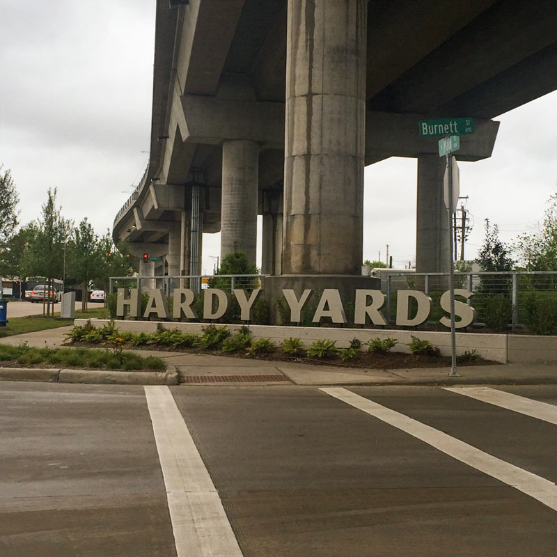
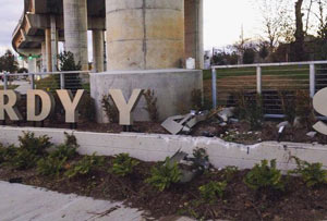
The second A, R, and D of the signage at the intersection of Burnett St. and N. Main are now back in action (up top) beneath the Red Line light-rail overpass. The letters have been patched up and sent back to their assigned places above a freshly-repaired concrete planter, following an unfriendly run-in (or -into) near the end of January (pictured second, with the A dramatically sprawled backward onto the mulch).
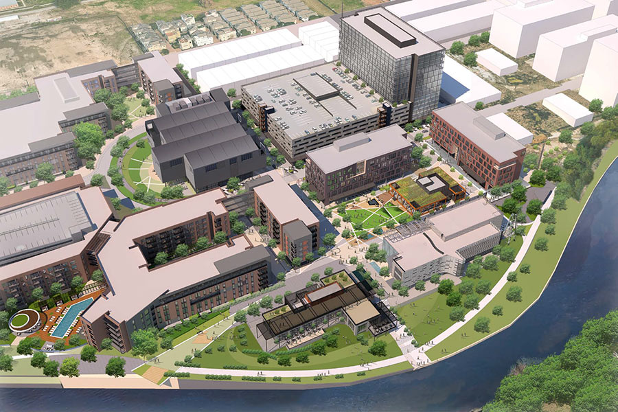
The sign, marking the intended redevelopment of the former Hardy Rail Yards into a mixed-use complex in Near Northside, was added as part of the street and infrastructure work that’s been going on at the 43-acre brownfield site. Some of that work is visible in the site plan for the property posted by landscape architecture and planning firm Design Workshop:Â
***
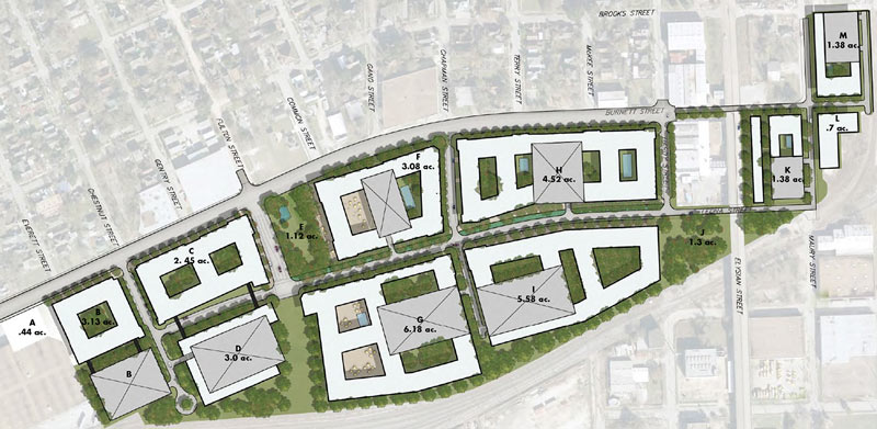
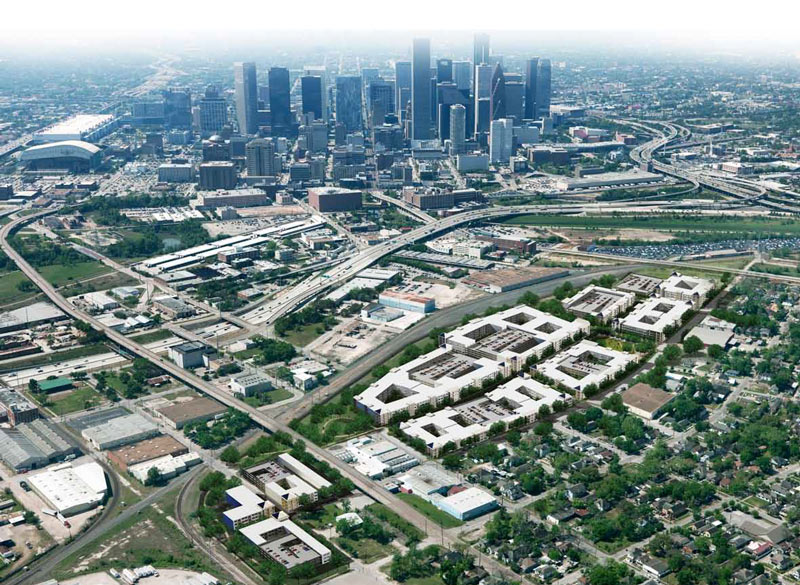
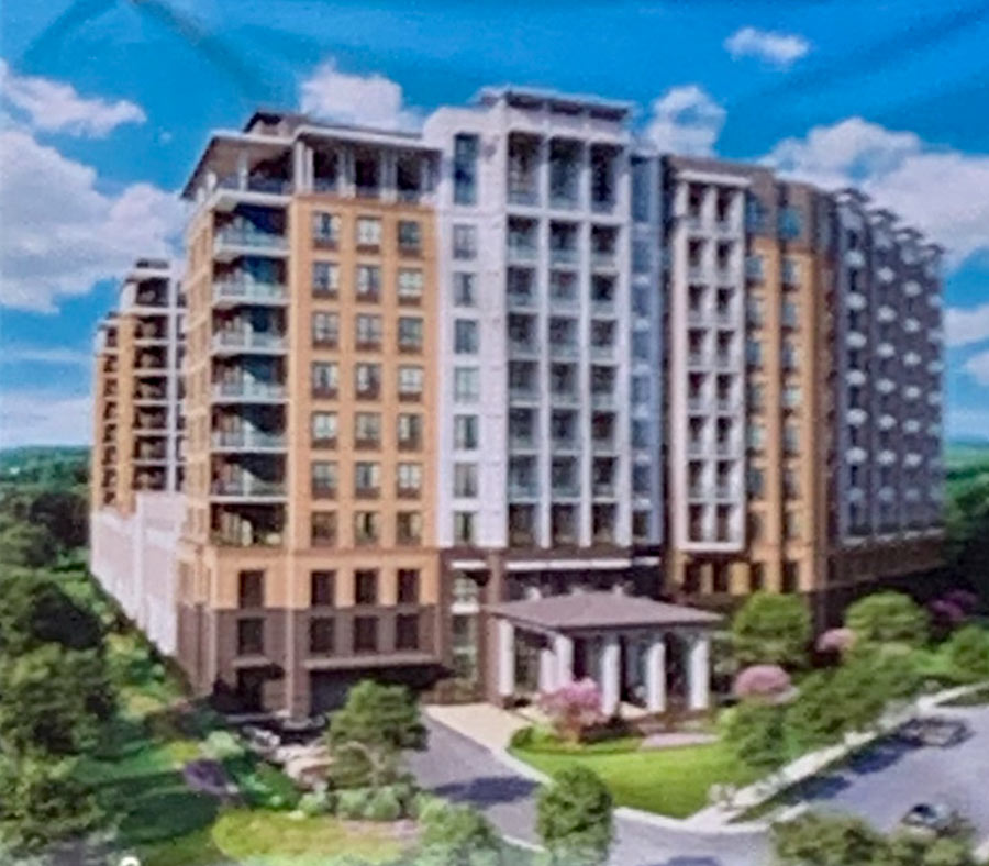
The map shows the already-mostly-complete extension of Leona St. (running roughly east-west through the middle of the highlighted site) as well as extensions to north-south-ish Chestnut, Fulton, Chapman streets; that’s the Burnett Transit Center parking lot visible on the faded aerial on the far left, south of Burnett St. (which has also been widened). At least some of the courtyard-riddled white footprints represent potential residential developments; an apartment complex at the site labeled I, south of Leona west of the intersection with Chapman, was announced last spring as the mostly-affordable Residences at Hardy Yards. The grey boxes represent potential parking infrastructure, which lines up with a 3D rendering of the whole site facing south toward downtown:
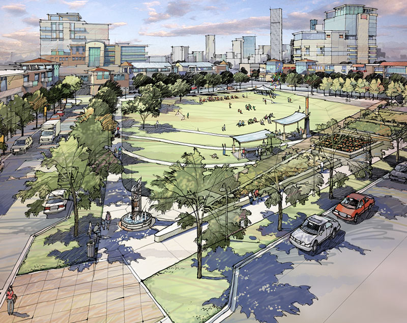
That bit of greenspace shown along Fulton south of Burnett might be the park rendered here:
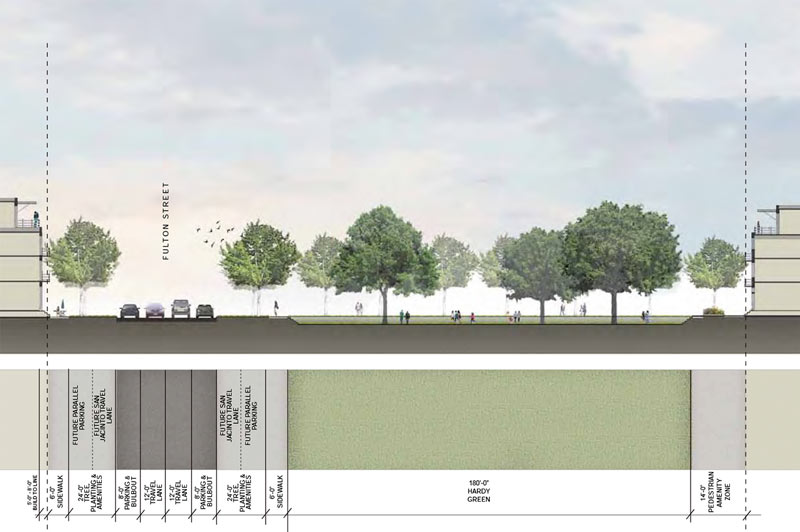
Here it is in cross-section, with Fulton on the left of the frame and the scale figures rendered about waist-deep below street grade; the park itself is labeled Hardy Green:Â
For those of you park-trackers following along at home, here’s a map to put that greenspace into context as far as what’s a 5-, 10-, and 15-minute walk away:Â
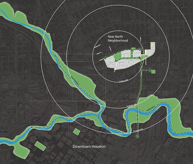
That’s Hennessy Park, just west of the Saint Arnold brewery, shown on the short eastward detour from the dotted green line running between Hardy Yards and Buffalo Bayou; the 2 green islands shown downtown are Market Square and Tranquility parks, from east to west.
- Hardy Yards [Design Workshop]
- Previously on Swamplot: Street Fattening, Intersection Birthing Going on Now by the Hardy Yards North of Downtown; Five of Old Hardy Rail Yard’s 50 Acres To Become a Mostly Affordable Near Northside Apartment Complex; Planting Bush Beans and Citrus Trees at the Hardy Yards
Images: Chris Andrews (top photo), RoB (second photo), Design Workshop (maps and renderings)
One area of concern to neighbors is that these Hardy Yards Signs appear to be on city property. With how hard the city makes it for civic clubs to put up neighborhood markers, it is baffling that they allow these developers to post signs on public property and makes you wonder who is paying the light bill.
I wouldn’t live on site of a former rail yard if someone paid me. Well over a century of chemicals moved, stores, passed through, including during times of zero environmental protections. That ground must be contaminated 300 feet down and in all directions. Sure they will claim it’s been cleaned up and tested, but there’s a difference between statistical risk and inherent risk.
@commonsense – I once did environmental work for a company associated with the site. We had an entire room just to store the cleanup documents on that site. I understand that eventually, it was given over to development with a deed restriction insisting that future uses do not use the ground water. My problem with this approach is that in an area like Houston, where the top groundwater table can fluctuate substantially, and sometimes even reaches the surface, you can’t guarantee protection of future residents.
One of the most eye-opening older site plats showed the location of the “Sludge Lagoon” (yes – that is exactly what Union Pacific called it). Aside from groundwater, the soil was all contaminated with lead from lead-based grease. Imagine around the year 1910 – thousands of railroad cars sitting in the rain, all getting a fresh coat of lead grease from a guy slopping it on with a mop. It went everywhere. That part was mostly cleaned up in a big “dig-and-haul” operation that removed the contaminated layer.
Still, knowing all that, I would NEVER buy anything close to that site, and certainly not live on top of it. And I am a big believer in brownfield redevelopment. It’s just that when this set of conditions is present, it would make a lot more sense as a commercial or public space, rather than a place where people live day in and day out.
Will the change to the downtown interstates effect this property? It looks like when I-10 is rebuilt to align with the new I-45 it’ll be shifted north closer to this site. I think the Near Northside is the next neighborhood close to downtown to get redeveloped.
There are a lot of MSD sites (municipal settings designation) in Houston that bar future owners from using ground water. Most of them are residential tracts. I can think of one off of Old Katy that has about 600 luxury homes going on it.
@Superdave – Ground water is about 15 to 20 feet below ground. All that soil above it is clay, so it’s never going to get high enough to come to the surface. If everything has been removed to below residential limits for redevelopment, or is being covered with concrete, then there’s no real risk. While commonsense is correct that “there’s a difference between statistical risk and inherent risk”, he should live up to his nom de guerre and realize that the risk of getting health problems from a site like this is much less than the risk of driving to the site in the first place, or from filling the car with gas to get there.
@Walker – The realignment that PurpleCity had (recently posted on here) showed the new freeway coming to just south of the still-existing railroad tracks, so no, it won’t affect the development (except for the noise driving down the property values). However, that realignment probably is 30 or 40 years off if it ever happens, so I’m not holding my breath.
@Chris C., tell it to the people living south of MarqE center on Silber @ I10. That used to be Cameron iron works back in the 60s and the ground is contaminated all the way south to the Buffalo Bayou due to underground water movement. There have been tests done and there are detectable (and unhealthy) levels of chemicals percolating all the way through foundation slabs into living spaces.
Introducing the newest, finest, destined to be tomorrows low-income subsidized housing!
@commonsense – I’m aware of the Silber Road site, but no two sites are the same. It sounds like contamination at Silber Road got into a high-permeability channel with apparently a pretty high gradient. I don’t know what the subsurface conditions are south of the site, but if there are vapor intrusion issues, it’s probably that high-permeability channel coming near the surface.
Hardy Yards, meanwhile, has an approved MSD. You can’t get that unless you can document stable or reducing plumes. According to the MSD application materials available on the city’s website, the uppermost impacted ground water is 25+ feet below ground, so that’s not going to cause a vapor issue. It just can’t get through 25 feet of clay.
What is the latest on this project?
Doesn’t seem like this project is going to happen. Just see streets but no real development?
Does anyone know when or if it’s going to happen. There’s no construction happening and I can’t seem to see any dates anywhere. Thinking of buying in the area.