JUDGE EMMETT: KATY PRAIRIE DEVELOPMENT SHOULD STOP ONCE AND FOR ALL 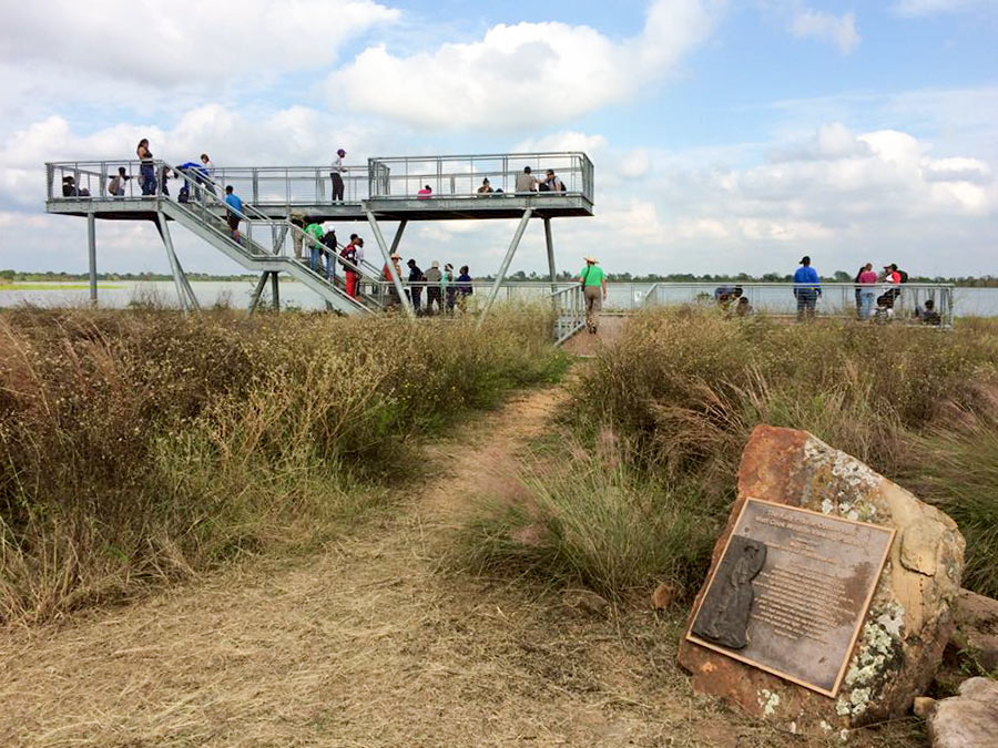 Here’s Harris County Judge Ed Emmett’s declaration Wednesday at a Rice University flooding conference: “We need to completely protect the Katy Prairie. Just set it aside and not touch it.” Or . . . what’s left of it. Last October, he called for a third reservoir in west Houston to “be part of a larger project to create a state or national park for the Katy Prairie.” And he wants Gov. Abbott to tap the state’s “rainy day fund” in order to build the prairie pond. (As for where it would go, a 2015 Harris County Flood Control District study proposed several sites, all on not-yet-developed parcels west of the Grand Pkwy. between Hwy. 290 and FM 529.) [Travis Bubenik] Photo of Matt Cook Wildlife Viewing Area on Warren Lake, south of Hockley: Katy Prairie Conservancy
Flooding
COMMENT OF THE DAY RUNNER-UP: A SOGGY MOD FOR GRABS IN BRAESWOOD 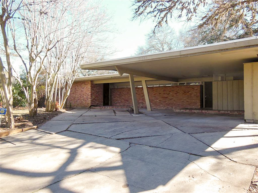 “For what it’s worth, my house flooded. I’m selling as is and would be thrilled for the free publicity.” [Joe, commenting on Houston Home Listing Photo of the Day: The Halfway House] Photo of 3611 N. Braeswood Blvd.: HAR
UH’S PHONE SURVEY POLLEES WANT TO MAKE FLOOD RECORD A GIVEN IN HOME SALES 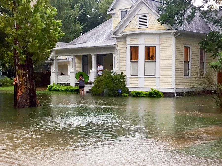 Here’s a tidbit from the UH Hobby School of Public Affairs’ new post-Harvey telephone questionnaire: 90 percent of Harris, Fort Bend, Brazoria, and Montgomery County residents who responded think sellers should be required to disclose prior flood damage to their homes and prior flooding in the surrounding neighborhood. Aren’t sellers already obligated to reveal their homes’ flood histories? Well, almost. State law requires most sellers to spill the details — but only if their home was previously occupied (and not if it was foreclosed on or if they’re selling it to execute someone’s will). For developers selling newly-built homes — sometimes in entirely new subdivisions — the rules are foggier: not all surrounding flood designations need to be disclosed to buyers. Among those details that can be withheld: whether the home is located in a flood pool, an area of land prone to inundation when water builds up behind a reservoir dam like that of the Addicks and Barker, as Lise Olsen wrote in the Chronicle last year. [University of Houston Hobby School of Public Affairs] Photo of home at 8th St. and Arlington during Harvey: Swamplot inbox
A FLOOD OF CHRISTMAS DINERS AT VIETOPIA An impromptu performance surrounding a centerpiece aquarium greeted Christmas dinner diners at Vietopia yesterday. Loud screams accompanied the appearance of twin streams springing from a leak in the glass on the dining side of freestanding structure at the Vietnamese restaurant in the Plaza in the Park (better known as the Kroger shopping center just south of the Southwest Fwy. on Buffalo Spdwy.) As a steady fountain of fishwater aimed itself at a nearby table or 2, the restaurant’s staff sprung into action: Large plastic garbage cans were deployed quickly to catch the water, and waiters used nets to collect the fish and transport them to new homes. [Wendy G Young Lightwalker, via abc13] Video: Wendy G Young LightWalker
WHAT IT TAKES TO JACK A HOUSE 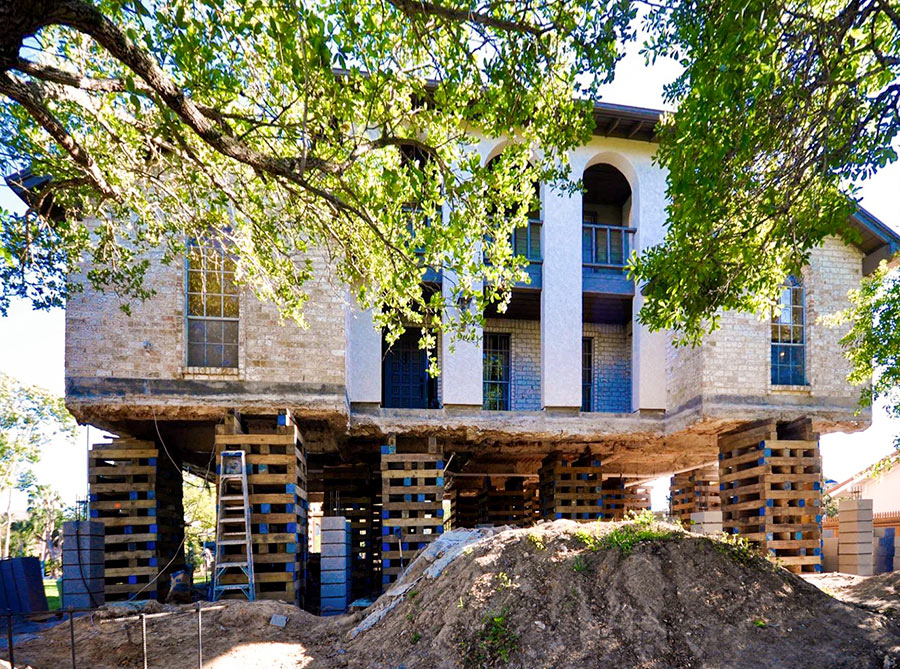 “Adam Bakir, a Houston builder and remodeler, does one or two home elevations a year. The job is akin to major surgery. Workers tunnel under the house, Bakir said, then raise the whole thing on jacks—the slab and the house that rests on it. Since Harvey, Bakir has received more than 20 inquiries about home elevation. If potential customers ask for a cost estimate, he’ll tell them: between about $75 and $100 per square foot. ‘If you have a 2,500-square-foot house, which is typical,’ he said, ‘the upper end of it would be about $250,000. The lower end, around $180,000.‘” [CityLab] Photo: Arkitektura Development
COMMENT OF THE DAY: THE ONLY MACKIE AND KAMRATH HOMES LEFT ON THE TIEL WAY LOOP 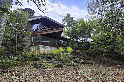 “. . . My husband and I drove around Tiel Way after the storm to check on all the MacKie and Kamraths. There were several homes on the street that flooded — and not just by a few inches but into their second levels. One of the things that make the Kamraths of this era (and really, many high-end midcentury homes) so gorgeous and unique is the abundant use of wood panels for all walls, doors, built-in storage cabinets and seating — everything. But it also makes them particularly expensive and hard to fix after extensive water damage.
As Swamplot reported earlier this year, the home at 2 Tiel Way was bought with the intention to restore but had so much termite and water damage it would have cost double to restore compared to a full rebuild price. So that’s what they are doing: rebuilding the same house. . . . It’s a controversial choice but in my opinion it’s the best architectural conservation alternative to demolition. But not everyone has the resources to undertake something like a full architectural rebuild. So while the demo of this house, one of Kamrath’s finest, is certainly a punch in the gut . . . I get it. They probably would have saved it if they could.
Tiel Way was the last concentration of MacKie and Kamrath’s great residential works, at one point having 7 homes on the loop. After this demolition we will be down to 2.5: the Gold Brick–awarded restoration at 67 Tiel Way (which thankfully, did not appear to have Harvey flooding issues), Kamrath’s own residence at 8 Tiel Way (definitely flooded, but appears to be safe at the moment), and the rebuild currently in progress at 2 Tiel Way.
48 Tiel Way won’t be the only midcentury treasure lost to Harvey, but it’s certainly one of the saddest to see go.” [Rabbit, commenting on Daily Demolition Report: Tiel Repeal; previously on Swamplot] Photo of 48 Tiel Way: HAR
COMMENT OF THE DAY: ANOTHER WILLOW MEADOWS FAREWELL 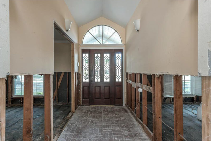 “Willowgrove is a beautiful street, and sadly, I think we’re going to see several homes come down akin to what we saw & are seeing again in Meyerland (I believe there was another one yesterday). It’s predominately 1960s single-story ranch homes, many custom designed and some of them oversized vs. the rest of neighborhood, below a canopy of oaks that drape the street. It’s terribly sad that what it was before is just gone now. Willowgrove backs up to one of the feeder ravines that breached when the bayou did, and homes on both sides of it — Cliffwood and Willowgrove — took a massive hit compared to the surrounding streets that only had street flooding. The cap on flood insurance, if homeowners had it, wouldn’t cover the value of those homes. I’ve had neighbors ask me, and I genuinely do not know — are those concrete ravines/mini-bayous supposed to drain/connect to Willow Water Hole at some point? Was that already supposed to have happened? If so, what was the delay?” [Heather, commenting on Daily Demolition Report: Lynn Parked] Photo of 10202 Willowgrove Dr. interior (now for sale): HAR
COMMENT OF THE DAY: SELLING THE HOUSE AT THE END OF THE RAINBOW  “Fabulous lot adorned with critters of all varieties, this property now features wild herrings, cranes, frogs, alligators and migrating herds of antelope during the rainy season. The home was originally built as an ark on pristine gathering grounds for pairs of animals to accumulate during the final days of destruction per sellers disclosure. Tall mature trees on property present amazing opportunity to cultivate your very own white dove habitat for olive branch collection.” [Toby, commenting on Houston Home Listing Photo of the Day: Outdoor Dining Area] Illustration: Lulu
COMMENT OF THE DAY: WHAT FLOODING ON THE WEST SIDE TOOK AWAY  “Homes underwater for extended periods can be rebuilt, as long as they were not subjected to currents sufficient to cause major structural damage or foundation scour. They just take longer to dry out (ours took over a month).
Like Local Planner said, in many of the flooded neighborhoods north of the bayou, original-condition homes had basically no value before the flood (i.e. they were being sold for lot value and torn down). The process is indeed accelerating, with new builds being elevated à la Bellaire and Meyerland.
The big question mark for me is how much of a market there’ll be for $1+ million new homes in a potentially flood-prone area (even if your elevated home doesn’t flood during the next big one, you’d likely lose the cars in your non-elevated garage and need to be evac’d by boat). The market was soft in the Energy Corridor even before the flood. A new supply of high-end homes doesn’t automatically beget demand. Hopefully the new MD Anderson complex in the area will help (and potentially spur further diversification of employment in the Energy Corridor beyond oil and gas).” [Grant, commenting on Daily Demolition Report: Memorial Glint] Illustration: Lulu
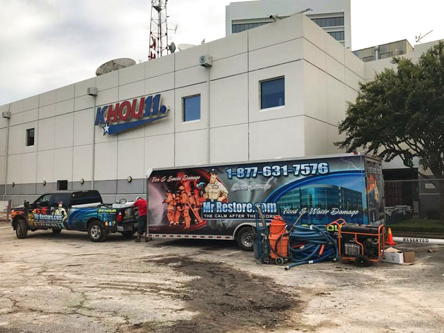
Teevee station KHOU is giving up on its 3.2-acre bayou-side home on Allen Pkwy. after repeated flooding and will soon be listing it for sale, according to a staff member’s Facebook post. The organization did file a permit for $594,740 worth of restoration work after Harvey between August and October, and hired 2 services to help with the clean-up — including Lewisville-based MrRestore, pictured above outside the building on August 30. Before Harvey, the studio enjoyed a 16-year dry run bookended by waters from Tropical Storm Allison back in 2001.
The 52,000-sq.-ft. studio, home to Channel 11 for 57 years, took on 5 ft. of water during the recent storm, forcing its staff to relocate broadcasting activity 3 times within the same day: first to a second floor conference room, then 2 blocks east on Allen Pkwy. to the Federal Reserve Bank, and finally to Houston Public Media’s office on Elgin St. just off I-45, where the news operation has now been headquartered for just over 2 months. That co-location wouldn’t be permanent, KHOU meteorologist Brooks Garner reported last month, although he indicated at that time that the station had not as yet decided whether to return home or seek a new venue.
Photos tweeted out by KHOU reporters of their original home showed the building at 1945 Allen Pkwy. taking on water during the storm. Here’s what the lobby looked like:
THE KATY ELEMENTARY SCHOOL WITH A FLOOD POOL SECRET 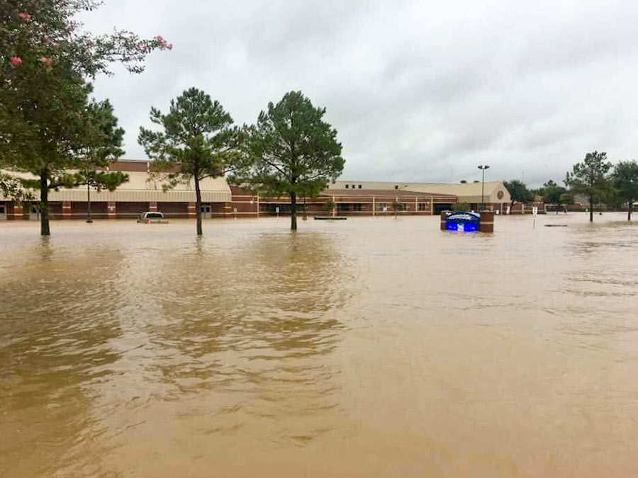 Some documents related to the Katy ISD’s 1998 purchase of the 15-acre site now occupied by Creech Elementary School at 4242 S. Mason Rd. have been frozen — in an attempt to preserve them, after they got flooded when Barker Reservoir got backed up after Hurricane Harvey. What those records might show, once thawed: some explanation for why school officials at the time signed a notice indicating they did not review a map filed with the county by Westbrook Cinco East LP (the developer from whom the property was purchased) that disclosed in a note that the land came with the risk of “extended controlled inundation.” Though several Katy schools sit on land near or in the Barker reservoir flood pool — the area expected to fill up with water when the dam is closed for a major flooding event — only Creech suffered major damage. All 800 Creech students are now attending classes at the University of Houston’s nearby Cinco Ranch campus while the school undergoes an estimated $5 million worth of repairs. The school district’s superintendent tells the Chronicle‘s Lise Olsen that he and other school officials were unaware that the school was built in the flood pool until they were contacted for her story. [Houston Chronicle] Photo of flooding at Creech Elementary School, 4242 S. Mason Rd., Katy: Breta Gatlin
A LAKESIDE ESTATES HOME NOW WORTH ITS WEIGHT IN WATER  Before the Army Corps of Engineers straightened the section of Buffalo Bayou between Hwy. 6 and Beltway 8 in the mid 1960s, the cul-de-sac at the end of Riverview Dr. in Lakeside Estates wasn’t just near the waterway, it was in it. But the “view” and “side” in the names the subdivision’s developers later attached to the property east of Wilcrest Dr. as they built on it didn’t hold: “When [Allen] Wuescher says he had 17 feet of water inside his house, it’s one of those things you have to see to believe. It is the fifth time in 26 months that his house flooded, and the third time his entire first story was destroyed by water deep enough for a diving board,” writes Meagan Flynn. “Since the home was built in 1979, homeowners at this address have recouped more than $850,000 in flood damage losses through FEMA’s National Flood Insurance Program, at this point making the home more expensive to taxpayers just to exist than for the government to buy it and destroy it. It was appraised at $825,000 by the Harris County Appraisal District. The FEMA flood insurance loss payments so far don’t even include the extraordinary damage wrought by Harvey. And when we enter the home through Wuescher’s garage — which looks like a scene out of The Texas Chainsaw Massacre but with the lights on and with mold instead of blood — it’s immediately clear that the house really is not a house anymore.” [Houston Press] Photo of 10807 River View Dr. living room: Realtor.com
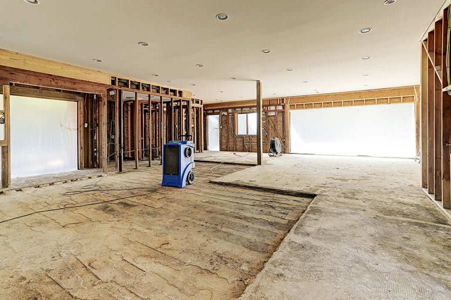
- 17 Legend Ln. [HAR]
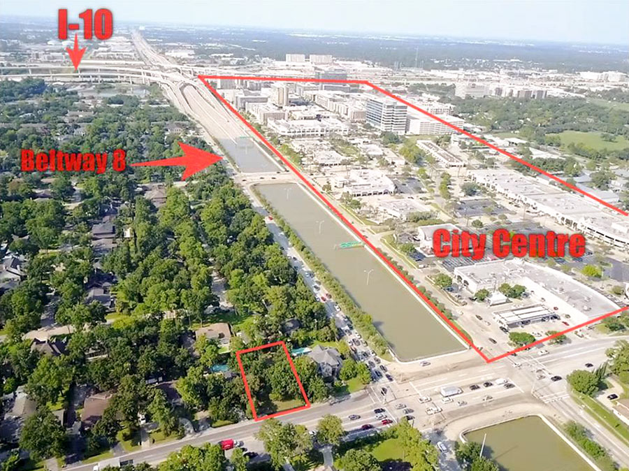
That’s not a retention pond pictured near the center of these aerial shots highlighting the vacant lot at 12906 Memorial Dr. — or at least that wasn’t its original main purpose: It’s the Sam Houston Tollway, shown filled almost to the brim after Hurricane Harvey flooding. “Lot has been cleared and is ready for construction,” declares the listing description for the featured 11,760-sq.-ft. vacant property, one house away from the corner of Memorial and Beltway 8. It’s now marked down to $505,000.
The only photos of the lot included in the listing are drone views that include the adjacent Memorial Dr. underpass, shown in its full-of-water configuration:
COMMENT OF THE DAY: A WATERSHED APPROACH TO PAYING FOR FLOOD CONTROL  “. . . I think that if we are going to be realistic about the way that we finance flood control, that the core of such a plan needs to take a page from how flood insurance gets underwritten. Everybody pays a property tax to a watershed-specific flood control entity, but that tax is adjusted based on the elevation of their first-floor living area relative to the Base Flood Elevation. If you’re more than a few feet above it, your tax is very low. If you live more than a few feet below it . . . you’re probably going to pay so much in taxes that it’ll become immediately economic to raise your structure or demolish it. Right away, the inventory and value of property subject to flood risk is reduced; and what’s left that is tolerably at-risk pays for its own reduced need for risk mitigation. And . . . if we’re too gun shy to pull the trigger on a plan like this, which would totally wipe out a lot of people’s equity in vast swaths of real estate, okay well that’s where people not at very much risk should be expected to pay more taxes even without receiving very much in the way of benefits. Yeah, I’m basically proposing Obamacare for flood control in Houston, but only as a humane alternative which reveals a startling truth: that the big money for this sort of thing is unlikely to come from up on high, from the feds or the state government (and it shouldn’t IMO). Financing this stuff locally is going to hurt. One thing is very very clear: whatever kinds of administrative bodies are created or re-jiggered to deal with this issue have got to address legacy development first and foremost. We need a plan to cope with what is already on the ground. This is not something that we can just build ourselves out of, going forward, with stricter rules for new development, feel the catharsis, hold hands and sing Kumbaya, and call it a day.” [TheNiche, commenting on An 8th Wonder Distillery; New Bridges for Brays Bayou; How Apartment Buildings Get On Your Nerves]

