
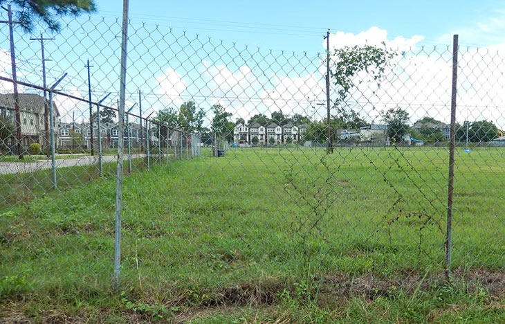
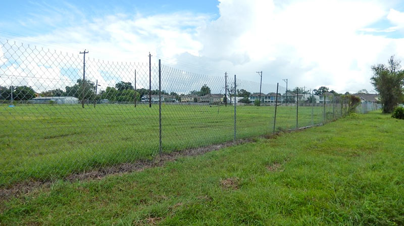
The field above, on the block between W. 24th, W. 25th, Ashland and Rutland streets in the Heights, will be the subject of a public meeting next month, a reader who got a letter about it from the city notes to Swamplot. The land (an also-ran in the Best Teardown category for the 2010 Swampies) was previously the site of some of National Flame & Forge’s operations, which extended into the double block immediately to the north (now sprouting the townhomes visible in the distance). The owners have spent some time in the last few years taking stock of some industrial leftovers on the property, and are now seeking a Municipal Settings Designation for the land, which will legally nix any future use of the site’s chromium-and-trichloroethylene-spiked groundwater for drinking purposes.
The letter, addressed to nearby property owners and water-well-havers, emphasizes that no city water sources are affected by the contamination, and adds that the city is also legally required to send the meeting invite to anyone who owns a water well within 5 miles of the site. The map below is included with the application from NFF Realty for the no-drinking label; the aerial shows the rough boundaries of areas where water sampling over 2014 and 2015 showed more-than-you-want-in-your-coffee levels of chromium (in red) and trichloroethylene (in yellow):
***
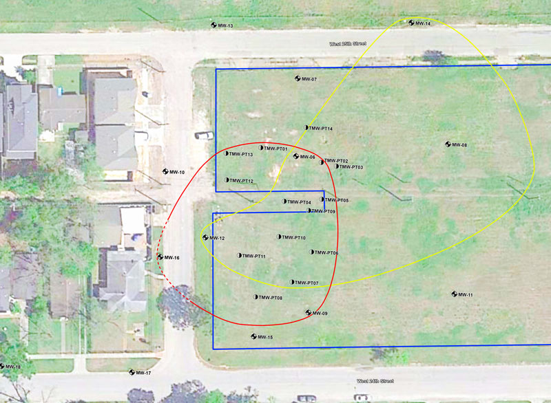
NFF also sold some easement strips to CenterPoint earlier this summer, along the track of the existing power lines that split the block in 2:Â
- MSD Application 2015-085-NFF [City of Houston]
- Municipal Settings Designations [City of Houston]
- Previously on Swamplot: New JLB Apartments Will Replace Warehouse Buildings at Nicholson and 24th St. in the Heights; Best Teardown: The Official 2010 Ballot; Daily Demolition Report: Along the Sulky Trail
Images: Doris Murdock (photos), City of Houston (map)
I can admit that I had no idea of the concept of an MSD (Municipal Settings Designation) and the City’s webpage was an interesting read. Given all of that and the red/yellow circled areas in the photo, how does a property owner ensure that the contamination doesn’t leach into neighboring water supplies?
.
The old adage of ‘water finds its own level’ comes to mind. I’d be worried if I were the townhomes to the west (on the left side of the red/yellow photo).
Multiple reasons. For starters, ground water in Houston is about 15 – 30 feet below ground surface. I didn’t look at the MSD to see how deep this is, but water lines are going to generally be no more than 5 or 10 feet underground. It’s really expensive to install pipe beneath the ground water level, because you have to pump that water out all the time while working, so they keep it shallow.
.
Second, water pipe is pressurized to a minimum of, I think, 40 psi. That pressure differential means nothing would go into the pipe, it would only come out.
.
Third, an MSD can only be approved if you have several year’s worth of data showing that the stuff in the ground isn’t going anywhere. So if it’s not under the neighboring townhomes now, it won’t be there in the future (in theory).
@ Chris C.
.
Many thanks for the primer on residential piping and how MSDs work – very useful and reassuring!
OK, so what about the ground that’s circled in yellow or red? Can people safely plant a few herbs or tomato plants in those areas?
One more question, what is likely to be done with this land?
I am a nearby neighbor (luckily not downstream of this mess or in the townhomes) that also received this notice of public hearing. I, too, am concerned about the future development of the site. I agree, however, that it is too valuable NOT to develop. It could be wishful thinking, but hoping it’s more like the Sullivan Bros product on W 23rd or at the very least Drake Homes of W 26th (every 3rd home the EXACT same paint color is a bit much, however).