
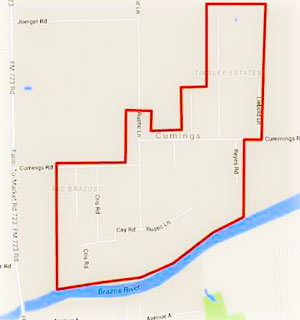
 Residents of the Rio Brazos area near Cumings Rd. north of Rosharon are being advised as of this afternoon to boil their tap water until further notice, while the Fort Bend County Fresh Water Supply District 2 sorts out possible problems stemming from a flood-related loss of water pressure in the network. (The map included here has been added to the Fort Bend County emergency office’s Facebook page following a brief online outpouring of confusion as to what neighborhoods the warning was actually targeting.)
Meanwhile, TXDOT is still listing dozens of miles of roadways as covered by to high water as of this morning, with more closures expected as Brazos floodwaters drain southwest toward Angleton and Freeport. Here’s Brazoria County’s latest worst case scenario potential floodmap, with the county’s mandatory evacuation zones now stretching across more than 15 miles from roughly Brazos Bend State Park to the outskirts of Angleton:
***
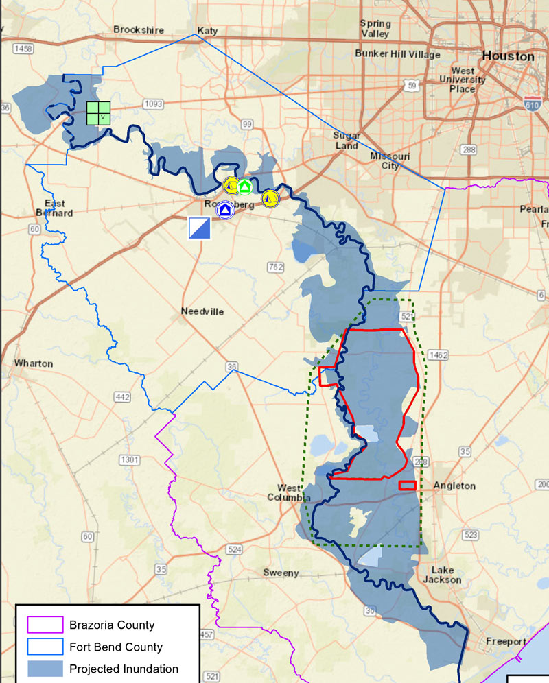
Mandatory get-out zones are marked in red, with voluntary evacuation areas marked with green dashes; yesterday’s additions to the list brought in a few new subdivisions and towns along Oyster Creek, including Bailey’s Prairie (the little red rectangle shown due west of the word Angleton) and the Bar X Ranch. Parts of upstream Fort Bend County started getting orders to evacuate more than a week ago in the leadup to Memorial Day, as the Brazos casually tossed aside its previous elevation record. This weekend also saw the evacuation of the W. F. Ramsey Unit prison in Rosharon, the third area prison to be evacuated since the flooding started in May.
- Public Notice to Boil Water [Fort Bend County Fresh Water Supply District 2; map of affected area added on Facebook]
- Third Texas Prison Evacuated Due To Flooding [Houston Public Media]
- Evacuation Maps [Brazoria County]
- Previously on Swamplot: What the Brazos River Looks Like When It Shatters All Previous Flood Gauge Records
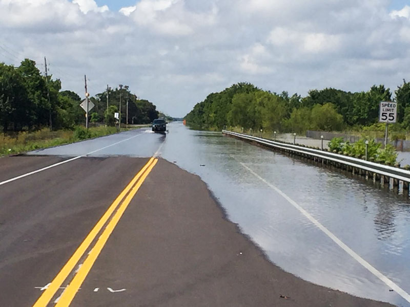
Images: TxDOT (photo of FM 521 near SH 35 in Brazoria County); Brazoria County (map of predicted worst-case flood extent and evacuation zones)

