
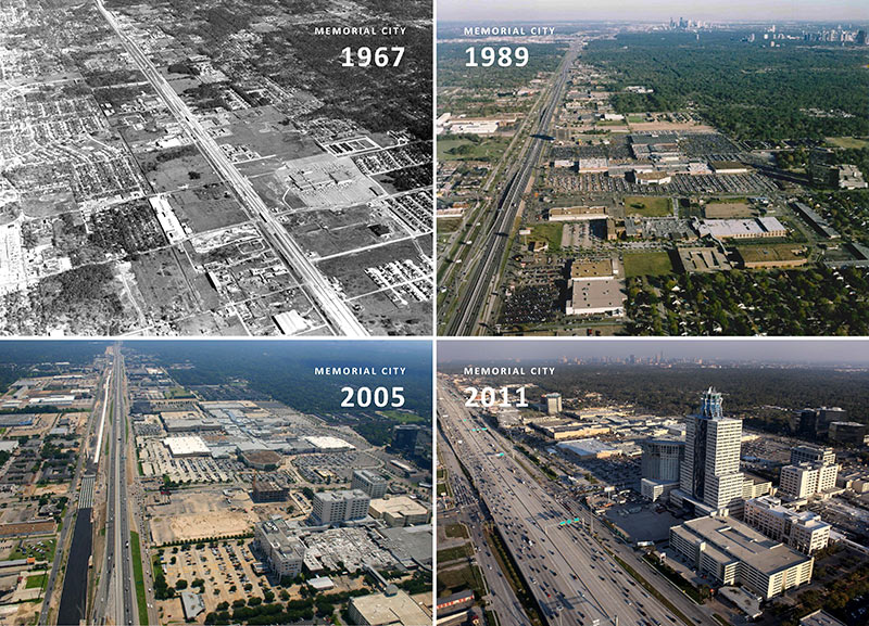
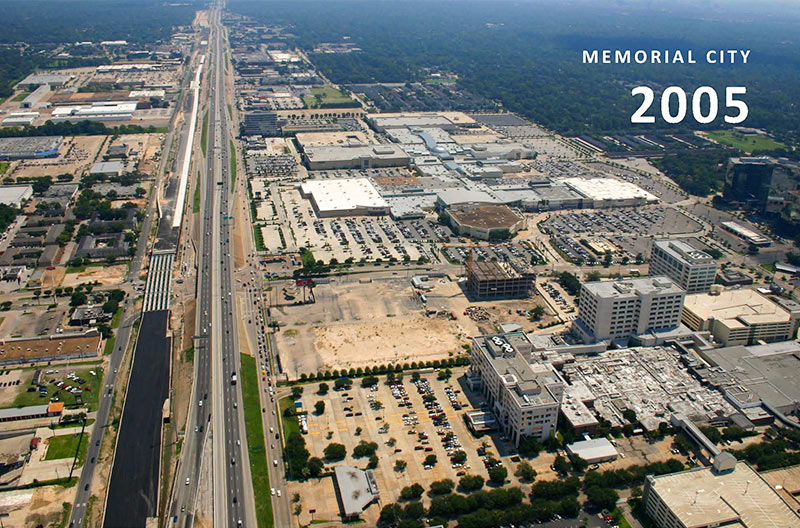
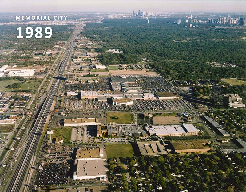
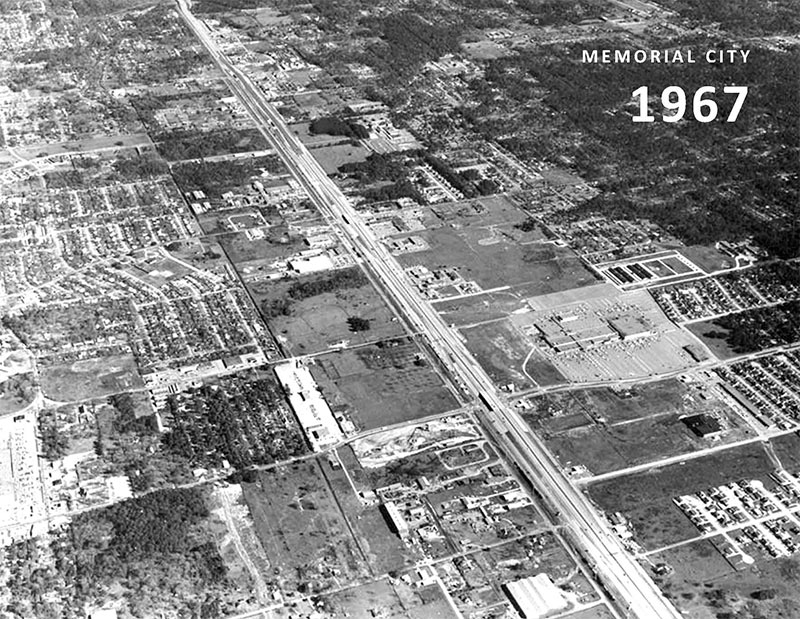
From high atop its I-10-side rooftop robo-pineapple, the powers-that-be at MetroNational have heard of your desires to see a timelapse video illustrating the monstrous growth of Memorial City, just as it prepares to spill north across the mighty 30-lane Katy Fwy. Well, the company’s marketing department has, at least. And has bestowed upon Swamplot readers the next-best thing: the tetraptych pictured above, featuring aerial shots dating back almost 50 years and extending to . . . 4 years ago.
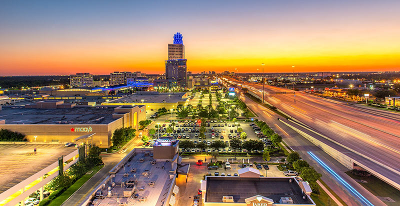
But what’s happened since? Edge City gotta keep up with the times! It now stands out above the expanse of west Houston sprawl in blazing color:
***
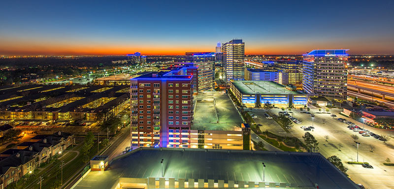
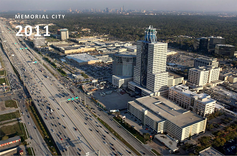
These latest pics are a little less lofty, of course. They were taken from the Frost Bank building (Memorial City Place, at 9821 Katy Fwy.) and the Nexen Tower (at 945 Bunker Hill). For a recent actual aerial shot, we’ll need to pull this late-dusk view freelance dronemaster Russell Hancock took last month:

Time traveling backwards now, enlarged for your review:
- Previously on Swamplot:Â Comment of the Day: Rise of the Memorial City Monster;Â Memorial City Prepares To Cross the Katy
Photos: Russell Hancock (drone view); MetroNational (all others)

Those top few look like a Fast and Furious, architecture edition. Like someone duct taping a spoiler to a minivan and then putting some neon highlights on it.
I like the 1967 Memorial City best. Accessible,greener, and more appealing that the concrete jungle and carbon monoxide factory of today.
How tall is the top of the pineapple tower? Was discussing how tall this building was with a friend but can’t find the actual height in feet anywhere.