
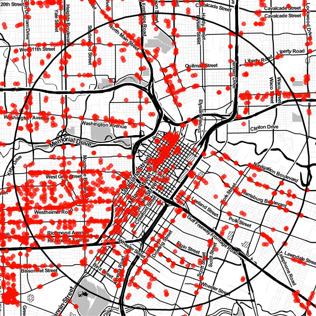
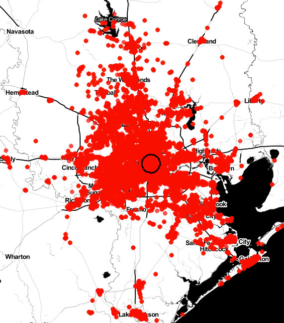
All the little red dots above show storefront retail locations throughout the Houston area. The map comes from Portland-based City Observatory, which just released a shiny new report on using the number and arrangement of customer-facing businesses to guide city planning. The bar in the top left corner lets you jump around between Houston and the 50 other cities mapped by the project.
Like the other studied towns, Houston is shown with a black ring marking off a 3-mile radius around Downtown. A closer look at Downtown shows a sharp divide in storefront density across the Main St. corridor:Â
***
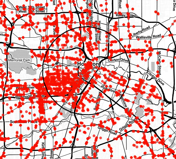
Zooming out, the highest Inner Loop density zones show up around Montrose and in the Greenway/Upper Kirby areas:
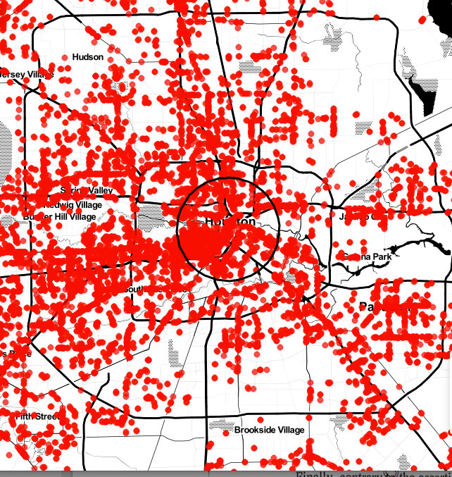
The dots don’t get any smaller as scale is increased, so lower zoom levels do obscure some of the trends visible closer in. That makes the gaps still visible at a Beltway 8 zoom level are all the more stark, including  south along 288, east along the Ship Channel, and northeast toward Greens Bayou and Lake Houston:
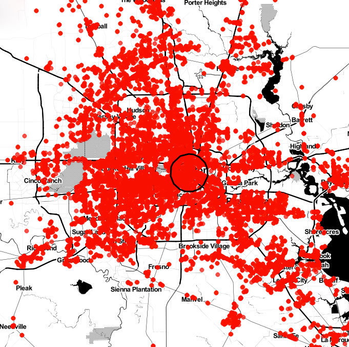
Further zooming away shows retail clusters along I-10, I-45, and 59, as well as in the northwest between 45 and 290, and south of Clear Creek from Pearland to League City:
Here’s one more look at the whole region, from Conroe to Lake Jackson:Â
- What your city looks like when nearly every store is mapped [Washington Post]
- The Storefront Index [City Observatory]
Maps: City Observatory
Incredibly confused…. they have my house as store front retail.
Maybe they thought you were a drug dealer, Triton!
I’m seeing other residences marked as retail, and also plenty of storefronts not on the map, so it seems their data is far from perfect.
Our red dot off Clinton Blvd on the east end has already closed :(….. but the new potato is opening soon :)
Not far from a Houston Chronicle slideshow…..
I know that this may not be politically correct but the SE quadrant of the Inner Loop could be such a ripe area of redevelopment if not for the poor people that live there. There is a stark difference between stuff west of 288 and east of 288: almost two separate worlds.
.
That being said, I appreciate the lack of traffic that the underdevelopment creates. Old Spanish Trail east of 288 is a great parallel to the Loop when it backs up.
So this is really a map of the population density of Houston?