
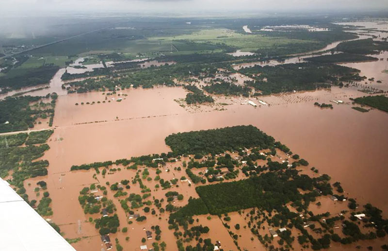
TxDOT has been doing some circling around over the thoroughly soaked Brazos River valley this week grabbing a few snapshots, including some taken yesterday morning as 31 East and Central Texas counties picked up flood-related disaster declarations from the governor’s office. Running north-to-south (right-to-left) under the murky waters shown above is FM 723 in Rosenberg, TX; you can spot the bridge rising up to cross the river’s normal channel on the left side of the photo, while SH 36 stretches away to the northwest.
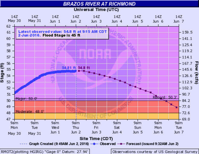
Flash- and non-flash flood warnings are in effect around the region through at least Friday night, depending on how intense the rest of this week’s predicted downpours turn out to be. Meanwhile, the already-feet-past-the-previous-record flood gauge at nearby Richmond, TX, is still creeping upward this morning toward 55 ft.:
***
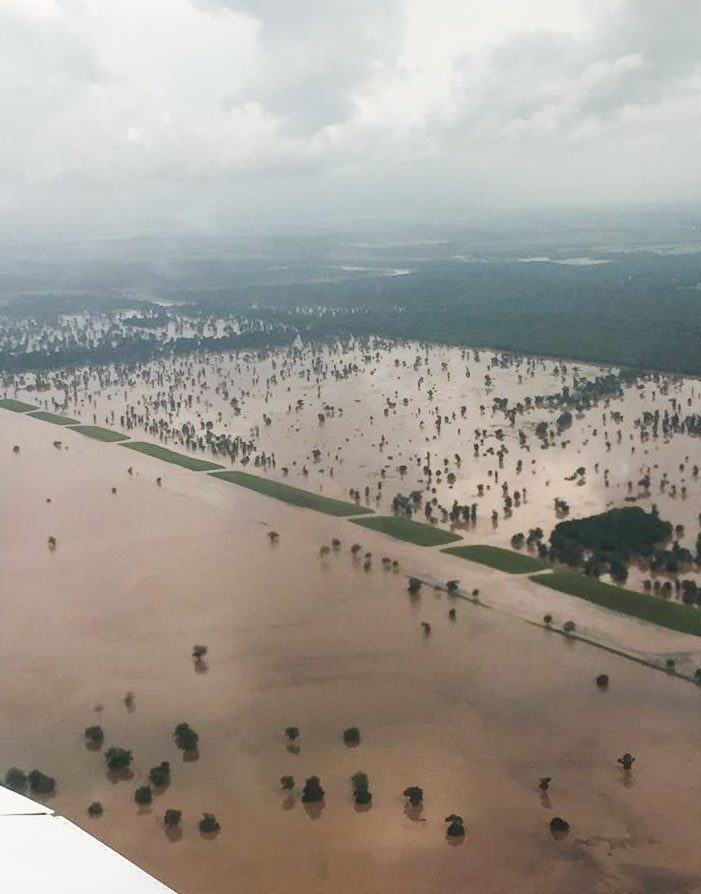
Here’s a shot of Brazos Bend State Park, looking southwest across a straight flood control channel toward the junction of the Brazos River and Big Creek:
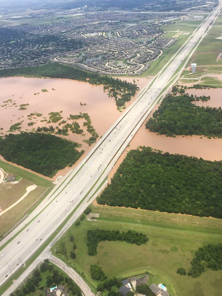
Here’s what the crossing of I-69/US59 looked like on Tuesday — the shot below is oriented north toward the Telfair subdivision, with University of Houston’s Sugar Land campus just out of the frame to the right:
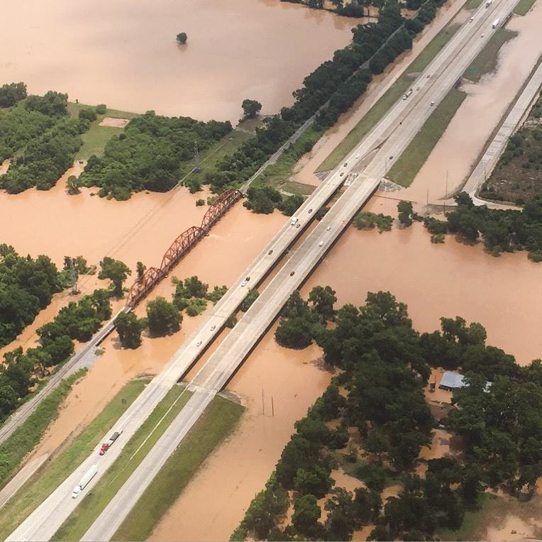
Moving north, here’s I-10 over the Brazos in Brookshire, also from Tuesday morning:
- Abbott Declares Disaster for 31 Texas Counties––But Wait, There’s More: Storms All Day [Houston Press]
- Flooding Of Brazos River Causes Mandatory Evacuations In Fort Bend County [Houston Public Media]
Images: TxDOT (photos); NOAA (Brazos River gauge chart)


Lots more rain today over the Brazos River basin. This could get Biblical.
Anyone who buys/lies near/next to ANY body of water anywhere KNOWS exactly what they’re going to deal with when the floods come. Make those property owners pay HIGHER flood insurance premiums for the INCREASED risk they take.
@Happy Go Lucky
Hot take!
It would appear that the levee districts in Fort Bend County are doing their job. Kudos to them.
@Happy Go Lucky
We do, and they do too. Just renewed my flood insurance and believe me it accounts for it much more than it used to.