- $70M Mixed-Use Project The Cannon To Start Construction Next Year Near I-10 and the Beltway [HBJ]
- Where Home Prices Have Increased and Decreased the Most Since Harvey [HBJ]
- What Downtown Houston Might One Day Look Like Tailored to Driverless Cars, Electric Vehicles, and Ride-Sharing Apps [Houston Chronicle]
- Bar Planned for Historic James Fadden Building on the Strand in Downtown Galveston [Galveston County Daily News ($)]
- El Burro & the Bull Chef Opening Grocery in the Sixth Ward [Houstonia]
- International Smoke Restaurant Headed to Former Straits Space at CityCentre in 2018 [Houston Chronicle]
- Museum of Fine Arts, Houston Pops Up in Heights Mercantile [Glasstire]
- Property Owners Speak Out Against Montrose Management District [Houston Chronicle ($); previously on Swamplot]
- The Health and Economic Problems Posed By the Sand Harvey Left Along Bayous [Houston Public Media]
- Some of the Research Studies Underway After Harvey [Houston Public Media]
- Houston Press Says Hurricane Harvey Was the ‘Final Straw’ As It Ends Print Publication [Houston Press]
- The Problems with the Government-Run National Flood Insurance Program [New York Times ($)]
- Houston Arboretum & Nature Center Plans Landscape Changes as Part of Restoration Effort [Houstonia]
- Why Houston Needs More Protected Bike Lanes [Houston Chronicle ($)]
- Sunday Streets Shuts Down Stretch of Gulfton to Traffic [Houston Chronicle]
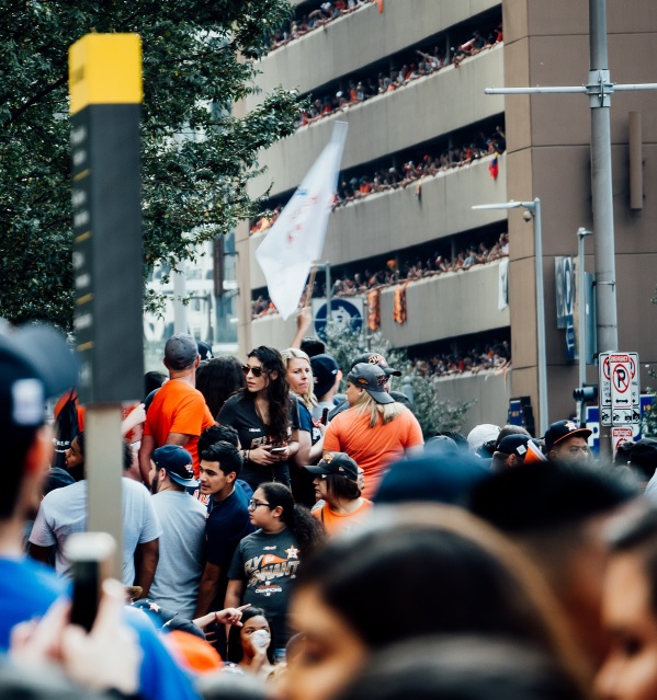
- Crowd of Nearly 1 Million Turns Out Downtown for Astos World Series Champions Parade [MLB.com]
Photo of the Astros World Series victory parade: thranth via Swamplot Flickr Pool
Headlines


Re: MFAH Opens New Satellite Space
Perhaps the MFAH or other museum should look into what Amsterdam’s Schiphol Airport has done … they have a “permanent” installation of art works installed in the departure area. It would definitely add a bit of class to Houston which is often viewed as an otherwise pedestrian city.
Anything zoomed out to the neighborhood scale post-Harvey impact-wise waters down the data so much as to be useless. In the Knollwood-Woodside are where homes are “up ~3%”, its a mix of ~$800k newbuilds that mostly didn’t flood and ~$400-500k 1950’s houses, some of which flooded and many-most that didn’t. That means any additional newbuild sale immediately skews the pricing average. What has already hit the market lately are mostly original homes that flooded, being sold as-is as teardowns (continuing the trend of the neighborhood), with lot-value on an upswing. I guess I presume all of Knollwood will be new construction in the near future, and almost all of “greater braeswood” being new construction soon, with everything getting higher elevations……
I second Juancarlos31 assessment. Since areas such as West U, Bellaire, etc.. have a wide range of old stock housing as well as multi-million dollar houses any downturn can be attributed to sale of lot-value stock (ie the old houses that flooded) which will be followed in 6 months by the upswing when builders throw down a 2 or 3 million dollar home on the lot.
Zillow and other such aggregate valuation apps have a very difficult time placing an accurate value of homes in urban neighborhoods of Houston on a good day. You can’t use the sale of the 1940 bungalow next door to calculate a value on a per square foot basis for my new build.. I used to notice swings in my home value day-to-day 20% or more. Nor can tax values be trusted (my neighbor for whatever reason, has NEVER protested his taxes and pays waaaay more than I do for a smaller home)
I think we will have to wait a while for the dust to settle, homes to be reclaimed by the county, and for displaced families to decide if they want to re-invest in homeownership before we get a good grasp on the impact Harvey will have on housing going forward. Just my two cents. For what that is worth.