- Houston Apartment Complexes Flooded at Rate of Less Than 2%, Apartment Data Services Finds So Far [Houston Chronicle ($)]
- 700 People in Meyerland Area on Waiting List to Elevate Their Homes [Washington Post ($)]
- Hurricane Harvey’s Toxic Floods Poisoned Houston Along Race and Class Lines [Salon]
- The Largest Harvey-Related Oil Spill Went Unknown for Weeks [Texas Monthly]
- South Houston Residents Affected By Harvey Still Waiting for FEMA To Pay a Visit [Houston Chronicle ($)]
- Redfin Agents Lost 8 out of 45 Deals on New Homes After Harvey [The Real Deal]
- West Houston Residents Work To Fend off Looters [KHOU]
- Houston Mayor Ends Hurricane Harvey Flood-Related Curfew [AP]
- Short-Term Rental App from 3 Real Estate Firms Helps Businesses Displaced by Harvey [Houston Chronicle]
- What StudioMET Learned Spending 2 Years Designing an Elevated House in Meyerland [Houstonia]
- Opinion: Harvey Can Help Houston Rethink Its Car Culture [Bloomberg]
- Coastal Growth Continues Despite Rising Sea Levels and Fierce Storms [AP]
- Before-and-After Landsat Satellite Images Show Coastal Change from Harvey Flooding [Houston Public Media]
- How the Internet Kept Humming During 2 Hurricanes [New York Times]
- Developers Killed Houston’s First Flood Control Plan in 1929 [Houston Chronicle ($)]
- Brookfield Asset Management Buying Houston Center Office Complex in Downtown Houston [HBJ ($)]
- Northeast Water Purification Plant Breaks Ground on $1.4B Expansion Project [HBJ]
- Bryan Caswell’s Slider Joint Little Big’s on the Hunt for New Space After Lease Negotiations Fail [Culturemap]
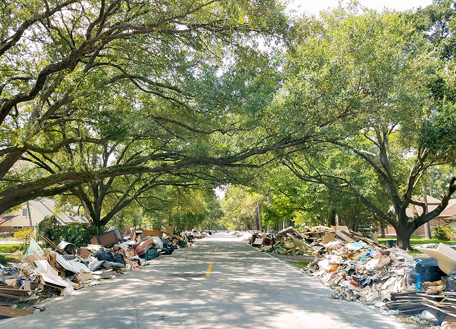
Photo of street in Bammel Forest: Marc Longoria via Swamplot Flickr Pool
Headlines


Re: The NPR article claiming “Shoreline Retreat”. Follow the link and you can slide across both satellite images. Indeed it is possible to discern a reduction in the width of the beach. More notable are some cuts in the southern tip of San Jose island and the opening-up of Cedar Bayou which separates San Jose Island from Matagorda Island. These cuts occur with most large storms and heal through natural processes. However, the most notable differences are in the estuaries and backwaters, which reveal — wait for it — the ‘after’ image is taken during a higher tide level than the ‘before’ image. That would seem to compromise its usefulness for very nearly any purpose.
.
Re: Salon article on Toxic Floods. It makes perfectly good sense that you’d expect to find higher levels of E. Coli bacteria and other bad stuff in waters further downstream in a watershed rather than upstream, especially along Buffalo Bayou’s course and given the geography and history of Houston’s development.
.
Re: The $1.4 billion Northeast Water Purification Plant. Someone was asking for examples of Houston’s megaprojects related to flood control. I provided a non-comprehensive list of them. This is yet another. Switching over from groundwater to surface water prevents subsidence, which wreaks havoc on legacy drainage infrastructure and places neighborhoods at lower elevations. Funny how the know-it-alls in the national press seem to overlook simple but very expensive stuff like this that’s already in the works, imply that Houston has its head in the sand, and proclaim no-zoning the big bad boogeyman.
Re: The Largest Harvey-Related Oil Spill Went Unknown for Weeks
FTFA: “A statement by Magellan on September 1 states that “clean-up work and inspections continue at the partnership’s Galena Park marine facility, but a restart timetable is not yet available,†but makes no mention of the size of the leak.
An initial estimate of the amount of the spill was 1,000 barrels of oil. It wasn’t until weeks later, on September 5, that Magellan reported that was oil spill amount actually totaled 11,000 barrels, or 460,000 gallons”
Since when is FOUR DAYS the same as “weeks later”?
Am I the only one who’s skeptical about the 2% figure for apartmen flooding in Harvey (re: Houton Apartment Complexes Flooded at a rate of less Than 2%…). That sounds about right for the newer complexes – built meeting current slab elevation requirements. But I highly doubt it’s the case for the older complexes in Greenspoint, Gulfton, Westwood, and the FM 1960 corridor among others.
.
I question how many of the fly-by-night investors in Class D apartments were surveyed – they make themselves pretty hard to find. And I also question if they’d tell the truth about flooded apartments. Many of them are collecting rent from tenants in flood damaged units. They’re not going to risk the income.
The Salon article is totally biased and inchoherent. They offer no example of how poor people were flooded more, or contaminated more than rich people. They only cite 2 data points, and those were of E. Coli which basically reflects the level of poop in the water, has nothing to do with metals or other toxins. I was at a friend’s house who flooded in the heart of Memorial and there was raw sewage pouring out of a manhole and flowing through people’s very expensive homes, was there a sample collected there? They also again blame the problem on lack of zoning (heard enough of that lately), and wish for an element of the Clean Air Act would kick in to solve the problem (the contaminants mentioned are in soil, pipes, groundwater, etc. – not air). Then they go on to blame it on lack of political representation. I really lament these types of articles because they stoke the flames of discontent between groups of citizens, based on hearsay and irrational fear.
The New York Times article about the data centers is fascinating, though.
@Superdave, It’s Salon. Did you expect anything different?
@ ZAW: Time for some back-of-the envelope calculations. The Houston Chronicle ran a story citing 119,000 homes in Harris County damaged by TS Harvey. The Census Bureau estimates that there were 1,751,802 housing units in Harris County as of 2016. So that’s what, 6.8% of homes being damaged in some way. (Now that damage might be superficial or it might be total destruction, but that’s not part of the analysis.)
.
Okay, so consider first of all, how much of the multifamily inventory is not situated on the ground floor? I’d figure without a doubt that it’s somewhat better than twice as many. Maybe 2.5x, maybe a little closer to 3x, but certainly not more than that. (Note that Camden reported only 80 out of 8,500 flooded; that indicates that only the first floors of *some* buildings within *some* complexes probably flooded.) Right off the bat, that could explain a lot of the disparity between single-family and multifamily damage rates. Second, where was the worst flooding? Upper reaches of Buffalo Bayou; in the encroaching development in Addicks and Barker Reservoirs; Cypress Creek; Kingwood; Meyerland. These are not major multifamily submarkets. The largest concentrations of apartments exist in Harris County are in the Inner Loop and Southwest Houston, with lots more in Greenspoint, Southeast Houston, and Pasadena. Most of these areas fared pretty well by comparison.
.
If only 80% of complexes were surveyed then complexes that were entirely down or that had flooded leasing offices may have comprised a substantial fraction of the non-responders. But…ADS has a minimum size cutoff of 20 units, IIRC, and that includes a lot of complexes that aren’t professionally managed. It could be a substantial fraction of complexes even if it doesn’t necessarily comprise a very large fraction of units.