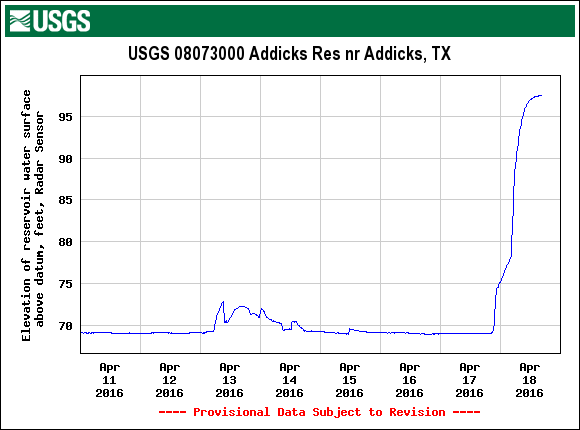
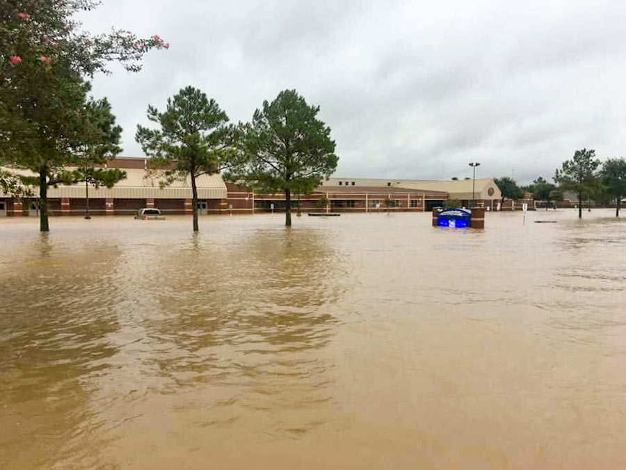
CITY WATCHING ADDICKS AND BARKER DO THEIR OWN DAM THING  The US Geologic Survey’s tracking of water collecting at the Addicks reservoir this week shows water levels jumping about 28 feet since yesterday morning, in the preliminary data graphed above. Both Addicks and Barker reservoirs, which function in large part as parkland when not busy storing potentially billion of gallons of floodwater, feed out into Buffalo Bayou near Hwy. 6 at Westheimer Dr. through dam outlets listed as extremely high risk structures by the USACE. The city’s Twitter account noted this morning that the Addicks dam was under municipal scrutiny; the Office of Emergency Management tweeted this afternoon that the stretch of Hwy. 6 and N. Eldrige Pkwy. running through the Addicks reservoir may be closed for a few days while the area drains. [USGS; previously on Swamplot] Graph of Addicks Reservoir water surface elevation since April 11: USGS


This pun is bad and you should feel bad.
I’m sure they’re overflowing with regret.
Counterpoint; this pun is great and you should feel great