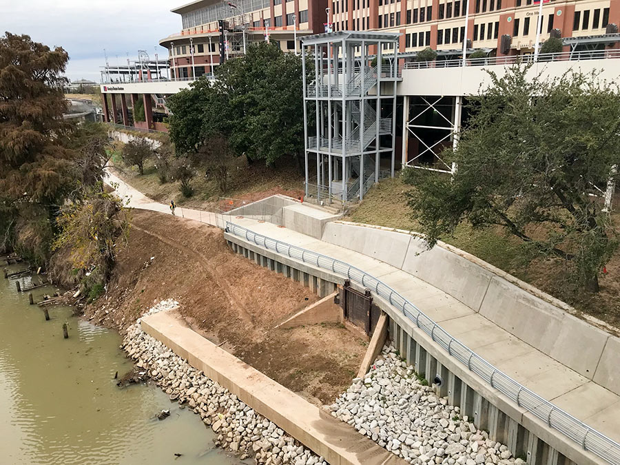
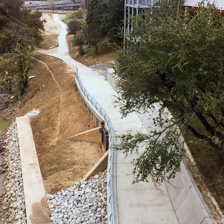
With the completion of the once-missing link shown above, the paths lining Buffalo Bayou are now fully connected to the Heights Hike and Bike Trail. Making use of the new route, you can now ride all the way from Shepherd to Heights Mercantile — provided rising floodwaters have not blocked the path. The photo at top, snapped from the southern section of the Main St. bridge, shows a new railing along the path in place of the temporary fencing that lined the edge last year. Travis and Milam streets are visible in the distance in the second photo. The elevated building to the right of the path is part of UHD’s campus.
The purple curve on the map below marks the location of the new connection, while the gray line running northwest indicates the Heights Hike and Bike Trail:
***
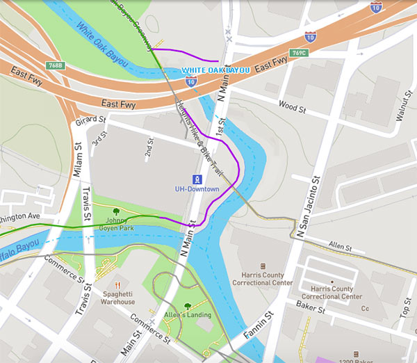
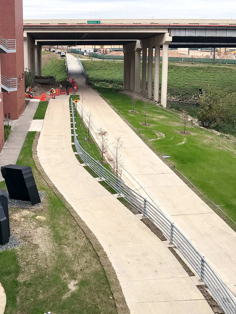
After passing under the Main St. bridge, the trail loops around the area just north of Allen’s Landing before crossing under the bridge a second time to head toward I-10. Just before the highway overpass is where new trail segment hooks up with the Heights Hike and Bike Trail. The photo below views that junction from the southeast, again atop the Main St. bridge:
- Previously on Swamplot: The Great Heights–Buffalo Bayou Bike Trail Hookup Is Almost Ready
Photos: Geoff Carleton (southern segment across bayou, northern segment); Christopher Andrews (overhead southern segment). Map: Bayou Greenways 2020


And you could cross a dozen fewer streets getting there if they would finish the stude park connector they put on the budget 3 years ago.
I do not follow what the flood gate-looking piece is in the center.
@ Alex Silva its not a floodgate, its the opening of a tunnel under what now is UHD’ s main building. In its former life that building was involved in the cotton trade. The tunnel allowed for bales to be hauled from the building directly to the dock where that “gate” is located.
It’s a sheet pile wall, Alex. It takes the bike trail (i) over the historic entrance to the merchants and manufacturers buildings, while (ii) not impeding flow in Buffalo Bayou, and (iii) holding up the slope above, which holds up the footings which hold up the plaza area on the south side of what’s now the One Main building, thereby preventing a catastrophic slump during high flow conditions which would send the bike trail and a chunk of UHD crashing down into the floodway.
Dumb Q — what’s the purpose of all the gravel/rocks/stones? Won’t that just float away when the bayou breaches and cause drainage issues downstream? I’m also seeing that in the small feeder bayous under construction.
It’s not complete if you are trying to take the MKT trail from the Heights into downtown and beyond while staying off streets. The Bayou Greenways interactive map still shows a dotted line for the missing connection between the MKT trail and the stretch of the trail at Stude Park. When completed, that tiny section will make a big difference.