COMMENT OF THE DAY: A BIG BLOW TO BAYOU BIKING  “. . . Have been riding Ant Hills since 1994. People who do not frequent this stretch of bayou may not know its beauty or usefulness but will be an irreplaceable loss of being able to enjoy the outdoors in Houston if allowed to go forward.” [Turning_Basin, commenting on New Overflow Pools Coming To Clear Out Trees, Anthills from the South Side of Buffalo Bayou] Photo of Terry Hershey Park: Save Buffalo Bayou
Tag: Bike Trails

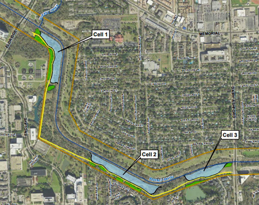
Time’s almost up for a whole mess of trees lining the south side of Buffalo Bayou between Eldridge Pkwy. and Dairy Ashford (pictured at top), where the Harris County Flood Control District plans to construct the first 3 of a series of overflow basins. Removal of vegetation across the bayou from Nottingham Forest’s southern border is scheduled to begin within a few weeks; construction company Lecon has the $1.8 million contract to build the “linear stormwater detention compartments,” which are meant to accommodate a temporary visit of up to 90 acre-ft. of bayou water during a flood.
The trees and basins will be carved out of Terry Hershey Park. The district notes that some trees and vegetation may be preserved — forming a buffer “where possible” between the basins and private property to the south. Large sections of the popular Anthills Mountain Bike Trail, which the district notes “were built on publicly-owned land without written permission and without compensation to the public” will be cleared, though a portion that sits between the 2 westernmost basins will remain.
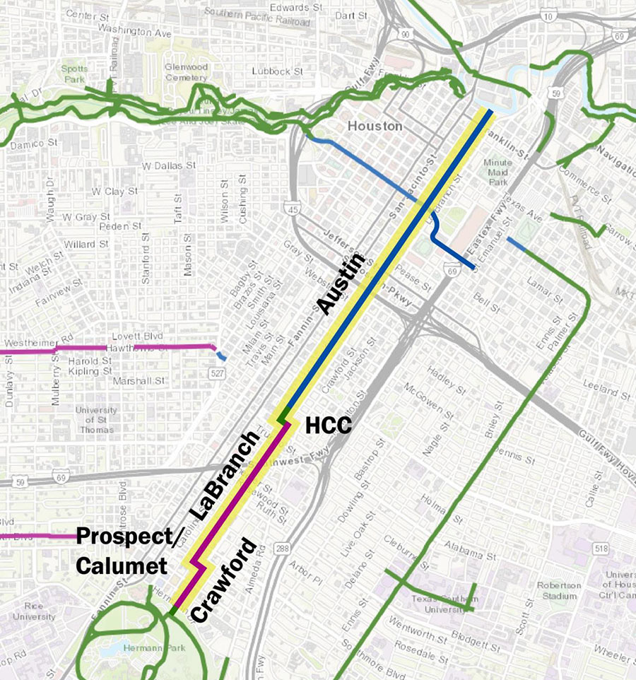
Last night Houston’s planning and development department spelled out a proposal to run a new pair of protected bike lanes on Austin St. from Buffalo Bayou to HCC’s main campus in Midtown. South of the college, the officially-designated bike route would continue down to Hermann Park along La Branch and Crawford streets but without anything to buffer it from the rest of the road.
Throughout Downtown and the northern portion of Midtown ending at McGowen St., plans show the bike lanes separated from the street by 2-ft.:
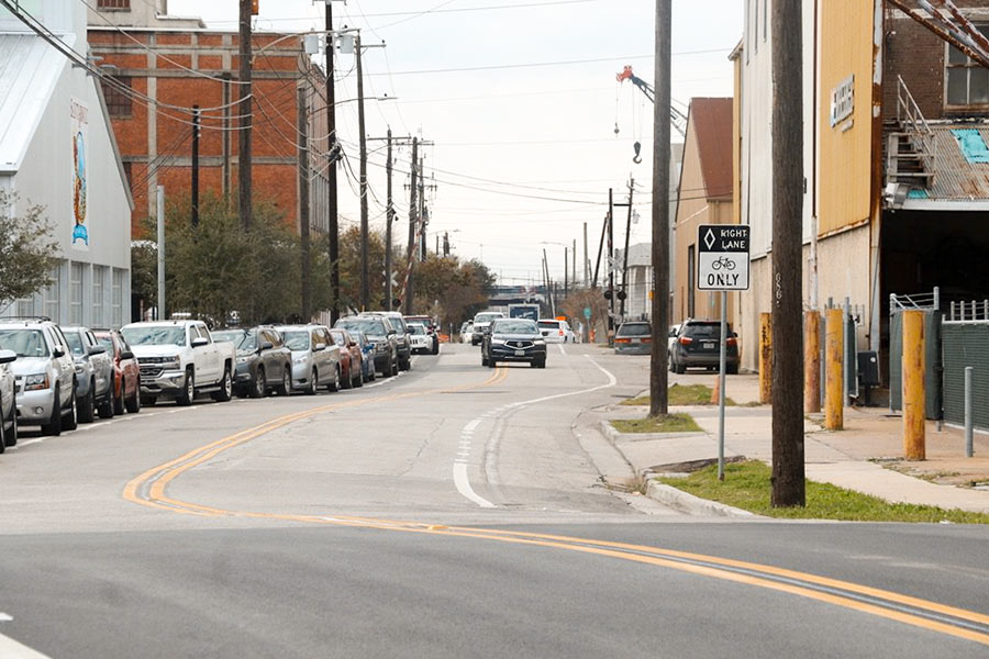
And people say Houston’s bike lanes don’t get any use! The next time someone gives you that line, there’s no need to bicker. Instead, just invite them out for a beer at Saint Arnold’s new-ish brewing cathedral off I-10. On the way there, you’ll spot the new bike lanes running adjacent to the brewery on both sides of Lyons Ave. And if the conditions in the one on the eastbound side of the street are anything like those shown in the photo above, then congratulations: It should be clear who’s right.
If, however, parked car traffic appears sparse on the day you stop by, there’s only one possible reason why: New signs must have been installed, prohibiting parking in the bike lane. As long as no ordinance exists to ban bike lane parking outright, such signage is the city’s only recourse to outlaw it.
Further east along Lyons, work to add new 6-ft. bike lanes to both sides of the street is underway and — at Jensen Dr. — has already been completed:
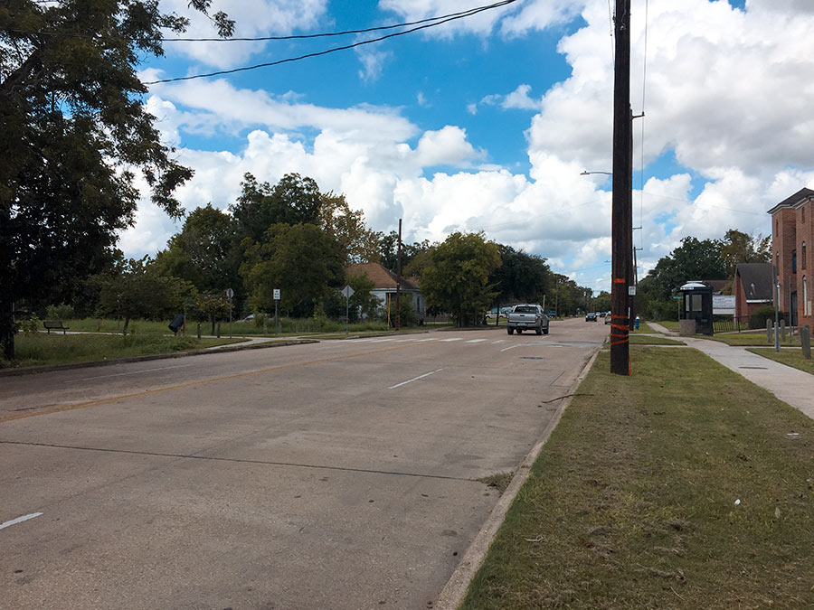
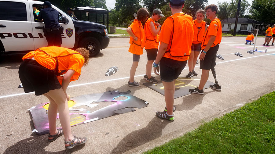
Three months after a group of freewheeling bike advocates marked off a portion of McGowen St. for cycling-only use, their work has vanished — effectively ceding the road back over to car traffic. The smaller photo above shows members of Bike Houston as well as other volunteers laying down boundary lines, directional arrows, and rubber barriers along the south side of the road at its junction with the Columbia Tap Trail between Burkett and Nettleton streets. At top is what that stretch looks like now from the opposite side of McGowen.
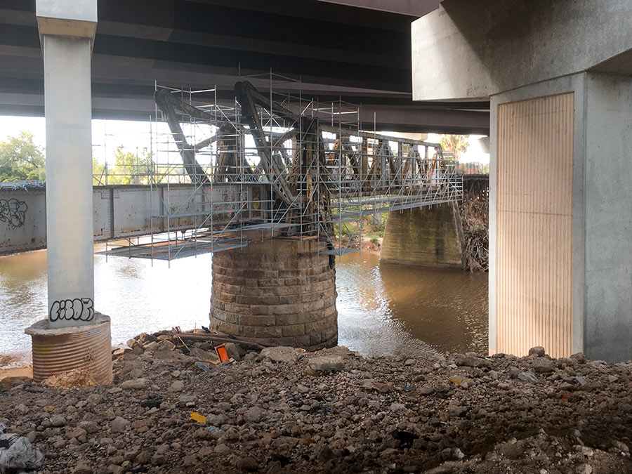
Here’s one of Houston’s latest walkable undertakings: converting the former railroad bridge beneath 59 to a pedestrian bridge that’ll link the trail along the bayou’s north bank to planned pedestrian segments south of waterway. It’s now overshadowed by the tangle of overpasses directly above it, but might not be once TxDOT starts straightening out 59 by nudging it east (and pairing it with a parallel segment of I-45) as part of its grand plan for north Houston highway improvement.
No southern trail segments are in place yet to greet the bridge upon its landfall just east of Downtown, but they will be soon: TxDOT’s already broken ground on a trail that’ll skirt the bayou as it crosses through the Houston Housing Authority’s Clayton Homes Neighborhood east of 59.
It’ll link up with the southern trail segment that does exist and runs east toward Lockwood Dr., as indicated by the gray line in the map below:

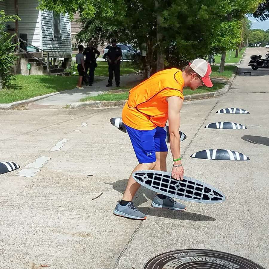
Over the weekend, members of cyclist group BikeHouston along with a number of volunteers sent to Houston by Evangelical Lutheran Church made a few bike-friendly modifications to the McGowen St. roadway between Burkett and Nettleton streets — the block that’s bisected by the Columbia Tap Trail. Armed with stencils, paint, and a supply of rubber armadillos, the group sectioned off a protected bike lane along the road leading toward the trail.
Along they way, they included a few helpful reminders:
Here’s the rundown of all the locations where vehicles injured (purple) or killed (black) cyclists and pedestrians in 2016 and 2017. Transit-focused organization LINK Houston used TxDOT reports to create the map, which plots out 85 percent of all the 641 major walk-and-bike crashes that occurred within city limits during those 2 years. (Locations for 15 percent couldn’t be nailed down.) Of all those collisions, just under a fifth involved bikers; the rest impacted pedestrians. Click on a dot to reveal more about the specific accident that happened at that location.
Even more data shows up here on the full-screen map, which tallies up demographics like the ages, races, and genders of those hit as you move around different neighborhoods. Citywide, one of the brightest constellations is an elbow-shaped one that stretches from Montrose through Midtown and into Downtown — where 22 crashes occurred over the last 2 years. But despite its dimmer glow, Sharpstown had the highest hit rate of any Houston neighborhood: 29. Throughout the entire city, 158 people were killed and 389 were injured.
- Ped/Bike Safety in Houston 2016-2017 [LINK Houston]
Map: LINK Houston
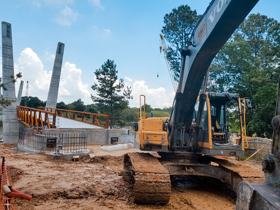
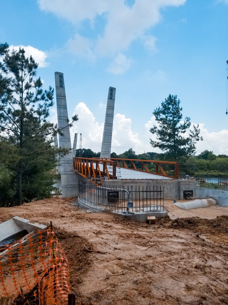
Construction on the new pedestrian bridge going up across Brays Bayou in Mason Park is heading into its 14th month. When it’s done, the 16-ft.-wide, 485-ft.-long structure will provide a link between the north section of the park off S. 7th St., and its southern portion — currently the only part of the 104-acre green space with access to the Brays Bayou Greenway Trail.
The bridge’s landing point on the south side will overshoot the trail by a bit though, as shown in the rendering below:
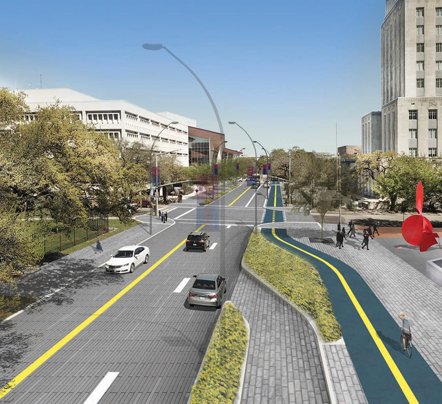
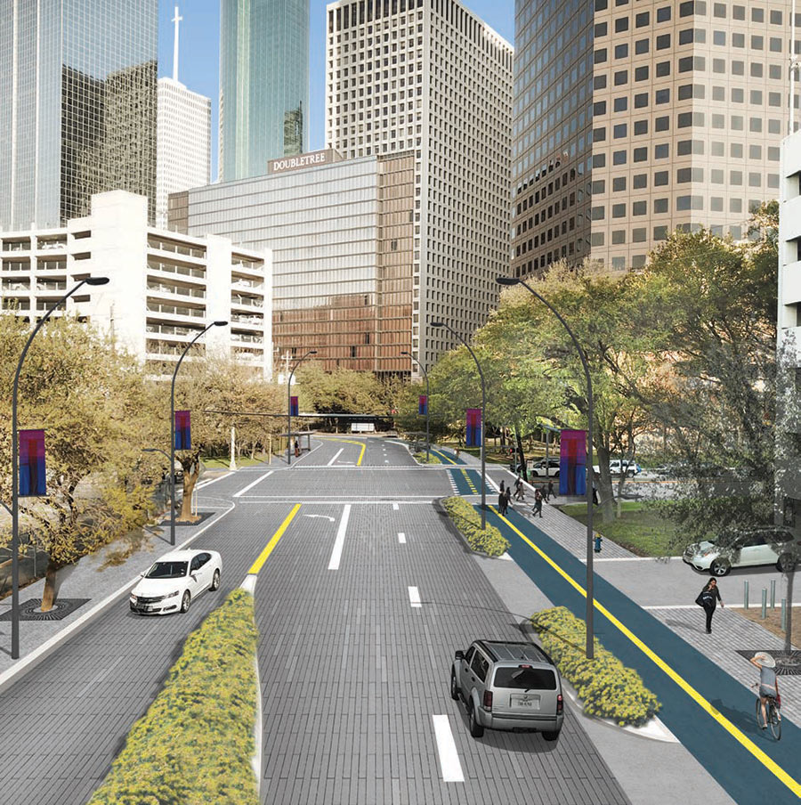
The Downtown Redevelopment Authority is kicking off the engineering phase of its project to run a 2-way bike path along the east side of Bagby St. The new thoroughfare — to be designed by engineering firm Jones Carter — would begin more precisely on W. Dallas St. by the Allen Center parking garages off I-45, then cross Clay St. and hug the curve shown distantly in the rendering above before heading 2 thirds of a mile north up Bagby past 4 adjacent parks. Also on the route: the Houston Public Library, City Hall (shown fronting McKinney in the view at top), the Hobby Center, and Bayou Place.
After crossing Buffalo Bayou, the path would make a right turn and continue east on Franklin St. Following one more right, it comes to an end on Congress, at an elevated drop-off point above the Buffalo Bayou bike trail that crosses through Sesquicentennial Park:
COMMENT OF THE DAY: A NEW DOWNTOWN BIKING MAIN LANE 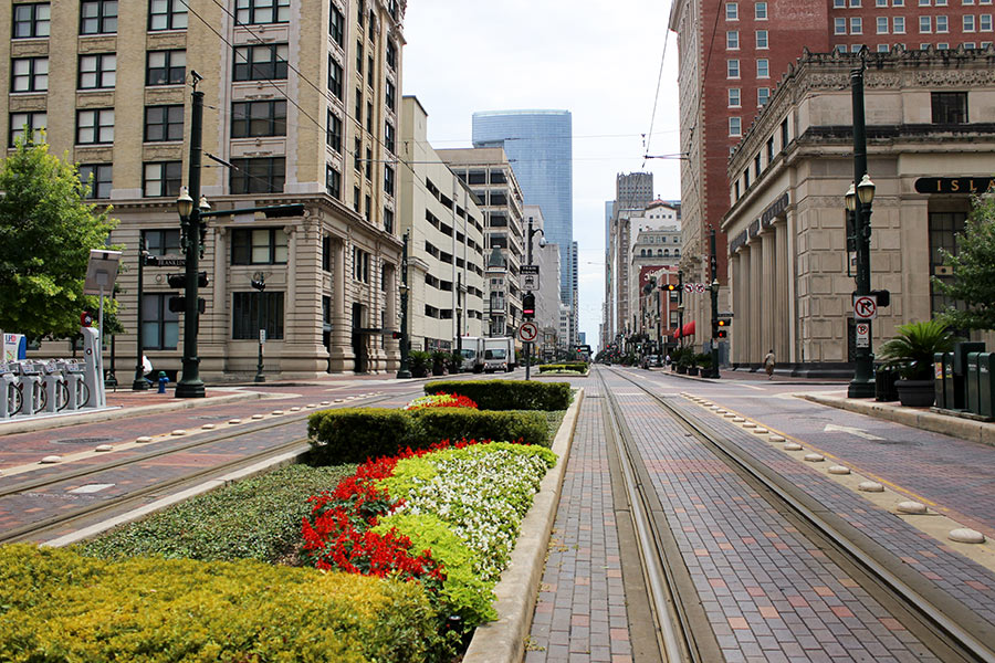 “. . . Metro and the City of Houston should close Main St. to vehicle traffic and make it a bike/pedestrian lane. It’s terribly confusing and extremely slow compared to the lanes next to it and causes more harm than good. People love to hate on bike lanes, but I bet all the haters avoid driving on Main like the plague already.” [HeyHeyHouston, commenting on Council Cuts a Break on Harvey Water Bills; Metro Cracking Down on Illegal Turns Across Tracks; Latest Timeline on the San Jacinto Waste Pits Cleanup] Photo of Main St. at Franklin St.: Russell Hancock via Swamplot Flickr Pool
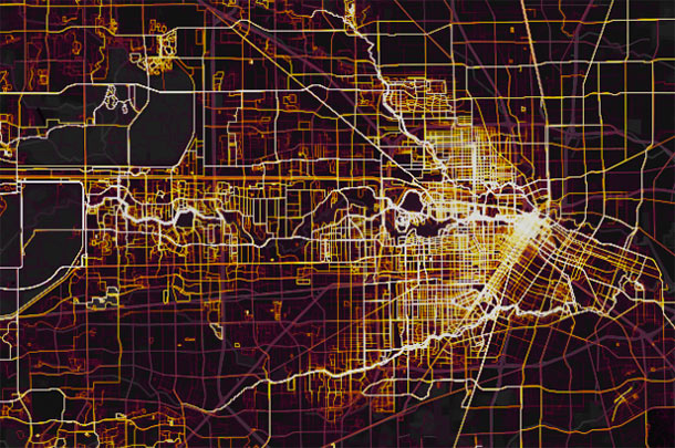
“On almost any map that plots some form of wealth,” writes the Kinder Institute’s Leah Binkovitz, “a familiar arrow takes shape over the Energy Corridor, Memorial and River Oaks, pointing east toward downtown.” Nowhere is that arrow clearer than on this map from fitness brand Strava, which visualizes running and biking activity in Houston from 2009 through last October. Strava updated its map — which includes 200,000 years worth of global exercise time — in November (although it’s been in the news more recently than that). Beginning just east of Hwy. 6, the arm of the indicator travels straight into Downtown, forming a point right around the Elysian St. bridge across Buffalo Bayou.
A little more zoom shows where the arrow’s edges run to the northwest and southwest of the city center:
COMMENT OF THE DAY RUNNER-UP: THERE’S STILL A MISSING LINK IN THE BAYOU BIKE CONNECTOR 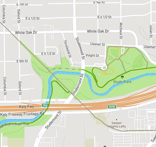 “It’s not complete if you are trying to take the MKT Trail from the Heights into downtown and beyond while staying off streets. The Bayou Greenways interactive map still shows a dotted line for the missing connection between the MKT Trail and the stretch of the trail at Stude Park. When completed, that tiny section will make a big difference.” [Gretchen Lindquist, commenting on Houston’s Bayou Biking Connector Is Now Complete] Image: Bayou Greenways 2020
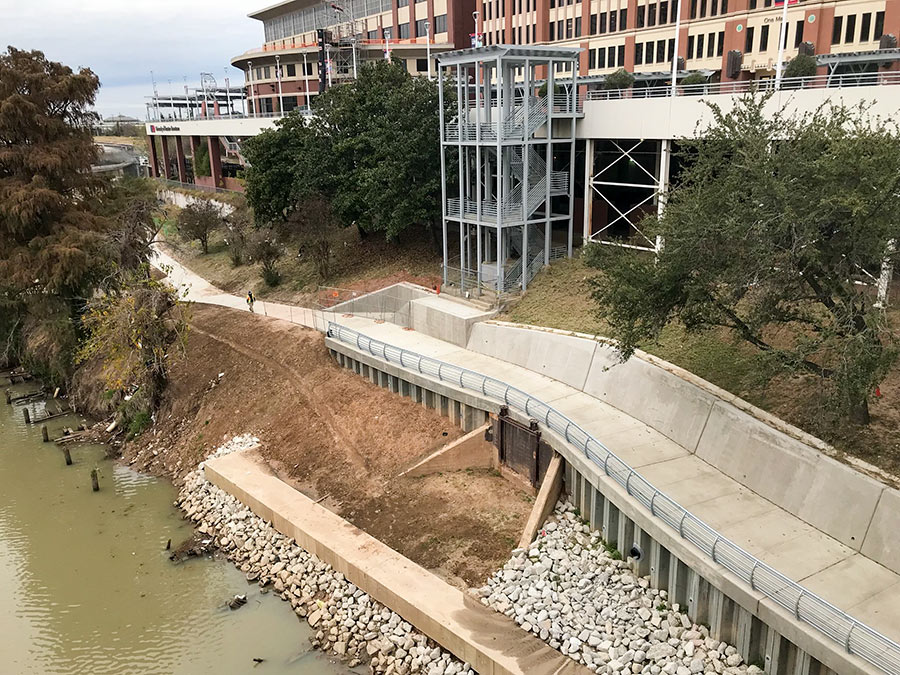
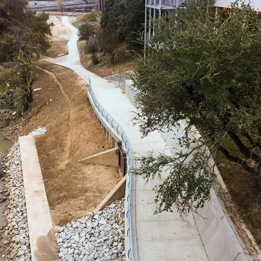
With the completion of the once-missing link shown above, the paths lining Buffalo Bayou are now fully connected to the Heights Hike and Bike Trail. Making use of the new route, you can now ride all the way from Shepherd to Heights Mercantile — provided rising floodwaters have not blocked the path. The photo at top, snapped from the southern section of the Main St. bridge, shows a new railing along the path in place of the temporary fencing that lined the edge last year. Travis and Milam streets are visible in the distance in the second photo. The elevated building to the right of the path is part of UHD’s campus.
The purple curve on the map below marks the location of the new connection, while the gray line running northwest indicates the Heights Hike and Bike Trail:
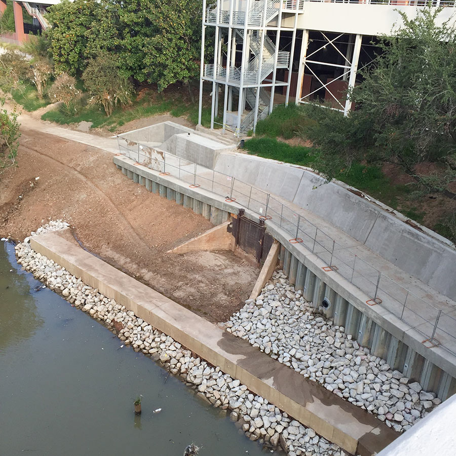
Construction is almost complete on a missing link between the bike paths lining Buffalo Bayou Park and the Heights Hike and Bike Trail, according to passer-by Christopher Andrews — who snapped the above photo from the southern span of the Main St. bridge, looking towards the back of the UH–Downtown campus. The purple curve just north of Allen’s Landing marked on the map below is the segment of the bayou trail that’s in the works. You can see where that portion will intersect the Heights trail, marked below in gray, after it crosses White Oak Bayou’s southerly meander to the east of UHD:

