COMMENT OF THE DAY: A BIG BLOW TO BAYOU BIKING  “. . . Have been riding Ant Hills since 1994. People who do not frequent this stretch of bayou may not know its beauty or usefulness but will be an irreplaceable loss of being able to enjoy the outdoors in Houston if allowed to go forward.” [Turning_Basin, commenting on New Overflow Pools Coming To Clear Out Trees, Anthills from the South Side of Buffalo Bayou] Photo of Terry Hershey Park: Save Buffalo Bayou
Tag: Buffalo Bayou
COMMENT OF THE DAY: THE WATER WILL ALWAYS COME AND MOVE STUFF AROUND  “I hope these detention pools make a difference but I doubt they will: Less likely since the rooted greenery is being removed. Flood events will always tear up a riverbed and its plants. The best thing to do is to let the vegetation grow up until the next flood event — that’s the cheapest most efficient tactic. If a future flood event takes people’s back yards away then that’s just tough for those homeowners. In spots, Buffalo Bayou is a lovely, primeval place to take a canoe trip. In spots it’s a trash heap. It’s always interesting though!” [movocelot, commenting on New Overflow Pools Coming To Clear Out Trees, Anthills from the South Side of Buffalo Bayou] Illustration: Lulu
WHEN THE CAR’S JUST TOO NICE FOR THE GARAGE “It takes a little bit of maneuvering,” explains Nick, the proud owner of a blue-and-orange McLaren Senna and the reworked 1954 William Floyd bayou-side home just north of Woodway Dr. whose living room he parks it in. “I usually leave 2 cars in here. I usually have to come in,” he explains to globetrotting carhound Alex Hirschi, “drive one into the kitchen and then bring in the other one. If you would have came here last night you would have found there was a purple Porsche sitting right here and the McLaren was pulled in there — because it was raining.” Video: Supercar Blondie via KHOU 11

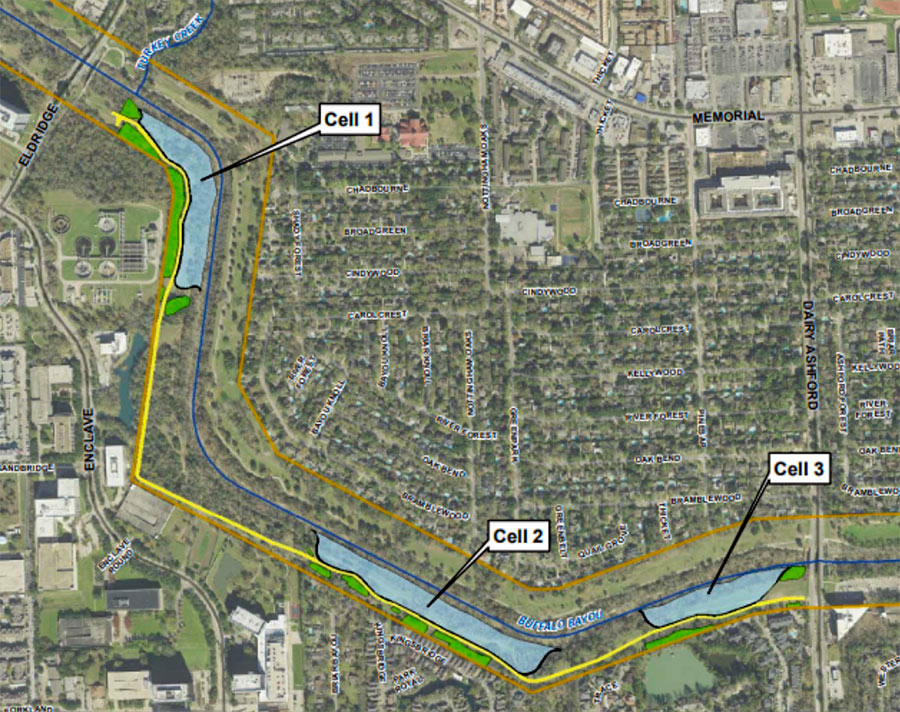
Time’s almost up for a whole mess of trees lining the south side of Buffalo Bayou between Eldridge Pkwy. and Dairy Ashford (pictured at top), where the Harris County Flood Control District plans to construct the first 3 of a series of overflow basins. Removal of vegetation across the bayou from Nottingham Forest’s southern border is scheduled to begin within a few weeks; construction company Lecon has the $1.8 million contract to build the “linear stormwater detention compartments,” which are meant to accommodate a temporary visit of up to 90 acre-ft. of bayou water during a flood.
The trees and basins will be carved out of Terry Hershey Park. The district notes that some trees and vegetation may be preserved — forming a buffer “where possible” between the basins and private property to the south. Large sections of the popular Anthills Mountain Bike Trail, which the district notes “were built on publicly-owned land without written permission and without compensation to the public” will be cleared, though a portion that sits between the 2 westernmost basins will remain.
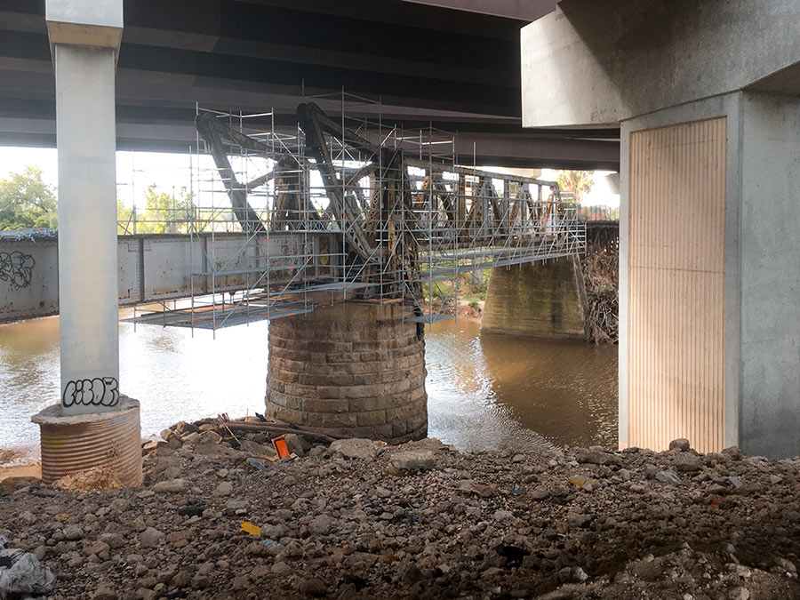
Here’s one of Houston’s latest walkable undertakings: converting the former railroad bridge beneath 59 to a pedestrian bridge that’ll link the trail along the bayou’s north bank to planned pedestrian segments south of waterway. It’s now overshadowed by the tangle of overpasses directly above it, but might not be once TxDOT starts straightening out 59 by nudging it east (and pairing it with a parallel segment of I-45) as part of its grand plan for north Houston highway improvement.
No southern trail segments are in place yet to greet the bridge upon its landfall just east of Downtown, but they will be soon: TxDOT’s already broken ground on a trail that’ll skirt the bayou as it crosses through the Houston Housing Authority’s Clayton Homes Neighborhood east of 59.
It’ll link up with the southern trail segment that does exist and runs east toward Lockwood Dr., as indicated by the gray line in the map below:
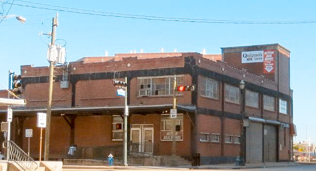
Harris County and the trailblazing Buffalo Bayou Partnership will soon clear the way for a new trail segment on the south side of the bayou by demolishing the vacant 1119 Commerce Building warehouse along with portions of the inmate processing center to its east. Pictured above, 1119 Commerce St. spans the width between San Jacinto St. and the Fannin St. bridge at which the existing trail terminates. Harris County Flood Control district bought the building in 2010 as part of its efforts to smooth out that sharp oxbow where White Oak and Buffalo bayous meet and allow more water to flow through Downtown.
But a lot of that water ended up flowing through the building itself, dampening its below-street levels on at least 4 occasions since the county’s purchase. The year after a 2015 checkup found that the structure’s lower-level steel columns were “95 percent rusted,” the flood control district axed its lease with former tenant Quiznos in preparation to bring down the 94-year-old house, originally built for the Texas Packing Company.
After the trail takes over the lot occupied by the not-yet-demolished building, it’ll butt up next against the adjacent Harris County Inmate Processing Center at 1201 Commerce:
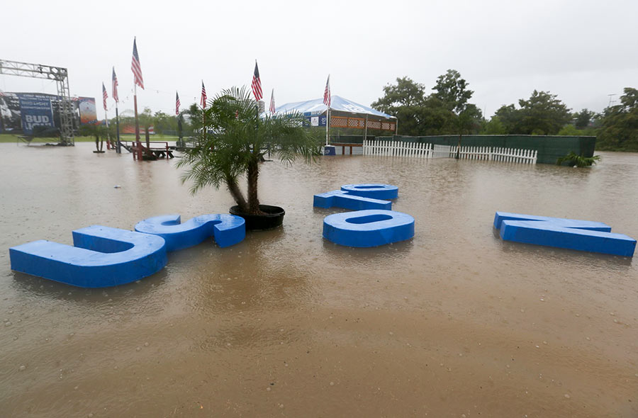
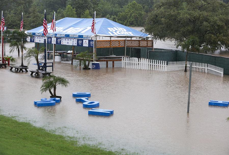
Mayor Turner had already cancelled all Freedom Over Texas events yesterday — save for the fireworks — by the time the HOUSTON sign planted in Eleanor Tinsley Park got caught up in the flow of things and began drifting downstream, away from the Bud Light Beer Garden that it originally fronted. Despite the disorder, the letters managed to stay afloat during their time on the water, captured by Chronicle photographer Yi-Chin Lee.
They ended up making landfall in the middle of the lawn:
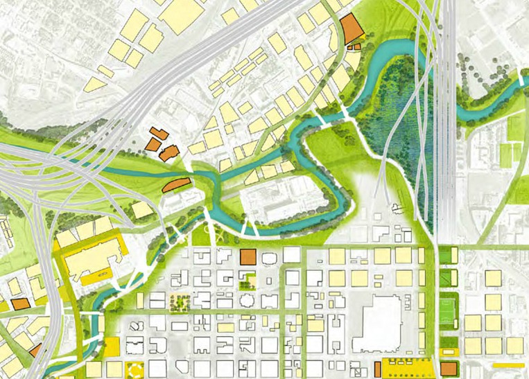
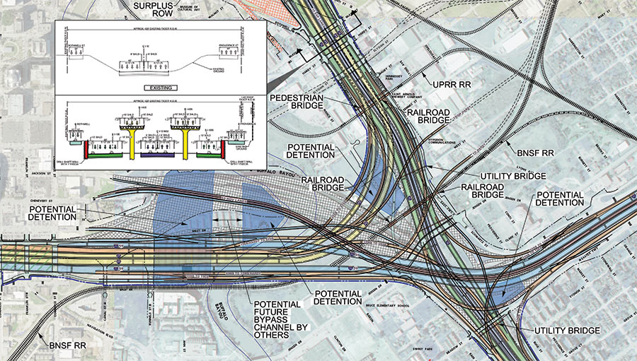
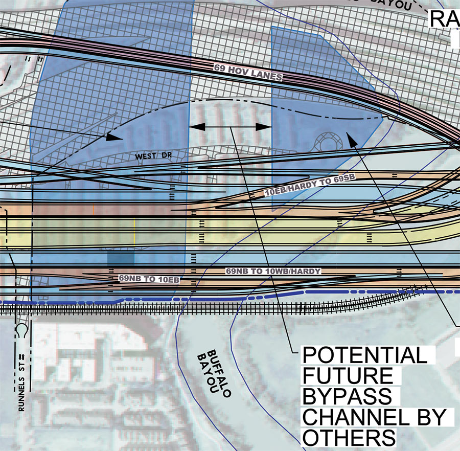
Remember that North Canal that showed up in Plan Downtown’s maps and drawing last year and included a island in Buffalo Bayou? Well, TxDOT’s latest schematics for its planned I-45 reroute include a bypass and island as well — but in an entirely different location. The highway agency’s map above — with west facing up — indicates a new waterway draining into Buffalo Bayou right underneath the section of I-45 it plans to build in place of a portion of the Houston Housing Authority’s Clayton Homes neighborhood. How the canal gets there is obscured, but a straight course northwest appears to shoot the gap between 2 planned detention ponds and cross under the existing section of 59 (shaded gray), before linking up with the bayou again east of Elysian St. Marooned on TxDOT’s version of the make-believe, bayou-banked island the canal would create: a few of the houses in Clayton Homes.
As TxDOT’s caption makes clear, it’d be up to someone else to actually build the waterway. Doing so wouldn’t preclude the previously proposed North Canal from being dug further upstream. Plan Downtown’s less technical map at top shows that waterway beginning at White Oak Bayou and emptying into a bend of Buffalo Bayou just west of Elysian. In doing so, its course creates an exclusive new landmass home to the Harris County jail.
- Conceptual Roadway Layouts and Typical Sections [TxDOT]
- Previously on Swamplot: Funding for Downtown Houston’s New Island; The North Canal, a New Downtown Island, and Other Secret Plans for Downtown Houston’s Future; Latest Mindboggling TxDOT Video Shows Off Rainbow Tangles of Spaghetti-tastic Downtown Freeway Redo Plans in Simulated Drone View; Big I-45 Downtown Rerouting, Grand Parkway Expansion Get Go-Aheads; TxDOT To Pierce Elevated: Your Years Are Numbered, Probably; TxDOT’s Plans for Freeway Expansion Around and Below the Newly Protected Cheek-Neal Coffee Building; Wacky TxDOT I-45 Redo Renderings Now Available in Mind-Boggling Video Format; The 5 Wackiest Images from TxDOT’s Plans To Reroute I-45 and Abandon the Pierce Elevated
Road map: TxDOT. Downtown map: Plan Downtown
THE BATS OF WAUGH DR. HAVE MOVED DEEPER INTO MONTROSE During Hurricane Harvey, Buffalo Bayou rose above the Waugh Dr. bridge, killing off some of the 300,000 Mexican free-tailed bats that lived there. Others have found new residences: “Some of the surviving bats have relocated to nearby buildings. Just take a sniff in any of the multi-floored parking garages lining the streets around the bayou, and you’ll smell their pungent droppings.” Now, Maggie Gordon writes, “In addition to a swarm of winged mammals flying out from beneath the bridge, smaller populations exit from nearby buildings. They join up with the bats from the bridge during their hunt, then return to their new homes for the night, before repeating the same cycle the next day.” [Houston Chronicle]Â Video: Ihadatt
COMMENT OF THE DAY RUNNER-UP: WHY YOU SHOULD TRY BOATING ON THE BAYOU 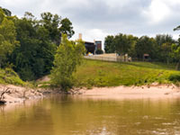 “. . . Buffalo Bayou looks really nice from a kayak or canoe, and you can see the houses from the water. I’ve encountered all sorts of wildlife including many different bird species, turtles, and an alligator. There are maps online locating the put-in / take-out spots, if you’re so inclined. Pro tip: if you’re paddling by yourself and wish to take out at the same spot you put in, paddle upstream first, and save the easier downstream half for when you’re tired and just want to go home.” [GoogleMaster, commenting on Comment of the Day: The Real Reason Why Buffalo Bayou Smells and Looks the Way It Does]
COMMENT OF THE DAY: THE REAL REASON WHY BUFFALO BAYOU SMELLS AND LOOKS THE WAY IT DOES 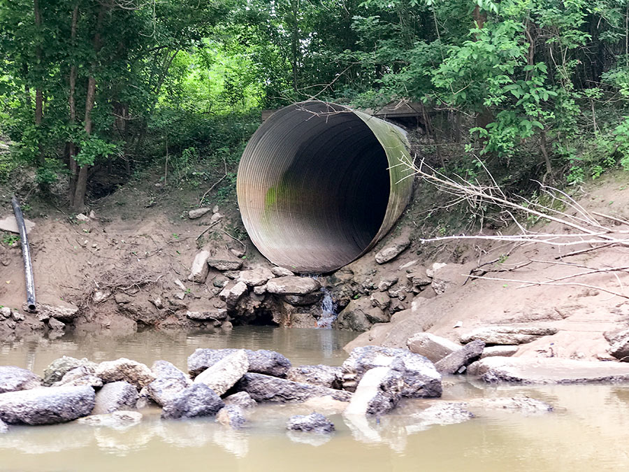 “If Buffalo Bayou stunk so much, then no one would have built a bunch of expensive homes all along it (west of downtown). Most of the Houston area’s waste water effluent flows into the Bayou east of downtown anyways. The Clinton/69th plant (the largest in the city) is just east of downtown, and the Sims and Braes plants don’t enter until well past downtown. With that said, I don’t think the treatment plants are the big contributors to the overall unpleasantness of the Buffalo Bayou water (flood events not withstanding). Most of the effluent (when the plants are properly operating) is nearly clear and usually only has an ‘earthy’ odor to it if any at all. I think the big issue with the bayou’s water quality is the regular runoff and trash that flows into it and eventually lines the shores of it all along downtown.” [nmj, commenting on The North Canal, a New Downtown Island, and Other Secret Plans for Downtown Houston’s Future] Photo: Swamplot inbox
MUD AND WATER AT THE PINE CREST GOLF COURSE  Tomorrow City Council is scheduled to approve a new municipal utility district for a proposed development on the Pine Crest Golf Course at Gessner and Clay Rd. in Spring Branch that would include enough new homes to house 800 residents. MetroNational is selling the 116-acre site to Meritage Homes. “The district would be served by the City’s regional plant, West District Wastewater Treatment Plant,” reads the agenda item. “The nearest major drainage facility for Harris County Municipal Utility District No. 552 would be Buffalo Bayou, which flows into the Houston Ship Channel.” [City Council; previously on Swamplot] Photo of Pine Crest Golf Course: Meritage Homes
A LAKESIDE ESTATES HOME NOW WORTH ITS WEIGHT IN WATER 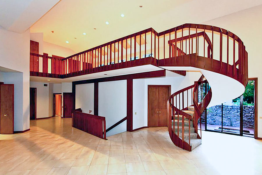 Before the Army Corps of Engineers straightened the section of Buffalo Bayou between Hwy. 6 and Beltway 8 in the mid 1960s, the cul-de-sac at the end of Riverview Dr. in Lakeside Estates wasn’t just near the waterway, it was in it. But the “view” and “side” in the names the subdivision’s developers later attached to the property east of Wilcrest Dr. as they built on it didn’t hold: “When [Allen] Wuescher says he had 17 feet of water inside his house, it’s one of those things you have to see to believe. It is the fifth time in 26 months that his house flooded, and the third time his entire first story was destroyed by water deep enough for a diving board,” writes Meagan Flynn. “Since the home was built in 1979, homeowners at this address have recouped more than $850,000 in flood damage losses through FEMA’s National Flood Insurance Program, at this point making the home more expensive to taxpayers just to exist than for the government to buy it and destroy it. It was appraised at $825,000 by the Harris County Appraisal District. The FEMA flood insurance loss payments so far don’t even include the extraordinary damage wrought by Harvey. And when we enter the home through Wuescher’s garage — which looks like a scene out of The Texas Chainsaw Massacre but with the lights on and with mold instead of blood — it’s immediately clear that the house really is not a house anymore.” [Houston Press] Photo of 10807 River View Dr. living room: Realtor.com
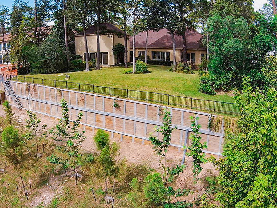
- 10915 Kirwick Dr. [HAR]
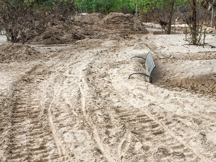
The retreat of floodwaters has revealed the extent of the silt that Harvey-triggered flooding deposited along Buffalo Bayou. A beachgoing reader sends Swamplot these pics of the new dust-colored landscapes that have taken shape along Buffalo Bayou Park and adjacent former green spaces.
The silt-covered bench shown above sits across Buffalo Bayou from the Houston Police Officers Memorial, near Glenwood Cemetery. Here’s a view from further back:

