01/25/19 10:30am

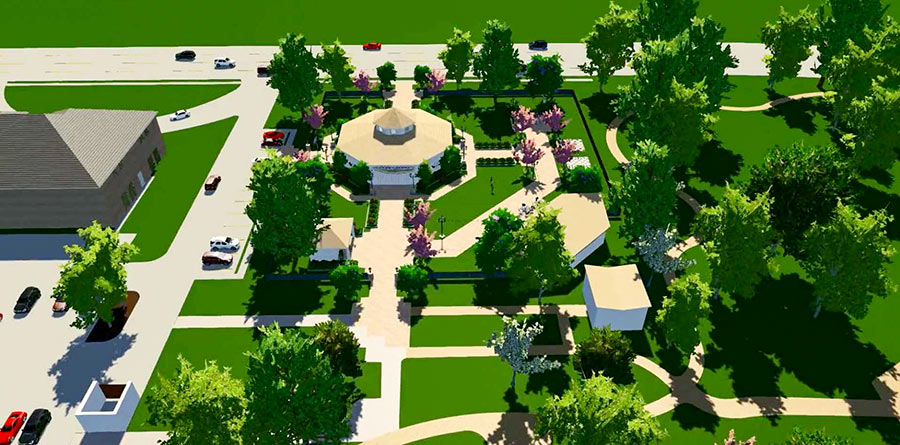
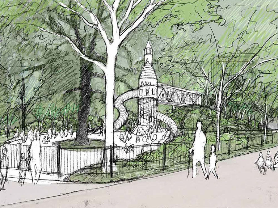
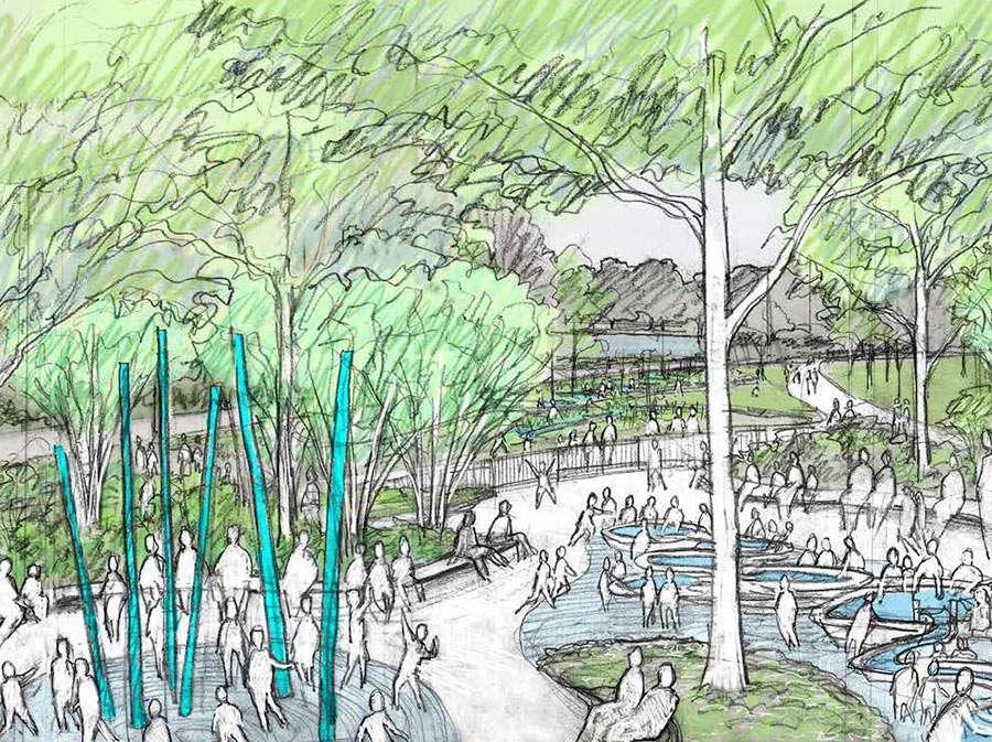
Narrowing in on the corner of Fannin St. and Cambridge St. which will soon go by the name The Commons at Hermann Park, landscape architect Michael Van Valkenburgh and his associates have sketched out a few potentially transformative ideas for the area, such as the rocket-ship-shaped children’s play structure depicted at top with a mock jetway linking it to the hill on the right. And above, a handful of other new outdoor features that seem to be a hit with the faceless crowd of park-goers shown engaging with them in various forms of recreation.

To find out what real people think about the proposals, part of the 20-year Hermann Park master plan, the Hermann Park Conservancy is asking folks to weigh in on them during a public meeting to be held in the Cherie Flores Garden Pavilion at McGovern Centennial Gardens off Hermann Dr. on Thursday, February 7 from 6 to 8 p.m.

Speaking of pavilions, there’s one included in Van Valkenburgh’s plan, too, as a complement to the existing one off Fannin St.

CONTINUE READING THIS STORY

Fannin at Cambridge St.
10/31/18 1:00pm

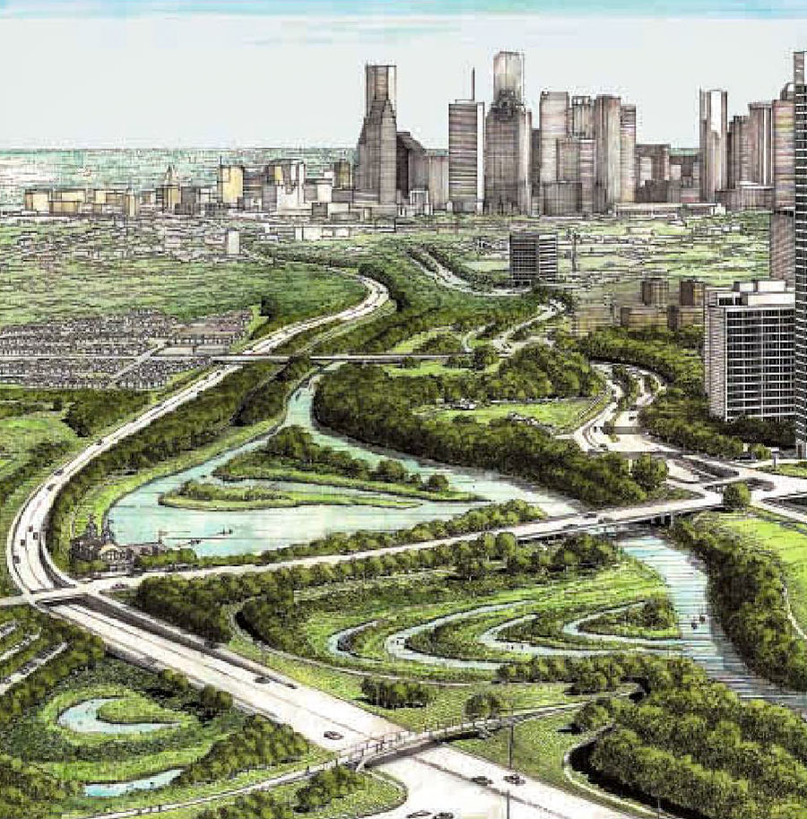
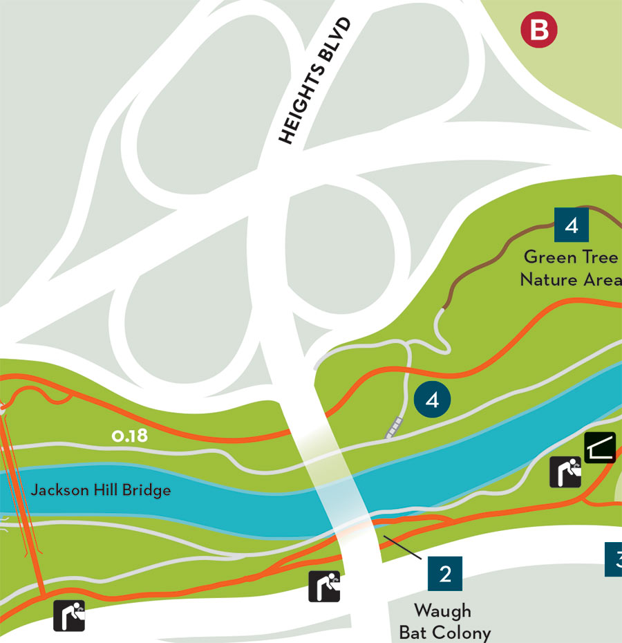
Here’s another highlight from the city council’s meeting this morning: Plans to get rid of the cloverleaf interchange that moves traffic between Waugh Dr. and Memorial Dr. got the green-light and will be sent over to the Houston Galveston Area Council as part of an application for funding. The idea first emerged in the Buffalo Bayou Partnership’s 2002 Master Plan as a way to make room for more bayou-side park space at the crossroads. Right now, all the land adjacent to the ramps — shaded gray in the map above — is vacant, except for the portions lassoed by the circular roadways, where 4 isolated tree groves continue to undergo seasonal color changes. You can see they’re gone in the east-facing rendering at top included in the Partnership’s plan — replaced by inlets, islands, stormwater detention, and what looks to be a boathouse at the southeast corner of the 2 roads — all accessible from a network of new walkways that link up to existing bayou-adjacent trails.

In total, 16 new acres are expected to become part of the park — providing a continuous swath of green between Spotts Park and Cleveland Park, shown below on opposite sides of Waugh in a map from the 2002 plan:

CONTINUE READING THIS STORY

Traffic Lights Likely
10/10/18 4:00pm

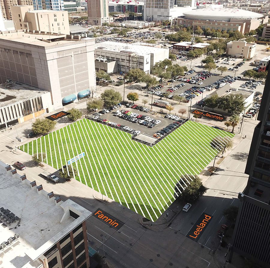
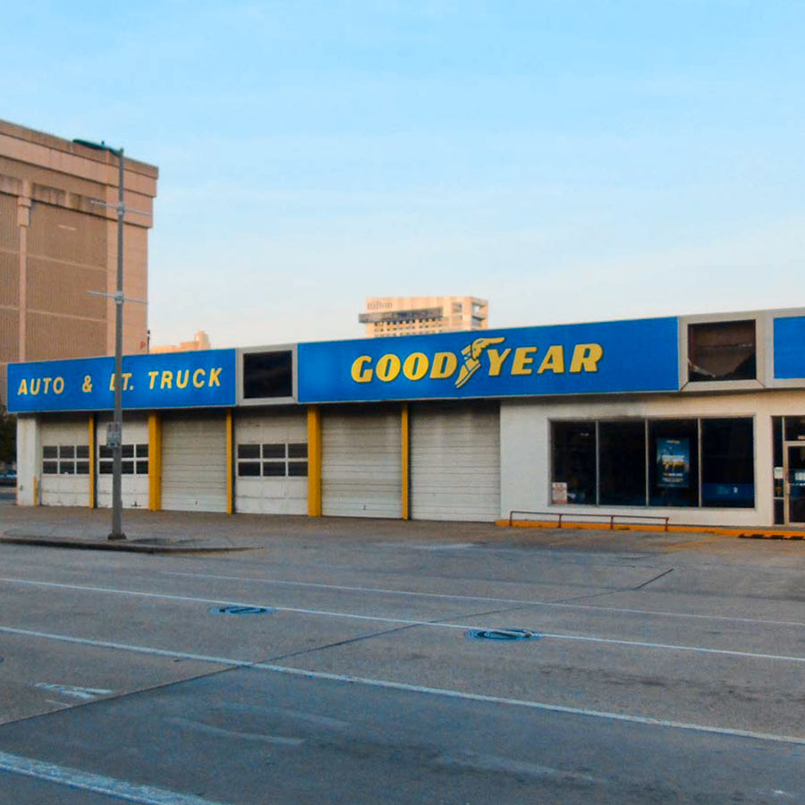
Nancy Sarnoff has a few more details today on what the Downtown Redevelopment Authority will be paying the private owner of the area shown shaded at top — which wouldn’t give up its one-acre parcel there for a new park but will grant the Authority a 30-year lease for: “$355,992 in annual rent,” during the first 5 years, a spokeswoman says, with a 10 percent hike every 5 years thereafter. With that agreement in place — and the Goodyear Auto Service Center that currently occupies the block’s Fannin-St.-side slated for demo next April — the Authority is now seeking plans from landscape architects that’d be responsible for designing the space, though it notes that whatever the chosen firm comes up with “will have a potentially short life, between 30 and 50 years, per the lease agreement currently in place and options to extend.” (The parking lot shown without shading belongs to the South Texas College of Law and is there to stay.)

But that hasn’t stopped those involved from dreaming big while they can. A conceptual map of the park drawn up Project for Public Spaces — a New York planning firm hired to brainstormed some preliminary ideas for the Authority — shows it divvied up among a pair of buildings and a variety of different green spaces including a dog park:

CONTINUE READING THIS STORY

Block 333
10/09/18 2:00pm


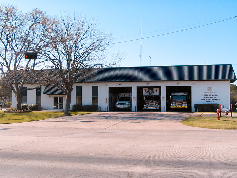
The Friends of Downtown Friendswood withdrew its plan last week to install a new wooden carousel in Stevenson Park next-door to City Hall. Since last November, the site’s been home to a concrete pad left behind when the 42-year-old Fire Station #1 pictured above was demolished and its staff relocated to a new facility at 1610 Whitaker Dr., built with funds from a 2013 bond referendum. By the time of the teardown, the carousel idea (code-named “Project C”) was already on the table, and some residents accused city council of being a little too demolition-happy, owing to their friendliness with the civic organization that proposed it, reported the Chronicle‘s Jeremy Gingrich.

Instead of getting rid of the building, some argued, why not turn its 9,000 sq.-ft. into a community center to double down on the space offered by the city’s existing 9,500-sq.-ft. Friendswood Activity Building shown below at 416 Morningside St.?

CONTINUE READING THIS STORY

Stevenson Park
07/13/18 5:00pm

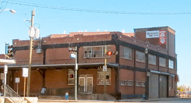
Harris County and the trailblazing Buffalo Bayou Partnership will soon clear the way for a new trail segment on the south side of the bayou by demolishing the vacant 1119 Commerce Building warehouse along with portions of the inmate processing center to its east. Pictured above, 1119 Commerce St. spans the width between San Jacinto St. and the Fannin St. bridge at which the existing trail terminates. Harris County Flood Control district bought the building in 2010 as part of its efforts to smooth out that sharp oxbow where White Oak and Buffalo bayous meet and allow more water to flow through Downtown.

But a lot of that water ended up flowing through the building itself, dampening its below-street levels on at least 4 occasions since the county’s purchase. The year after a 2015 checkup found that the structure’s lower-level steel columns were “95 percent rusted,” the flood control district axed its lease with former tenant Quiznos in preparation to bring down the 94-year-old house, originally built for the Texas Packing Company.

After the trail takes over the lot occupied by the not-yet-demolished building, it’ll butt up next against the adjacent Harris County Inmate Processing Center at 1201 Commerce:

CONTINUE READING THIS STORY

Jailbreak
07/11/18 3:00pm

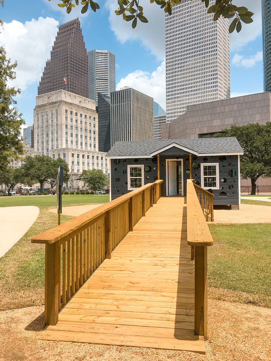
A new downtown hole-in-the-wall is making its debut at the foot of the city’s longstanding famous buildings. Among all the openings in the house now standing in the middle of Sam Houston Park, the most accessible one (ADA-certified) is at the end of the ramp pictured above. Cherry Moving was the first to add holes to the building: it inserted the more conventional windows after scooping up the 80-year old, 16-by-24-ft. single-story from the East End in order to resell it. The buyers: serial house tweakers Dan Havel and Dean Ruck, who perforated its façades and lined the bubbles with PVC piping to make them watertight.

You can see the piping’s light blue tint from the angle below:

CONTINUE READING THIS STORY

Say Cheese
07/05/18 4:00pm

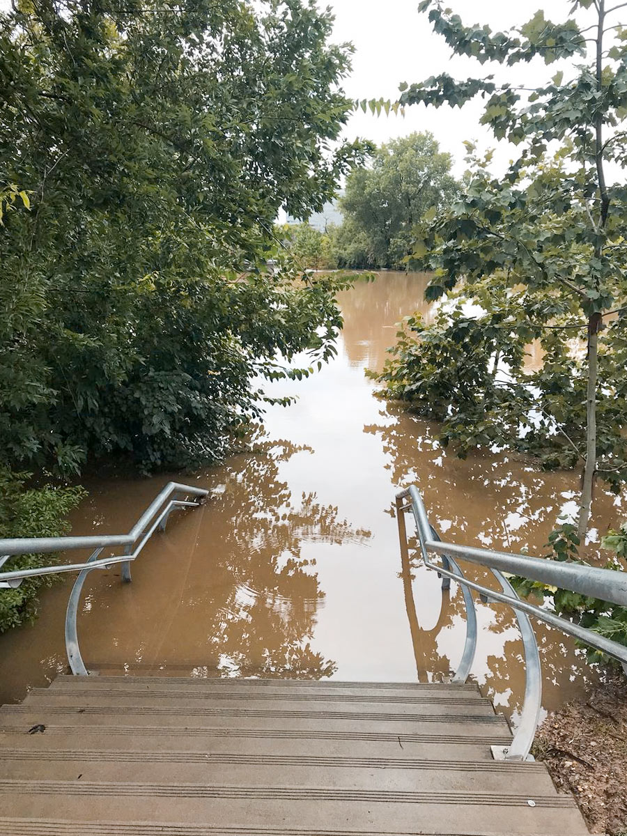
On-the-ground footage from KHOU reporter David Gonzalez shows just how much water the Johnny Steele Dog Parkredone and reopened 3 weeks ago following its last flood — took on yesterday. By the end of the downpour, floodwaters had risen up a few steps from where the park begins at the foot of the staircase leading to Allen Pkwy., as shown in the photo above.

That left these 2 out of luck:

CONTINUE READING THIS STORY

Bayou Spillover
07/05/18 10:00am

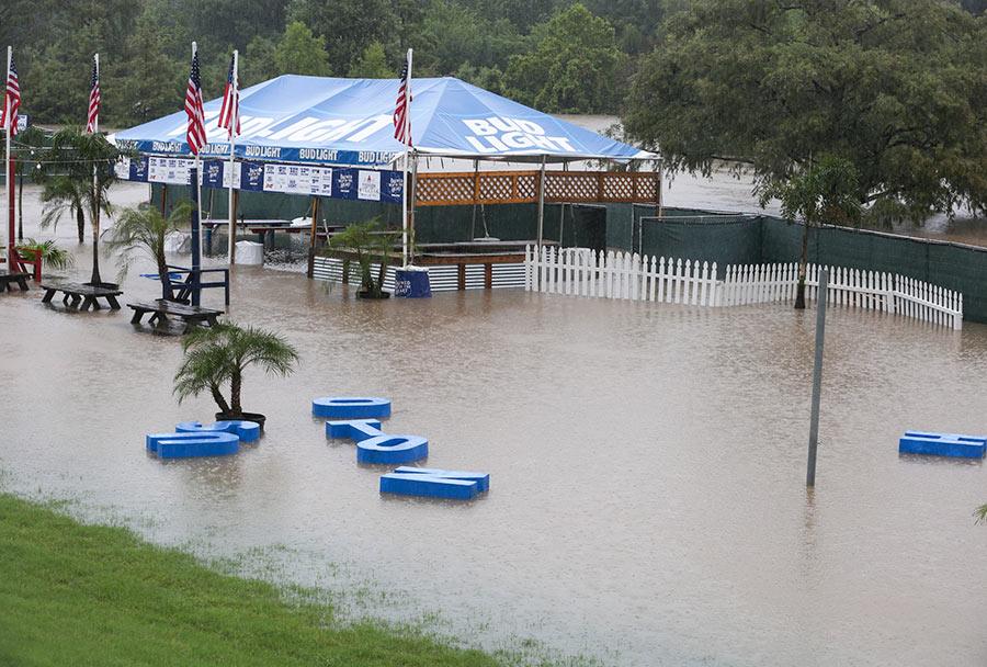
Mayor Turner had already cancelled all Freedom Over Texas events yesterday — save for the fireworks — by the time the HOUSTON sign planted in Eleanor Tinsley Park got caught up in the flow of things and began drifting downstream, away from the Bud Light Beer Garden that it originally fronted. Despite the disorder, the letters managed to stay afloat during their time on the water, captured by Chronicle photographer Yi-Chin Lee.

They ended up making landfall in the middle of the lawn:

CONTINUE READING THIS STORY

Rainy Spell
06/14/18 1:15pm

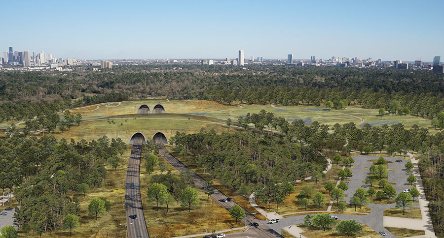
Among the many changes now slated for Memorial Park: parking meters. The $70 million gift the Kinder Foundation pledged in April to expedite park renovations came with a few spend-it-wisely stipulations, including one that the city won’t blow any of it on maintenance costs — which could rise as the redo adds new trails, drainage improvements, a running complex, and a land bridge (depicted in the rendering above) across Memorial Dr. to the green space over the next 10 years. Although the $1-per-3-hour-block meters will only crop up in certain sections of the park, the change they collect will help offset upkeep across the whole 1,500-acre area.

A consolation: the new trail system proposed for the park will be vast, according to a handout from the city’s Quality of Life Committee, “thereby reducing the need for car access” in the first place. But that workaround only helps if you’re arriving empty-handed, unlike golfers who’ll have top pay $1 per hour to park in the course and driving range lot — Mike Bailey notes in Golf Advisor — beginning sometime before the fall.

Rendering of planned Memorial Dr. tunnels beneath park: Memorial Park Conservancy

Upping the Ante
06/14/18 10:00am

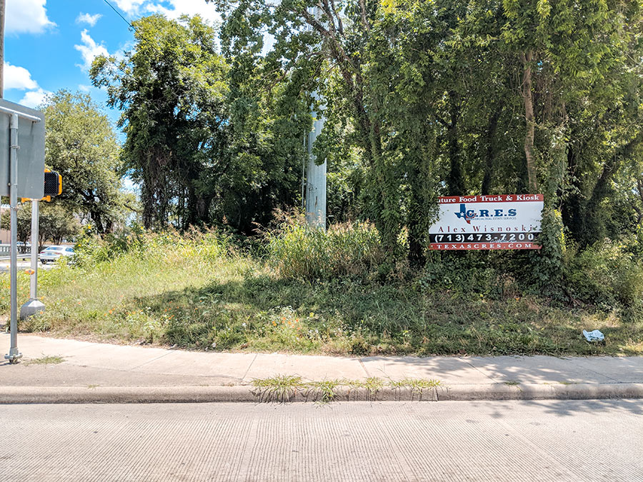
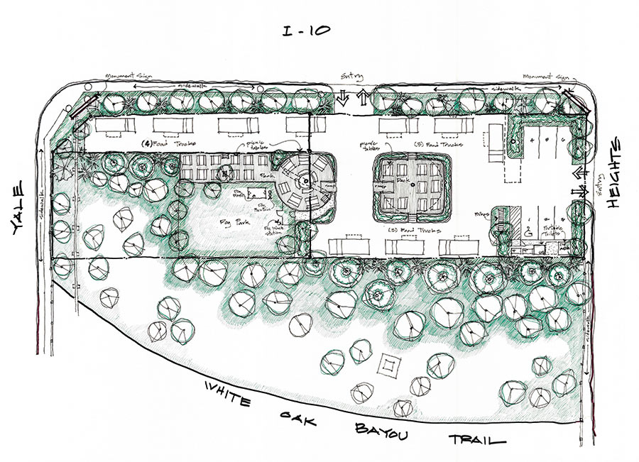
Only about 250 ft. separate I-10’s eastbound feeder from White Oak Bayou between Heights Blvd. and Yale — and within that never-developed span, Texas C.R.E.S. and an adjacent landowner are hoping to plant a food truck park, as advertised on the sign up near the southeast corner of the site. The conceptual plan above from architect Marshall Porterfield — not yet okayed by the city — indicates parking spaces for 10 vendors (and 6 patrons) accessible via entrances on the feeder and on Heights Blvd., across from the Heights Business and Mediation Center. A deck seating island in the middle of the parking lot provides some dining room within the third-acre site, owned by the current pair of developers since last year.

The rest of the land is devoted to park space for people and dogs. It backs up to an imagined spur of the White Oak Bayou Trail (currently only accessible on the other side of the bayou) that curves to the south.

Photos: Jason Cockerell. Site plan: Marshall Porterfield via Texas CRES and Delux Realty/Michel Coret

South of I-10
05/22/18 4:00pm

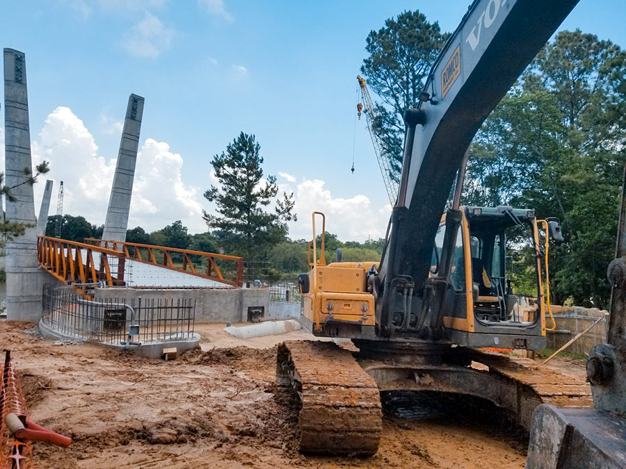
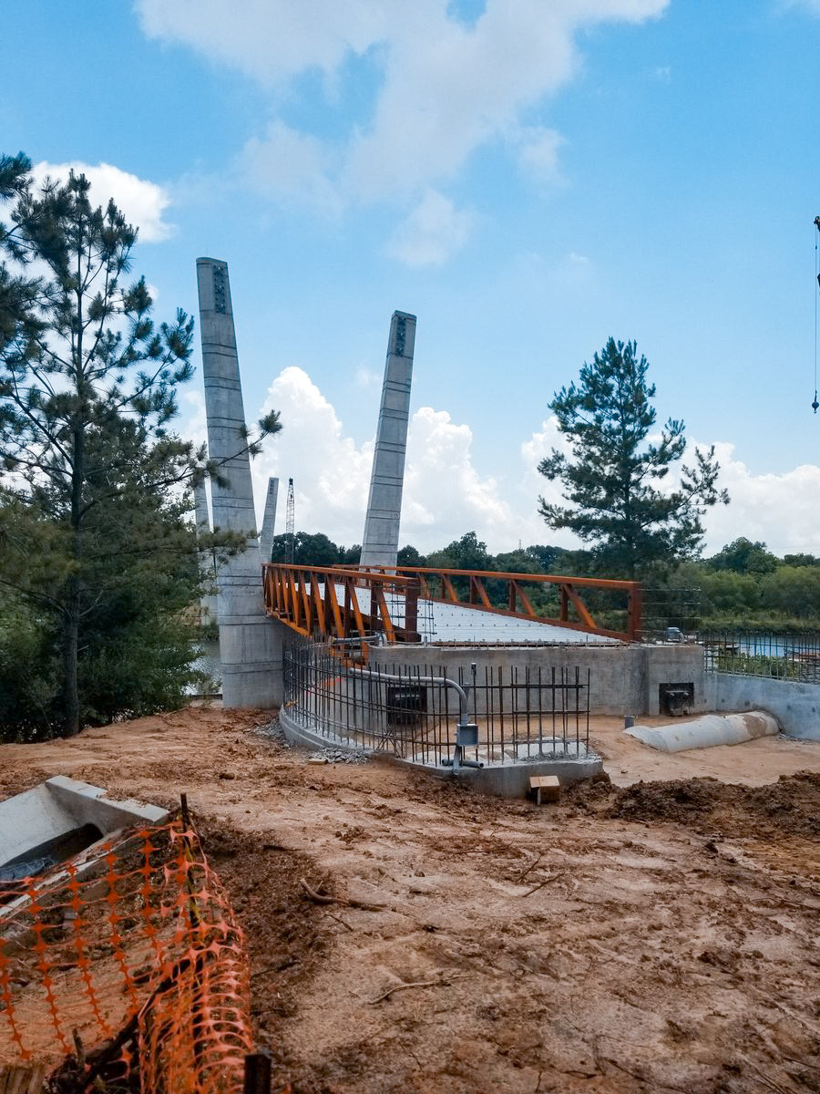
Construction on the new pedestrian bridge going up across Brays Bayou in Mason Park is heading into its 14th month. When it’s done, the 16-ft.-wide, 485-ft.-long structure will provide a link between the north section of the park off S. 7th St., and its southern portion — currently the only part of the 104-acre green space with access to the Brays Bayou Greenway Trail.

The bridge’s landing point on the south side will overshoot the trail by a bit though, as shown in the rendering below:

CONTINUE READING THIS STORY

Bayou Biking Link
05/18/18 4:00pm

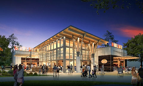
A pair of new renderings shows off the 2 food options planned for Levy Park — now in its second year of operation since the overhaul that reshaped and then reopened it last February. The kiosk depicted above — dubbed Love Shack — gets its name from chef Tim Love. (A previously-announced moniker, Love Bird, appears to have been scrapped.)

Love is also the operator behind the larger restaurant dubbed Woodshed Smokehouse that’s shown with a tall glass-walled dining room in the rendering at top. Below, a map of the park shows a spot labeled “Future Restaurant” in its bottom right corner:

CONTINUE READING THIS STORY

Preparing to Sprout
04/18/18 11:45am

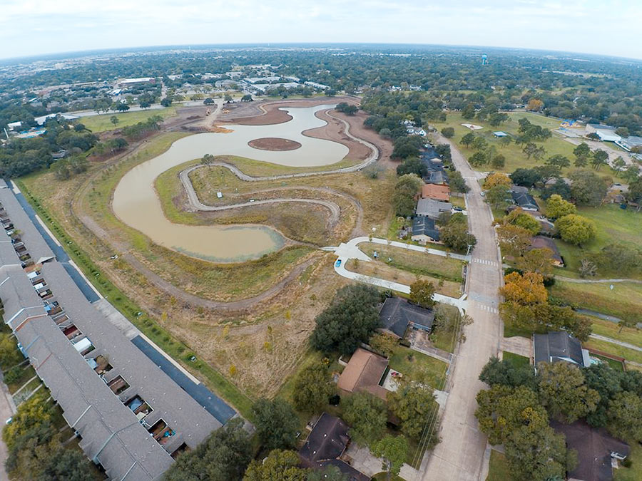
An official aerial video shows off the golf-course-to-retention transformation that’s taken place across a few holes of the former Clear Lake City course north of where Diana Ln. and Ramada Dr. converge. The first all-inclusive shot comes at about 30 seconds. In it, paved and unpaved trails wrap the new pond, which is surrounding by just a few saplings — although plans note it will eventually be an “abundant natural habitat” filled with native vegetation. Some of those incoming species may reside on the so-called “habitat island” that shows up clearly at the 40 second mark.

A parking lot neighbors the southwestern waterfront, adjacent to a pair of new sports fields:

CONTINUE READING THIS STORY

Exploration Green
04/17/18 5:00pm

COMMENT OF THE DAY: THE CITY SHOULD HAVE BEEN BUYING PARK SPACE SOONER “Back in the Mayor Parker days, the city would just take the green space fees and use them to plug holes in HPARD’s budget. As was typical for the time, the reasoning from the Parker administration was basically: ‘Nothing says we can’t do that.’ Sadly, back then, market value was about half of what it currently is in the Heights and other hot markets in town where larger tracts are becoming exceedingly rare. Many opportunities to add park space were missed.” [Old School, commenting on A New Heights Park for the Shuttered Bus Stop on N. Main?] Illustration: Lulu
04/17/18 12:30pm

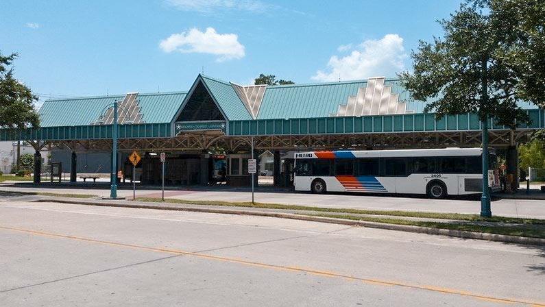
A NEW HEIGHTS PARK FOR THE SHUTTERED BUS STOP ON N. MAIN? METRO rendered the Heights Transit Center just north of Cavalcade obsolete when its new bus routes went into service in 2015. Although 3 routes still converge below the southern tip of the 0.88-acre, triangular property where Studewood dies into N. Main, not all of them let on at that location and none of them arrive at the covered waiting area riders once used for boarding. Now, reports the Chronicle’s Mike Morris, the City plans to buy the unused lot. The price: $1,425,000, to be funded by fees imposed on developers who didn’t include green space in their projects as specified in a 2007 ordinance. The fees, writes Morris, “must be spent there within three years and can be used only for park improvements.” The city council will vote on the land purchase today. [Houston Chronicle] Photo: Save the Heights Transit Center