10/09/18 2:00pm


The Friends of Downtown Friendswood withdrew its plan last week to install a new wooden carousel in Stevenson Park next-door to City Hall. Since last November, the site’s been home to a concrete pad left behind when the 42-year-old Fire Station #1 pictured above was demolished and its staff relocated to a new facility at 1610 Whitaker Dr., built with funds from a 2013 bond referendum. By the time of the teardown, the carousel idea (code-named “Project C”) was already on the table, and some residents accused city council of being a little too demolition-happy, owing to their friendliness with the civic organization that proposed it, reported the Chronicle‘s Jeremy Gingrich.

Instead of getting rid of the building, some argued, why not turn its 9,000 sq.-ft. into a community center to double down on the space offered by the city’s existing 9,500-sq.-ft. Friendswood Activity Building shown below at 416 Morningside St.?

CONTINUE READING THIS STORY

Stevenson Park
01/30/18 4:15pm

“On almost any map that plots some form of wealth,” writes the Kinder Institute’s Leah Binkovitz, “a familiar arrow takes shape over the Energy Corridor, Memorial and River Oaks, pointing east toward downtown.” Nowhere is that arrow clearer than on this map from fitness brand Strava, which visualizes running and biking activity in Houston from 2009 through last October. Strava updated its map — which includes 200,000 years worth of global exercise time — in November (although it’s been in the news more recently than that). Beginning just east of Hwy. 6, the arm of the indicator travels straight into Downtown, forming a point right around the Elysian St. bridge across Buffalo Bayou.

A little more zoom shows where the arrow’s edges run to the northwest and southwest of the city center:

CONTINUE READING THIS STORY

Citywide Fitness Tracking
12/04/15 9:15am

Wildcat Golf Club, 12000 Almeda Rd., Pierce Junction, Houston

Looking for an overview of the new site of UT’s recently-announced Houston campus? Your best bet may be to stop in at the Wildcat Golf Club, located directly across Holmes Rd. from the site of UT’s planned purchase. Native Houstonians may experience a touch of vertigo trekking up the club’s grassy peaks to catch the view of NRG Park and downtown (see above) — hills on the site reach more than 115 feet above sea level in places. (Downtown, for comparison, stands at roughly 50 feet, and the big hill at Miller Outdoor Theater tops out around 65.)

The golf club’s topography is a byproduct of its original gig as a major municipal landfill, operating for nearly two decades until 1989; clay and topsoil were imported to sculpt the waste heaps into today’s smoothly rolling hills and water features:

CONTINUE READING THIS STORY

Houston Hill Country
06/02/14 10:30am

HIGH VOLTAGE NEWS FOR HOUSTON BICYCLISTS Bike Trail Along Transmission Line Right of Way, Brays Bayou, Houston
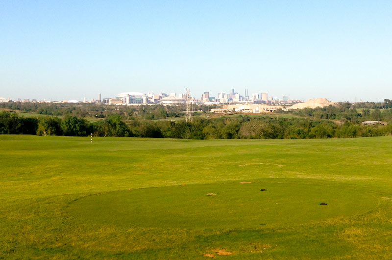
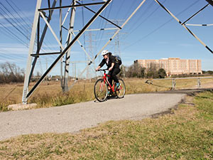
Parks and Rec department director Joe Turner tells the Chronicle‘s Mike Morris that a powerline right-of-way crossing on University of Houston property northeast of the intersection of Martin Luther King Boulevard and Old Spanish Trail will be the first improvement allowed by a new agreement between the city and CenterPoint Energy (subject to city council approval this week) that will allow hike-and-bike trails to be cut along electrical transmission-line right of ways throughout the city. Most likely the next up, according to Turner: a trail from Sims Bayou to Cambridge Village Park in southwest Houston. That route, along with others being contemplated, runs north to south. As Mayor Parker noted in her announcement, that should complement the bayou-side (and therefore mostly east-west) trails being created as part of the Bayou Greenways 2020 project. CenterPoint is donating $1.5 million toward the creation of new trails on their property, possibly because it got what it wanted in the deal, which also involves the conversion of all 165,000 city traffic signals to LEDs over the next 5 years. Writes Morris: “Bills to allow trails on utility right of way were filed as early as 2007 but stalled over questions about how much liability CenterPoint should face in opening its land for recreational use. A compromise was reached last year. The utility is liable only for a serious injury or death caused by its ‘willful or wanton acts or gross negligence.’ Under the agreement announced Friday, the city would pay the utility’s legal bills if lawsuits are filed.” [Houston Chronicle ($); more info; previously on Swamplot] Photo of bike trail along Brays Bayou: Dave Fehling/State Impact

10/30/13 11:00am

MAKING MORE SPLASH IN PASADENA The Pasadena city council got together last week to have a look at a $4 million plan that would expand the community pool at Strawberry Park on Lafferty Rd. and Parkside Dr. into something a bit splashier, reports the Pasadena Citizen: “Progressive Commercial Aquatics’ Steve Davis explained the success public and private entities have had with water parks, including nearby Pirates Bay, owned by the City of Baytown. In Davis’ plan for Pasadena, the . . . project would add a new bath house, ‘lazy river,’ concession area, multiple shaded areas and lots of other pool features.” But not all council members were sold. Says Pat Van Houte: “To me, it’s not really a priority. I would look at the economics of, ‘How much is this going to cost long run?’” [Pasadena Citizen] Drawing: Progressive Commercial Aquatics

10/23/13 4:30pm

Here’s a rendering that shows how that informal dog bowl along Buffalo Bayou near Montrose Blvd. will be formalized and capitalized into a Dog Park. Construction, says a PR rep for the Buffalo Bayou Partnership, will begin the first of the year; the park should be open next winter.

Why, you might wonder, would it take that long to build a place for dogs to romp and run and bark and stuff? Part of it will be creating the pond you can see in the rendering. The pond, which will be treated with a “bio-filter” and native vegetation, is meant to keep said dogs 1) safe and 2) away from the bayou, so they don’t muddy up the banks scrambling in and out of the water and contribute to erosion. Other additions? A purty fence that will separate the pups from the joggers and 2 pavilions, at the top of the hill, that will provide a bit more shade.

Rendering: SWA Group

10/07/13 11:00am

BUILDING A MONUMENT TO GATED FLOOD CONTROL AND TOURISM Protecting the Ship Channel during an Ike-like (or worse) storm surge has led some to propose a big dike, others a big gate. But UH professor of urban planning Tom Colbert doesn’t see why we couldn’t trouble ourselves to make such protection a real sight to see too: “Colbert likes the idea of . . . connecting the Centennial Gate and its levees to the proposed Lone Star National Recreation Area, undeveloped land that would both attract ecotourists and slow floodwaters,” reports the Houston Chronicle’s Lisa Gray: “I remembered one drawing I’d seen in [Colbert’s] PowerPoint show: Happy tourists, paddling kayaks past the Hartman Bridge, on one of the byways out of the big ships’ path, waterbirds and wetlands all around. Colbert motioned southeast, toward the Ship Channel’s mouth, toward Barbours Cut, the other possible location for the floodgate. There, he said, the levees would cross the channel’s water, connecting the Ship Channel’s artificial islands — made from dirt dredged from the channel — to the shore. Enough room could be left on top of the levee for a hiking path or even for car access; for the first time, it would be possible for people to get to the Atkinson Island Wildlife Management Area — a bird mecca on manmade land — without a boat. You could even, he notes, build a tourist destination atop one of those islands: He proposes a monument to Houston, the gateway to North America, the place where nature meets industry. In some drawings, just to give people the idea, he plunks the Statue of Liberty atop a Ship Channel island.” [Houston Chronicle ($); previously on Swamplot] Photo of Fred Hartman Bridge: Chuck Wilkson

10/03/13 3:30pm

Construction began yesterday on a new 1.35-mile segment of hike and bike trail on White Oak Bayou, the first of 5 planned sections that will more or less formalize the route that some trail users have taken it upon themselves to blaze. Eventually, the $3.4 million that the Bayou Greenways project will spend here will create about 11 miles of off-street passage from Hollister Rd. in Spring Branch to Downtown.

But first things first: This new segment will span Shepherd and Durham and W. 11th St., where, as this rendering from SWA Group shows, that charred MKT railroad trestle will be replaced with a snazzy new one — somewhat to the chagrin of John Nova Lomax, you’ll remember, who’s on the record lamenting the yoga dads and their ilk that that char might have once scared off.

Rendering: SWA Group

09/12/13 2:00pm

At a meeting yesterday, reps from the Houston Parks Board told reps from the Idylwood Civic Club that the HPB would agree to let alone that grassy knoll, shown here, where a trailhead providing access to the Brays Bayou hike and bike was to have been installed. Described in 2009 documents as “Sylvan Dell Parking Lot,” it appears that the proposed trailhead would have provided 19 off-street parking spaces, benches, lighting, a gazebo, and exercise equipment. Though those specs don’t really matter now: Houston Parks Board rep Jen Powis tells Swamplot that the Idylwood residents “chose to eliminate” the project.

CONTINUE READING THIS STORY

08/19/13 10:00am

Across town from the molten-zinc-dipped pedestrian bridges and Bud Light Amphitheaters going up along Buffalo Bayou, site prep is underway to build a new section of hike and bike trail along Brays Bayou in Mason Park. Paid for by the same federal scratch that will fund a yet-to-be-designed pedestrian bridge spanning the bayou on the south side of 75th St. (or behind that bridge in the photo), this section will connect 75th to Forest Hill Blvd., where the trail picks up and splits, running west to Lawndale and east to Capitol near the Magnolia Transit Center.

CONTINUE READING THIS STORY

08/05/13 1:15pm

Metalab recently collaborated on and completed this so-called “architectural folly” commissioned by those staunch advocates of play, The Art Guys. Dubbed the “Tumbling House,” the private playshack rests atop a 50-ft. galvanized arch of rolled pipe; the pipe spans much of the backyard and branches off into a manic jungle gym of swings, slides, monkey bars, and ladders. Metalab declined to give many more details about the project, since it’s a private thing and all, but you can see more photos of the whimsical whozee-whatzit from the firm’s blog:

CONTINUE READING THIS STORY

07/17/13 1:00pm

COMMENT OF THE DAY: HUNTING FOR BURIED TREASURE AT CAMP STRAKE “I was once on a campout there and some guy in my troop, in the process of digging a hole for something, found an early 1940′s Walking Liberty half dollar, the most beautiful coin the U.S. mint ever produced. Suddenly we were all seized with hysteria. Old silver coins! In the ground! Right beneath us! And it just so happened that one of the scout masters had a metal detector. So at the behest of a dozen crazed boys in their early teens, he led us off on an afternoon mission seeking treasure. Each boy took turns claiming whatever was unearthed in the next metal strike. The beeping sounded, the digging commenced, up came an old rusty nail. Ten minutes later beeping again, excitement, digging, rusty nail. On and on, crisscrossing Camp Strake, through the woods, down the dirt roads, along the lake: rusty nail, rusty nail, rusty nail. Our numbers dwindled; soon it was just me and one other guy, dreaming of coins, digging up nails. And then it was evening and we gave up. All those little holes. A bucket full of rusty nails.” [Mike, commenting on Boy Scouts Sell Camp Strake in Conroe To Master-Planned Community Master Planners] Illustration: Lulu

07/08/13 4:00pm

You’ve got to make some divots before you can start replacing them: Construction will begin this week in Spring on another TopGolf in Houston. This 65,000-sq.-ft. bar, event venue, and aim-required golfing alley will be located on almost 11 acres at 560 Spring Park Blvd., a few miles south on I-45 of the coming-along-now ExxonMobil campus. In December, TopGolf opened its first Houston location at 1030 Memorial Brook Blvd. You can see more renderings of what to expect after the jump.

CONTINUE READING THIS STORY

06/18/13 4:30pm

HOW TO PAY FOR THE CYPRESS CREEK GREENWAY PROJECT The Houston Parks Board, needing funding for the 40-mile Cypress Creek Greenway, commissioned a study that concluded that the Cypress Creek Greenway needs funding. Apparently, the creek that runs between IAH and Hwy. 290 is the only one of the 10 waterways involved in that 100-mile interconnected greenway plan that hasn’t identified where it’s getting its money; that’s where the study comes in. The Magnolia Potpourri’s Crystal Simmons explains: “Because [Harris County] funds are wrapped up in other projects, the study suggested creating a fundraising vehicle dedicated to generating funds specifically for the greenway’s planning, design and construction.” Now there’s an idea! And if that doesn’t cut it? “[L]ocal advocacy organizations including the Bayou Land Conservancy, the Houston Northwest Chamber of Commerce and the Cultural District have volunteered to continue publicizing the project.” [Magnolia Potpourri; previously on Swamplot] Photo: Cypress Creek Greenway Project via Facebook

05/03/13 2:30pm

WILL POWER LINE BIKE TRAILS COME TO HARRIS COUNTY? Approved this week and sent on to Gov. Perry was a new draft of that bill proposing bike trails along CenterPoint utility rights of way. CenterPoint didn’t seem too crazy about the first draft of the bill, saying back in February that it wouldn’t allow the trails unless it was assured it wouldn’t be liable should something shocking happen. This revised draft, the Houston Chronicle’s Mike Morris reports, covers CenterPoint all the way up to “willful or wanton acts or gross negligence.” And Morris writes that as many as 142 miles of right of way in Harris County could be available for trails if Gov. Perry signs off on the bill, many of them providing missing north-south connections between the existing trails that run primarily east-west along the bayous. (Houston Chronicle ($); previously on Swamplot) Photo: StateImpact