
- 5115 Heatherbrook Dr. [HAR]
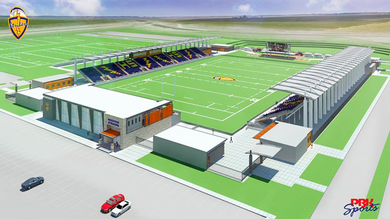
The group of rugby aficionados called the Houston Strikers — seemingly a revival of the name of an 80’s-era semi-professional rugby club — has been showing around the rendering above of a new rugby stadium lately. The facility is said to be planned near the Houston Sports Park along 288 just south of Mowery Rd. by various rugby news sites and discussion groups; the early renderings floating around since last summer corroborate that, showing the stadium tucked next to the distinctively curved crossing of Sims Bayou under 288 (along with some parking lots and a detention basin):
THE HOUSTON ZIP CODE WHERE THE KIDS DON’T LEAVE HOME 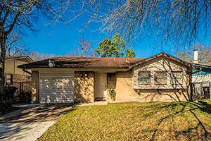 New number crunching from the Pew Research Center suggests that around 57 percent of the folks between 18 and 34 in the 77045 Zip Code may be living with their parents. (77045 includes both residential areas and the salt-dome-adjacent industrial hodgepodge between Holmes and Almeda roads, southwest of that recycling plant that smoked out the Med Center last year). That figure compares to a 28.2 percent boomerang rate across most of Houston, which falls below the current-ish 32 percent national average, writes Maggie Gordon (who notes that the “new” numbers are based on the organization’s 2014 data). What’s responsible for the anomalously high numbers in South Main, which shoots well past even the Great Depression’s 35 percent? The difference, Gordon writes, may be rooted not only in the area’s low average wages, but also in the lower rate of folks actively pursuing college (which Gordon says is connected to low wages); the study also notes that some of the difference might reflect the smaller proportion of the Zip Code’s Millennals living with a romantic partner (which, Gordon notes, might be easier to meet in college these days). [Houston Chronicle] Photo of 3414 Ebbtide Dr., 77045: HAR
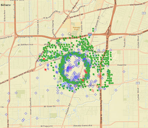
Right next door to the fairways of the Wildcat Golf Club, Fairway Energy Partners is moving forward with plans announced this summer to put nearly half a billion gallons of crude oil back into the ground, right in the center of the once-wild Pierce Junction oil field just south of the Inner Loop between S. Main St. and Highway 288. (The field, which a 1956 Time Magazine article called the site of “the biggest of all Gulf Coast oil booms,” still pumps out oil.) Fairway announced in November that they’ve picked engineers to help them retrofit 3 of the 8 man-made caverns dissolved into the Pierce Junction salt dome for crude storage. A dense ring of current and closed oil wells (mapped as green dots above) traces the uppermost reach of the migrant salt, buried approximately 950 feet below the surface and extending several miles deep to its source layer.
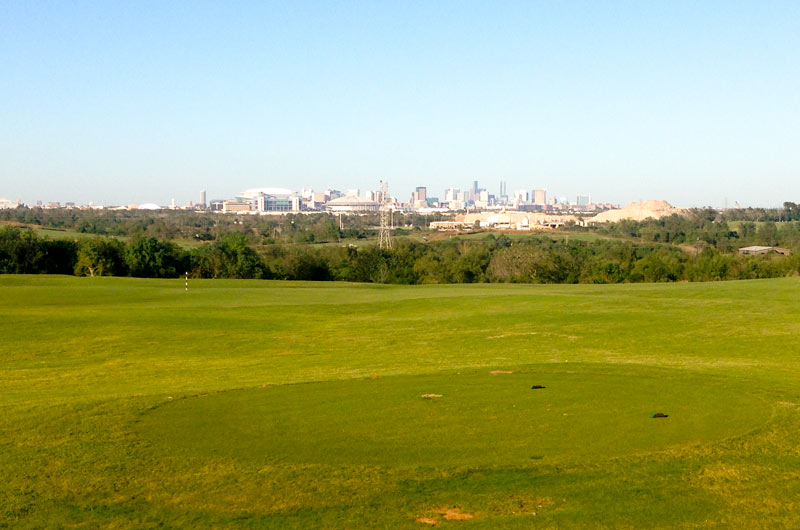
Looking for an overview of the new site of UT’s recently-announced Houston campus? Your best bet may be to stop in at the Wildcat Golf Club, located directly across Holmes Rd. from the site of UT’s planned purchase. Native Houstonians may experience a touch of vertigo trekking up the club’s grassy peaks to catch the view of NRG Park and downtown (see above) — hills on the site reach more than 115 feet above sea level in places. (Downtown, for comparison, stands at roughly 50 feet, and the big hill at Miller Outdoor Theater tops out around 65.)
The golf club’s topography is a byproduct of its original gig as a major municipal landfill, operating for nearly two decades until 1989; clay and topsoil were imported to sculpt the waste heaps into today’s smoothly rolling hills and water features:
COMMENT OF THE DAY: WHEN HOUSTON WAS RIGGED “The Astrodome is ~1 mile north of the old Pierce Junction Oil Field. Most of the area is industrial, but there are homes along the perimeter of the field where Glenn McCarthy, who later built the Shamrock Hotel, made his first millions. Here’s a link to a 1956 TIME magazine article about the field and issues regarding growth of Houston versus industrial development. If anyone reads the article, I believe the dump it refers to is now a golf course. There are methane candy canes all around it. This is to say nothing of the Humble area. If anyone can find any old aerial photos of Humble online, let me know. I’ve seen them in the past and would like to do an overlay of current use versus prior use.” [J Wilson, commenting on House Shopping in the Chemical Discount Zones: Finding Houston’s Less-Toxic Neighborhoods]

Today, a lucky smart Neighborhood Guessing Game player wins a Houston. It’s Worth It. gift box — containing a copy of the original Houston. It’s Worth It. photo book, a HIWI mug, a HIWI T-shirt, a HIWI baseball cap, several “afflictions” postcards, and of course HIWI bug repellent. Very appropriate prizes for this game, and all donated by . . . yes, Houston. It’s Worth It. (You can find more about the individual products at the HIWI store.)
Before we announce the prizewinner, there’s a long list of neighborhoods to call off — your guesses! Ready? Meyerland off South Post Oak near 610, “between Westwood CC and Beechnut,” the Heights, La Porte, Jersey Village, Willow Meadows, “near the bayou off Braeswood in a flood zone,” “between 610 and the beltway, near the Ship Channel,” Jacinto City, Denver Harbor, Pasadena (2 guesses), Galena Park, North Shore, Clover Leaf, Channelview (2 guesses), “near Antoine, south of Tidwell,” off Griggs or Scott, the East End (2 guesses), the Energy Corridor, “off Dairy Ashford close to Stratford High School,” “somewhere along the 225/Allen Genoa/Allendale area,” “north of Braes Bayou, west of Buffalo Speedway, east of Weslayan/Stella Link,” Forest West, Oak Forest, “south along the I-45 corridor,” South Houston, Harrisburg, Magnolia, Baytown, “around Irvington [or] continuing north to the Airline area,” Sagemont, “the Westbury/Willowbend area,” Briarmeadow, Sharpstown (2 guesses), “Sharpstown near Gessner/Bellaire,” the “Sharpstown/Chinatown area” (2 of you), “south of Braeswood near Buffalo Speedway,” near UH, “damn close to Southmore,” Lazybrook, Pearland, “off Navigation,” Meyerland, lower Westbury, the “southern part of Greater Westbury,” south of the Med Center, Southwest Houston, Alief (2 guesses), Bellaire between Wilcrest and Dairy Ashford, around Friendswood, “over by the Georgia addition in Eastwood (sort of near Evergreen Cemetery maybe),” “Larkwood, near Bissonnet and Fondren,” Spring Branch, Windsor Village, the Hiram Clarke area along Sims Bayou, Riviera East, along Normandy north of I-10 by Greens Bayou, near “perennial Channelview area flooder Sterling Green by Carpenters Bayou,” Maplewood between Braeswood and Beechnut, Glenbrook Valley, and Meadowcreek Village.
Phew! That’s quite a tour! And there are some great guesses in there.
Picking the winner was a little tough this week because nobody guessed the exact name of the subdivision — and because a few players came mighty close. The winner of the photo finish — and the prize — is subprimelandguy, who managed to name a couple of flanking neighborhoods and a nearby bayou . . . among others:
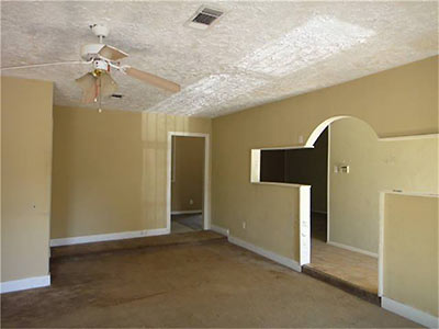
I agree that there is definitely some flooding bayou love going on here. But due to the decor and burglar bars, I’m not thinking Braes Bayou or White Oak, but instead prolly Sims or Greens. Maybe somewheres in Windsor Village or elsewhere in the Hiram Clarke area along Sims, or maybe out east in Riviera East or elsewhere along Normandy north of I-10 by Greens. Or, maybe even perennial Channelview area flooder Sterling Green by Carpenters Bayou. All feature 1960’s or 1970’s General Homes type tract specials.
Congratulations! And shouts-out to runners-up flake (for “lower Westbury”) and JT (for “the southern part of Greater Westbury”). A whole bunch more of you were pretty darn close, too.
This was your target:
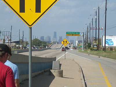
Veteran Houston hoofers John Nova Lomax and David Beebe and a guest suffer a vehicle breakdown on their latest walking tour — from West Fuqua up South Post Oak to W. Bellfort. The trip, says Lomax,
ended up as little more than a Bataan death pub crawl, taking in three unjustly obscure near southwest side strip mall taverns.
But . . . oh, the sights!
NEW DYNAMO SPORTS COMPLEX IN SOUTHERN HOUSTON The City of Houston, the Houston Dynamo, and a few other partners are funding a new multi-use recreation center between a new extension of Kirby Dr. and 288, just north of Sims Bayou and southeast of the former toxic landfill now known as the Wildcat Golf Club. “The complex, on a 100-acre site purchased earlier this year by the city, will include as many as 18 outdoor soccer and athletic fields with natural and artificial turf, plus recreational parks. Part of the facility will house a practice field for use by Dynamo that would include site improvements paid for by the team.” The site may ultimately include a social center and charter school. [Houston Business Journal]
Today’s round of demolitions are all residences. Ten doomed houses, after the jump.


