


Ever notice that the Wheeler-Ave. side of the Midtown Sears (shown above) doesn’t quite jibe with the rest of the building? It’s become even clearer since all that beige metal cladding was stripped off the structure earlier this year. Upon its removal, the biggest revelations were cascading green, red, and blue art-deco tile mosaics (shown here) running from top to bottom on every side of the building, except the Wheeler one, where the array of facade openings pictured at top are a bit less architecturally refined despite their prominent positions overlooking crosstown traffic.
So, what gives? Well, it turns out that Sears’s south side wasn’t all that visible when the building opened in 1939. Back then, Wheeler was just a narrow side street off Main and did not flow directly into Richmond as it does now, explains Preservation Houston’s Jim Parsons. Richmond, a much larger thoroughfare, also dead-ended into Main St., across from the Sears and just north of where Wheeler began. You can see the missed connection in the 1950 street map above.
It wasn’t until the early 1960s that the 2 streets were joined through a partial annexation of the Delman Theater property at 4412 Main, catty-corner southwest of the Sears:
CONTINUE READING THIS STORY
When Roads Collide


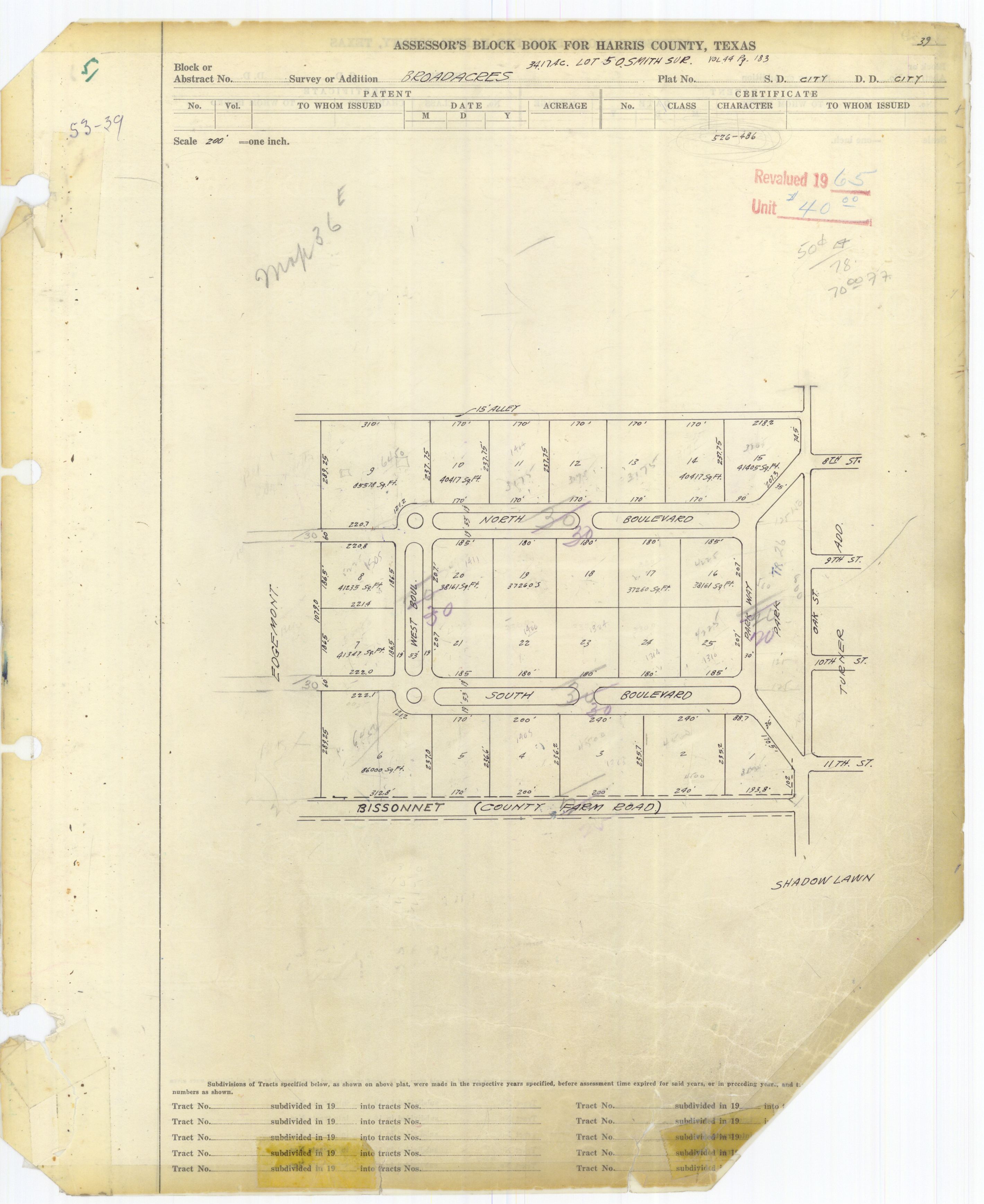
 “In a way, this is just the latest battle in a hundred year old fight. On a Preservation Houston tour of Broadacres (where we trespassed all over the esplanades), it was pointed out that the neighborhood was originally designed as a closed loop with the only access to the city via Parkway to the east. Houston, however, viewed the streets as public and forced the developers to cede ROW through the lots on the western side of the loop to connect North and South Blvds to their counterparts in the west. This is why North and South Blvds pinch weirdly right around West Blvd. — when you’re ceding expensive land, you only give the minimum required. . . .” [
 “I recently moved back to Houston after living in Colorado for a few years. I still find myself in the habit of coming to a complete stop any time that I see a pedestrian attempting to cross a street. In CO, it is state law to stop at any legal pedestrian crossing should someone be there. Many of those crossings have signage that illuminates when the pedestrian presses the button to cross. Some even illuminate the crosswalk itself á la Galleria crosswalks, but it’s expected that you stop whether those are in place or not. Also, most people there abide by the rule of allowing people to cross at major intersections (traffic lights) before passing through in their vehicles; this is something that my fellow Houstonians always honk at me for doing here.” [
 Reader Adam Goss, who identifies himself as a Houstonian — and a graduate of Wesleyan University in Connecticut — writes that it “drives him insane” that “the street named after our alma mater is misspelled. All the surrounding streets are named after similar universities and colleges (Amherst, Oberlin, Georgetown), yet for some reason the largest of all, Weslayan, is spelled incorrectly.
How would Rice grads like it if a major thoroughfare in Chicago was named after the famed Houston university, Rize Avenue. Or if Boston named a major street Longhornes, after a famed UT alum?”
Photo of street sign at the corner of Weslayan and W. Alabama St.: Jeremy Hughes
Reader Adam Goss, who identifies himself as a Houstonian — and a graduate of Wesleyan University in Connecticut — writes that it “drives him insane” that “the street named after our alma mater is misspelled. All the surrounding streets are named after similar universities and colleges (Amherst, Oberlin, Georgetown), yet for some reason the largest of all, Weslayan, is spelled incorrectly.
How would Rice grads like it if a major thoroughfare in Chicago was named after the famed Houston university, Rize Avenue. Or if Boston named a major street Longhornes, after a famed UT alum?”
Photo of street sign at the corner of Weslayan and W. Alabama St.: Jeremy Hughes


 “. . . Easy — Look at
 “This ramp will now allow more traffic to use Shepherd as an alternate to the freeway system. Thus creating longer delays for those who use surface roads to travel. What is sorely required is a road that would flyover Memorial Park adding a much needed way to travel from the inner loop north. Currently, the only options are the West Loop and Kirby/Shepherd. Both of which are overly congested at most times of the day. It doesn’t help that Shepherd is down to two lanes from four in stretch from Westheimer to Dallas while the city installs much needed storm drainage.” [
 The Uptown Property and Business Owners Coalition is out today with a new website (portrayed here) meant to drum up opposition to the Uptown District and Metro’s plans to install dedicated bus lanes down Post Oak Blvd. The lanes, the last vestige of what was once a plan for an


