09/19/17 3:15pm

The 2 very different videos above give a taste of what the last few weeks have been like in Nottingham Forest, the Memorial neighborhood along the north side of Buffalo Bayou between Dairy Ashford and Kirkwood south of Memorial Dr. Nottingham Forest filled with water after Hurricane Harvey — and releases of water from the oversubscribed Addicks and Barker reservoirs. The first video, taken by Swamplot reader Gatewood Brown from a GoPro mounted on a kayak, shows portions of the neighborhood underwater during rescue operations 3 days after Houston was first hit by the storm. The second video was taken yesterday by reader Kyle Steck, using a mobile phone he carried while biking hands-free through Nottingham Forest’s now dry but extensively garbage-lined streets.

Videos: Gatewood Brown; Kyle Steck

Before and After
09/12/17 12:45pm

Sometime over the weekend the row of a dozen-plus street trees lining the west side of Kirby Dr. between W. Main St. and Colquitt got cut down, a Swamplot reader reports. This leaves the eastern front of the Kirby Collection construction site fronted by an alternating pattern of high and low streetlights and stumps. The wooden construction fence that stood for about a year just inside of the sidewalk in front of the mixed-use project is now gone. The photo above shows the view looking south now from the corner of W. Main St.

The removed “highrise” oaks had been installed 9 years ago with the reconstruction of Kirby Dr. — replacing the larger 20-year-old oaks that had been there earlier.

Photo: Swamplot inbox

Upper Kirby
07/26/17 11:15am

DOWNTOWN HOUSTON IS NOW DOWN TO A SINGLE STREET-LEVEL SUBWAY With the shuttering last week of the Subway sandwich shop at the corner of Milam and Rusk streets — catty corner from Pennzoil Place, in the ground-floor space below the Level Office at 720 Rusk St. (pictured here) — the national sandwich chain is now down to a single Downtown location that can be accessed from a sidewalk. Another streetside Subway, in the ground floor of the Americana Building 5 blocks to the south at the corner of Milam and Dallas, exited its space before demolition began on that structure in February. A total of 8 Subways are located Downtown, but they’re all now harbored in tunnels or lobbies or food courts — except the lone fresh-air holdout at 405 Main St., at the corner of Preston. [Previously on Swamplot] Photo of former Subway space at 802 Milam St.: cmoney_htx

07/10/17 2:15pm

COMMENT OF THE DAY: THE OLD URBANISM “None of these places achieve anything like the feel of a real town because they abandon all of the design elements which actually create that feeling. There are no real walkable main streets with mom and pop stores lining the sidewalks. No town squares at the heart of real (albeit small) downtowns. It’s all just strip malls and McMansions along freeways and 6-lane collector roads. If you want a small town feel you have to start with traditional pre-WW2 urban design.” [Christian, commenting on Still Selling a Little Place in the Big City] Illustration: Lulu

06/28/17 11:30am

Among a few Fifth Ward buildings abutting a new railroad underpass scheduled to be installed near the intersection of Lyons Ave. and West St.: The warehouse pictured above at 2305 Lyons Ave., graced by a Wiley Robertson mural. The Gulf Coast Rail District plans to eliminate the at-grade railroad crossing west of I-69 and directly to the east of that corner by routing Lyons Ave. under the tracks. According to the district, 30 trains a day currently cross Lyons Ave. — on 3 separate sets of tracks. North of Lyons, 3 additional at-grade crossings will be eliminated by closing down West St. entirely from a little south of Lyons to a little south of Brooks St.

The earliest possible start date for the project, which would cost an estimated $28.5 million and take approximately 2 years to complete, is listed as the fall of 2020. At a meeting last night at the Saint Arnold Brewery, which is just west of the West St. intersection, the district and TXDOT showed these images of a widened Lyons Ave. with dual 12-ft.-wide car lanes as well as bike lanes and sidewalks passing under the HB&T rail line:

CONTINUE READING THIS STORY

Underpasses and Overpasses
05/11/17 2:30pm

Here’s your chance to see in first person what the city’s come up with for that under-discussion redo of Westheimer Rd. in Montrose. The video above flies viewers slowly through a flatly rendered Westheimer corridor east of Shepherd Dr. (complete with digital versions of all your favorite ex-clothing shops, storied condo buildings, and paired Mattress Firms) with the new street plan in place. Reality check with the existing state of the roadways happens at a handful of the corridor’s intersections.

The biggest change: A drop down to 2 lanes of car traffic in most places (versus the 4 narrow lanes currently in place), beginning around Huldy St. and moving east. The road would briefly widen back out to 4 lanes around the crossing of Montrose Blvd., then back down to 2 until the name swap to Elgin St. at Bagby St. All that slimming down leaves room for wider sidewalks; the plan also includes some set-aside zones for bus drop-off, some left turn lanes, and a few stretches of parallel parking areas, highlighted in pink.

CONTINUE READING THIS STORY

Montrose Flyby
03/28/17 3:45pm

COMMENT OF THE DAY: THE NO-BIKE-LANE BIKE PLAN Bike Rider in Traffic
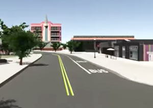
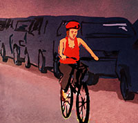
“There’s even a more simple plan: Make the right lane 12 ft. (or more) and the left lane 10 ft. Don’t stripe new bike lanes or overly alter existing regulations. Don’t plan. Don’t get approvals. Don’t p/o motorists with the silly bike lanes that bikers fear and never use. We just need a little extra space for cars to pass us by. And: Motorists will like having buses and other heavy vehicles in the larger right-lane, too . . . you don’t even need signage.” [Chris M(2)., commenting on Comment of the Day: Houston’s New Bike Plan Is Just a Plan] Illustration: Lulu

03/24/17 3:30pm

COMMENT OF THE DAY: HOUSTON’S NEW BIKE PLAN IS JUST A PLAN Bike Lane
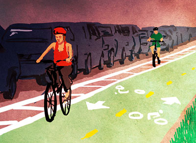
“The plan is really just a recommendation of where to put lanes. The decision of actually putting in the bike lanes in a given spot will be evaluated on a case-by-case basis, mainly as roads are rebuilt. Most of the money can come from TxDOT, TIGER, TIRZs, etc. It’s much easier to get that funding if you have a plan already in place. An example: Maybe your local CIP project involves tearing up a road and replacing it. Instead of repainting the road with the old 12-ft. wide lanes, maybe make them a reasonable 10-ft. wide and spray in a line for a bike lane. That’s a cheap addition to a project that doesn’t involve a lot of overhead that would normally come from a separate project to put in a new bike lane somewhere.” [Biker, commenting on Houston Bike Plan Up for a Vote Again This Morning Amid More California-ization Fears] Illustration: Lulu

11/08/16 1:30pm

Hardy Yards, Near Northside, Houston, 77026

Not many signs of the buildings yet — but Chris Andrews notes the new benches, sidewalks, and railyard-themed signage recently installed in the formerly-a-railyard Hardy Yards site, along some initial roadways laid out for that planned mixed-use redevelopment complex. The signage above, complete with what appear to be segments of decorative rail track, is at the corner of now-extended Chapman and Leona streets.  Here’s a look at a new industrial-chic bike rack installed nearby, with a bonus glimpse of a few of the warehouses along parallel-ish Burnett St. visible to the north:

CONTINUE READING THIS STORY

Tracking Near Northside
09/16/16 2:00pm

Park(ing) Day 2016, 500 McKinney St., Downtown, Houston, 77002

What’s all this sitting by the meters on the 500 block of McKinney St. today? Allyn West sends over some shots of the parking-spot-sized pocket parks currently occupying a few of Downtown’s on-street spaces. And you, too, can sit there, but only if you hustle: The ephemeral parklets are open for communal use until about 3 PM as part of the annual Park(ing) Day affair, now in its 12th year of instigating fleeting streetscape conversions in hundreds of cities around the world.

One of this year’s parks has its very own ideologically-conflicted seesaw:

CONTINUE READING THIS STORY

Metered Park(ing)
07/21/16 10:45am

Thornsen Streetlab Silver St. Redo

In the small but growing city tradition of redoing street plans in your spare time, urban planner and general Houston improvement brainstormer Jesse Thornsen has recently launched a website to showcase weekly ideas for making bits the local streetscape easier to navigate (by bike, foot, car, or other means). This morning’s addition: how to smooth out the westward jog in Silver St. as it crosses Dart St. The spot (shown in the above left-to-right conceptual before and after) is southeast of Annex Houston automobile storage and the Silver Street Studios complex; not quite due west lies the Shops at Sawyer Yards warehouse retail redevelopment.

Thornsen’s plan adds sidewalks and a landscaped median (to discourage vehicles from taking the most direct route straight through the jagged intersection). Thornsen points out that the section is designated for both bikes and cars by the Houston Bike Plan; his redo includes bike lanes, including a queuing spot big enough for multiple cyclists to cozy up together as they wait to turn north. Here’s a close up and a cross section:

CONTINUE READING THIS STORY

Squaring Up in First Ward
04/12/16 5:15pm

Proposed street work, Fourth Ward, Houston, 77006

The presentation slides from last week’s meeting about the street and infrastructure work planned for Fourth Ward between W. Gray and Welch streets are now online — you have until May 6th to email the city about it, if you feel like doing so. The green lines show areas where 50-ft.-plus cross-sections are planned, with anywhere from 7 to 22 ft. of pedestrian space (mostly running 12-to-17 ft., in the not-to-scale drawings). Streets marked in light blue would range from 33 to 36 ft. wide, including only 1 sidewalk and a 2-ft. easement on the opposite side; areas marked in dark purple would also get 1 sidewalk, but both vehicle and pedestrian lanes would be several feet narrower (27 to 30 ft. in total).

The work skirts the southern edge of the not-quite-rectangular Freedmen’s Town National Historic District, which runs north-to-south roughly from W. Gray to W. Dallas St., and east-to-west from Gennessee St. as far west as Arthur St. in some places. Planned street and infrastructure work in that area is currently on hold due to the ongoing court case over preserving the remnants of brick roadways in the district, along parts of Wilson and Andrews streets. 

CONTINUE READING THIS STORY

Hitting the Streets
03/31/16 4:00pm

Dallas St. Improvements complete, Downtown, Houston, 77002

Beating the basketball crowds headed to Houston this weekend, the Downtown section of Dallas St. that’s been getting done over looks to be pretty much finished and ready for action. A reader took some shots looking both ways in front of the south entrance to the Four Seasons between Caroline and Austin streets — up top is the eastern view down Dallas, gazing toward the George R. Brown Convention Center and the catty-corner staredown between Hilton Americas and Embassy Suites from either side of Crawford. The new trees seem to line up with the spacing plans shown in the previously released project plans, which included knocking out a driving lane on the north side and turning it into parking (as the vehicles above are politely demonstrating).

Here’s the Four Seasons again from other direction — this time looking west toward Houston Center, with the First City Tower rising out of the frame on the right:

CONTINUE READING THIS STORY

Traveling Downtown
02/08/16 12:00pm

New Signal at Dunlavy St. and Allen Pkwy., Buffalo Bayou Park, Houston, 77019

The metal arm of a future traffic signal is now reaching out of the ground across a few westbound lanes of Allen Pkwy. at the intersection with Dunlavy St. The new crosswalk will protect foot traffic on the way to bayou-side party-venue The Dunlavy and to the Adath Yeshurun Cemetery next door.

The stoplight fits into the larger plans to revamp Allen Pkwy., in part intending to dial down the road’s speeds from not-quite-freeway to next-to-a-park levels. The redo also aims to make it simpler for both cars and people trying to make their way to all the new park infrastructure and improvements along Buffalo Bayou.

A drawing from early last year shows the plan view of the finished intersection at Dunlavy:

CONTINUE READING THIS STORY

Crossing Over