12/11/18 10:45am

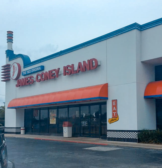
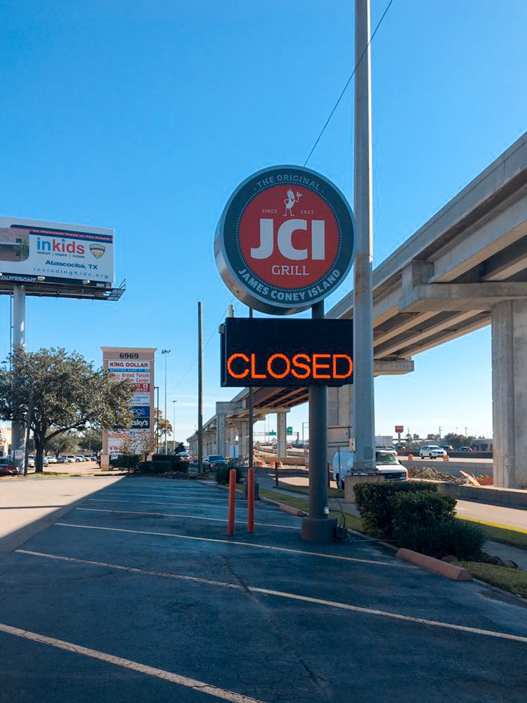
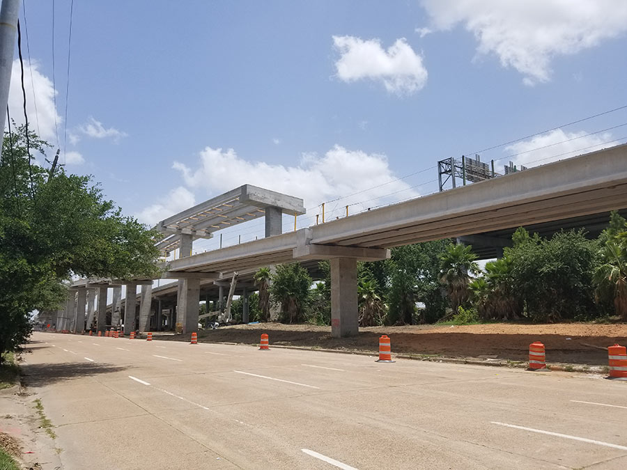
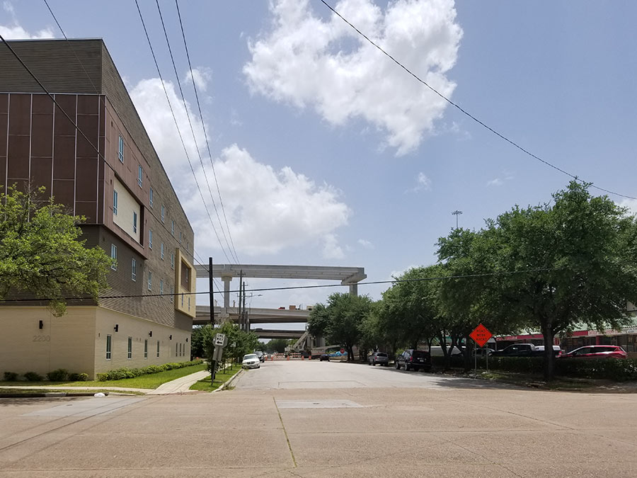
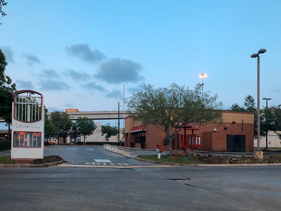
A Swamplot reader writes in to report that the JCI Grill across I-45 from the Home Depot near Gulfgate Mall is now closed. No need to get too close in order to tell; the electronic sign fronting the feeder road gets the message across to highway drivers as shown above. Behind it, you can see the new ramp TxDOT’s been working on to connect 610 eastbound to I-45 northbound — as well as the shadow it’s cast on the restaurant’s parking lot.

A flyer posted on the building says the construction was in part what inspired the closure:

CONTINUE READING THIS STORY

The Dog Days Are Over
11/19/18 11:45am

WESTHEIMER WILL HENCEFORTH NOT BE CALLED UR 1093 ANYMORE, SAYS TXDOT Before last week, TxDOT had an obscure formal name for Westheimer Rd. on the books: UR 1093. The designation — short for “urban road” — was created 23 years ago to distinguish city thoroughfares from farm to market roads, reports the Chronicle‘s Dug Begley. But “No signs were ever erected,” he writes, “and it became clear no one was going to stop calling the roads what they always had, officials said in a written briefing for transportation commissioners. The only place the urban roads ever appeared was in the internal TxDOT roadway inventory.” There, Begley counts 30 Houston-area roads that were set to set to become URs “in theory, at least.” Officials killed the designation on November 15, reinstating Westheimer’s previous pseudonym FM 1093. The only thing that really changes: where funding for those roads can come from. Had the UR designation stuck, says a TxDOT spokeswoman, they would’ve been eligible for some extra federal maintenance money aimed at cities. [Houston Chronicle ($)] Photo of Westheimer Rd. at El Real Tex-Mex Cafe west of Yoakum Blvd.: Bill Barfield via Swamplot Flickr Pool
08/03/18 3:00pm

Fasten your seat belts — it’s time for a detour down the new ramp TxDOT just opened off I-45 north to 59 north. Included in the footage: new views of the downtown skyline, along with some of an adjacent ramp now under construction between the 2 highways that’ll offer freeway sightseers an even higher vantage point when its open.

You can see it taking shape off to the left in the still photo below:

CONTINUE READING THIS STORY

Dashcam Footage
07/31/18 3:00pm

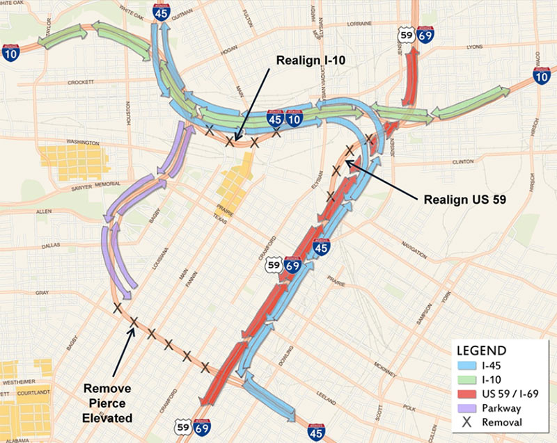
THE BUILDUP TO TEAR THINGS DOWN FOR THE NEW I-45 HAS BEGUN “I’ve noticed a trend in lower Fifth Ward to start building or planning to build in the path of the upcoming I-45 reroute,” writes a Swamplot reader. “Is there a chance that developers can make more money on their buyout if they have developed plans?” Developed or not, there’s certainly been some action along the right of way that TxDOT plans to crater for the new highway segment — like that recent buying and selling in East Downtown across from the GRB. No one’s signed up to build anything new on those parcels yet — but with roadwork not slated to start until 2020, that’s plenty of time to get something ready ahead of the demolitions the highwaymen have planned to make way for the reroute. [Previously on Swamplot] Diagram of I-45 reroute: TxDOT
06/27/18 2:15pm

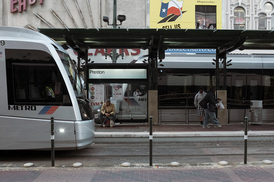
WHAT TXDOT’S TINY 2-YEAR PUBLIC TRANSIT ALLOWANCE ADDS UP TO Transit-focused fact-finder Allyn West pulls out this nugget from the Texas Tribune’s report on regional transit development: “While the Texas Department of Transportation has a budget of more than $26 billion for the 2018 and 2019 fiscal years, less than 1 percent of that is earmarked for public transit.” That puts the burden squarely on county and local agencies — including metropolitan planning groups like the Houston-Galveston Area Council — to dig up funding for non-car-catering projects. [Texas Tribune via Allyn West] Photo of Preston St. METRO stop: telwink via Swamplot Flickr Pool
06/26/18 4:30pm

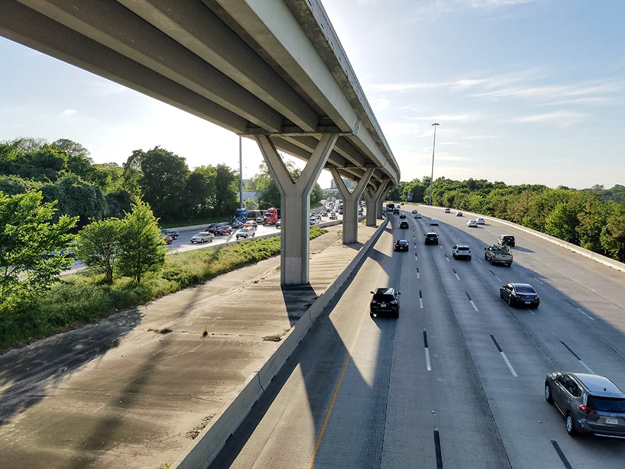
COMMENT OF THE DAY: I-10 LOW-BRIDGE ALERT SYSTEM ISN’T EYE-CATCHING TO PASSING TRUCKERS “The sign mentioned in the posting is a joke — it’s small, off to the side, partially obscured, and it is not readily apparent what it’s referring to. Worse than that, it is 2 miles ahead of the 610 interchange, and 7 miles ahead of the Houston Ave. overpass. It is nowhere close to a sufficient or effective system, and along with the new low clearance signs inside the Loop, has every appearance of a band-aid solution to something that needs a more comprehensive approach.” [TMR, commenting on How TxDOT Tries To Stop Trucks from Clipping the Houston Ave. Bridge] Photo of I-10 near Houston Ave. bridge: Marc Longoria via Swamplot Flickr Pool
06/26/18 11:30am

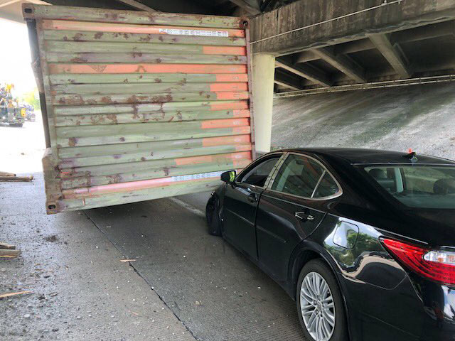
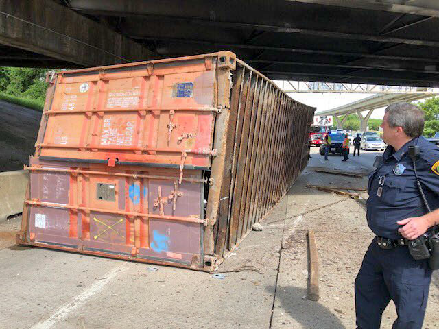
The latest 18-wheeler to drive into the Houston Ave. bridge didn’t make enough of an impact to force repairs yesterday, although it did stall I-10 traffic all the way to T.C. Jester while TxDOT closed 2 lanes to clear the debris (including the truckload pictured above pinning a sedan) and inspect the overpass to ensure its integrity. (The last round of bridge maintenance in March — to repair a strike in December — couldn’t have come at a better time: “Just as crews were putting barriers in place,” for an overnight closure to fix the damaged structure, another truck drove into itreported Houston Public Media’s Gail Delaughter.)

Over the last 4 years, the 14-ft.-3-in.-high bridge has been hit 22 timesreports Click2Houston; historically, it’s struck “more than any other bridge in the Houston area,” says a TxDOT spokesperson. Not a great track record — until you factor in how many trucks aren’t hitting it as a result of TxDOT’s high-tech warning system. In 2015, the agency installed infrared sensors at Mercury Dr. and Wirt Road that detect oversized vehicles and — if spotted — flash a warning message to get off the road on an electronic billboard. Between January and June 2 of this year alone, the sensors transmitted 13,477 warnings.

Photos: Emily Black

Chronic Drive-By Zone
06/11/18 11:00am

I-45’s new, longer flyover is creeping steadily west toward 59 north following about 7 months of work to get there. The farther-away photo above looks south from the corner of Hutchins and Jefferson streets to show where the partly built roadway currently drops off, about 2 blocks east of its planned merge with 59.

The existing ramp toward 59 north — which diverges from the Gulf Fwy. just east of Emancipation — shut down last December 1. Its soon-to-be-built successor branches off from 45 a few blocks further east, giving drivers more time to swerve onto it than they had previously:

CONTINUE READING THIS STORY

Cliffhanger
05/21/18 4:30pm

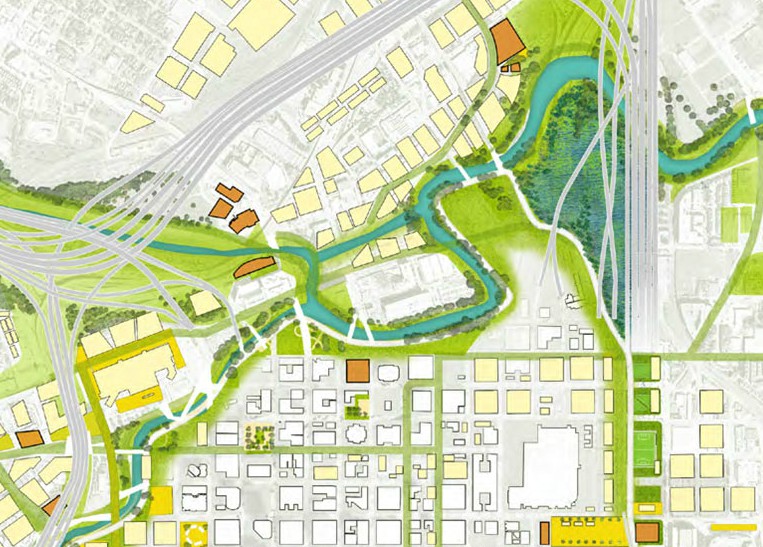
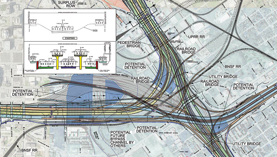
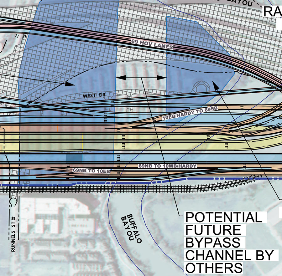
Remember that North Canal that showed up in Plan Downtown’s maps and drawing last year and included a island in Buffalo Bayou? Well, TxDOT’s latest schematics for its planned I-45 reroute include a bypass and island as well — but in an entirely different location. The highway agency’s map above — with west facing up — indicates a new waterway draining into Buffalo Bayou right underneath the section of I-45 it plans to build in place of a portion of the Houston Housing Authority’s Clayton Homes neighborhood. How the canal gets there is obscured, but a straight course northwest appears to shoot the gap between 2 planned detention ponds and cross under the existing section of 59 (shaded gray), before linking up with the bayou again east of Elysian St. Marooned on TxDOT’s version of the make-believe, bayou-banked island the canal would create: a few of the houses in Clayton Homes.

As TxDOT’s caption makes clear, it’d be up to someone else to actually build the waterway. Doing so wouldn’t preclude the previously proposed North Canal from being dug further upstream. Plan Downtown’s less technical map at top shows that waterway beginning at White Oak Bayou and emptying into a bend of Buffalo Bayou just west of Elysian. In doing so, its course creates an exclusive new landmass home to the Harris County jail.

Road map: TxDOT. Downtown map: Plan Downtown

Offshored
05/04/18 4:15pm

The 2 new METRO bus lanes — linking a proposed Bellaire transit center to the new middle-of-the-road path up Post Oak Blvd. — won’t run over the actual building at Chick-fil-A’s Richmond Ave location, but they will cut through the property. Last month, the fast-food company agreed to vacate its spot at 5005 Richmond after the State of Texas initiated an eminent domain proceeding against it — and the location subsequently closed. (The 4 strip tenants in Weingarten Realty’s surrounding Richmond Square Shopping CenterBestBuy, Mattress1One, Cost Plus World Market, and Luggage & Leather — are also targeted in the proceeding.)

Adding the new transit route (shown in the map below as a vertical orange line partly covered-over with yellowish-gray) is part of a whole tangle of changes TxDOT has planned for the 610-59 interchange:

CONTINUE READING THIS STORY

Eminent Domain
02/09/18 4:00pm

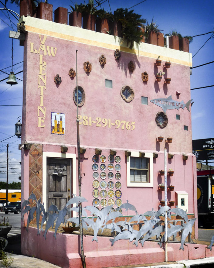
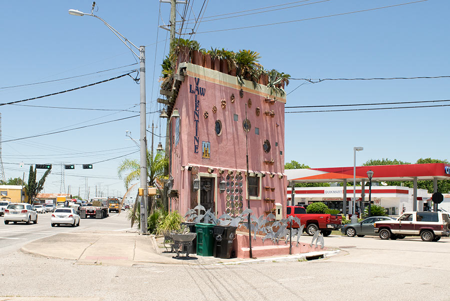
COMMENT OF THE DAY: IDENTIFYING THE WILDLIFE ON THE VALENTINE CORNER LAW OFFICE IN SEABROOK “So those are dolphins along the sidewalk, made many years ago by Mr. Miller across the street. And there were sharks on the side of the building up high. I took them down a few years ago to have the sharks polished, and the guy I hired disappeared with my 2 sharks.” [Michael Valentine, commenting on TxDOT Wins Custody of Head-Turning Tiny Law Office in Seabrook Ahead of Planned Hwy. 146 Widening] Photo of Valentine Law Office, 1210 Bayport Blvd.: BFS Man [license]
02/07/18 4:30pm

The 660-sq.-ft. law office marooned on a traffic island in Seabrook for 86 years might finally get ousted from its spot in local what-is-that-thing lore when TxDOT’s planned road widening project gets underway along a 3-mile stretch of Hwy. 146. Attorney Michael Valentine bought the building on the corner of Bayport Blvd. and 2nd St. in 1989 and did it up with the leafy haircut and  shark dolphin-themed metal edging. (Bayport Blvd. is the segment of 146 that runs through Seabrook — shown to the left of building in the photo at top.) In its past lives, the 2-story wedge at 1210 Bayport had been at various points an ice house and a bait shop.

Documents filed with Harris County Clerk show that TxDOT agreed to snatch the building from Valentine for a sum of $114,356 last October after filing an eminent domain proceeding against the entity he uses to administer the property. At least 9 other businesses along Bayport, including Ryan’s Cleaners, Tookie’s Burgers, and Laredo’s Tex-Mex Cafe have already closed or relocated ahead of the roadwork that plans to turn 146 between Red Bluff Rd. and Clear Creek — currently 4 lanes — into 12.

CONTINUE READING THIS STORY

Eminent Domain
12/19/17 12:00pm

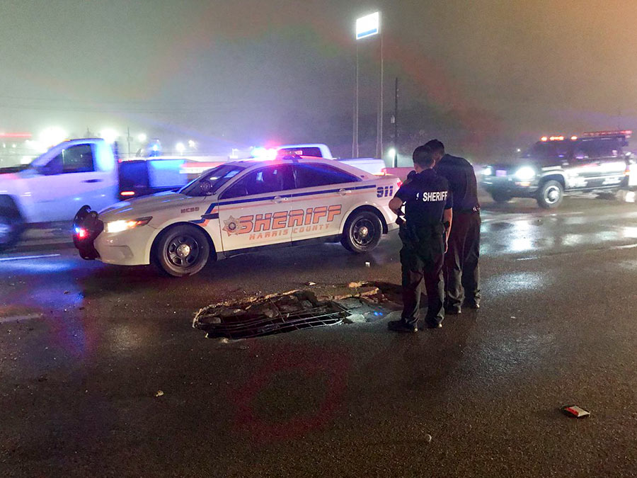
AN ASPHALT FAULT ON THE 59 OVERPASS ABOVE LITTLE YORK RD. Over the weekend, TxDOT made temporary repairs to a stretch of the Eastex Fwy. that crosses over Little York Rd. by pouring a “hot mix” of asphalt over a portion the roadway, Meagan Flynn reports. Crews planned to return to the site for more permanent repair work tonight, but got an early call this morning after the concrete beneath the road’s surface collapsed overnight, opening up a hole straight through southbound side of the overpass. ABC13’s Courtney Fischer snapped this photo of emergency workers looking down through the hole after multiple accidents took place this morning during rush hour. Portions of the freeway are now closed for repairs. [Houston Chronicle] Photo: Courtney Fischer
11/09/17 3:30pm

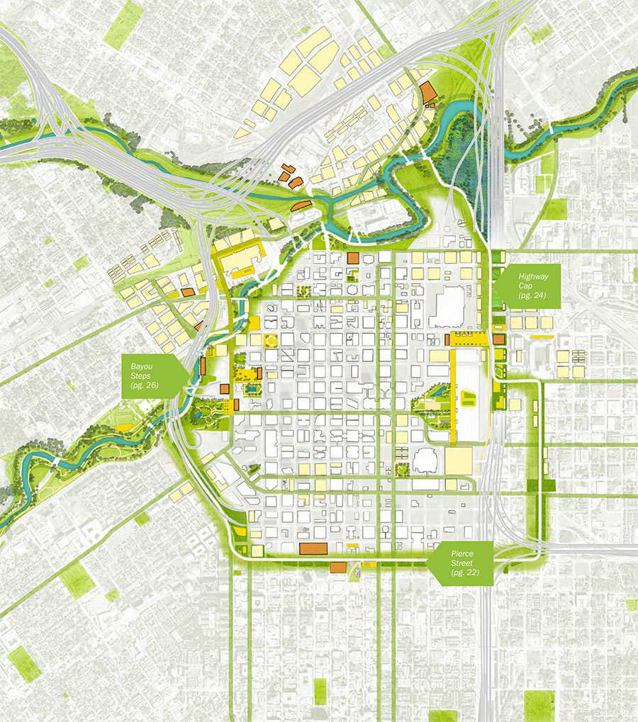
Is Houston ready for yet another loop road? Here’s the proposed Green Loop, a 5-mile network of parks, trails, and other public spaces that the neighborhood supergroups behind Plan Downtown imagine ringing in Houston’s bicentennial — if it’s completed by 2036. One of 10 separate proposals in the plan, the city’s littlest loop is meant to take advantage of TxDOT’s proposed rerouting of I-45 to the east side of Downtown — by wrapping the district tightly with a transportation and recreation circuit that could attract adjacent development and help link the city center to adjacent neighborhoods.

Plan Houston’s new report flags ideas and renderings for 3 spots along Downtown’s proposed Emerald Choker: At Buffalo Bayou, on top of I-69 and I-45 once they’re sunk behind the George R. Brown, and on Pierce St. at the Midtown border.

New buildings at the northwest corner of Downtown would face Buffalo Bayou as well as the surrounding streets, lining the waterfront with flood-worthy attractions:

CONTINUE READING THIS STORY

It’s a Wrap!
06/28/17 11:30am

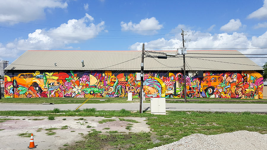
Among a few Fifth Ward buildings abutting a new railroad underpass scheduled to be installed near the intersection of Lyons Ave. and West St.: The warehouse pictured above at 2305 Lyons Ave., graced by a Wiley Robertson mural. The Gulf Coast Rail District plans to eliminate the at-grade railroad crossing west of I-69 and directly to the east of that corner by routing Lyons Ave. under the tracks. According to the district, 30 trains a day currently cross Lyons Ave. — on 3 separate sets of tracks. North of Lyons, 3 additional at-grade crossings will be eliminated by closing down West St. entirely from a little south of Lyons to a little south of Brooks St.

The earliest possible start date for the project, which would cost an estimated $28.5 million and take approximately 2 years to complete, is listed as the fall of 2020. At a meeting last night at the Saint Arnold Brewery, which is just west of the West St. intersection, the district and TXDOT showed these images of a widened Lyons Ave. with dual 12-ft.-wide car lanes as well as bike lanes and sidewalks passing under the HB&T rail line:

CONTINUE READING THIS STORY

Underpasses and Overpasses