THE WOODLANDS EXPRESS HAS ARRIVED ITS REAL-TIME BUS MAPPING FUTURE 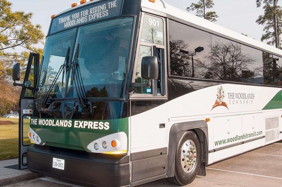 Note: This story has been updated to indicate that METRO also has a real-time bus mapping app.
Now you can know exactly how far your The Woodlands Express bus is from picking you up thanks to the township’s recently-released transit tracking service. The tool, powered by transportation mapping company Ride Systems, is accessible right now through The Woodlands’ mobile ticketing app (launched in August) and at this webpage — which indicates all Woodlands Express vehicles at as they proceed along their designated routes. (Things are a bit slow at midday compared to commuter hours.) METRO — which has nothing to do with The Woodlands’ in-house transit agency — released its own mobile ticketing app in 2016, as well as a companion app called METRO Trip that features live location data for its fleet of buses. [Community Impact] Photo of The Woodlands Express bus: The Woodlands Township
Tag: Public Transit
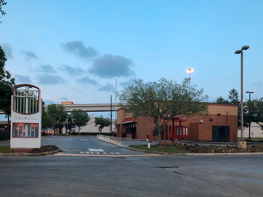
The 2 new METRO bus lanes — linking a proposed Bellaire transit center to the new middle-of-the-road path up Post Oak Blvd. — won’t run over the actual building at Chick-fil-A’s Richmond Ave location, but they will cut through the property. Last month, the fast-food company agreed to vacate its spot at 5005 Richmond after the State of Texas initiated an eminent domain proceeding against it — and the location subsequently closed. (The 4 strip tenants in Weingarten Realty’s surrounding Richmond Square Shopping Center — BestBuy, Mattress1One, Cost Plus World Market, and Luggage & Leather — are also targeted in the proceeding.)
Adding the new transit route (shown in the map below as a vertical orange line partly covered-over with yellowish-gray) is part of a whole tangle of changes TxDOT has planned for the 610-59 interchange:
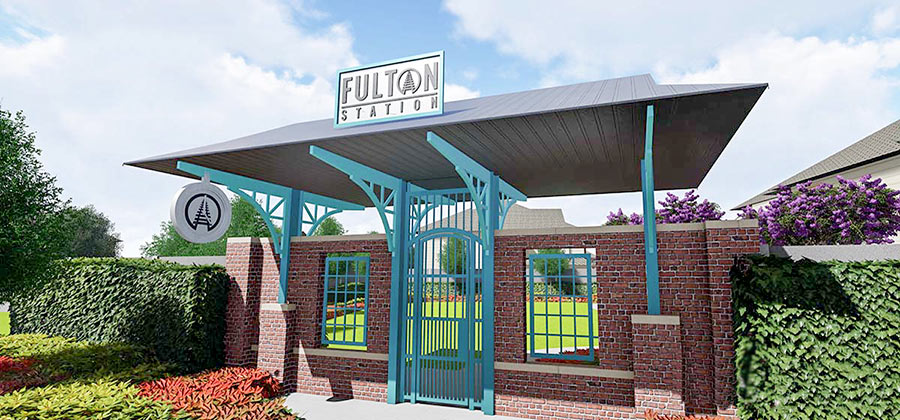
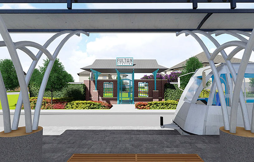
The transit-themed entryway Lennar Homes wants to build to its 39-lot development — dubbed Fulton Station — on the corner of Fulton and Cavalcade will get another shot at city approval when it goes before Houston’s planning commission this afternoon. Lennar’s new residential neighborhood hugs the Charisma Design Studios & Art Gallery Building, west of the southbound stop for METRO’s Red Line in the middle of Fulton St.
The gated entrance would go at the foot of a private park Lennar has planned just across the street from the rail platform, on the parcel highlighted red in the map below:
METRO NOW TESTING OUT SELF-DRIVING BUSES FOR HOUSTON 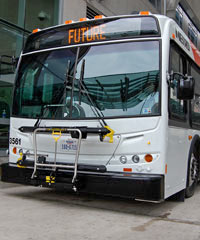 Preliminary tests of the new autonomous buses METRO is studying for potential use in Houston have gone well so far, agency board member Sanhjay Ramabhadran said at a luncheon in Cy-Fair on Tuesday — “although,” he added, “they tend to overheat in the Texas weather.” The next test phase, METRO spokesperson Jerome Gray tells abc13, “will be on the campus of Texas Southern University with a small bus at slow speeds.” If it goes well, a prototype could then graduate to real traffic. Last January, the U.S. Department of Transportation named Houston one of 10 official proving grounds for driverless buses “in part for its miles of HOV lanes that could easily work as testing lanes.” [abc13] Photo: METRO
COMMENT OF THE DAY: HOW TO HELP CANINO’S NET THAT DESTINATION FISH MARKET APPEAL 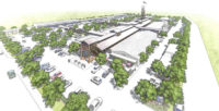 “Something that seems to make other markets around the world such successful destinations (Pike Place, Borough Market, Reading Terminal, etc.) is their accessibility within a dense urban core. In each case, the locations are accessible to pedestrians and located near high-traffic public transit locations. They are also near other walkable destinations like stores and restaurants, art galleries and museums; within walking distance from hotels and other destinations. It will be interesting to see how this works out in Houston on Airline Dr., with all of the car traffic and expansive space needed to accommodate parking. I hope Airline and Cavalcade get to be a little more walkable, and buses run there more often.” [Nearnort, commenting on Destination-Ization Plans for Airline Dr. Farmers Market Show New Rooftops, Playground, Multistory Observation Tower, Some Whitewashing] Rendering of plans for Canino Market on Airline Dr.: MLB Capital Partners
COMMENT OF THE DAY: I AM A METRO RIDER, I CONTAIN MULTITUDES  “There are valid reasons for the increase in boardings, which sound like a lot but are only +4.65 percent year-over-year. FYI — a boarding is counted every time that a person steps across the threshold of a transit vehicle . . . To put things in perspective, that means that if I’m a park-and-ride commuter and I have to make 2 transfers each way every day of a 5-day work week to get where I’m going, I count for 30 boardings per week and 1,500 boardings per fifty-workweek year. It’d only take 60,000 of me to account for all of METRO’s users. That isn’t to try to generalize about their user base, but it is to demonstrate that not all boardings are created equal, and that the circumstances of even some modest fraction of super-users can easily help to make these big numbers possible.” [TheNiche, commenting on First Signs of This Year’s Sargassum Seaweed Invasion; Houston’s Top Crime Spots]
COMMENT OF THE DAY: FOR WHOM THE TRAIN ROLLS  “. . . The few large cities that you’re referring to, where central living expenses are far higher than Houston, all provide far more extensive mass transit options. I know I have multiple transit options after midnight in other large cities — not so for Houston. For those without reliable transportation and non-office hours, the availability of Park and Rides does not solve or address accessibility issues.” [joel, commenting on Grand Central Park’s Official Debut; Houston’s Not All Sprawl] Illustration: Lulu
COMMENT OF THE DAY: HOW TO EITHER ELIMINATE OR WILDLY EXACERBATE THE HOUSTON TRAFFIC JAMS OF THE FUTURE  “Once people figure out that it’s cheaper to keep the autonomous cars on the road rather than storing them in parking garages, and that having them circle the block at a very low rate of speed in perpetuity keeps them in a ready state – ready to zoom off to pick up passengers and bring in income while the owner is at work – then, and only then, will Houston residents know the true meaning of ‘gridlock’ and immediately wish that legitimate mass transportation alternatives had been built long ago.” [justaswell, commenting on Comment of the Day: Holding Out for that Younger, Sexier Mass Transit Option We Haven’t Met Yet] Illustration: Lulu
COMMENT OF THE DAY: WAIT, SO ‘KEEP ADDING FREEWAYS’ WAS THE LONG-TERM FIX?  “The Chronicle article made a fairly big deal out of the following H-GAC quote: ‘Future growth and the resulting travel is expected to surpass our ability to meet regional mobility needs by relying solely on increased roadway capacity.’Â I question the significance of this excerpt. Is that not the case at the present time? Has that ever not been the case?” [TheNiche, commenting on Houston #1 in Sublease Office Space; Downtown Getting a WeWork] Illustration: Lulu
HOUSTON LIGHT RAIL BEATS THE COMPETITION IN PEDESTRIAN, BICYCLE COLLISIONS PER MILE 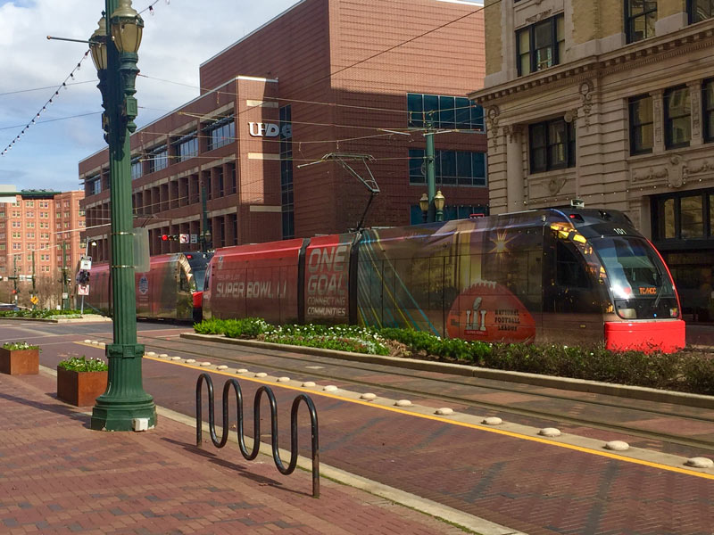 Following 2 deaths over the course of Super Bowl Week and Weekend resulting from cyclist-vs-light-rail collisions, the Chronicle‘s Dug Begley takes a look at how Houston stacks up nationally in terms of train-related accidents. The verdict, after a look through some National Transit Database data: Houston’s rail system has more walker and cyclist hits per mile “than any other major line in the country.” Houston breezes in at less that 100,000 train miles travelled per collision (compared to more than twice as many miles traveled per collision in Dallas, and more than 17 times as many in Boston). Metro CEO Tom Lambert tells Begley it may have to do with Houston’s high number of at-grade crossings and relative lack of barriers to keep people off the tracks. Begley says that the original decision to build the train at-grade isn’t itself unusual given the cost of elevated rail, but notes that “few places outside Houston have built their lines in some of the most congested and pedestrian-heavy areas of their respective urban regions.” [Houston Chronicle; previously on Swamplot] Photo of light-rail train dressed for Super Bowl Week: Christine Wilson
FINDING THE RIGHT WORDS TO TALK THROUGH HOUSTON’S RELATIONSHIP WITH SIDEWALKS 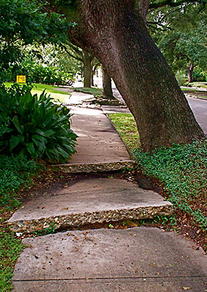 Taking together a recent rash of of essays complaining about Houston’s walkability, public transit, and sidewalk situation, Joe Cortwright over at City Observatory offers some thoughts on why it might be harder for city planners to buff up the city’s walking infrastructure than focus on its car standards: planners, both locally and nation-wide, don’t have as many ways to measure unpleasant walking experiences, or sufficient language to describe them. Cortwright writes that the anecdotes and narratives put forth by Houston’s frustrated would-be walkers are “rich and compelling in their detail, but lack the technocratic throw-weight of quantifiable statistics or industry standards to drive different policies and investments in our current planning system. [ . . . But] this isn’t simply a matter of somehow instrumenting bike riders and pedestrians with GPS and communication devices so they are as tech-enabled as vehicles. An exacting count of existing patterns of activity will only further enshrine a status quo where cars are dominant. For example, perfectly instrumented count of pedestrians, bicycles, cars in Houston would show — correctly — little to no bike or pedestrian activity. And no amount of calculation of vehicle flows will reveal whether a city is providing a high quality of life for its residents, much less meeting their desires for the kinds of places they really want to live in.” [City Observatory] Photo: Flickr userbpawlik
DIVINING HERMANN PARK’S FUTURE TRANSIT NEEDS  Another 20-year master plan for Hermann Park is currently in the works as the last one gets wrapped up, writes Molly Glenzter this morning. Per designer Chris Matthews, who’s working on the project as part of landscape architecture firm Michael Van Valkenburgh Associates, the planning isn’t all “fun things like choosing what tree to plant:” unlike the 1995 master plan redo, the design team this time includes a “consultant for all things mobile, which in the old days used to mean cars. Now it means cars, bikes, transit and pedestrians — how to balance all that stuff.” Matthews notes that the planning is further complicated by the need to predict what mass transit will look like 2 decades from now; Hermann Park Conservancy president Doreen Stoller adds that “with Houston getting ever more dense, each square inch of park space is becoming more precious and will need to be put to its highest and best use.“ [Houston Chronicle; previously on Swamplot] Photo of Hermann Park kiddie train: Lou Minatti
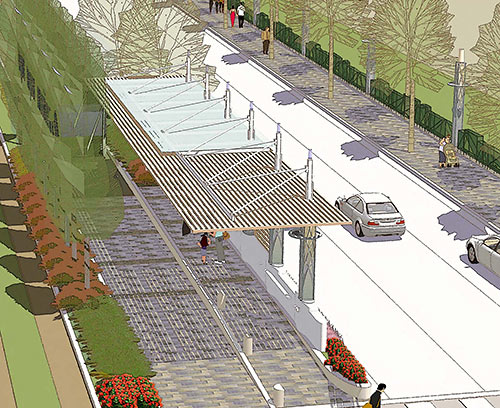
The Uptown PAC angling to stop both a planned Dinerstein highrise (which they say would increase area traffic) and the Post Oak Blvd. dedicated bus lane project (designed to reduce area traffic) has been ramping up for a legal fight lately: On Monday the organization asked the city to stop approving permits for any new highrise developments in the area, and to stop work on the bus lanes, both pending the completion of a new traffic study. Paul Takahashi writes that the group is also taking legal fund donations and looking at filing lawsuits over the matters.
What is the PAC worried about, exactly? Back in 2014, when the group formed to fight the bus lane project and a nixed AmREIT tower previously planned next to the Cosmopolitan condos (where many of its members reside), spokesman for the group said it was worried that ambulances wouldn’t be able to quickly move through increased gridlock stemming from additional development. The talking points have expanded significantly since then; now ABC 13 reporter turned hired investigator-slash-media-attention-consultant Wayne Dolcefino is on the case (the self-consciously horse-centric video below was released late last month), and recent talking points even include calls for the bus lane money to be used to fix flooding issues in not-in-Uptown Meyerland and Greenspoint instead:
COMMENT OF THE DAY: ELEVATING HOUSTON’S FREEWAYS TO GLOBAL MASCOT STATUS  “If you want transit to be ‘Great for Tourism,’ then you’ve got to look at transit systems such as in NYC, London, and Tokyo that are not only exceptional but that serve as cultural iconography for the city. There has to be some showmanship. Houston’s METRO was never building a cultural icon, even if some people embraced it as such back in 2004 for lack of any sort of imagination otherwise. Ironically, I’ve given rides to the airport from international visitors from places as different as India and Australia, and they seem to really enjoy riding on the freeways, taking in the vast expanse of concrete and the tangle of overpasses and underpasses. Houston’s freeways are a spectacle! Houston’s freeways are cultural iconography!” [TheNiche, commenting on Feds: Unused Richmond Light-Rail Funding Offer Now Expired, Getting Thrown Out] Illustration: Lulu

