COMMENT OF THE DAY: KEEPING BUFFALO BAYOU IN ITS PLACE 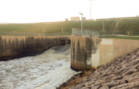 “Sounds nice — but that little part about the bayou being in the middle of the city, that’s why it can’t be left up to nature. . . . I understand the need to conserve and protect, but the Buffalo Bayou we know today is man-made. Ship Channel, Turning Basin, the resevoirs, Allen’s Landing, even the ill-fated Shepherd’s Dam all took a meandering stream and turned it into an industrial workhorse for Houston. Basically the ‘natural flow’ is impossible to get back; for that matter it never was something that the majority of Houstonians wanted. There are other bayous and creeks in the area that can take up the cause that don’t happen to be in one of the most expensive and sought-after flood plains in America. It is a noble battle but it was doomed to be one of beautification, not naturalization the moment the Allen Brothers decided to build a better New York City in Texas.” [SimplySid, commenting on Stop Trying To Fix Buffalo Bayou, Says Save Buffalo Bayou] Photo of Barker Dam outlet structure on Buffalo Bayou: Swamplot inbox
Tag: Bayous
GROUP FORMS TO CLEAN UP THE UPPER SAN JACINTO BEFORE IT GETS AS BAD AS BRAYS, BUFFALO, SIMS BAYOUS 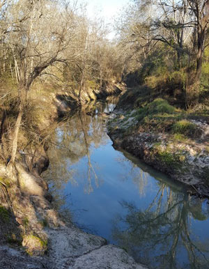 The West Fork of the San Jacinto River (implicated in much of the latest flooding between The Woodlands and Conroe) is in a bacterial “sweet spot”, environmental planner Justin Bower tells Matthew Tresaugue in the Houston Chronicle this week  — more contaminated than is acceptable, Bower says, “but not so much that we can’t do anything about it.” Tresaugue writes that E. coli levels have been trending upward since 2002, in some cases running as high as 10,000 colonies per 100 milliters of water (around 80 times higher than the 126-colony limit recommended by the state of Texas). The river’s water quality problems are multifaceted, but generally boil down to increased development in the watershed causing increased runoff that carries more junk — from human and animals waste to sediment from a nearby gravel mining operation — into the river and ultimately the Lake Houston reservoir (from which the city pulls drinking water). The newly formed West Fork Watershed Partnership has no definite plan yet (other than to work with area stakeholders to develop a plan). But Lisa Gonzalez (VP of the Houston Area Research Council) notes to Tresaugue that not doing anything could allow the West Fork’s water problems to get as bad as those of other major urban waterways in Houston. [Houston Chronicle; previously on Swamplot] Photo of West Fork of the San Jacinto: West Fork Watershed Partnership
THE ESTIMATED PRICETAG ON A STOP TO HOUSTON FLOODING 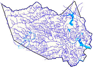 Amid the latest round of area flooding last week, Dylan Baddour traces the roots of Houston’s massive publicly funded drainage projects, which have brought the total length of Harris County waterways up to 2,500 miles (many of those channels widened, lined with concrete, or dug from scratch). Baddour also talks with current county flood control district director Mike Talbott about what it would take to expand and refine the city’s outdated flood infrastructure (which is often locked into place by close surrounding development) up to modern expectations — namely, that the flow of water over land that would otherwise be totally submerged should be totally controlled. Baddour writes that Talbot “has a simple solution: allocate $26 billion, more than a fifth of the state’s 2015 budget, mostly to buy property adjacent to the waterways, bulldoze and expand the canals.” Rice University ecologist Ron Sass tells Baddour he’s surprised the city hasn’t been tearing down old houses to build new bayou channels: “We build freeways. I would think that a bayou would be as important to our infrastructure as a freeway.” [Houston Chronicle] Map of Harris County waterways: Harris County Flood Control District
COMMENT OF THE DAY: WILL HOUSTON STOP TURNING ITS BACK ON THE BAYOU GREENWAYS? 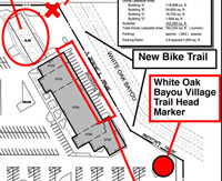 “This is revolutionary…they will make a building FACE the bayou, rather than back up to it with a solid concrete wall lined with putrid dumpsters. I have been waiting for this day for decades! To my knowledge, the only business in Houston that has proudly claimed its bayou-ness is Brenner’s on the Bayou (I’m sure there are others, I just can’t think of them right now). I bike many of the trails in Houston’s bayou network and still marvel at how segregated the trails are from city life. The stretch along Brays through the Med Center is the worst – it is a gallery of the backs of parking garages, 2 sewage plants, security fences, and sheer walls on high rises. It’s so barren and inaccessible that hospital employees go there to secretly smoke their cigarettes (some hospitals fire their employees for smoking now, so it’s a big deal to not get caught).” [Superdave, commenting on Bayou-Side White Oak Village Hopes To Woo Cyclists, Ninja Warriors, Coffee Shop to Antoine Dr.] Proposed siteplan: White Oak Bayou Village
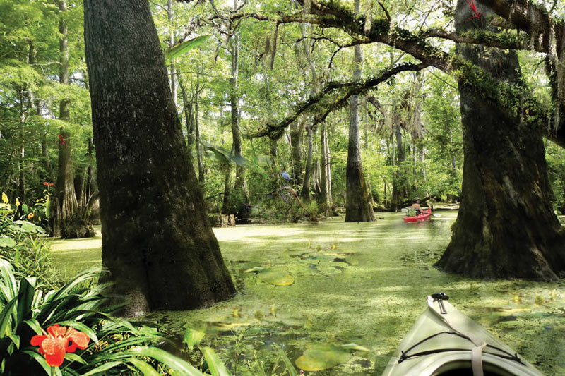
Bright and shiny renderings from the recently-released master plan for the Houston Botanic Garden show that design firm West 8 is aware of the challenges involved in straddling a world-class park across Sims Bayou, on the site of Glenbrook Park Golf Course just across I-45 north of Hobby Airport. The Dutch firm, known internationally for unusual bridges and unconventional landscape design, has planned for many of the Garden’s displays to flood at will; the shores of Sims Bayou on the Garden’s property will also be resculpted. And to combat Houston’s just-shy-of-year-round heat, shade trees would be preserved or planted throughout the park, including the towering cypresses depicted in the bayou-side wetland gardens shown above (parts of which will be explorable by kayak).
Meanwhile, the more formal garden spaces planned for the park are shown with their own built-in shade (complete with custom ceiling fans): Colonnade structures (like the ones picture below) will ring each of the major collection gardens, which are designed to be “entered, enjoyed, and contemplated from the comfort of the shaded perimeterâ€:
HIGH VOLTAGE NEWS FOR HOUSTON BICYCLISTS 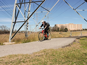 Parks and Rec department director Joe Turner tells the Chronicle‘s Mike Morris that a powerline right-of-way crossing on University of Houston property northeast of the intersection of Martin Luther King Boulevard and Old Spanish Trail will be the first improvement allowed by a new agreement between the city and CenterPoint Energy (subject to city council approval this week) that will allow hike-and-bike trails to be cut along electrical transmission-line right of ways throughout the city. Most likely the next up, according to Turner: a trail from Sims Bayou to Cambridge Village Park in southwest Houston. That route, along with others being contemplated, runs north to south. As Mayor Parker noted in her announcement, that should complement the bayou-side (and therefore mostly east-west) trails being created as part of the Bayou Greenways 2020 project. CenterPoint is donating $1.5 million toward the creation of new trails on their property, possibly because it got what it wanted in the deal, which also involves the conversion of all 165,000 city traffic signals to LEDs over the next 5 years. Writes Morris: “Bills to allow trails on utility right of way were filed as early as 2007 but stalled over questions about how much liability CenterPoint should face in opening its land for recreational use. A compromise was reached last year. The utility is liable only for a serious injury or death caused by its ‘willful or wanton acts or gross negligence.’ Under the agreement announced Friday, the city would pay the utility’s legal bills if lawsuits are filed.” [Houston Chronicle ($); more info; previously on Swamplot] Photo of bike trail along Brays Bayou: Dave Fehling/State Impact
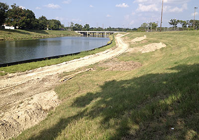
Across town from the molten-zinc-dipped pedestrian bridges and Bud Light Amphitheaters going up along Buffalo Bayou, site prep is underway to build a new section of hike and bike trail along Brays Bayou in Mason Park. Paid for by the same federal scratch that will fund a yet-to-be-designed pedestrian bridge spanning the bayou on the south side of 75th St. (or behind that bridge in the photo), this section will connect 75th to Forest Hill Blvd., where the trail picks up and splits, running west to Lawndale and east to Capitol near the Magnolia Transit Center.
Yep, that’s a bike-gear-sporting State Sen. Rodney Ellis, 2 city council members, and both bearded and cleanshaven versions of model Lauren Bush’s brother — Pierce Bush — talking up the idea of building more parks by more Houston bayous in this promotional video for an organization called Parks By You. What are they and their smiling costars so earnestly upbeat about? A $160 million bond initiative on the November ballot that would take a big step toward implementing the Houston Parks Board’s Bayou Greenways Project — a proposal to add green spaces and linear parks with concrete hike-and-bike trails along 100 miles of Houston bayous. The bond issue would help pay for improvements to more than a dozen existing parks and connect trails along 7 bayous in the city.
The overall vision (not all of which, apparently, is included in the bond measure) would transform Houston’s park map from this:
MISSOURI CITY GROWS ITS OWN TRAIL MIX 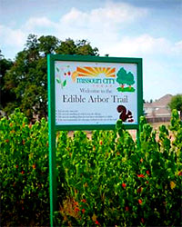 Missouri City forester Paul Wierzbicki tells reporter Cory Stottlemeyer that he expects the Jujubes, Mexican plums, Mexican persimmons, mulberries, pomegranates, figs, pears, and kumquats he began planting along the Oyster Creek Trail last fall to survive through the year. The 70 fruit- and nut-bearing trees now growing along half of the Missouri City section of the trail between Mosley Park and FM 3345 were selected for their tolerance to local conditions, including drought and Gulf Coast pests. Planted in 7 separate groves and interspersed with signage bearing descriptions and the corporate logos of sponsors, they constitute the region’s first-ever edible arbor trail. By next fall, Wierzbicki hopes to have the city’s entire portion of the trail lined with tree bounty trailgoers can reach out and eat. [Fort Bend Sun] Photo: Missouri City
COMMENT OF THE DAY: A PARK GROWS IN IDYLWOOD “The neighborhood will be able to ‘use’ the vacant land but cannot build permanent structures upon it. With the exception of one lot at the far end of N. Macgregor, 9 are connecting so that they will form a large U shaped property. There’s been talk of a shared garden but who knows… The area still looks pretty rough right now, but the damaged sidewalks, where driveways once were, are being repaired and curbs installed. There are existing trees and lawns so hopefully it will become, at the very least, another usable green space. I suspect that, when the next big flood happens and some of the remaining homes get hit yet again, if another FEMA buyout is offered, we’ll be seeing more open land along N. Macgregor. . . .” [PYEWACKET2, commenting on Comment of the Day: The Great Idylwood Shoreline FEMA Buyout]
Just out of edit: this action-packed reel featuring Houston’s multi-site skate park and its signature attraction, the bayou hop.
Video: Vimeo user emill
MORE PONDS, HUGGING BAYOUS Houston will spend $30 million in the upcoming fiscal year on detention ponds like those built under Project Brays. “About $20 million in federal Hurricane Ike relief money and $10 million in city capital improvements funding will be used to buy land and design and build basins that can hold hundreds of acre feet of water when the bayous become full, [Mayor] White said. City officials are evaluating sites along the Hunting, Greens, White Oak, and Halls bayous for new detention basins, said Andy Icken, deputy director of the Public Works and Engineering Department.” [Houston Chronicle]
PAY NO ATTENTION TO THE BAYOU Lisa Gray gets a glimpse of the “chai-colored” waters of Berry Bayou behind her 1966-model Meadowcreek home: “Most of the new houses sprouting in the neighborhood did their level best to ignore the bayou. Most of them still do; it’s rarely a selling point. A year ago, I was delighted to find that not only was it possible to buy a non-flooding bayou house for $150K, but that it might not cost any more than a similar three-bedroom house on a neighboring suburban lot. On har.com’s real estate listings, bayou frontage either went unmentioned or hid under the faint praise ‘no backyard neighbors’ — the same thing sellers say when a house backs up to train tracks. When first looking at the house I now live in, I had to stand on an overturned bucket to see over the privacy fence and down to the water.” [Houston Chronicle]
HOUSTON BAYOUS: NOW FEATURING RAW SEWAGE! “Ever since the hurricane, a number of the city’s waste water treatment plants went without power. As a result, the city was forced to actually dump raw sewage straight into the bayous. First of all, it smells awful. There have also been some oil slicks along the waterways. And you can’t miss the dead fish.” [abc13]

