11/13/18 10:15am

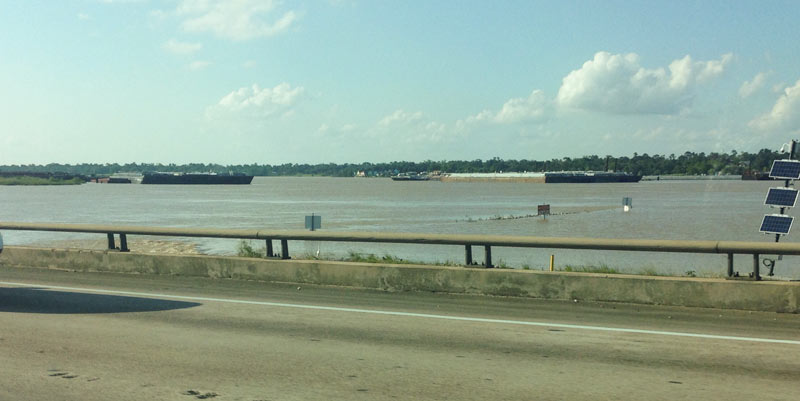
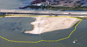
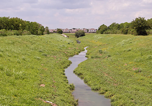
Aside from the presence of workers, the only hint you’ll find that construction has begun on the MDI Superfund site is the sign now standing at the location itself (and the HAIF thread where a user first called attention the whole scene). It’s facing toward the end of Gillespie St., a tiny Fifth Ward road that crosses over Hirsch Rd. and some railroad tracks 3 blocks north of Clinton Dr. before petering out into the eastern edge of the vacant, 35-acre industrial site. There, 3 acres are now giving rise to 42 new townhomes put there Urban Living, the Houston developer that received a multi-million dollar bill in court last week for copying copyrighted townhome plans at a handful of other sites. It’s calling this latest batch East River Yards (an apparent nod to the other industrial tract just south, the gradually crumbling KBR campus that’s been redubbed East River.)

The East River Yards houses will cluster around 3 shared driveways, all of which let out onto Press St.:

CONTINUE READING THIS STORY

East River Yards
09/05/18 4:00pm

COMMENT OF THE DAY: THE BRIO LATENCY EFFECT “I moved to Sageglen in 1981 during kindergarten and went to Weber all the way through 6th grade and onto Webster. We played in the ditches catching crawdads, waded through flood waters, and drank the water freely. So many friends lived in Southbend so plenty of time was spent there as well playing throughout the neighborhood on what we thought were playgrounds and neighborhood pools. During the notification process of the contamination, my mother (Chinese and unable to read English at the time) was never aware of any class action suit. I, being a child, only knew we weren’t allowed to drink from the water fountains and didn’t even know what a class action suit or toxic contamination was at the time. Thus, we never signed up for it, nor received any compensation whatsoever. . . After reading all the accounts of vague health issues, I am realizing more and more that my own health issues are pretty much parallel. This cannot be a coincidence. Does anyone know of any sort of data collection on former residents to track the health implications? Or is there a class action suit still available to join; or has anyone filed another considering a lot of these issues are not presenting until adulthood? My biggest concern is: Will these issues be passed down and affect my own child? I just don’t feel this catastrophe and crime against so many people’s health/lives that we are all still/now finding out about should be a ‘closed’ case. We were oblivious kids back then without any idea of how this would affect us in our lives and well-being as adults.” [Marie, commenting on My Toxic Houston Childhood] Photo of Clear Creek near Brio Superfund site: Allyn West

12/04/17 12:30pm

Included in ProPublica’s effort to identify and map every abandoned munitions facility in the U.S. — especially those that might still harbor toxic waste, residue from chemical weapons, or explosives: Houston’s own San Antonio Ordnance Depot, the original boundaries of which straddle Jacintoport Blvd., just east of Beltway 8 and immediately north of the Houston Ship Channel.

The 4,850-acre former depot and ordnance demolition facility was sold to the Ship Channel’s governing authority in 1964. It counts as one of 62 current or former military installations in Texas still containing hazardous waste, but according to Department of Defense documents is not scheduled to be cleaned up entirely until 2084.

Photos of San Jacinto Ordnance Depot bunkers: arch-ive.org

Along the Ship Channel
10/11/17 5:00pm

EPA: YEAH, BETTER CLEAN OUT THE DIOXIN PITS FROM THE SAN JACINTO RIVER NOW THAT THEY’VE LEAKED A bit later than had been urged by those alarmed by the longterm presence of pits full of toxic waste sealed only with a tarp on top hanging out in the San Jacinto River, the EPA has now approved a plan to remove most of the dioxin stored within them. “As exemplified today, EPA is prioritizing Superfund clean-up by making decisions in a decisive, timely manner,” reads a statement from administrator Scott Pruitt released this afternoon. “The San Jacinto Waste Pits site was added to the National Priority List nearly a decade ago.” What’s the rush? As predicted by EPA studies and many a casual observer, the pits appeared to have leaked extensively after Hurricane Harvey flooding. Under the new $115 million plan, cofferdams will be installed around the pits and almost 212,000 cubic yards of dioxin-contaminated material will be excavated — leaving just enough behind that the agency can, it says, ensure controls that will “prevent access, eliminate off-site migration, and monitor the natural recovery into the future.” [EPA; more info; Houston Chronicle; previously on Swamplot] Video of waste pits after Harvey flooding: Greg Moss

08/31/17 3:45pm

Captured on Sunday between bands of Harvey downpour by an enterprising drone photographer hunkering in Friendswood, the video above includes a quick pan over the Brio Superfund site south of Beamer Rd. near the intersection with Dixie Farm Rd. The former chemical facility, once at the heart of both the long-gone Southbend neighborhood and of the series of lawsuits filed by Southbend residents over contamination-related birth defects and illnesses, makes its cameo around minute 3, as the drone passes over a waterlogged Exxon Mobil station and rotates from south to east down Beamer toward the San Jacinto College South Campus.

Might floodwaters flowing across the Brio site and all those other Superfund spots dotting the local map have stirred up toxin-laced sediments and spread them around? (Texas A&M Galveston scientist Wes Highfield was worried enough about the possibility to attempt a mid-flood outing from his home to try to get some water samples.) In the video, the Brio site appears to be a little less waterlogged than some of its surroundings — including the adjacent section of Beamer Rd., shown picking up a bit of kayak traffic — but likely got washed over by around 42 in. of rain altogether in the past week.

In a follow-up drone run flown on Wednesday, the site (making an appearance about 2-and-a-half minutes in) looks like it might have dried off a bit:

CONTINUE READING THIS STORY

Superfund and Beyond
09/29/16 2:45pm

San Jacinto River at I-10 Crossing, Channelview, TX 77530

Aerial View with Delineated San Jacinto Waste Pits Cap, I-10 at San Jacinto RiverYesterday the EPA released their recommendations for what to do about the toxic muck in the San Jacinto Waste Pits, after more than a decade of local and federal agencies poking and fishing around in the area (on either side of the I-10 crossing of the river). So far the Superfund site has been temporarily dealt with by the 2011 placement of a pretty-much-just-a-tarp-with-rocks-over-it armored cap, which the EPA says has already been repaired at least 7 times; the document released yesterday notes, however, that disturbances at the site caused by weather and previous nearby sand mining operations “could cause a catastrophic release of the highly toxic waste materials from the impoundments, if they remain in place.

The EPA wants to remove about 202,000 cubic yards of contaminated material (roughly enough to fill the floor of the Astrodome with a 13-foot-deep layer) but says it’ll have to be done carefully so as not to accidentally stir up the waste into the surrounding river while trying to get it out; the removal would also probably take place in stages to avoid potentially exposing too much of the waste at a time to storms or flooding. Here’s the EPA’s map of the 2 sites where the paper sludge was originally dumped in the 1960s — the (capped) northern area is outlined in blue and labeled Cap Site, while the southern site (outlined in yellow and labled Southern Impoundment) is covered in part by the Glendale Boatworks building, next to Southwest Shipyard:

CONTINUE READING THIS STORY

Not Keeping a Lid on It
12/01/15 10:00am

UT Houston Campus Site, Buffalo Lakes, Houston

Some zoomy conceptual renderings of the University of Texas’s coming Houston campus, centered on the largely undeveloped intersection of Buffalo Spdwy. and Willowbend Blvd., made their debut at last month’s Board of Regents meeting, where the intended purchase of land for the project was announced. Buffalo Spdwy. gently winds through the drawings of the new campus to a track and several baseball diamonds along Holmes Rd. (which runs horizontally across the top of the image above).

Although the images are only “concepts”, the pictures do provide a sense of how the campus might unfold: For example, that linear water feature shown at the center of the campus aligns with an existing drainage ditch on the property, and the 3 long, low structures in the foreground are good candidates for parking garages, which will be needed regardless of the new institution’s yet-to-be-decided purpose.

Existing residential communities and industrial parks are here rendered as sparsely-treed fields — the boundary of the land slated for purchase by UT currently houses several apartment complexes on the north side and the Orkin Industrial Surplus facility to the south.

But another conceptual rendering (this one looking northwest across Holmes Rd. towards the distant Williams Tower) shows the campus in place amongst some of its eclectic neighbors:

CONTINUE READING THIS STORY

Welcome to the neighborhood
05/13/15 4:30pm

COMMENT OF THE DAY: HOME IS WHERE THE CHEMICAL WASTE IS Southbend, Houston“I lived there from 1984-1990, from 2nd to 7th grade. I remember there being a ton of empty houses by the end. They never finished the neighborhood either, given that the problems occurred and people knew about it by the end. You’d have entire streets with 4 or 5 houses on it. My friends and I would play baseball, or football in those empty lots. We’d hit baseballs through windows of abandoned homes, and it’d be a dare to ‘go into that ghost house’ to get the ball back. I remember going back in 1993 or so, and the entire place was empty, boarded up. It was sad. My dad and I hopped the fence and walked back to where our house was. We were there for about 5 minutes when the police came and wanted to know what the hell we were doing. Apparently, it’d become a place for squatters. By 1995 the entire neighborhood was bulldozed to the ground. Now just an empty field. Yes, my dad lost a ton on that house. But we were part of that settlement that is mentioned. Paid for a small portion of my college, will pay for a tiny portion of my kids’ college. We were lucky in that I didn’t have any defects (that I know of), and my sister seems alright as well, though she had severe migraines at the time. It was a weird situation, especially for a 7-12 year old. But, I didn’t know it was ‘odd’ at the time. I just thought that it was cool, that I could break a window, or climb into a back yard to get a ball back, at a house that sat empty for 4 years. I thought it was ‘normal.’” [Matt, commenting on My Toxic Houston Childhood] Illustration: Lulu

01/06/15 1:30pm

Variance Sign for Living Green, MDI Superfund Site, 3617 Baer St., Fifth Ward, Houston

Signs have gone up around the former metal foundry site at 3617 Baer St. in the Fifth Ward indicating that a hearing is scheduled for this Thursday to get city approval for the latest rejiggering of homesites on the 35-acre tract. Developer Frank Liu of Lovett Homes, InTown Homes, and a few other local builder brands plans to put a total of 538 homes (down from 589) on the EPA-monitored property, known as the MDI Superfund Site after the last owner of the metal-casting operations, Many Diversified Interests, which shut down in the early 1990s (previously, the plants were owned by TESCO). The property, which lies just south of I-10 about 2 miles of east of downtown, was listed on the EPA’s list of priority Superfund sites in 1999, after tests showed the soil and groundwater was contaminated with lead and other hazardous metals.

CONTINUE READING THIS STORY

Living Green
10/01/14 12:00pm

Area Surrounding Former Brio Superfund Site, Dixie Farm Rd. at Beamer Rd., Southbend Subdivision, Friendswood, Houston

Inspired by reading René Steinke’s new and recently optioned-for-film novel Friendswood, the plot of which centers on the aftermath of the Brio Superfund mess just south of I-45 and the Beltway, Cite magazine’s Allyn West returns to the former chemical waste facility at Dixie Farm Rd. and Beamer Rd. to snap some photos and have a look around: “The first thing you pass is a landfill. And then, incongruously, you pass archetypal subdivisions with bucolic names, much like Southbend must have been. There’s a dedicated bike lane on both sides of Dixie Farm, clearly marked and freshly painted. Then turning toward the site onto Blackhawk Boulevard, you pass Ashley Pointe, a new subdivision. That morning, I saw construction workers milling about around unfinished stick frames. If Southbend still existed, Ashley Pointe would sit right next to it.”

CONTINUE READING THIS STORY

Buried Secrets
07/25/13 4:05pm

SOME REAL-LIFE OCCUPANTS FOR GALVESTON’S LONG-ABANDONED BREWERY? The endangered historic Falstaff Brewery that once harbored a bunch of scared architecture students in a horror flick might become a real refuge for Galvestonians looking for cheap housing — or so Culturemap’s Tyler Rudick seems to think, divining a hint about Dallas developer Matthews Southwest’s plans for the property from the very title of the rep he interviews: “Company officials are unable to reveal the full details until a purchase is finalized,” cautions Rudick. “But [we] spoke with current project leader Scott Galbraith, whose position as Matthews Southwest’s vice president of affordable income development suggests the company’s larger plans for the complex.” Perhaps, but Galbraith is also quick to point out that Matthews Southwest is keeping its options open while studying the site; previous environmental investigations have found plenty of asbestos in the 313,000-sq.-ft. building and soil contamination around it. [Culturemap; previously on Swamplot] Photo: Candace Garcia

04/19/12 11:33am

SMELT ON THE BANKS OF THE HOUSTON SHIP CHANNEL Included in USA Today‘s national list of “ghost factories”forgotten lead smelting sites that have left behind toxic particles in the nearby soil — is the Lead Products Co. site at 709 N. Velasco St., just south of the Ship Channel a mile and a half east of Downtown. The TCEQ tells the newspaper that the site was a secondary lead smelter until 1968: “Contamination at the site is being addressed under a voluntary cleanup program and has focused on the disposal of lead battery casings at the site and on the adjoining KQXT transmitter property, the state said. Cleanup actions have included construction and placement of an earthen cap. Groundwater contamination also has been investigated, the state said.” Helpfully, Lead Products Co. has a “ghost” website to go along with its “ghost” factory. [USA Today] Photo of adjacent Cary St. play area: Lead Products Co.

08/12/10 11:06am

Start with a few architecture students on some kind of field trip with their professor. Throw in a “freak storm.” Then trap everyone — along with a “chaperone” — inside a massive and spooky abandoned building. What do you get? The setup for Hellstorm, a new horror movie from local producers Epiphany Filmwerks.

Epiphany promises its filming location, Galveston’s long-abandoned and rotting Falstaff Brewery, will be “one of the main characters in the movie.” That’s where the young cast of pouty screamers will, of course, “encounter something much more terrifying than the storm itself.” What could that be?

CONTINUE READING THIS STORY

07/22/10 11:13am

A little more detail on that other Walmart headed for I-10, from Memorial Examiner reporter Rusty Graham: Construction will begin within a couple of months on the 185,000 sq. ft. Supercenter just north of the Marq*E Entertainment Center, on the remaining 23 acres of the former Cameron Iron Works plant. The company has quietly owned a portion of the TCEQ remediation site, which features soil and groundwater rich in cleaning solvents, since 2008. (“Most of the soil at the site has now been cleaned to meet residential standards,” Cooper Cameron claims.) Six of 7 surrounding pad sites will line Silber Rd. The Walmart itself will form a scenic backdrop to an expansive 880-space parking lot:

CONTINUE READING THIS STORY

05/11/10 11:20am

Playing around with a super-fun online tool that lets you superimpose the blobbish outline of the 2500-sq.-mile (and growing!) Gulf of Mexico oil slick from the Deepwater Horizon offshore-rig disaster onto various cities, Houstonist editor Marc Brubaker tries it on Houston — for size.

“It’s almost creepy how the slick follows I-10 out to Beaumont,” he comments. Of course, Brubaker should have nudged the oily blob a bit more to the east. Sure, he might have lost a few of those shiny exploration-company offices that have fled to the western stretches of Katy that way, but you’d be picking up lots of fun storage tanks and chug-chugging industrial plants at the northern reaches of Galveston Bay, and you’d get better coverage of Texas City, too.

Oh — but the outline is only up to date as of May 6th? Maybe we’ve got full coverage by now, then!

Image: Houstonist