
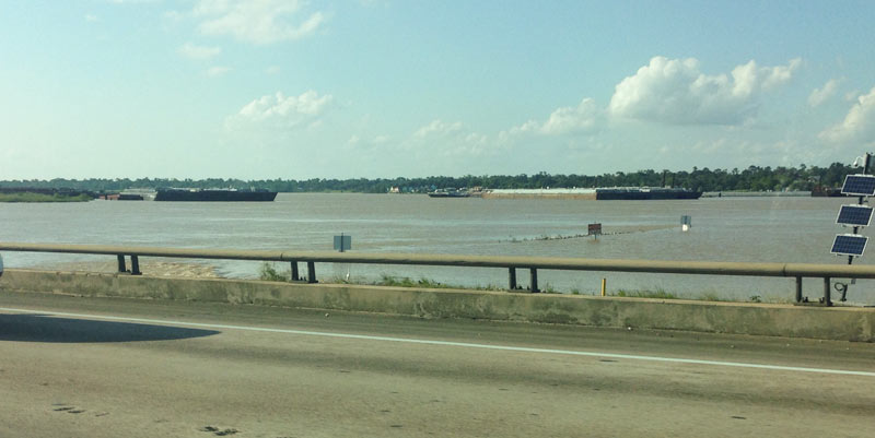
 Yesterday the EPA released their recommendations for what to do about the toxic muck in the San Jacinto Waste Pits, after more than a decade of local and federal agencies poking and fishing around in the area (on either side of the I-10 crossing of the river). So far the Superfund site has been temporarily dealt with by the 2011 placement of a pretty-much-just-a-tarp-with-rocks-over-it armored cap, which the EPA says has already been repaired at least 7 times; the document released yesterday notes, however, that disturbances at the site caused by weather and previous nearby sand mining operations “could cause a catastrophic release of the highly toxic waste materials from the impoundments, if they remain in place.“
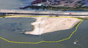
The EPA wants to remove about 202,000 cubic yards of contaminated material (roughly enough to fill the floor of the Astrodome with a 13-foot-deep layer) but says it’ll have to be done carefully so as not to accidentally stir up the waste into the surrounding river while trying to get it out; the removal would also probably take place in stages to avoid potentially exposing too much of the waste at a time to storms or flooding. Here’s the EPA’s map of the 2 sites where the paper sludge was originally dumped in the 1960s — the (capped) northern area is outlined in blue and labeled Cap Site, while the southern site (outlined in yellow and labled Southern Impoundment) is covered in part by the Glendale Boatworks building, next to Southwest Shipyard:
***
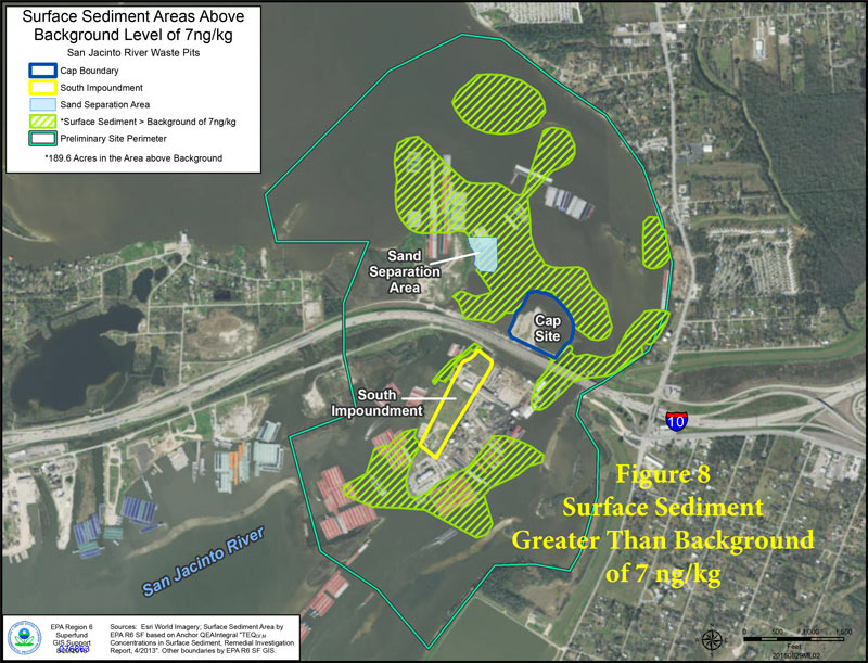
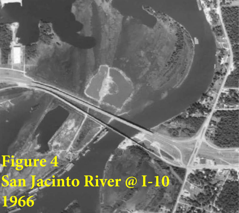
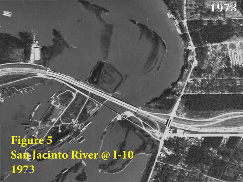
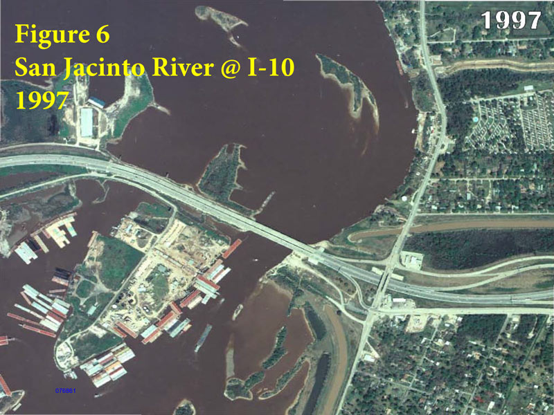
The green hatch marks show areas where dioxin levels have been measured as above the normal background level expected in the river’s sediments; that blue Sand Separation Area is part of the sand mining operations that the EPA’s report says helped spread the contaminants. The report also includes some old aerial photos of the site, which show the waste pits (and the whole Ship Channel area) sinking due to groundwater extraction:
Removal plans (the ones called Alternatives 6N and 4S in yesterday’s report) were selected out of a list of options for each site. The cleanup plan for the mostly-submerged waste area north of the bridge appears to involve a couple of permanent berms (and a bunch of signage) to permanently keep boats and people away from the site (and from any leftover residue). The report says that the excavated muck from that site would be dried out and possibly mixed with cement to stabilize it for long-term disposal.
- San Jacinto River Waste Pits Site Proposed Plan [EPA]
- San Jacinto River Waste Pits Superfund Site Current Status [EPA]
- EPA Favors Excavation At San Jacinto Superfund Site [Houston Public Media]
- Previously on Swamplot:Â San Jacinto Toxic Waste Studies Delayed by San Jacinto Flooding;Â Group Forms To Clean Up The Upper San Jacinto Before It Gets as Bad as Brays, Buffalo, Sims Bayous; How To Prepare San Jac River Stew
Images: Swamplot inbox (top), USACE (2nd), EPA (all others)


An ecological nightmare no matter how you cut it. Sad we have to deal with it at all. But it’s there; if it’s going to continue poisoning the water, AND will likely lead to a catastrophic release in the near-ish future, AND there’s a good chance that remediation efforts could significantly reduce these risks, the remediation work simply has to be done.
Word of the day: “externality”
Good to know the environmental/engineering business still has un-tapped opportunities in Houston.