09/20/17 12:00pm

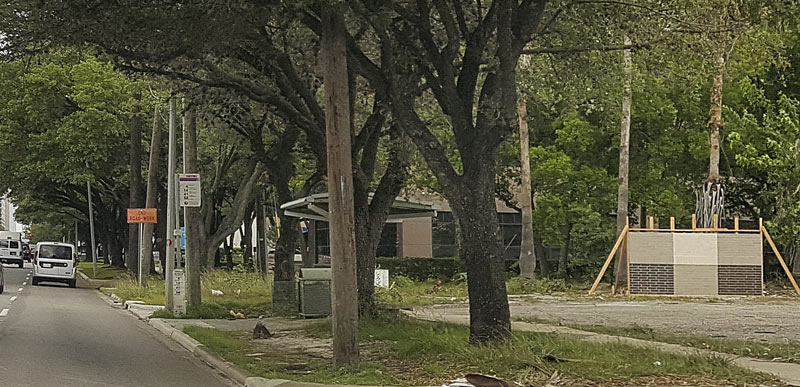
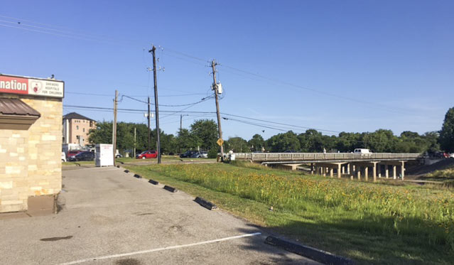
It’s coming a little late for many homes in Meyerland, but excavation crews are once again at work widening the segment of Brays Bayou just downstream of that flooded neighborhood. Work on the segment between Buffalo Speedway and S. Rice Ave. began this past summer. The widening is a part of the decade-plus-old Project Brays, begun before but accelerated as a result of flooding during Tropical Storm Allison in 2001.

Water levels on the bayou have returned to a manageable level; this photo, sent in by a Swamplot reader, shows an excavator at work on its south bank just west of the inlet between Timberside Dr. and Bevlyn Dr.

Photo: Swamplot inbox

Braeswood Place
09/14/17 1:30pm

Construction began in June, but the new administration of Houston’s Ronald McDonald House chose this past Tuesday — 2 and a half weeks after water spilling over the banks of adjacent Brays Bayou made Holcombe Ave. in front of the property difficult to pass — to hold an official groundbreaking ceremony for its new 3-phase expansion and renovation project. The facility at 1907 Holcombe Blvd., which sits across the Texas Medical Center’s official southern border between Holcombe and the bayou just west of Cambridge St., serves as a temporary home for families with children receiving treatment for serious illnesses.

Now going up: a new 2-story bedroom wing directly to the west of the main building. A complete renovation of the 50-bedroom existing building — dubbed Holcombe House — will follow. The photo immediately above, taken from the third floor of that building, shows the construction site as it looked earlier this week.

The official rendering below is still being used to raise the $22.5 million needed for the project; it shows the new bedroom wing on the left and the existing building on the right:

CONTINUE READING THIS STORY

Bedrooms Above
07/31/17 2:30pm

COMMENT OF THE DAY: ASIDE FROM THESE 2 ISSUES, FISHING IN BRAYS BAYOU IS ENORMOUSLY APPEALING “The problem: I don’t think I would trust any of those fish to eat. Sure, you can catch and release, but I also don’t see the appeal of standing on the banks of a concrete ditch.” [Heightsresident, commenting on A Fishing Guide to Concrete-Lined Brays Bayou] Photo: Payton Moore

07/31/17 11:15am

A FISHING GUIDE TO CONCRETE-LINED BRAYS BAYOU What kind of fish can an enterprising angler find in the wilds of inner-loop Brays Bayou? Episcopal priest and urban fly-fishing evangelist Mark Marmon tells the Chronicle‘s Shannon Tompkins he’s caught 18 different species in Brays Bayou alone, including largemouth bass, crappie, catfish, sunfish, Rio Grande perch, longnose gar, spotted gar, and white bass. But that’s just counting the natives. The biggest draws — and what you’re most likely to find — are the alien invaders, which include mullet, the aquarium-fugitive armored catfish known as plecostomus, tilapia, and grass carp, aka “Bellaire bonefish.” But you’ve got to know where to look for them: “They, like most fish in the bayou, tend to cluster around the mouth of ‘feeder’ creeks,” Tompkins reports. “They also like structure anomalies that create accelerated current or breaks in the current; in Brays Bayou, these are created by breaks or buckles in the otherwise smooth concrete lining of the bayou or maybe an abandoned shopping cart that has found its way into the bayou. (Anglers call those shopping carts ‘Brays Bayou mangroves.’)” [Houston Chronicle] Photo: Payton Moore

07/28/17 3:45pm

All construction work appears to have stopped, a reader notes, on the transformation of the former Pilgrim Cleaners and (later) Shriners Hospital clothing donation drop-off building at 4005 N. Braeswood into a second location of the Bacco wine bar. (The building, at the corner of Stella Link, backs up to Brays Bayou.) A red tag from city’s floodplain management office sticky-noted to the window beside the front door and dated July 3 gives a hint as to why: “Remodeling without floodplain permit in the floodplain,” it reads. On the next line, it adds another bit of advice: “Need electrical, plumbing, and structural permits as well.”

Photo: Swamplot inbox

When It Pours
07/24/17 11:30am

WHAT’S BLOCKING THE BRAYS BAYOU TRAIL 
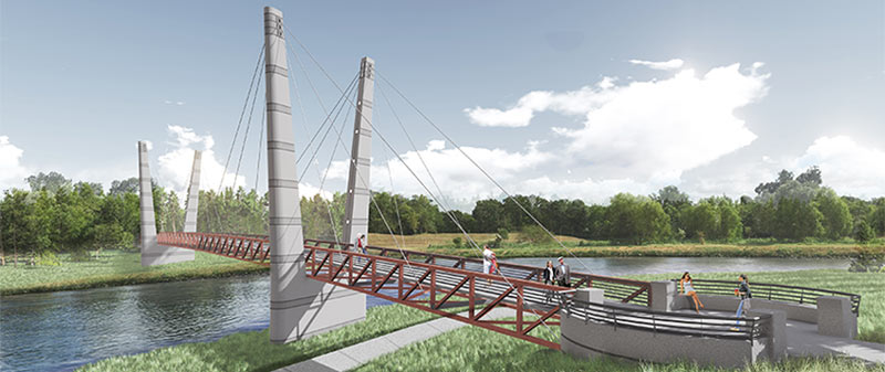
That sign posted just west of Chimney Rock declaring that the Brays Bayou trail “connects 31 miles of uninterrupted, off-street, multi-use trails and greenspace from the Ship Channel to George Bush Park and the Addicks-Barker Reservoir” is more aspirational than accurate at this point, a Houston Parks Board official admits to David Olinger. (“It got ahead of itself, let’s put it that way.”) Olinger set out to walk the supposed marathon-distance-plus continuum, but found it blocked and interrupted by construction zones, an unidentified fork to a neighboring bayou, and dead ends, including some fronting 7-miles-worth of land adjacent to Arthur Storey Park the parks board is still in the process of acquiring: “I tried walking west from Kirkwood and waded into knee-high weeds. I tried walking north on Kirkwood and found no trail. I drove up and down Kirkwood, searching in vain for Arthur Storey Park. Finally I consulted a map — and found the park about 2.5 miles northeast from the westbound Kirkwood dead end.” The Bayou Greenways trail system is expected to connect that length of Brays Bayou by 2020. [Houston Chronicle; previously on Swamplot] Photo of Brays Bayou trail: Jan Buchholtz  

06/13/17 9:30am


The little swatch of test facade tilted up at 7551 Main St. north of Brays Bayou earlier this spring is still standing, a reader’s drive-by snap attests this week. The piece, which shows off the look of a handful of warmer and cooler beige-and-brown pairings, is likely related to the much taller project planned on the site by Allen Harrison Company, which bought the land last year. The developer has the spot marked for an 11-story residential building (the top 7 of which’ll hold 186 apartments, and the bottom 4 of which’ll hold 285 parked cars). A reader over on HAIF also spotted the recently completed review of the building by the Federal Aviation Administration folks, who okayed the plans for the 125-ft.-tall structure as not a flight hazard.

Photos: Swamplot inbox

Beiges of Brays
05/31/17 11:15am

The Bacco folks appear to be moving right along with the makeover of that little freestanding Shriner’s Hospital clothing donation center building along Brays Bayou northwest of Stella Link Rd., a few readers note. The donation center signage (shown in the second photo) has now been fully swapped out for the wine bar’s logo and entryway stylings, and the bar says it’ll be working on an outdoor deck soon, now that internal rearrangements have mostly wrapped up. The new look has so far maintained the stone skin that the building picked up around 2013, before the then-empty retail shell picked up senior care consultant Care Locators as a tenant; before that, the Pilgrim Cleaners had opted for a more flat color scheme (shown below in an old listing photo without much in the way of windows, either):

CONTINUE READING THIS STORY

Bar on the Bayou
05/24/17 4:45pm

6 MOCK ICE HOUSES FOR BRAYS BAYOU, AS PROPOSED BY THAT GUY WHO TAKES PHOTOS OF HOUSTON ICE HOUSES That massively expanded greenway network is all well and good, suggests architect and icehouse photographer-philosopher David Richmond in the Chronicle today — but bayouside trails are a lot better at getting people from up and down the waterways to run right past one another than they are at getting the same folks to mix or hang out. Richmond offers a suggestion to change that: a design for a boxy, glassy pavilion structure loosely inspired by the shape of, and what he argues is the historic social function of, Houston’s icehouses — namely, as a stand-in for the kind of town squares that he says most of Houston doesn’t really have. Richmond proposes sticking the same square design in 6 different spots along Brays Bayou, with each structure’s range of possible uses (from flea markets and coffee shops to movie nights and wedding receptions) being tailored to fit the surrounding area. [Houston Chronicle] Speculative rendering of pavilion structure along Brays Bayou: David Richmond

05/04/17 3:45pm

COMMENT OF THE DAY: WILL THE BAYOU CITY PLEASE START ACTING LIKE IT? “Is the new business going to incorporate the bayou, or keep its back turned to it? Would be nice to see the trend continue of businesses along the bayous turning around and accepting the existence of a recreational green belt and trail network in its backyard, rather than using that as the side for the dumpsters.” [Superdave, commenting on Sixties Ex-Dry Cleaning Spot To Be Made Over as a Brays-Side Wine Bar] Photo of Brays Bayou at Stella Link Rd.: Frank Karbarz

05/03/17 10:00am

The scenic view from behind the former Pilgrim Cleaners building at 4005 N. Braeswood Blvd. will reportedly belong soon to a second location of West University-adjacent wine lounge Bacco. The 1966 building (northwest of the Stella Link Rd. bridge over Brays Bayou) operated as a dry cleaner prior to its conversion to a clothing donation drop spot for the Shriner’s Hospital for Children.  Ralph Bivins notes this week in Realty News Report that the location may encourage traffic from Bayou Greenway hikers and bikers; a reader’s photos from the scene show that the trail on the north side of the bayou in this section is still sporting the au naturel look, though the trail on the south side is fully paved:

CONTINUE READING THIS STORY

Reborn on the Bayou
03/15/17 1:45pm

Rendering of pedestrian bridge over Brays Bayou at Mason Park

A double-V’d walkin’ and bikin’ bridge like the one shown above will be spanning Brays Bayou before too long, the Houston Parks Board says, linking together the sections of Mason Park separated by the waterway. The agency is planning a short mid-morning party for the planned structure’s construction kickoff next Tuesday, on the southern side of the park (mostly located east of the 75th St. crossing). The whole complex is just downstream of the Gus Wortham Golf Course, for which renovations finally teed off a few weeks ago (trailing much ado a few years back that culminated in the land not getting turned into a botanical garden).

The board says the other, decidedly less suspenseful pedestrian bridge announced earlier this year should be done in the fall as well; that one will will run across Brays alongside the Martin Luther King Blvd. car bridge at the downstream edge of of MacGregor Park, and look kinda like this:

CONTINUE READING THIS STORY

Double Crossing Brays
01/19/17 4:15pm

Flooded Project Brays Construction Site, Brays Bayou at Main St.

If you have information regarding the whereabouts of the cheery orange digging machine spotted yesterday morning dipping its tracks into a brimming Brays Bayou, a concerned reader would like to hear it — the shot above is his last sighting of the machine, taken from the Main St. bridge. “When I looked today, it was gone. Any idea what happened to it?” 24 hours, of course, is plenty of time for someone to have taken the excavator somewhere warm to dry off, so no reason to assume anything particularly unfortunate transpired; the photo was taken around 8:30, a little over an hour after the water had begun to recede from its early morning crest, according to the Harris County Flood Control gauge readings at the Main St. bridge:

CONTINUE READING THIS STORY

No Reward
10/13/16 11:00am

Brays Bayou from Buffalo Speedway to Bevelyn, Linkwood, Houston, 77025

A mobile reader sends some fresh shots of not-quite-green-yet redone greenway along Brays Bayou, looking west from Buffalo Spdway. along S. Braeswood Blvd. The Harris County flood control folks have been widening this section of the channelized stream this fall as they work their way through the Project Brays checklist; the stretch seen above and below is about 2 miles downstream of some of those more submersion-prone areas of Meyerland near the Brays crossing under 610.

The new trail is a fair bit wider and smoother than the one it’s replacing — for some soggy comparison, here’s a view of the trail from around noon on Tax Day, just up past the next bend near where Ilona Ln. meets S. Braeswood:

CONTINUE READING THIS STORY

Widening Greenways and Waterways
10/05/16 12:00pm

HCC Expansion east of Pressler and Main streets, Texas Medical Center, Houston, 77030

A crane and 2 egrets were spotted on Brays Bayou just east of Main St. by a curious reader, along with the rising superstructure of the new Houston Community College Coleman College for Health Sciences building. The midrise, which will eventually connect to the other HCC buildings across Pressler St. via skybridge, should have 10 stories by the time the building opens (which, per HCC’s current plans, will be next August). The building is going up between the UT’s Sarofim Research Building and the large parking lot where the Shamrock Movie Theater once stood, across Main St. from the currently-also-mostly-a-parking-lot Shamrock Hilton site where the new DeBakey High School campus is going up.

Photo: Swamplot inbox


Med Center Operations