12/08/16 2:00pm

Pedestrian Bridge over White Oak at Durham St.

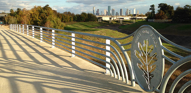
The section of bayou-hugging greenway trail running between Durham St. and Stude Park is getting the official OK tomorrow morning from Harris County Flood Control District and the Houston Parks Board. The photo above is of the pedestrian bridge across White Oak near Durham St. that previously supplanted the area’s “Bridge of Death” route; the segment opening tomorrow runs from that same bridge east along the bayou to the Studemont St. non-pedestrian bridge. The organizers are hoping would-be trail fans will use some means other than car to get to the ceremony location (off Studemont just north of I-10); if you have to drive, however, the invitation says you might be able to get a parking space across the freeway north of  Target.

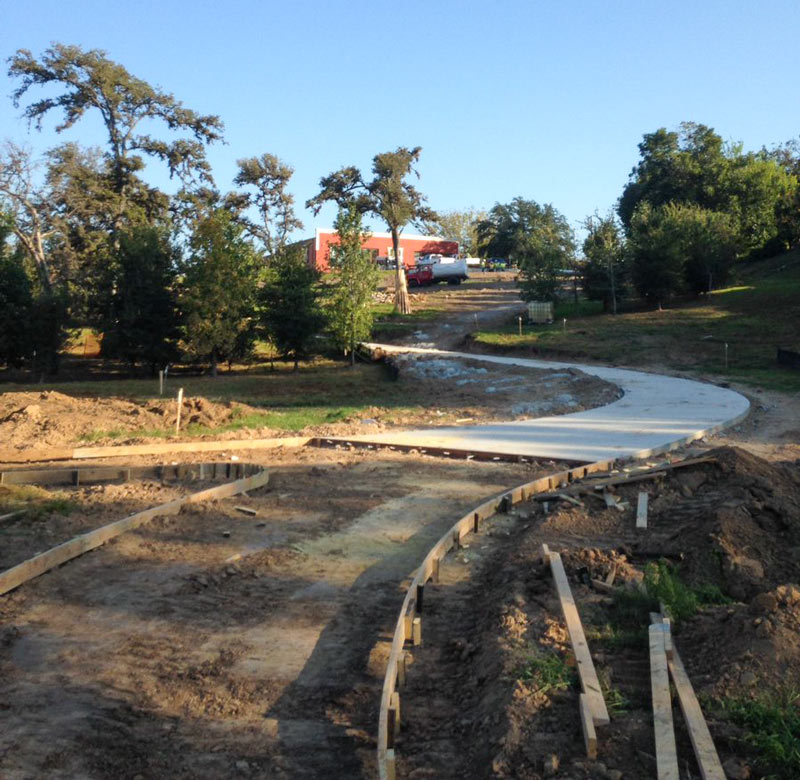
Further east along the White Oak trail, here’s an updated view of how that link into Near Northside by the Leonel Castillo Community Center is coming along (taken in mid-November, once again from the same spot as that glitzed-up flood photo that made an appearance in Air New Zealand’s recent in-flight feature on Texas):

CONTINUE READING THIS STORY

Greenways Growth Spurts
10/21/16 1:30pm

Trail construction along White Oak Bayou near Leonel Castillo Community Center, 2101 South St, Near Northside, Houston, 77009

A reader caught some shots last week of the current trailblazing going on between the Leonel Castillo Community Center and the White Oak Bayou greenway trail in Near Northside. The new connector should hit the path roughly between the south end of the building and the nearby Thomas Street Health Center HIV-slash-AIDS service building, just north of where the Heights hike-and-bike trail crosses over the bayou and under the Hogan St. bridge to merge with the White Oak trail on the way into Downtown:

CONTINUE READING THIS STORY

Closing Distance to Downtown
10/13/16 11:00am

Brays Bayou from Buffalo Speedway to Bevelyn, Linkwood, Houston, 77025

A mobile reader sends some fresh shots of not-quite-green-yet redone greenway along Brays Bayou, looking west from Buffalo Spdway. along S. Braeswood Blvd. The Harris County flood control folks have been widening this section of the channelized stream this fall as they work their way through the Project Brays checklist; the stretch seen above and below is about 2 miles downstream of some of those more submersion-prone areas of Meyerland near the Brays crossing under 610.

The new trail is a fair bit wider and smoother than the one it’s replacing — for some soggy comparison, here’s a view of the trail from around noon on Tax Day, just up past the next bend near where Ilona Ln. meets S. Braeswood:

CONTINUE READING THIS STORY

Widening Greenways and Waterways
04/18/16 1:00pm

1031 Stude St, Woodland Heights, Houston, 77007

While all bus and rail service is currently on hold due to widespread flooding, the route 66 bus stop sign on White Oak Dr. is still bravely performing its signaling duties (lower left above) as water from White Oak Bayou rushes past. A reader sends several studies of the area around Stude Park at the Taylor St. bridge at the southern edge of the Woodland Heights area; here’s a few more shots of the White Oak Bayou greenways gone brown this morning, with I-10 in the background to the south:

CONTINUE READING THIS STORY

Woodland Heights