03/07/16 12:15pm

Proposed White Oak Bayou Village redevelopment, Antoine Dr. at W. Little York Rd., Near Northwest, Houston, 77088Livable Centers plan, Near Northwest, Houston, 77088

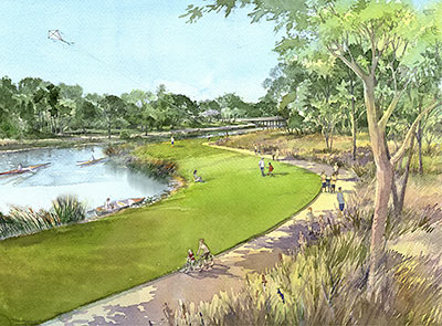
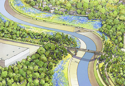
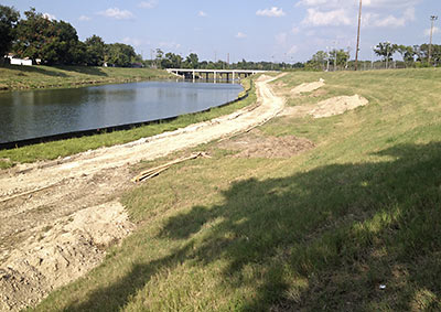
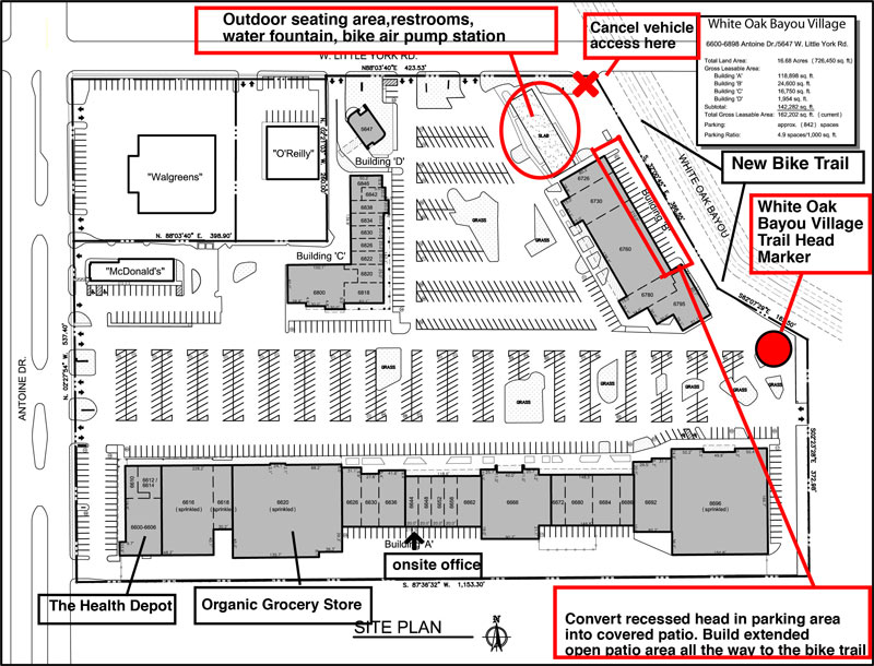
Plans are in the works to give the shopping center at the southwest corner of Antoine Dr. and W. Little York Rd. a thorough redesign and rebranding as White Oak Bayou Village. A spokesperson for Nankani Development tells Swamplot that the group is seeking both tenants and ideas for the center’s redevelopment, which will be geared toward drawing bicycle traffic. So far, plans include an about-face for the bayou-side building in the back of the shopping center (labeled Building B above) by way of new glassy storefronts opening toward the White Oak Bayou greenway now running behind it; the developers claim the center would become the first private development to cater explicitly to the expanding bayou trail system.

Per preliminary plans, car access to the back of the shopping center would be blocked off. Former parking spaces along the back Building B (currently home to Northwest Beauty School) would be made over into a covered patio leading to the bayou trail. For the pad site of the burned-down former restaurant next door, the development group is considering a park-like events plaza that could host a bi-monthly farmer’s market — along with a giant chess board, maybe, or even a bayou-side zip lining station. “We are open to anything at this point,” writes the Nankani rep.

Hoped-for tenants for the center currently include a coffee shop-slash-electric bike rental joint, an ice house-style music venue, and an outdoor obstacle course and adult gym — possibly from Sam Sann of American Ninja Warrior fame, who trains contestants at his Iron Sports gym in Cypress.

CONTINUE READING THIS STORY

Bayou Turnaround
06/08/15 12:15pm

Brays Bayou Trail at Almeda Rd., Hermann Park, Houston

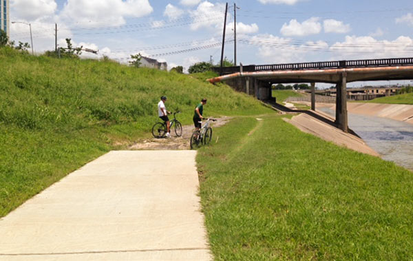
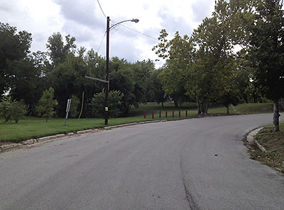
Reader Scot Luther, who claims to have witnessed “wrecks and several flat tires” on a gap in the bayou-side trail along the north side of Brays Bayou just across N. MacGregor Way from the eastern border of Hermann Park wonders why this portion of the several-year-old concrete trail was never completed. Here’s a photo of the scene — where more cautious bike riders regularly dismount for the muddy or bumpy path under the Almeda Rd. bridge. A few hundred ft. beyond the bridge, the trail picks up again on its way to Riverside Terrace.

Photo: Scot Luther

Water’s Edge
06/03/15 3:00pm

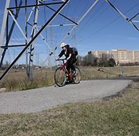
COMMENT OF THE DAY: WILL THE NEW BIKE TRAIL SYSTEM BE THIS SHOCKING? Biking Along a Powerline Easement“Here’s something a little off topic but has to do with putting trails on power easements. Has anyone ever experienced what happens when you ride under the lines down the dirt road in Memorial Park? The electromagnetic field actually shocks you where you are touching the frame or handlebars especially during peak Summer usage hours and when sweaty. Not sure if that’s ever been addressed.” [j, commenting on FPSF Moving Next to the Astrodome; I-10 Toll Hike Delay; Secrets of the I-45 Redo Plan] Illustration: Lulu
06/02/14 10:30am

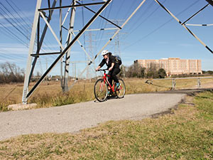
HIGH VOLTAGE NEWS FOR HOUSTON BICYCLISTS Bike Trail Along Transmission Line Right of Way, Brays Bayou, HoustonParks and Rec department director Joe Turner tells the Chronicle‘s Mike Morris that a powerline right-of-way crossing on University of Houston property northeast of the intersection of Martin Luther King Boulevard and Old Spanish Trail will be the first improvement allowed by a new agreement between the city and CenterPoint Energy (subject to city council approval this week) that will allow hike-and-bike trails to be cut along electrical transmission-line right of ways throughout the city. Most likely the next up, according to Turner: a trail from Sims Bayou to Cambridge Village Park in southwest Houston. That route, along with others being contemplated, runs north to south. As Mayor Parker noted in her announcement, that should complement the bayou-side (and therefore mostly east-west) trails being created as part of the Bayou Greenways 2020 project. CenterPoint is donating $1.5 million toward the creation of new trails on their property, possibly because it got what it wanted in the deal, which also involves the conversion of all 165,000 city traffic signals to LEDs over the next 5 years. Writes Morris: “Bills to allow trails on utility right of way were filed as early as 2007 but stalled over questions about how much liability CenterPoint should face in opening its land for recreational use. A compromise was reached last year. The utility is liable only for a serious injury or death caused by its ‘willful or wanton acts or gross negligence.’ Under the agreement announced Friday, the city would pay the utility’s legal bills if lawsuits are filed.” [Houston Chronicle ($); more info; previously on Swamplot] Photo of bike trail along Brays Bayou: Dave Fehling/State Impact
03/31/14 10:30am

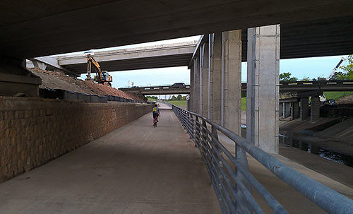
White Oak Bayou Hike and Bike Trail Along T.C. Jester at 610 Loop, Oak Forest, Houston

Here’s the news that’s “all the rage in Oak Forest,” according to a reader: TxDOT has reopened the segment of the hike-and-bike trail along White Oak Bayou that wends its way between between Ella Blvd. and 34th St. That stretch of asphalt had been closed in December 2011 for construction on the North Loop overpass at T.C. Jester. TxDOT is planning an official celebration of the reopening this coming Saturday, but it’s unclear whether the path, which lines the east side of the bayou, will have to be closed again at some point. “Please note that TxDOT has not completed the reconstruction of the bridges that support the feeder roads across the bayou,” reads a note on the Houston Bikeways Program Facebook page posted this morning. “We hope to get more details shortly.”

Photo of trail at E. T.C. Jester and Loop 610 North: Jim Mackey/White Oak Bayou Association

610 Underpass
10/22/13 3:45pm

So the city has agreed to hand over maintenance of all the new bayou trails ’n’ stuff to the Houston Parks Board — it was the one condition that the Kinder Foundation stipulated before it would agree to donate $50 million to the Bayou Greenways project. That donation became a done deal earlier today. This dough, says the Parks Board, is going to allow construction to begin before the end of 2014 on as many as 14 new sections of trail — including even more work along Brays Bayou in Mason Park in the East End, shown in this rendering from SWA Group.

CONTINUE READING THIS STORY

10/03/13 3:30pm

Construction began yesterday on a new 1.35-mile segment of hike and bike trail on White Oak Bayou, the first of 5 planned sections that will more or less formalize the route that some trail users have taken it upon themselves to blaze. Eventually, the $3.4 million that the Bayou Greenways project will spend here will create about 11 miles of off-street passage from Hollister Rd. in Spring Branch to Downtown.

But first things first: This new segment will span Shepherd and Durham and W. 11th St., where, as this rendering from SWA Group shows, that charred MKT railroad trestle will be replaced with a snazzy new one — somewhat to the chagrin of John Nova Lomax, you’ll remember, who’s on the record lamenting the yoga dads and their ilk that that char might have once scared off.

Rendering: SWA Group

09/23/13 4:00pm

Last week, the city and the Army Corps of Engineers agreed to build almost 14 new miles of hike and bike trail — from I-45 to west of 288 — along Sims Bayou. The project, construction for which could begin as early as November, will cost about $7 million, and it will connect 7 city parks: Reveille Park, Stuart Park, Law Park, Sims Bayou Park, the County’s Hill at Sims Park, Scottcrest Park, and Townwood Park.

The first stretch to be built will be a 10-ft.-wide 3.1-mile span from I-45 to Stuart Park on Bellfort, just a few miles from Hobby Airport. Also included in the trail construction? The usual swag: Picnic tables and pavilions, benches, drinking fountains, lighting, and parking lots.

Photo of Sims Bayou: Allyn West

09/12/13 2:00pm

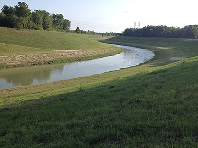
At a meeting yesterday, reps from the Houston Parks Board told reps from the Idylwood Civic Club that the HPB would agree to let alone that grassy knoll, shown here, where a trailhead providing access to the Brays Bayou hike and bike was to have been installed. Described in 2009 documents as “Sylvan Dell Parking Lot,” it appears that the proposed trailhead would have provided 19 off-street parking spaces, benches, lighting, a gazebo, and exercise equipment. Though those specs don’t really matter now: Houston Parks Board rep Jen Powis tells Swamplot that the Idylwood residents “chose to eliminate” the project.

CONTINUE READING THIS STORY

08/21/13 4:15pm

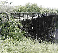
FEARING THE YOGA DADS THE NEW HEIGHTS HIKE AND BIKE LINK WILL BRING The Houston Chronicle reports that the Bayou Greenways project is paying for a new 1.35-mile section hooking up the existing White Oak Bayou and Heights hike and bike trails. Part of completing this stretch will require replacing the bridge shown here, a burned-out trestle that butts up to the former Eureka Railyard. Psyched about this new link that, when completed in 2014, will get cyclists from Downtown all the way out to Antoine Dr., Houstonia’s John Nova Lomax still seems more than a little ambivalent about losing the blackened thing: “The eastern foot of that bridge has been a meditation zone / power spot of mine for the last few years, my own trash-strewn bayou-pungent pre- and post-work Eden. No more — soon it will teem with with yoga dads and crossfit maniacs and their occasionally ill-behaved pooches.” [Ultimate Heights; Houstonia; previously on Swamplot] Photo: Patrick Feller [license]

08/19/13 10:00am

Across town from the molten-zinc-dipped pedestrian bridges and Bud Light Amphitheaters going up along Buffalo Bayou, site prep is underway to build a new section of hike and bike trail along Brays Bayou in Mason Park. Paid for by the same federal scratch that will fund a yet-to-be-designed pedestrian bridge spanning the bayou on the south side of 75th St. (or behind that bridge in the photo), this section will connect 75th to Forest Hill Blvd., where the trail picks up and splits, running west to Lawndale and east to Capitol near the Magnolia Transit Center.

CONTINUE READING THIS STORY

05/03/13 2:30pm

WILL POWER LINE BIKE TRAILS COME TO HARRIS COUNTY? Approved this week and sent on to Gov. Perry was a new draft of that bill proposing bike trails along CenterPoint utility rights of way. CenterPoint didn’t seem too crazy about the first draft of the bill, saying back in February that it wouldn’t allow the trails unless it was assured it wouldn’t be liable should something shocking happen. This revised draft, the Houston Chronicle’s Mike Morris reports, covers CenterPoint all the way up to “willful or wanton acts or gross negligence.” And Morris writes that as many as 142 miles of right of way in Harris County could be available for trails if Gov. Perry signs off on the bill, many of them providing missing north-south connections between the existing trails that run primarily east-west along the bayous. (Houston Chronicle ($); previously on Swamplot) Photo: StateImpact
03/19/13 10:00am

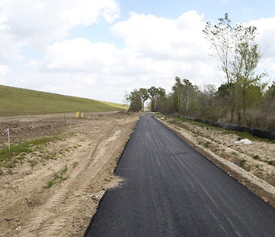
Looks like this mile and a half extension of a hike and bike trail leading north out of Terry Hershey Park is ready to go. Photos popped up on HAIF yesterday that follow the trail as it dives beneath the Katy Fwy. and banks west between Highway 6 and Eldridge Pkwy. along the Addicks Dam.

According to the Terry Hershey Park website, this extension now makes a continuous ride possible from neighborhoods around Wilcrest, Kirkwood, and Dairy Ashford to the Addicks Park and Ride to the northwest.

Here are a few more photos of what you’ll see:

CONTINUE READING THIS STORY

09/07/12 10:16am

Reader Jeromy Murphy sends a couple pics of a temporary ford of Buffalo Bayou seen last week near the site of the Police Officers Memorial off Memorial Dr. just west of Downtown. Planned nearby: a new permanent pedestrian bridge that will make the memorial accessible to soulmates hanging about in Glenwood Cemetery to the north. The bridge will also open the memorial to visits from bikers on the recently updated trail on the bayou’s north side.

This map shows the plan:

CONTINUE READING THIS STORY

08/06/12 12:39pm

Yep, that’s a bike-gear-sporting State Sen. Rodney Ellis, 2 city council members, and both bearded and cleanshaven versions of model Lauren Bush’s brother — Pierce Bush — talking up the idea of building more parks by more Houston bayous in this promotional video for an organization called Parks By You. What are they and their smiling costars so earnestly upbeat about? A $160 million bond initiative on the November ballot that would take a big step toward implementing the Houston Parks Board’s Bayou Greenways Project — a proposal to add green spaces and linear parks with concrete hike-and-bike trails along 100 miles of Houston bayous. The bond issue would help pay for improvements to more than a dozen existing parks and connect trails along 7 bayous in the city.

The overall vision (not all of which, apparently, is included in the bond measure) would transform Houston’s park map from this:

CONTINUE READING THIS STORY