06/20/18 10:45am

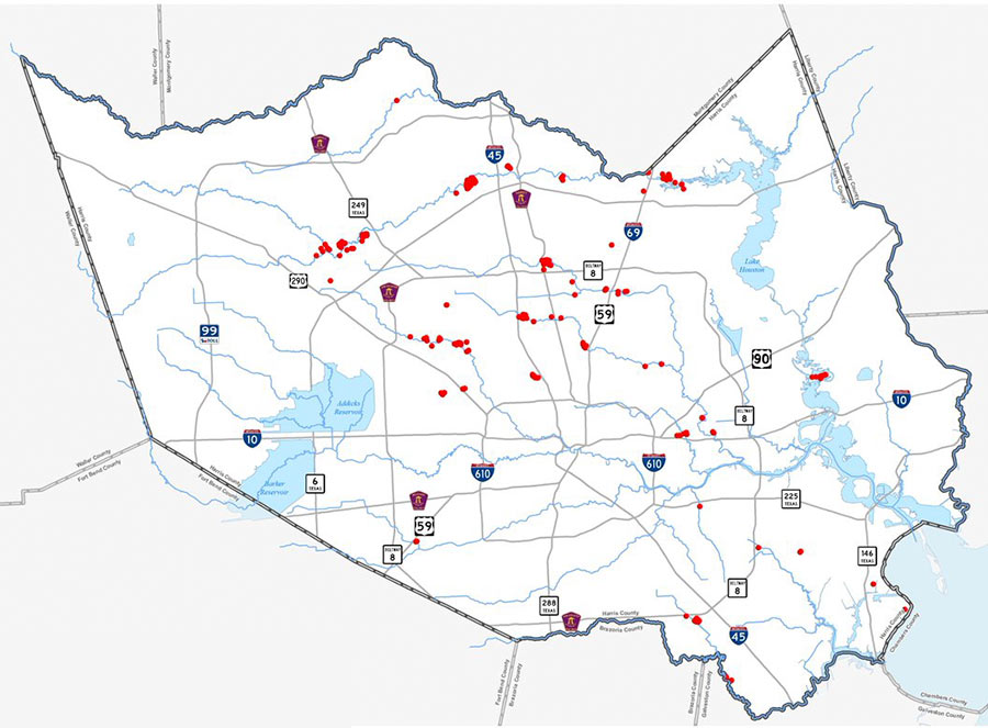
Now that a second, $51 million round of FEMA funding for home buyouts has come through, here’s the map of where the latest government snatch-ups are planned, 294 total. As indicated by the red dots above, they’re all outside the Loop — with a good portion grouped in 3 distinct clusters along Cypress Creek (which drowned out previous flooding records along nearly its entire length during Harvey). Other hotspots include several along White Oak Bayou, as well as a Greens-Bayou-adjacent bunch off Beltway 8 just north of Aldine and a San Jacinto River-side group south of Hwy. 90, near Highlands.

The money Harris County Flood Control District expects to receive for these purchases supplements an earlier $25.6 million FEMA committed to it on June 4. That previous check (along with an $8.6 million match the Harris County Commissioners okayed in order to get it) will be spent on about 169 buyouts, mapped out below:

CONTINUE READING THIS STORY

Along the Bayous
03/20/18 4:30pm

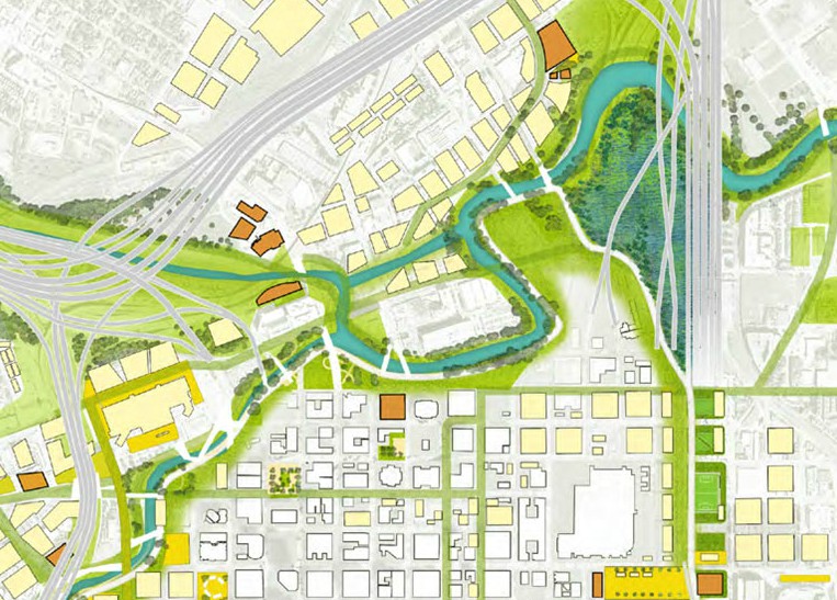
FUNDING FOR DOWNTOWN HOUSTON’S NEW ISLAND Houston’s flood czar Steve Costello tells the Chronicle’s Mike Morris that the city plans to apply for FEMA resiliency grants in order to build the North Canal Bypass — the long-whispered diversion channel that would relink White Oak and Buffalo bayous between Main and Elysian streets. The waterway concept bubbled up last year in Plan Downtown where its course formed an island northwest of Allen’s Landing indicated in the imagined map above. By bypassing the bayou’s oxbow, the channel is expected not only to reduce flooding downtown — it could also “help lower the water level in White Oak Bayou all the way to the 610 Loop and in Buffalo Bayou as far west as Gessner,” according to a county study. The result: “A little more than half of the 854 structures in the 100-year floodplain along White Oak and an adjacent tributary, Turkey Gully, would be removed from the floodplain.” [Houston Chronicle; previously on Swamplot] Map: Plan Downtown  
01/11/18 1:00pm

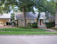
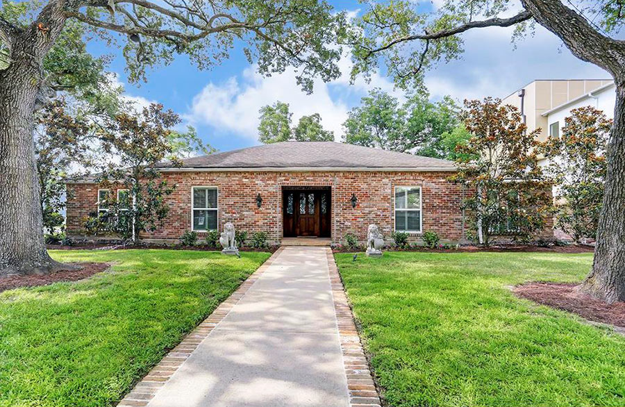
WHAT HOUSTON WILL SPEND TO RAISE A FEW FLOODY HOUSES IN MEYERLAND Houston City Council approved construction yesterday to raise 5 Meyerland houses — a subset of the 42 Houston homes FEMA paid the city $14.8 million to elevate back in 2015. One of those 42 houses has already been jacked up and 8 more are currently within the levitation process, according to the Chronicle’s Rebecca Elliott and John D. Harden. The costs to raise the 5 homes now slated for elevation 12 ft. above flood level — which include a few extra thousand dollars to put residents up in temporary lodging — range from $218,700 to $416,000 per property. In total, the bill comes to $1.6 million. Harris County appraises the total value of properties themselves from $125,906 to $507,152, with the value of improvements within that ranging from $34,700 to $201,200. One of the houses — 5150 Braesheather Dr. — shown above as it appeared before Harvey, is currently listed for sale. [Houston Chronicle; more info (items 24–28)] Photo of 5150 Braesheather Dr.: HAR  

09/04/17 9:30am

If you or someone you’re helping has been accepted into FEMA’s Transitional Shelter Assistance program — meant to clear out shelters by providing people who can’t return to their homes a hotel or motel room for a limited period of time — you may want to use the map shown here. It marks the locations of every eligible hotel or motel in the Houston area approved by the program. Using the map should make it easier to find an acceptable one nearby. To view the map in its own browser window, click here.

This map is yet another whipped-up-by-volunteers-in-a-jiffy product of Sketch City — this one created by the civic hacking group’s founder, Jeff Reichman. Sketch City volunteer and college sophomore Nile Dixon (who earlier created a similar tool to help people find nearby shelters) has created a simplified text-it-to-me version of it as well: Just text your ZIP Code to 832-981-4926 and a bot will send back contact info for the nearest verified accommodations in the program.

You can find out more about U.S. government Harvey assistance, including the TSA program, from the FEMA Harvey website.

Map: Sketch City

Harvey Maps
12/08/16 12:00pm

COMMENT OF THE DAY: FURTHER READING INTO YOUR HOUSTON FLOOD AND FIRE CHANCES Jan 2017 FEMA Special Flood Hazard Zone classification changes“Every home is susceptible to flooding. There are not ANY non-flood areas. There are only homes that are more likely to flood and homes that are less likely to flood. The likelihood is expressed, on flood maps, by the single-year probability of being flooded (with some other factors). This does not properly describe the likelihood of being flooded during the course of a longer time period — of, say, a 30-year mortgage. Homes eligible for NFIP preferred flood rates can have up to just less than a 1 percent chance of flooding annually. These ‘preferred areas’ are what the public thinks of, euphemistically, as non-flood areas. Assuming a .009 probability (just less than 1 percent), a home has a 20 percent chance of flooding, at least once, over the course of a 30-year mortgage (look up binomial probability). An alternative way to think about it is that 1 in 5 homes, in preferred flood zones, will flood over the course of a 30-year mortgage. [In that case,] you are actually more likely to experience a flood than a house fire in a ‘preferred flood area.'” [Jardinero1, commenting on Where Houston Floods Outside the Flood Zones] Image of recent flood map revisions: FEMA RiskMap6
10/04/16 5:00pm

Jan 2017 FEMA Special Flood Hazard Zone classification changes

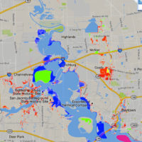
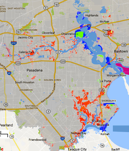
The areas in red above mark some of the new additions to the legally-gotta-buy-flood-insurance zones on FEMA’s recently revised flood maps. The agency’s interactive online viewer lets you mix-and-match a few data sets for Harris County (as well as Galveston, Fort Bend, and Wharton), compare the old mapped flood zone boundaries to proposed new ones, or look only at what would change — a FEMA spokesperson told Houston Public Media that about 8,000 properties have been added to the list in Harris County, while only about 400 were dropped.

Those acid-green highlights are areas that have been removed from the special flood hazard zone by the updated map (while blue shows areas that have just changed floodplain classification some other way. Bits of brown and yellow in other areas of the map show places added or removed (respectively) from the floodway. The updates above to the mandatory flood insurance zone (legally called the Special Flood Hazard Area) are set to go into effect in January, as shown above. Buffalo Bayou and its tributaries are pretty marked up:

CONTINUE READING THIS STORY

Flood Insurance Ebb and Flow
05/03/16 4:30pm

A set of 4 new FEMA disaster recovery centers opened yesterday, sprinkled around the north and west sides of Houston hit hardest by the Tax Day flooding. The locations include a Greenspoint office building right across Greens Bayou from some of the apartment complexes evacuated during the flooding (including Arbor Court). The other centers opened Monday in Meyerland, Cypress, and Spring, and additional temporary help centers might get set up elsewhere around town.

As of yesterday night, FEMA had already received nearly 12,000 applications for post-flood assistance. Harris County reported last week that more than twice as many homes were damaged by the April floods as reported during last year’s Memorial Day flooding. Farmers Insurance agent Peter Zografos told the Houston Press last week that many of the same houses have filed claims a second time: “Some of these homeowners may have to be insured directly with the National Flood Insurance Program due to repetitive claims, [and] basically will be charged more for too many flood claims.”

Map of FEMA disaster recovery centers: City of Houston

Still Under Water
08/13/10 9:10am

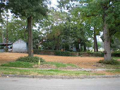
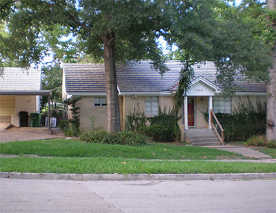
Then you saw it, now you don’t: Part 2 of FEMA’s buy it, then demolish it plan for the oft-flooded home at 1954 N. MacGregor Way in Idylwood is now complete, reports a reader. “The plants around the trees seem to be all that’s left. And, that funny knotty thing on the tree on the right.” A source scores the low-lying property as the 10th FEMA buyout of Hurricane Ike-damaged homes in the neighborhood, though more residents have turned down similar offers. Just across the street from the property: The uppity banks of Brays Bayou.

Photos: Swamplot inbox

07/13/10 11:57am

Readers in Idylwood have been watching Swamplot’s Daily Demolition Report for the appearance of this house at 1954 North MacGregor Way, as it wraps around to Sylvan Rd. in their neighborhood. A local resident tells us the 1950 home will be the 10th Hurricane Ike-flooded house bought up by FEMA and torn down. (Other homeowners on the same street have turned down similar early-retirement deals for their properties, claims the resident.) But focusing on that singular pre-storm flooding event in 2008 only doesn’t do justice to this home’s long history of seaworthiness: Our source says this house had 4 feet of water in it on at least 2 occasions, along with several less dramatic Brays Bayou baptisms. Water from the bayou came back to play in the street in front of the house just 2 Fridays ago.

Idylwood scored 3 FEMA buyouts in the wake of Tropical Storm Allison, in 2001.

Photo: Swamplot inbox

03/15/10 1:28pm

COMMENT OF THE DAY: A PARK GROWS IN IDYLWOOD “The neighborhood will be able to ‘use’ the vacant land but cannot build permanent structures upon it. With the exception of one lot at the far end of N. Macgregor, 9 are connecting so that they will form a large U shaped property. There’s been talk of a shared garden but who knows… The area still looks pretty rough right now, but the damaged sidewalks, where driveways once were, are being repaired and curbs installed. There are existing trees and lawns so hopefully it will become, at the very least, another usable green space. I suspect that, when the next big flood happens and some of the remaining homes get hit yet again, if another FEMA buyout is offered, we’ll be seeing more open land along N. Macgregor. . . .” [PYEWACKET2, commenting on Comment of the Day: The Great Idylwood Shoreline FEMA Buyout]

03/08/10 3:51pm

COMMENT OF THE DAY: THE GREAT IDYLWOOD SHORELINE FEMA BUYOUT “The ten houses in Idylwood, 6 along N. Macgregor, 2 on Wildwood and 2 on Park Ln were all heavily damaged by Hurricane Ike. Most all those houses have been hit numerous times, not the least of which was Allison. Those homes were right on Brays Bayou. Come on folks, some of the homeowners hated to sell to FEMA but it was either that or jump through impossible hoops to raise the homes’ foundations. True, there’s been a lot of improvement to the bayou but who knows if those improvements will be effective when the next flood hits? Not everyone chose to take the buyout.” [PYEWACKET2, commenting on Daily Demolition Report: Idylwood Hat Trick]

09/14/09 4:34pm

COMMENT OF THE DAY: A BOOST FOR THE BOLIVAR BUYOUT? “A large part of Bolivar is going to be turned into a nature preserve. FEMA is buying out many of the properties. . . . I suppose that buyout was made easier by the rate of foreclosures. . . .” [Raj, commenting on Where the Action Was: Houston Summer Foreclosure Map]