
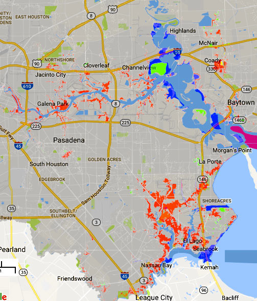
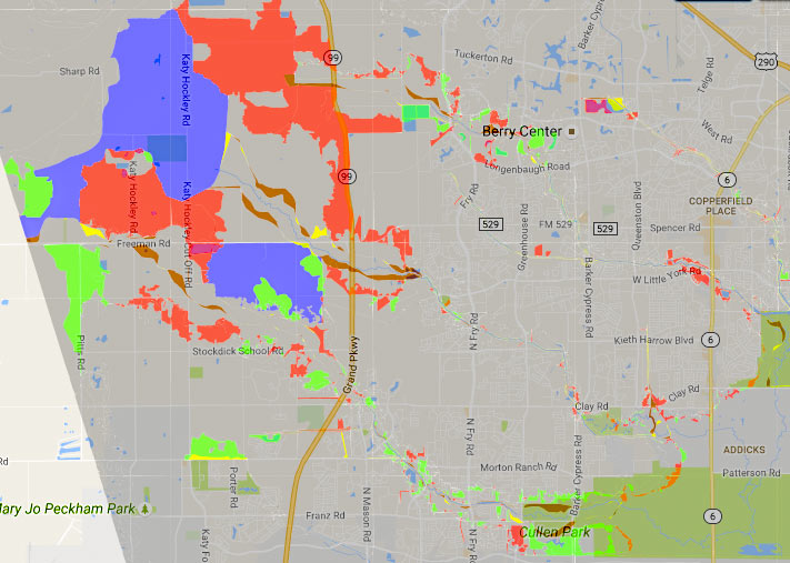
The areas in red above mark some of the new additions to the legally-gotta-buy-flood-insurance zones on FEMA’s recently revised flood maps. The agency’s interactive online viewer lets you mix-and-match a few data sets for Harris County (as well as Galveston, Fort Bend, and Wharton), compare the old mapped flood zone boundaries to proposed new ones, or look only at what would change — a FEMA spokesperson told Houston Public Media that about 8,000 properties have been added to the list in Harris County, while only about 400 were dropped.
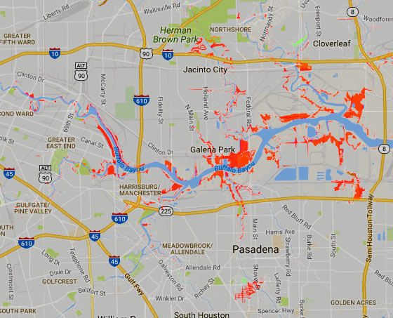
Those acid-green highlights are areas that have been removed from the special flood hazard zone by the updated map (while blue shows areas that have just changed floodplain classification some other way. Bits of brown and yellow in other areas of the map show places added or removed (respectively) from the floodway. The updates above to the mandatory flood insurance zone (legally called the Special Flood Hazard Area) are set to go into effect in January, as shown above. Buffalo Bayou and its tributaries are pretty marked up:
***
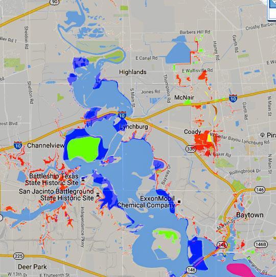
The big patches of green in the San Jacinto River highlight a few of the slowly growing islands where dredging sediment gets dumped:
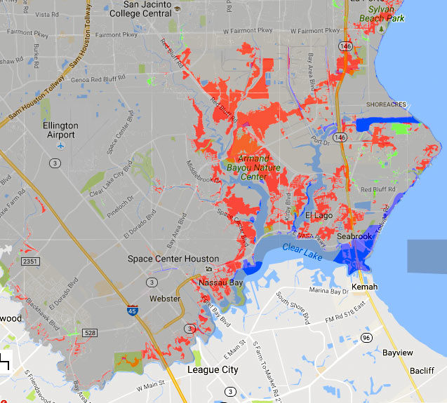
Moving south, here are the changes around Clear Lake and Armand Bayou:Â
Meanwhile, here’s a sneak peak at what might happen to the flood maps in the western area of the county, if proposed changes are approved: some areas west of the Addicks and Barker reservoirs could get large swaths added to the mandatory flood insurance zone, particularly in a few places outside the Grand Pkwy. that drain into Bear and Cypress creeks:
- FEMA Releases Final Update To Harris County/Houston Coastal Flood Map [Houston Public Media]
- County Flood Map Portal [FEMA]
- Flooding coverage [Swamplot]
Images: FEMA RiskMap6


The effective date is incorrect\misleading. There are two PMRs that are currently in process (riskmap6 shows both). The Coastal PMR is slated to take effect in January 2017. HCFCD\FEMA have not released an effective date for the Addicks PMR.
The areas in west Harris County likely won’t be official until Oct 2017 due to some public protests. It originally slated for January 2017.
http://Www.Riskmap6.com is a good resource for preliminary maps.
Thanks for catching that, Kokatat and kjb! We’ve revised the article to reflect the fact that only the coastal section is finalized.
Wonder how many areas will sue to get out of the high risk zones, only to get flooded years later and have no insurance and cry fowl. Note to those who are able to sue or survey theirselves out of a flood zone… BUY the insurance anyways! If you are in a high risk zone, right or wrong, you are close enough to warrant the protection.
There must be a site somewhere that defines the meanings of A, AE, AO, AH, A99, VE, X, FIRM panel, BFE (Best Friend Eternally?), etc, but I didn’t find it. Must go find a hydronautical engineer……
@Gisgo each Flood Insurance Rate Map (FIRM) panel has a legend. You can find FIRM panels on the Map Service Center website. If you still don’t understand ask a Civil Engineer.
Here you go:
https://www.selective.com/~/media/Files/S/Selective/documents/Flood/Forms/what%20are%20the%20different%20zones.pdf