CLOSING IN ON CLEANUP TIME AT THE SAN JACINTO WASTE PITS  The EPA, TCEQ, and the 2 companies they’re holding responsible for cleaning up the San Jacinto Waste Pits near I-10 will soon get started on the design phase of a project to remove about 212,000 cubic yards of dioxin-contaminated muck from the Superfund site — reports the Chronicle’s Alex Stuckey. It’s “expected to take about 29 months,” she writes, “with the clean-up to follow.” The cooperation marks a friendly turnaround in the EPA’s relationship with the 2 companies — International Paper Co. and McGinnis Industrial Maintenance — which it thought about taking to court last year after they initially opposed the agency’s plan. Going that route, writes Stuckey, could have brought “years of litigation and cleanup delays.” [Houston Chronicle; previously on Swamplot] Photo of waste pits after Harvey flooding: Greg Moss
Sign up for the Newsletter
Environmental


Local grassland steward the Katy Prairie Conservancy is for the first time branching out beyond its natural habitat with a 5,332-acre ranch about 90 miles outside the area the organization is named for. The Spread Oaks Ranch — part of which is shown above — sits near Hwy. 35 in Markham, just outside Bay City and about 70 miles southwest of Sugar Land. Last December, Spread Oaks’s owner closed a deal with the Conservancy giving the organization’s land trust the power to restrict development and subdivision of the coastal prairie property forever. Spread Oaks still owns the land and can pass it on if it chooses, but the Conservancy gets the power to limit its use, regardless of who has the deed.
Spread Oaks is the name given to the Morrow, Cuenca, and LeTulle ranches — pieced together by a single landowner between 2012 and 2015. The property is a working cattle ranch that “prides itself on raising some of the finest quality Brangus cattle in Texas.” Farming and hunting also take place on the land, which includes lodging for overnight guests. The Colorado River runs along an eastern section of the property.
Before the agreement, all of the roughly 20,000 acres the Conservancy protected were located inside the green ring on the map of west Houston below:
Lending a Ranch Hand

THE BATS OF WAUGH DR. HAVE MOVED DEEPER INTO MONTROSE During Hurricane Harvey, Buffalo Bayou rose above the Waugh Dr. bridge, killing off some of the 300,000 Mexican free-tailed bats that lived there. Others have found new residences: “Some of the surviving bats have relocated to nearby buildings. Just take a sniff in any of the multi-floored parking garages lining the streets around the bayou, and you’ll smell their pungent droppings.” Now, Maggie Gordon writes, “In addition to a swarm of winged mammals flying out from beneath the bridge, smaller populations exit from nearby buildings. They join up with the bats from the bridge during their hunt, then return to their new homes for the night, before repeating the same cycle the next day.” [Houston Chronicle]Â Video: Ihadatt
COMMENT OF THE DAY: THE PITS  “Up until the 1930s, most oil taken from the ground was quite simply stored in earthen pits. Oil penetrated the soil to about 30 feet vertically and 100 feet horizontally. Humble by itself had 6,000,000 barrels of earthen pit storage. Note that the world’s largest documented land-based oilspills (not related to the Gulf War) were the Lakeview Gusher in Kern County, California (9 million bbl) and Fergana Valley in Uzbekistan (2 million bbl). Deepwater Horizon was the worst maritime spill (4.1-4.9 million bbl). These pits are not considered spills, but the land around them is far more impacted than a spill site. Back then, when pits failed from flooding or erosion, that was often unreported.” [TheNiche, commenting on An Update on the Leaky Oil Well in Missouri City] Image: Lulu

AN UPDATE ON THE LEAKY OIL WELL IN MISSOURI CITY  All liquids that spewed from the oil well on McHard Rd. just west of the Fort Bend Tollway after its blow-out accident last Wednesday have been removed from the ground surrounding the facility, the Missouri City Office of Emergency Management now reports. But that’s just the wet stuff. Workers from Haz Mat Special Services have so far dug up 1,200 of an expected 5,200–7,200 yards of possibly contaminated dirt from the immediate vicinity, to be replaced with soil from somewhere else. What else can they do? “Crews have also sprayed the area to reduce the odor. Air monitoring is still on going. Crews are also trying to prep the area for the predicted rain fall the region may receive.†[Missouri City Emergency Preparedness; previously on Swamplot] Photo: Fort Bend County OEM

IN THE MISSOURI CITY AIR Wild West Well Control is expected to finish capping an oil well this evening on McHard Rd. just west of the Fort Bend Tollway that blew out last night, sending foul-smelling fumes southeast into Fort Bend County. Nearby residents got a nose-ful: “Winds carried the smell across a large portion of the area; it is believed that the smell was from hydrogen sulfide. Total Fire has been conducting air monitoring in the area and has been unable to detect significant amounts of the chemical in the air.” [Fort Bend County OEM]
Photo: Fort Bend County OEM

COULD HARRIS COUNTY SAVE UP SOME FLOODWATER FOR WHEN IT’S REALLY NEEDED? 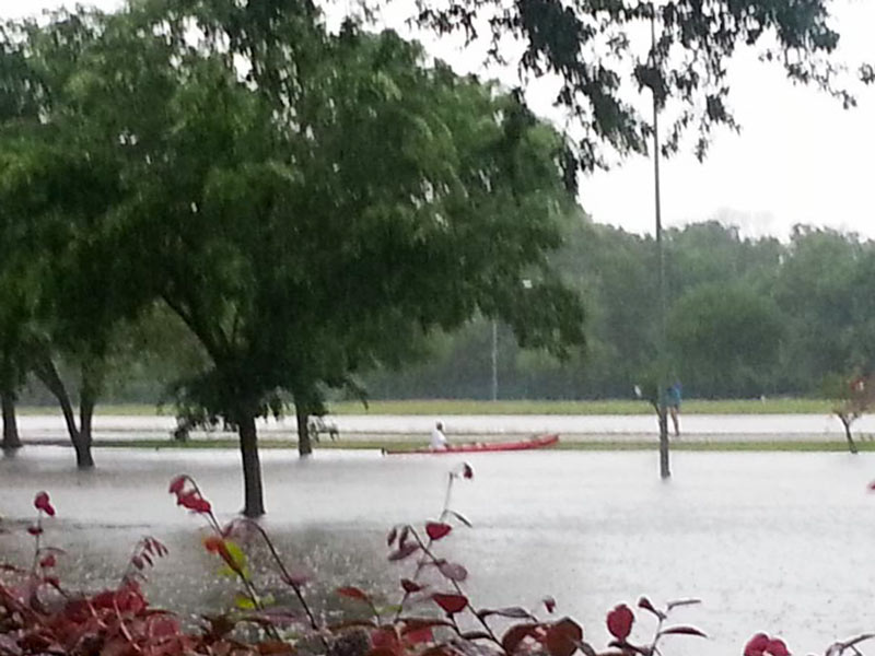 Finding a way to stockpile floodwater during years of plenty, commissioner Jack Cagle tells Mihir Zaveri this week, might not only help to make more water available for use during Houston’s drought years. It might also be a way to check the Houston region’s tendency for subsidence (that slow, permanent sinking that can happen when groundwater is pulled out of Houston’s soft clay layers too quickly). Or maybe, Zaveri adds, it could be used to help keep seawater from being sucked into aquifers as fresh water gets sucked out the other side — as long as doing so didn’t accidentally contaminate those same aquifers with junk from the surface. Who knows? Nobody, yet — but the county commissioners have given the $160,000 okay to a study team to shed light on whether it would be possible, feasible, or advisible for Harris County to pump floodwater underground for storage during major storms. [Houston Chronicle; previously on Swamplot] Photo of Meyerland flooding on Tax Day 2016: Tamara Fish

W. A. PARISH PLANT ONE OF THE WORST POLLUTERS IN THE COUNTRY, FINDS REPORT  According to a new study published by Environment America, NRG Energy’s coal-firing W. A. Parish Electric Generating Plant, on Smithers Lake outside of Richmond, is really good at being dirty. Though the plant has been messing around with a way to clean itself up in the past year or so, the report, published today, still fingers it as the 5th dirtiest in the country when it comes to carbon emissions. And here, in order, are 1-4: “Georgia Power Co.’s Plant Scherer, Alabama Power Co.’s James H. Miller Jr. Plant, Luminant’s Martin Lake in Texas, [and] Ameren’s Labadie in Missouri.” [StateImpact; Environment America; previously on Swamplot] Photo: Flickr user Joe A.

STUDYING HOUSTON’S ROADSIDE AIR QUALITY  Another source of Houston’s pollution has got the attention of the Texas Commission on Environmental Quality: tailpipes. Starting in January, the agency will place a pair of monitors within 160 ft. of 2 our most heavily used roads — including the Southwest Fwy. near the Westpark Tollway — to record the amount of nitrogen dioxide leaked into the air. Apparently, the stuff can be pretty nasty, writes the Houston Chronicle’s Matthew Tresaugue: “The Environmental Protection Agency said studies have measured concentrations of the gas to be as much as 100 times greater near major roadways than away from them. Scientists, meanwhile, have linked the pollutant to asthma and other lung ailments, especially among children and the elderly.” The results of these monitors, adds Tresaugue, might lead the city to make decisions about preventing schools and residences from being built in and around affected areas. [Houston Chronicle ($); previously on Swamplot] Photo: AA Roads

The Bayou Land Conservancy is really pushing to raise $4 million in the next week or so in order to outbid a homebuilder on a 50-acre patch of prairie in Deer Park. The video above is part of what the Houston Chronicle’s Lisa Gray describes as a “Hail Mary pass” to raise the money before August 20.
The sought-after patch is among the last 1 percent of the Gulf Coast’s original prairie, reports Gray. The conservancy has been attempting to raise the money to buy it for the past year and a half — an attempt that’s now being hastened by a recent $4.25-million offer from a developer with plans for a 201-home subdivision on the land near Spencer Hwy. and Luella Ave.
And what would the conservancy prefer for the prairie? Here’s Gray:
The prairie’s fans imagine a visitor’s center fashioned from a next-door ranch house. They imagine busloads of visiting schoolkids. They imagine research into the still-mysterious workings of the prairie biome. They imagine harvesting native seed, to be used in eco-conscious plantings in the area. They imagine Battle of San Jacinto re-enactments more realistic than those that take place at the battlefield itself.
- Deadline August 20! [Save College Park Prairie]
- Donate Now To Save Deer Park Prairie [Bayou Land Conservancy]
- The clock is ticking for prairie [Houston Chronicle ($)]
Video: Bayou Land Conservancy
THE WOODLAND PARK THINNING STORY THICKENS  The backlash to the clearing of Woodland Park vegetation behind the 7 townhomes he’s building on Wrightwood St. seems to have encouraged first-time developer Bill Workman to make hardhat-in-hand rounds this week with local media: He’s given similar statements regretting the snafu to Hair Balls, KUHF, Click2Houston, and abc13. But more details are coming out that complicate a situation that Workman maintains resulted from a miscommunication with a subcontractor hired, he says, only to grade the site: Debris from what’s been reported to be 3/4 of an acre of parkland has been pushed down to the banks of Little White Oak Bayou, presenting a possible drainage problem — which, of course, the grading was undertaken in the first place to solve. And the claim that only invasive species had been removed doesn’t seem to be the case, either, reports the Houston Chronicle: “The Parks Department reported that the cleared property included some healthy trees,” write Erin Mulvaney and Mike Norris. (As many as 100, estimates abc13.) “Reforestation and replanting will be necessary, and erosion control and possible regrading of the site may be required, officials said. A debris pile will also need to be removed. Workman said a large amount of bamboo and an undergrowth of vines were removed in the clearing.” [Houston Chronicle ($); previously on Swamplot] Photo: Andrea Greer

FIGHTING THE INVADERS OF BUFFALO BAYOU  Though much of the Buffalo Bayou Partnership’s (BBP) plans for that eponymous waterway involve adding things — kayak rental shops, pedestrian bridges, etc. — there seems to be the need for subtraction, too: “‘People look at the park and see that it’s filled with trees and grass, what most people don’t realize is that most of those plants shouldn’t be there,'” BBP’s prez Anne Olson tells Alex Wukman of Free Press Houston. “A study of the park’s vegetation, which the Partnership filed with the Texas Forest Service, found Buffalo Bayou to be overrun with invasive species — primarily White Cedar and Chinese Tallow. . . . Olson explained that the Partnership plans to combat the invasive species problem by removing 50 percent of the park’s lawn, which is mostly made up of easily-maintained but non-native Bermuda grass, and replacing it with native grasses.” Adds Olson: “‘We’re going to create an 11 acre urban prairie.'” [Free Press Houston; previously on Swamplot] Photo: Flickr user barryDphotography


Here’s a rendering of the classroom studio (and vegetable garden and recycled shipping container) that’s now under construction at the Monarch School in Spring Branch. North of the Katy Fwy. near Kempwood and Gessner, the school serves students with neurological disorders, and it says that the design elements and architecture of this very green 1,120-sq.-ft. studio from Architend will become part of the curriculum:

ACTUALLY, SAY CRITICS, ‘ONE BIN FOR ALL’ MAYBE NOT BEST IDEA  Mayor Parker’s prize-winning garbage program was questioned yesterday by activists and environmentalists, reports Hair Balls’ Vanessa Piña — especially because the $1 million the city won from Mayor Bloomberg seems awfully puny in light of the expected $100 million the new sorting facility could cost. And, reports Piña, critics are suggesting that “One Bin for All” seems kinda unnecessary: “There is a successful partnership between the city and waste management, and material is daily being handled. Waste Management’s single stream sorting facilities are running at an estimated 50 percent of capacity and can easily handle more if the city will only provide more carts to our citizens,” says Leo Gold. And here’s Dr. Robert Bullard, public affairs dean at Texas Southern: “For someone who has done research and written more than 18 books on this stuff it is rather odd that we would be opting for an unproven, risky idea.” [Hair Balls; previously on Swamplot] Photo of recycling bin in the Heights: Charles Kuffner

GARBAGE PROGRAM STILL ‘ABSOLUTELY DOABLE,’ SAYS MAYOR PARKER
So Houston’s “One Bin for All” idea didn’t win the $5 million grand prize in Mayor Bloomberg’s philanthrophic challenge — but it did tie for second. And that means $1 million will be coming Houston’s way, along with $50,000 extra for being so darn lovable and winning the “fan favorite” vote online. And what’s the city going to do with all this dough? The Houston Chronicle’s Carol Christian reports that the consolation prizes might be just enough to get the program off the ground: Though the idea to combine garbage, recycling, and yard waste into one big bin for mechanized sorting later has been around for awhile, Mayor Parker says, “This award will allow us the seed money to begin the process . . . We have thoroughly researched the technology. It’s absolutely doable.” Construction on a new sorting facility could begin as early as 2014, reports Christian. [Houston Chronicle; previously on Swamplot] Photo of recycling bin in the Heights: Charles Kuffner
