

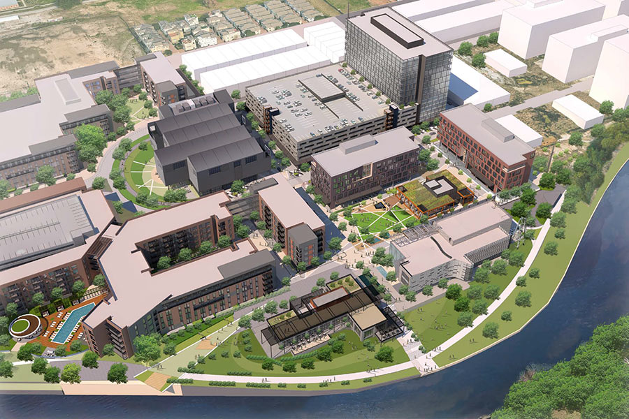
What could possibly have been worse than Hurricane Ike? Super Ike, a stronger hurricane aimed 30 miles further west, causing a larger storm surge, more deaths, and significantly greater damage to Houston’s industrial infrastructure. To protect against that hypothetical $100 billion threat, a Rice University team is recommending some bolstered defenses for the region. Included among the suggestions: a “moveable gate structure” just upstream from Baytown’s Fred Hartman Bridge, to block the Ship Channel and San Jacinto River from rising waters in Galveston Bay (pictured above); elevating Hwy. 146 along the west edge of Galveston Bay so that it forms a levee protecting much of La Marque, Dickinson, League City, Clear Lake, and La Porte; a “baywall” to protect Galveston Island’s backside from sneaky storm surge waters; and preserving a 130-mile-long stretch of existing coastal wetlands between High Island and Matagorda as a recreation area and when-needed storm barrier.
***
Here’s what that levee along Hwy. 146 might look like:


And one alignment option for the bay-side levee to protect Galveston Island:

A map showing the recreation study area:

The study’s principal investigators, hydrologist Philip Bedient and attorney Jim Blackburn, were both part of the environmental team that planned The Woodlands 4 decades ago.
- Protecting Houston from the next big hurricane [Rice University]
- Learning the Lessons of Hurricane Ike: Preparing for the Next Big One (PDF)
Images and video: Rice University

Are those ferries that would be planned between Smith Point and Kemah or San Leon?
And then there’s Galveston, and a levy that would ruin the appeal of the downtown waterfront. I’d prefer that a levy be on the Pelican Island side, connected to Galveston by “movable gate structures”.
Nice pipe dreams.
Ouch…sounds spensive.
When will people learn that they cannot control nature?
People are nature.
so, the Rice Ike Dike proposal sacrifices everything East of hwy 146, from Seabrook, Kemah, Bayview, Bacliff, and San Leon shorelines. all these communities would be washed away due to a brick wall as backstop to them, just to protect the developers west of hwy 146. really?
This rise plan makes to sence. The Texas A&M plan would help to secure the region (truley secure). While the Rice plan calls for a “patchwork” of protective barriers, The Texas A&M plans for extending the sea wall to block the storm serge from flooding the entire region.