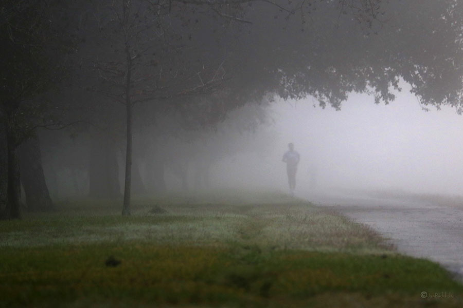
WHAT’S BLOCKING THE BRAYS BAYOU TRAIL  That sign posted just west of Chimney Rock declaring that the Brays Bayou trail “connects 31 miles of uninterrupted, off-street, multi-use trails and greenspace from the Ship Channel to George Bush Park and the Addicks-Barker Reservoir” is more aspirational than accurate at this point, a Houston Parks Board official admits to David Olinger. (“It got ahead of itself, let’s put it that way.”) Olinger set out to walk the supposed marathon-distance-plus continuum, but found it blocked and interrupted by construction zones, an unidentified fork to a neighboring bayou, and dead ends, including some fronting 7-miles-worth of land adjacent to Arthur Storey Park the parks board is still in the process of acquiring: “I tried walking west from Kirkwood and waded into knee-high weeds. I tried walking north on Kirkwood and found no trail. I drove up and down Kirkwood, searching in vain for Arthur Storey Park. Finally I consulted a map — and found the park about 2.5 miles northeast from the westbound Kirkwood dead end.” The Bayou Greenways trail system is expected to connect that length of Brays Bayou by 2020. [Houston Chronicle; previously on Swamplot] Photo of Brays Bayou trail: Jan Buchholtz
Tag: Bike Trails
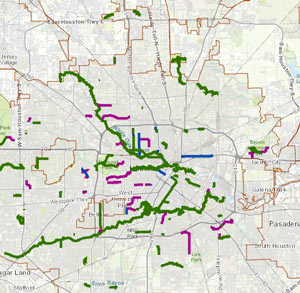
Don’t feel like hopping on your bike to see how construction on that northern piece of the White Oak Bayou hike-and-bike trail is coming along? The click-and-drag-able digital map released this week by the Bayou Greenways 2020 folks may be a decent substitute for the real thing (depending on how often it ends up getting updated). Zoom in closer on the map above to check out completed trail sections (outlined in green), under construction spots (traced in dark purple), and areas planned for trail-ification at a later date (highlighted in a purple haze).
Here’s the area around Mason Park (where that double-V suspension bridge is under construction at the moment):
HOUSTON BIKE PLAN UP FOR A VOTE AGAIN THIS MORNING AMID MORE CALIFORNIA-IZATION FEARS  This morning’s city council meeting has the Houston Bike Plan back on the docket, following the most recent round of public-input-based tweaking to the plan (as well as a delay of the vote, which was initially scheduled for earlier this month). Over in the Chronicle Dug Begley recaps some of the arguments being made for and against the years-in-development guidance plan, which have a bit of a chicken-vs-egg flavor: do only 0.5% of Houstonians bike to work because safe-feeling bike paths are scarce outside of certain Inner Loop neighborhoods? Or are those areas where the active bikers are already clustered the only ones where bike path improvements are warranted? Councilman Greg Travis, one of the folks who pushed back the vote at the last council meeting, told Begley he does see a need for some kind of bike safety improvement plan, but adds that he’s “not sure this is the plan for Houston. We’re not Amsterdam or San Francisco, and we don’t know what’s needed here, really needed.“ [Houston Chronicle; previously on Swamplot] Map of existing ‘high-comfort’ bike paths: Houston Bike Plan Interactive Map

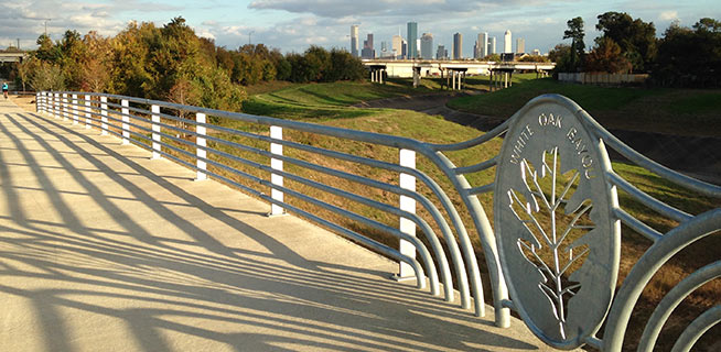
The section of bayou-hugging greenway trail running between Durham St. and Stude Park is getting the official OK tomorrow morning from Harris County Flood Control District and the Houston Parks Board. The photo above is of the pedestrian bridge across White Oak near Durham St. that previously supplanted the area’s “Bridge of Death” route; the segment opening tomorrow runs from that same bridge east along the bayou to the Studemont St. non-pedestrian bridge. The organizers are hoping would-be trail fans will use some means other than car to get to the ceremony location (off Studemont just north of I-10); if you have to drive, however, the invitation says you might be able to get a parking space across the freeway north of  Target.
Further east along the White Oak trail, here’s an updated view of how that link into Near Northside by the Leonel Castillo Community Center is coming along (taken in mid-November, once again from the same spot as that glitzed-up flood photo that made an appearance in Air New Zealand’s recent in-flight feature on Texas):

