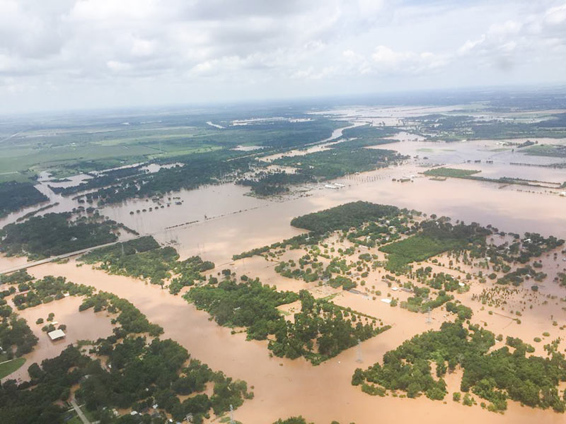
REPEATED 100-YEAR FLOODING ADDS UP TO HOUSTON’S WETTEST YEAR AND A HALF ON RECORD  Internet weather guy Eric Berger takes a look today at 6 major flooding events in the Houston area over the past year and a half: last year’s Memorial Day flooding, the pre-Memorial Day flooding that preceded it, the Halloween flooding, the pre-Halloween flooding, this year’s Tax Day flooding, and this year’s Memorial Day weekend flooding. The 6 events, Berger writes, collectively pushed Houston’s rainfall total for the 18-month period ending with August up to more than 119 inches of rain, breaking the previous record by more than a foot. “The ultimate cause of this flooding isn’t entirely clear,” Berger writes, noting that none of the rainfall events listed were connected to tropical storms except for the late-October remnants of Pacific hurricane Patricia. But he does add that “it’s safe to say that rapid development of rural areas — converting prairies into concrete — and a warmer climate likely played some role in exacerbating what were already heavy rains.” [Space City Weather; previously on Swamplot] Photo of Brazos River flooding in June 2016: TxDOT
Tag: Tax Day Flood
DEPT. OF PUBLIC SAFETY TO UT: PLEASE DITCH THE PHOTOS OF FLOOD-RELATED CHEMICAL SPILLS WE DIDN’T NOTICE Meanwhile, in Austin: Texas Department of Public Safety officials have recently asked the University of Texas to remove an online collection of aerial photos taken by the Texas Civil Air Patrol during major flooding events, Marty Schladen writes in this weekend’s El Paso Times. The request comes after the Times reported earlier this spring on what appeared to be photos in the database showing a number of chemical spills not captured in any other state monitoring records, including spills along the Trinity river north of Galveston Bay; other photo sets previously on the site reportedly included shots of Houston sewage treatment plants being flooded on Tax Day, as well as possible unreported spills along the Colorado, Sabine, Red, and Pecos rivers since 2014. DPS Spokesman Tom Vinger tells the Times that pulling the photos is a matter of protecting privacy — “for example, there could be pictures of deceased individuals prior to family members being appropriately notified first,” says Vinger. Non-emergency-responders can still ask for the photos via Public Information Act request. [El Paso Times]
The footage above captures Ed Nelson’s high-water trek last Monday through an overflowing detention basin at the corner of Bob White Dr. and Reamer St. just north of Brays Bayou. Nelson narrates his soggy expedition through the basin (which sits at the south end of the Robindell and Braes Timbers neighborhoods, between Hillcroft Ave. and Fondren Rd.) as he attempts to document different flows of water into and out of the pond; he ultimately claims that water is flowing into the detention pond from Brays, and moving from there into the floodway easement running behind nearby houses on Reamer.
Nelson and other neighbors claim that the surrounding area did not flood prior to the detention basin’s completion in 2008, and that the detention pond was intended to collect water from the surrounding neighborhood and prevent it from flowing too quickly into Brays bayou  — whereas during the Tax Day and Memorial Day floods, the basin purportedly collected water from the bayou and channeled it into the neighborhood, causing houses to flood that neighbors believe might not have otherwise.

