7 DAYS OF HARVEY BEFORE THE BRAZOS RIVER REACHES ITS SUGAR LAND PEAK  It wasn’t until early this morning that the Brazos River in Sugar Land and Richmond reached its highest level since area flooding triggered by Hurricane Harvey began. And it was a new record, reached at 5:15 am: 55.19 ft., according to the National Weather Service. The previous record, 54.7 ft. — surpassed Thursday at 1:30 am — was set by a flood last year on
 Tax Day June 2nd. The photo here shows the river during a rare moment of sunshine a day earlier than that — from Hwy. 59 where Greatwood, Riverpark, Telfair, and Sugar Land Memorial Park meet. [Houston Chronicle] Photo: Grace Carlson
Sign up for the Newsletter
Tag: Brazos River

REPEATED 100-YEAR FLOODING ADDS UP TO HOUSTON’S WETTEST YEAR AND A HALF ON RECORD 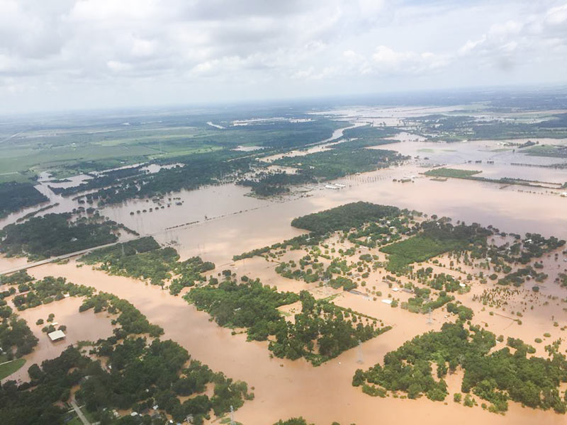 Internet weather guy Eric Berger takes a look today at 6 major flooding events in the Houston area over the past year and a half: last year’s Memorial Day flooding, the pre-Memorial Day flooding that preceded it, the Halloween flooding, the pre-Halloween flooding, this year’s Tax Day flooding, and this year’s Memorial Day weekend flooding. The 6 events, Berger writes, collectively pushed Houston’s rainfall total for the 18-month period ending with August up to more than 119 inches of rain, breaking the previous record by more than a foot. “The ultimate cause of this flooding isn’t entirely clear,” Berger writes, noting that none of the rainfall events listed were connected to tropical storms except for the late-October remnants of Pacific hurricane Patricia. But he does add that “it’s safe to say that rapid development of rural areas — converting prairies into concrete — and a warmer climate likely played some role in exacerbating what were already heavy rains.” [Space City Weather; previously on Swamplot] Photo of Brazos River flooding in June 2016: TxDOT

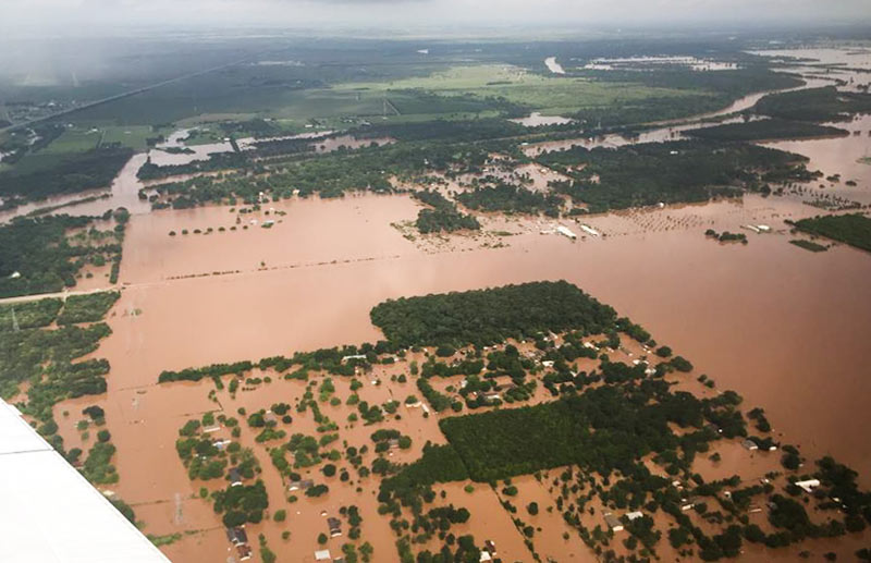
TxDOT has been doing some circling around over the thoroughly soaked Brazos River valley this week grabbing a few snapshots, including some taken yesterday morning as 31 East and Central Texas counties picked up flood-related disaster declarations from the governor’s office. Running north-to-south (right-to-left) under the murky waters shown above is FM 723 in Rosenberg, TX; you can spot the bridge rising up to cross the river’s normal channel on the left side of the photo, while SH 36 stretches away to the northwest.
Flash- and non-flash flood warnings are in effect around the region through at least Friday night, depending on how intense the rest of this week’s predicted downpours turn out to be. Meanwhile, the already-feet-past-the-previous-record flood gauge at nearby Richmond, TX, is still creeping upward this morning toward 55 ft.:
Water Under the Bridges
