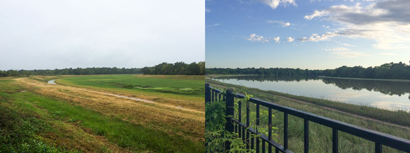
A water-watching reader sends some south-facing photos from yesterday evening (right) and last October, comparing views over the fenceline of the 400-ft.-wide diversion channel at the northern edge of the Addicks reservoir. The channel picks up most of the flow from Langham and Horsepen creeks where they join up as they flow south into Addicks. The 400-ft.-wide floodway was dug in the 1980s; the flow usually lurks down in the narrow channel seen in the shot on the left.
The scene above is less than a mile east of Bear Creek Village, where water is now moseying into neighborhoods from the western edge of the reservoir (and washing some wildife and livestock around). The Army Corps of Engineers has been releasing water from both Addicks and Barker dams to minimize the pooling (and relieve stress on the dam structures themselves) — but those releases have to be done slowly enough to avoid causing additional flooding downstream along Buffalo Bayou. Meanwhile, water is still flowing into the reservoirs from western watersheds; the measured levels behind the 2 dams topped all previous water level records and normally allowed pooling limits in the reservoir by Tuesday, and has been rising since. Here’s a shot of water gushing out through some of the gates of the Barker dam this afternoon:

