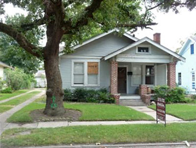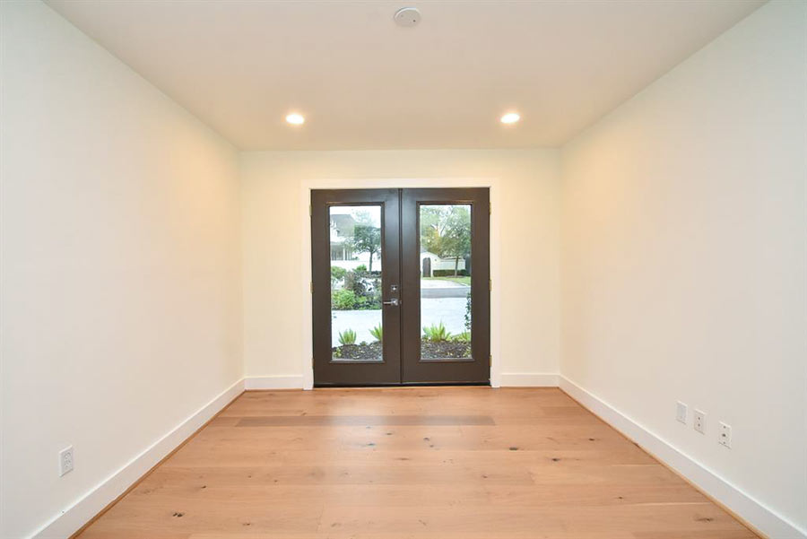
Here’s a 1920 bungalow taking up valuable space on a 7,000-sq.-ft. lot on Merrill St. near Watson. The lot size and the Woodland Heights address make the “perfect combination for building your new home in the Heights,” declares the new listing. The structure, “in need of extensive repairs,” features 3 apparently unphotographable bedrooms and 1 bath. List price: $245,000.
- 726 Merrill St. [HAR]


Seems like a shame, but then again I guess that anybody who can buy the house could choose to live in it and rehab the existing home. Not sure why marketing the home as a tear-down seems to be expedient. Perhaps it’s the seller’s way of saying that the price is firm regardless of what the home inspection report says.
FYI, this property is being marketed by an agent who doesn’t appear to have done any business in the Heights in at least the last year and half. The Heights is a unique and charming neighborhood. And the potential value in saving a home like this is oftentimes lost on those who don’t do a lot of business in the Heights. Hopefully the buyer will be working with an agent who is a Heights specialist.
Isn’t Woodland Heights a historic district?
I thought the HAHC was not in the habit of approving tear downs such as this.
“but the value is in the lot.”
Yes, there is a place for the old and the new but give it a fighting chance… A good Realtor, familiar with the area, would know that there are indeed people who may value this house for the house. Maybe Bungalow Revival or Nautilus can pick this bad boy up and make it something special as they have done on so many other lots in the Heights.
ugh
Tear it down people! Nothing special here – and I am renovating a run down house in the Heights – but most likely who ever would renovate this house will just throw up some paint and cheap cabinets – why bother.
@PYEWACKET2: An effort is under way to make Woodland Heights a historic district. Merrill would not be included in the proposed district so it is not under any protection.
@matt: I wonder if whatever structure replaces the bungalow will last for 90 years and still be in demand.
Pyewacket, this house sits just north of the Woodland Heights district and south of the Norhill district. We are a tiny little neighborhood called Hermosa Court. A lot of the houses in our little area are aren’t much to look at and our streets are not the prettiest in the Heights.
FYI, I have been seeing termite guys around here a lot lately. This house looks cute, but there might be some bad structural issues, thus the land value price.
Though I actually think this is one of the consequences of the historic district designations. Buyers are already looking outside the historic districts for property and that would be us. There are two rehabs and one total reconstruction project on Merrill St. already, and this street has had lots of sad, neglected little houses on it for years. I’m actually glad to see it coming around finally. No one really liked this area much before.
I just took another tally of the construction going on within one block on Merrill since the Historic District was first proposed: there are two rehabs just completed, one project that took a two-story house down to just four walls (this was the rundown house that had the murder) and one totally new construction under way. (The asbestos-sided, cement porched house torn down for that one was not protested by any historic district proponents that I know of).
Dear Socialists,
The market will decide. That is all.
-LG-
What are the boundaries for Hermosa Court? HCAD shows Woodland Heights and WH annex for this property. Do they not recognize Hermosa Court?
Parts of Merrill are also shown as being in Norhill. How does the incorrect name on HCAD affect property tax appraisals?
I checked out the HAR listing and it seems that the realtor for this house has the same last name as the deceased owner.
Hmmm…I thought this house was Hermosa Court. It gets confusing because there are some really strange dividing lines around this area.
I’ve had to go through HCAD house by house on both Merrill and Redan St. to hit the Hermosa Court homes. The key is the house numbers change from the 800s to 500s between houses where Hermosa starts. HAR Neighborhood finder shows 24 houses in Hermosa, and you’re absolutely right, this one is not Hermosa. The 726 number made me think it was Hermosa, but it’s falling into the Annex side. Sorry for the misinformation there.
It’s like back in the day, some of the less desirable areas were cut out to be part of Hermosa, then the better homes are Woodland Heights Annex. Must have been a tract home builder back in the day and why it’s not included in the historic district.
So, here goes, Hermosa Court ends at 614 Merrill, then the neighborhood of Willborg starts at 623 Merrill and ends at 705. 708 Merrill is where WH Annex starts.
Geez, going through HCAD makes me realize I’m truly all messed up on which house is in which little neighborhood in our area. There’s Marquant, Willborg, Hermosa, then Woodland Park starts up on one street and Stude on another.
Can a realtor or someone who knows some of the history in the area explain what’s up with all the tiny neighborhoods? Was each a different builder back in the ’20s and ’30s?
Maybe the little neighborhoods were created after the Bayland Orphanage was closed.
According to the Woodland Heights website, the 35 acres of the orphanage started at Julian and Bayland and went west. These little neighborhoods are on the east side, heading east from Watson past Travis Elementary and north of Omar to Pecore. It’s all these little neighborhoods that aren’t included in the historic districts. Quite a number of the houses were built in the ’30s and are not the typical Heights-style house.
I may be delusional, but I thought I remembered one of my elderly neighbors saying there once was a lake here. Norhill Joe, have you ever heard anything about a lake? Could that have been some part of the orphanage?
After reading more, I’m wondering if these neighborhoods sit on part of the former Woodland Park Lake. It was a full 30 acres and a tourist attraction in 1907.
I know you can find the remains of a far end of the park area if you crawl between the trees down to the bayou below I-45 and I-10 at Houston Avenue. It’s pretty amazing to imagine what it once looked like, though you need to be careful of startling the homeless who hang out there.
It would be a typical Houston thing, fill in the lake and build tract homes.
I’m intruiged by your discussion. And by the wiggle in Merrill St. near Northwood -what do you suppose caused the developer to create that?
Perhaps a small ravine, part of the earlier topography.
But, unless Woodland Lake was a very long, skinny 30 acres, I don’t think it could have reached this particular neighborhood. Assuming 30 acres is equivalent to 200 or so lots, plus streets.
My understanding is that the lake was where I-45 is now, east of Woodland Park and south of where Main crosses.
There are a blue slew of different subdivisions within the boundaries of what is popularly known as Woodland Heights; only part of the Woodland Heights subdivision is currently applying for historic status.
I have always wondered about that curve on Merrill too. A ravine that ran off the lake would make sense. I could imagine it looked something like Little White Oak which runs off White Oak Bayou at TC Jester south of 11th. Would have been easy to fill in too. And it might explain the shells I find when I dig into my yard, maybe?
I had absolutely no idea just how many tiny little subdivisions there are in the area.
There are old maps and city directories that might shed some light.
I don’t know enough about that area to speak to any of the questions but you might go to the HAIF site and put a question to the group. There is a section for the Heights and could be someone knows “the rest of the story” as Paul Harvey used to say.
I live right on the Merrill “wiggle”, and I would be very interested to know why the street does that. Any ideas?
The lake I know of was around Beverly and 7th street-ish.
Hi Mike, I think you are one of my back fence neighbors. If you are, I’m the one with the yapping pug who tries to get your dogs’ attention through the fence. Sorry about that. I know she’s annoying but really sweet.
I’m planning on doing some more research and haven’t gotten around to it. I’ll post here when I find out more.
Looking at a 1912 city map of Houston it indicates Merrill street starts at the 800 block (orphanage at the west end) and then east to a partial 600 block. At that point there is a section of undeveloped land all the way to Beauchamp. At that time Northwood was north of Pecore and ended there. The map shows a road where Northwood is now located south of Pecore but I cannot read the name. This road runs north from White Oak and ends at Omar.
Someone may know why the original Woodland Heights omitted the 3X3 block square of land from development. Might explain why Merril makes the jag. I am guessing there was some building/structure to go around.
NorhillJoe, I still wonder if there might have been a ravine between St. Marks Methodist and the original Woodland Heights neighborhood that was filled in. My house was built right off this jag area in 1925, then all the houses past mine going east were built in 1935. I have wanted to talk to my neighbor next door who moved into her house in 1935, but she has been ill.
Good news! The buyer is represented by a Boulevard Realty agent who knows the Heights. And the buyer’s plans are to renovate this home as he has done to others in the area.