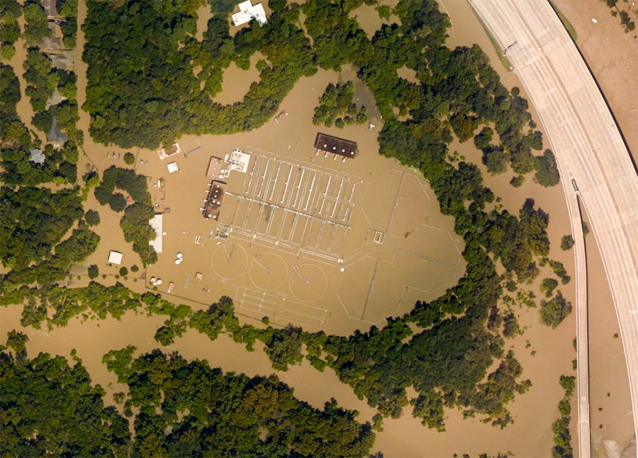
WEST HOUSTON CAN NOW FLUSH IN GOOD CONSCIENCE  When last we (and the aircraft supplying aerial images to NOAA) left the West District wastewater treatment plant along Buffalo Bayou just outside Beltway 8 at the flooded southeast corner of Memorial Glen, it looked like this: shut down and surrounded by muddy floodwaters sorely in need of its services. That was September 3rd. As of this morning, the city’s Office of Emergency Management reports, both this plant and the one on Turkey Creek off Eldridge between Briar Forest Dr. and Memorial have been restored to full operation. This means persons in ZIP Codes 77024, 77041, 77043, 77055, 77077, 77079, 77080 and 77094 who had been following guidelines to limit their water use are once more free to shower, flush, brush, and otherwise send wastewater down their drains without special consideration of the consequences. [Alert Houston; previously on Swamplot] Aerial image of West District plant from September 3: NOAA
Memorial Glen
Here’s the latest publicly available high-resolution aerial imagery of Houston-area flooding, in an interactive map you can use to zoom in and examine in detail and by address. The imagery in the map above comes from the National Oceanic and Atmospheric Administration, and was taken this past Wednesday and Thursday, August 29th and 30th — as floodwaters subsided in many areas of the city but continued to build in a few parts west.
Included in the portions of the city photographed by NOAA: the sections of Memorial south of I-10, west of Gessner Rd., north of Briar Forest Dr. (that’s below Buffalo Bayou), and east of the Addicks and Barker reservoirs. That’s the area where Mayor Turner earlier today said residents who already have water in their homes should probably leave their homes now if they haven’t already — because water is likely to remain in them for the next 10 to 15 days as releases from the dams continue.
To zoom in on the latest aerial imagery from that area, you can click on the search box in the map above and type “Memorial, Houston,” then click on the first option that appears below where you’re typing. Then zoom in further to see where the floodwaters are and aren’t. You can identify the date of the imagery and turn on and off various layers if you click on the lower of the 2 icons on the top right of the map. To view the map larger in your browser window, navigate directly to NOAA’s Harvey site.

