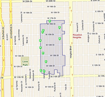
Houston’s 15 “please wait 90 days before demolishing” historic districts — plus that special one that’s a little more strict — now have their own special page on HAR.com. And it comes with maps! It’s now easy to stake out the boundaries of each one, if you’re into that sort of thing. And each map shows properties for sale within the district.
But the information doesn’t appear to be flowing in the reverse direction. Listings for properties located in historic districts still include no indication what district they’re in — or even that they’re in one at all. Unless, of course, the agent is forthcoming enough to mention it in the main text of the listing itself.
The Greater Houston Preservation Alliance also reports that “if a designated landmark is located within a historic district, the designation will appear on the site.” Anyone wanna show us some examples?
- Houston Historic Districts [HAR]
- Greater Houston Preservation Alliance [Facebook, via Swamplot inbox]
Image showing map of Houston Heights West Historic District: HAR


Good Job HAR. Now I know where not to buy a house next time. It’s great where I currently live having a group of women who moved into the neighborhood in 2008 from the northeast teling me what I can and cannot do with my home.
Thanks to HAR for providing information on areas that are most likely to be very attractive in terms of housing stock, walkability, and hopefully, lower density.
Bob: Does the HAR map show deed restricted areas? Because when I think of “a group of women” (or men) “teling me what I can and cannot do with my home” in Houston, the very first thing that pops into my mind are deed restricted neighborhoods and the busy-bodies who love them.
A map of deed restrictions–now that would be useful.