

Swamplot reader Superdave, a self-proclaimed “Google Earth junkie,” is grooving on the program’s recently extended time travel feature:
In the most recent update of the free software, they added a feature where you can view aerial images from previous years, which is cool. At first they only went back 5 years or so. However, today I noticed that they’ve added imagery from December 1978 for nearly the entire Houston area.
I was numbstruck as I zoomed around and realized how substantially different this city is after our rampant growth over the past 30 years. I even got kind of sentimental seeing all those rice fields out west, where I grew up. I also felt a conflicted sense of relief that we’re in an economic downturn that will kind of apply the brakes (I’m sick, I know).
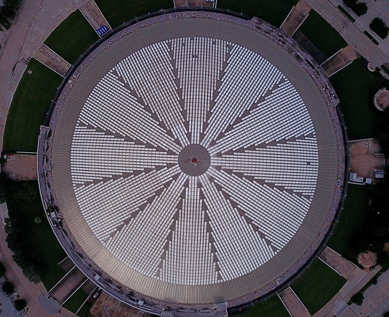
How’d the area around the Astrodome look 30 years ago?
***

From the sky in 1978, it makes you wonder if they really were trying to communicate with ET’s with that design. It looks like a cycloptic alien head staring up at you.
Google Earth fans: Find any other good before-and-after shots worth sharing? Send them in!
“From the sky in 1978, it makes you wonder if they really were trying to communicate with ET’s with that design. It looks like a cycloptic alien head staring up at you.”
The layout wast supposed to look futuristic and “spacey”. It goes with the theme name of Astro and Houston having NASA headquarters.
You can see the old brick Robinson Public Warehouse and its railroad bridge at Allen Parkway & Montrose disappear. First, the bridge is gone in Dec 2002, then *poof* the warehouse is gone in Jan 08. Yet, the faint imprint of the bridge is still visible in the most recent image.
http://www.historicaerials.com/
The website above goes back further. You can see before I-10 was built just inside the West Loop.
That historic aerial’s site is cool! You can see all the homes that used to sit where 288 now runs.
Check out the aerial views of the Galleria. Dramatic difference for the Post Oak-Westheimer intersection (5000 Westheimer). In 1957, 3 cars and farmland and no freeways. Later Sakowitz and Joskes/Dillards; and now, traffic, lots of buildings, and you can even see the weird circle sign hanging over the intersection.
Most missed: Rice Silos S of Studewood, between Washington and Memorial.
“Most missed: Rice Silos S of Studewood, between Washington and Memorial.”
i would stare out of my office window in downtown Houston at “Success Rice” and it would actually motivate me to get back to work. no kidding. others in the office said so too.