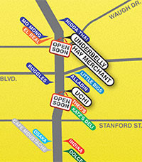
 Over at the Houston Press, food critic Katharine Shilcutt and chief mapmaker Monica Fuentes have traced the history of locally owned restaurants on the stretch of Lower Westheimer from east of Taft all the way to Dunlavy way, way back — to the long-ago days of 1997. Sure, the sequence of maps (see below for the latest) leaves out bars, coffee shops, and fast-food joints, but culinary additions are color-coded (after the start date) by year of appearance. Featured appearances between now and next year: Underbelly, the Hay Merchant, Uchi, and L’Olivier. Your guide to eating the strip and curve:
***
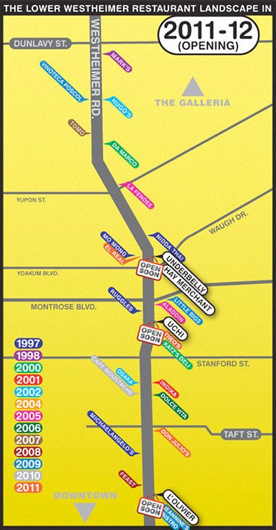
- The Restaurant Gentrification of Lower Westheimer: A Long Time Coming and The Restaurant Gentrification of Lower Westheimer: 1997 to 2012 (slideshow) [Eating Our Words]


What about Sorrento’s???
I was wondering the same thing! I’ve had good experiences eating there – I wonder if the mapmaker hasn’t?
I like the series of maps they did. I’d like to see more this kind of map that shows the ongoing evolution of a street or neighborhood in Houston.
Katharine here! For what it’s worth, the maps aren’t meant to be comprehensive. They’re meant more as an overview of how the area has changed in the last 15-odd years. Thanks for linking back to us! :)
Do food carts and trucks merit a mention? If so, Melange Creperie should be added, too.
Back in the ’77 or so there were a lot of cool clubs and restaurants. In cute original houses. Then that strip devolved for quite awhile.
I’ve always wanted to organize a margarita crawl from Taft to Kirby. I figure by the time you hit Cafe Adobe, you can barely walk, and there are still two more establishments to hit. Four, if you venture across the street to Armandos and Chuy’s.
Houlihans # 2 on Westheimer in the 1970’s!
I like it in concept, but I find the west->up east->down orientation a bit annoying.
Don’t forget about BBs on Montrose.