
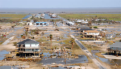
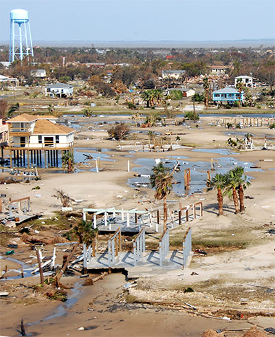
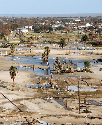
A company called U.S. Forensic has posted 1700 aerial photographs taken from a low-altitude airplane the company flew over southeastern Texas and Louisiana a few days after the hurricane. The photos are arranged in an overlay accessible through Google Earth, so you can import the file into the free software and search for views by address.
Even if you don’t use the Google Earth interface, the directory of individual photos provides some shocking scenes:
***
- Hurricane Ike Response [U.S. Forensic]
- Previously in Swamplot: New Hurricane Ike Aerial Photos: Househunting from Above
Photos: U.S. Forensic

The biggest question I have is: Why has no news organization covered the story of the dead body recovery efforts in Bolivar Peninsular and Galveston Island. My conversations with several US Coast Guard and National Guard personnel were bringing this up. Much of their time last week was devoted to this effort.
The number is in excess of 100 dead.