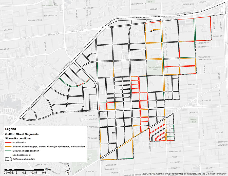
The results are in from the Kinder Institute’s recent survey of Gulfton sidewalks: where they exist, they’re in bad shape. The map above uses a stoplight-style color scheme to rank the condition of each segment: red means no sidewalks, yellow means they exist but with gaps, hazards, and other obstructions — and green means they’re good to go. (Black areas weren’t assessed by the 16 participant-observers who set out on foot to compile the study last month.)
Out of all charted segments, the worst is a 9-block corridor along Atwell St. that starts a block west of Burnett Bayland Park; it’s completely sidewalk-less between Elm St. and Bissonnet. In total, nearly 43 percent of the examined street segments lacked any kind of pedestrian walkway. Other side-ways where you might want to tread lightly include those along Chimney Rock — which is laced with trip hazards all the way from 59 down to Evergreen St. at the southern end of the neighborhood. Nearly three-quarters of the sidewalks in study fell into this category of disrepair.
Even the areas with smooth pavement were beset with other problems: 70 percent had almost no shade, and 98 percent had no pedestrian-level lighting. The consequences: between 2010 and 2017, 149 people were either killed or injured while walking through Gulfton, according to TxDOT data.
Map: Kinder Institute


Well done Houston. Make sure everyone must have a car in order to get around.
You’re telling me that 16 people participated and that’s all they could get done? I think in a single day in a car by myself I could’ve made a more comprehensive map than that.