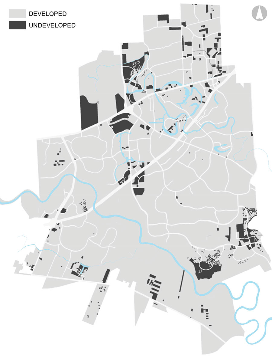
Here’s a nugget from the latest draft of Sugar Land’s 2018 land use plan: the map above, showing the 7% of acreage that still hasn’t been developed within the 32.2-sq.-mi. town and its roughly 20 sq.-mi. of extraterritorial jurisdiction. The thickest road running diagonally through the gray matter is the Southwest Fwy.; it’s intersected and then paralleled by Hwy. 90 to the north. Conspicuously blackened: the area on the top left edge indicating a tract west of Sugar Land Regional Airport and adjacent to the Chelsea Harbour subdivision off 90. There’s another vacancy along the Brazos River, way far south near FM 2759. And a few gaps show up between the hodgepodge of industrial buildings in the northeast corner of town.
A more detailed map below color codes what all that land — built and unbuilt — was used for as of 2016:
***
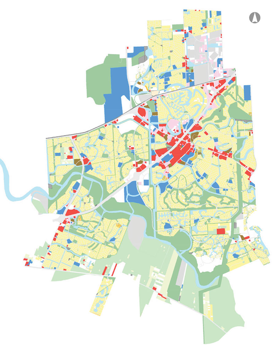
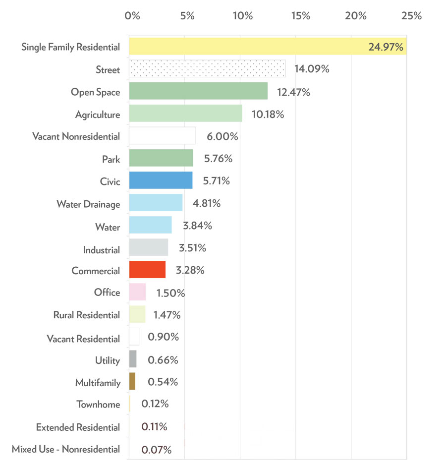
All that yellow is single-family residential, which makes up nearly a quarter of the entire town. The next quarter goes to a combination of streets serving all those houses, as well as open space:
- Read the Draft Land Use Plan [City of Sugar Land]
Images: City of Sugar Land


