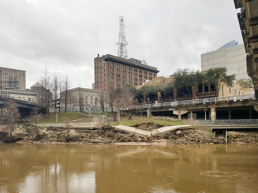
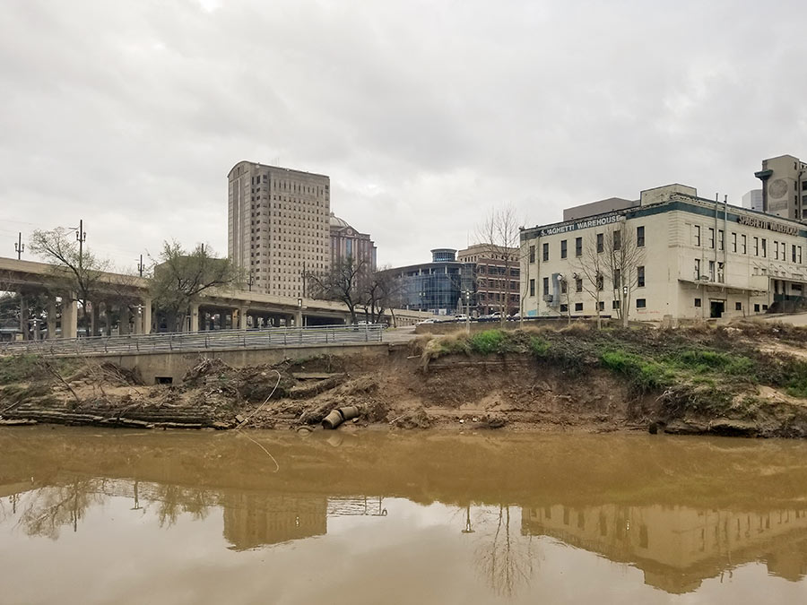
There’s more damage to the areas along Buffalo Bayou than just the collapsed segment of trail pictured at top between the Travis and Milam street bridges. The photo above taken east of Travis shows where Spaghetti Warehouse’s former parking lot is eroding as well and transforming into a new set of cliffs on the water.
Heading west down the trail, more obstacles appear near Montrose Blvd. where the northern trail cuts past the closed Johnny Steele Dog Park:
***
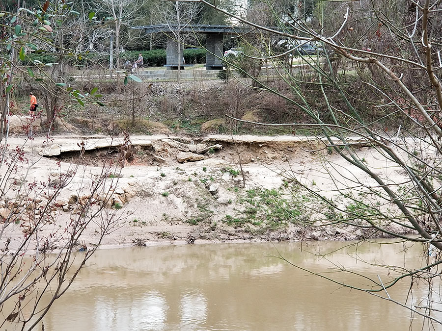
A good chunk of the silt Harvey deposited on the banks has been removed, but the slope down to the bayou still looks pretty beached:
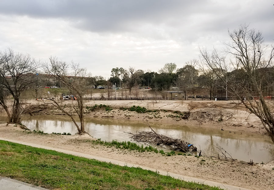
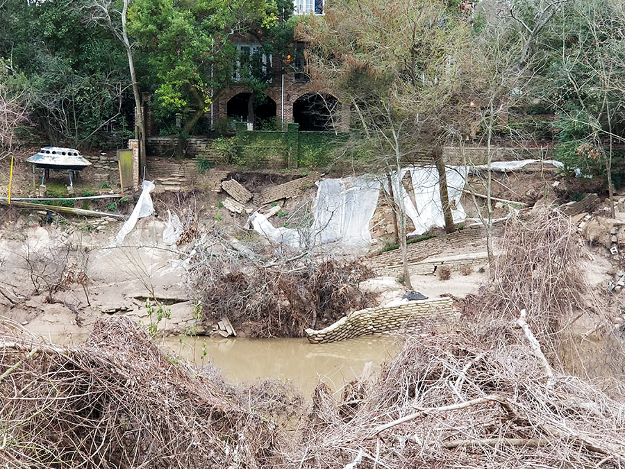
Private property has taken a hit too. Here’s a view across the water from the small portion of Buffalo Bayou Park that lies west of Shepherd showing the back yard of a house on Tiel Wy.:
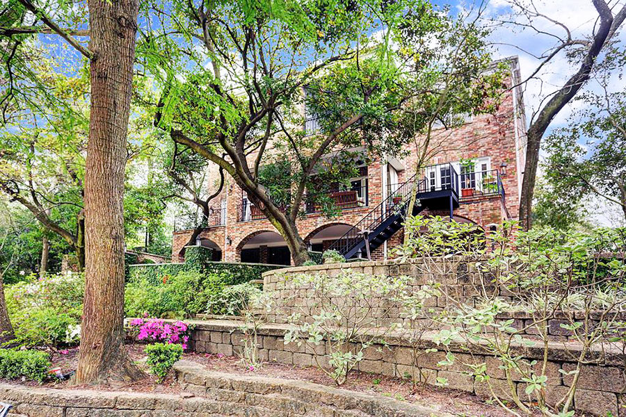
Here’s a photo of the house last June when it was up for sale and the terraces were intact:
- Buffalo Bayou trail bridge collapses in downtown Houston [abc13]
- 12 Tiel Way [HAR]
- Previously on Swamplot: A Photo Tour of the Brand New Beaches Along Buffalo Bayou
Photos: Marc Longoria (erosion); HAR (12 Tiel Way)


Whatever happened to the controversy around shoring up Buffalo Bayou near the pricey homes where people were fighting with the Army Corps of Engineers over how to do it?
Gee, is that what happens when you remove all of the natural erosion control (trees)?
Harvey killed this city and no democrat mayor is going to have the skill to bring it back to life.
Yep, that’s what happens when man tries to control nature… scraping the banks clean of its native riparian vegetation.
Is that a UFO in the picture of the Tiel house?
@ GoogleMaster & evwytinguwan: Buffalo Bayou widens, deepens, and has higher banks downstream of downtown. When the stretch of bayou from downtown to Memorial Park was graded and mostly stripped of vegetation in the 1950s, it was to enable water from upstream to get downstream faster. Vegetation does prevent erosion, but it also introduces turbulence to floodwaters, slowing them down. Fast-moving floodwater also exacerbates erosion. Although ground cover has been planted that mitigates some erosion and although some concrete lattice has been placed in the channel that allows plants to grow through it, erosion remains an intractable problem. If you want to solve the erosion problem and deal with the floodwater, look at Brays Bayou. That’s how you’d go about doing it. That approach don’t get much in the way of open space for recreation, though. So pick your poison.
So apparently, some natural vegetation is going to stop 33 trillion gallons of water from eroding the banks of the bayou (rolleyes)?
.
yes, in normal conditions, even in heavy rain conditions, natural vegetation help to slow erosion, but with as much water as we had over that 3 day period, plus the month after of releasing water from the reservoirs, water will move things. Trees were moved. huge boulders were moved. Natural vegetation wasn’t going to stop the banks from being eroded.
.
You are all being exceedingly silly for even considering that trees, or vegetation would stop erosion in the type of event that Harvey was.
.
Concrete lined bayous, like brays bayou, that would have stopped the erosion. There will have to be lots of time/money spent to build things back up, or maybe the properties that got encroached just need to be condemned and turned into park land.
Keeping vegetation in place is the only way to keep a bayou as a bayou. Brays is nothing more than a glorified ditch. The problems with flooding happened because building was allowed in the flood plain, and bizarrely enough, the flood pools. Yes, the rain we received was unlike anything since the last time it happened, but building next to a bayou is just folly. The Tiel house was built in a place doomed to flood. How can anyone be surprised? The new beaches are a natural consequence. Most of it should be left in place. Too bad about the dog park.
KG-I’ve seen that thing from Memorial Dr. when I’m at the light at Shepherd and wondered the same?
Riparians: Vegetation will not stop a bayou from changing course, which is what we are seeing here. Silt is deposited, banks erode, and water meanders over the landscape. That’s why Houston is flat. The course of a bayou is temporary.
Memebag and I have the same Word of the Day Calendar. I’m gonna try to use the word riparian to get a date this weekend.