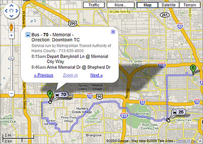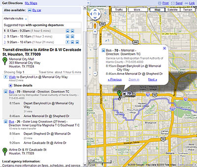
It’s now a whole lot easier to figure out how to get around Houston using public transit: Metro routes have at last been embedded in Google Maps. Which means if you use Google to plan a local trip, figuring out how to get there by bus or rail is now as simple as choosing “By public transit” from a dropdown menu. Schedule info is right there too.
So far, the public transit option shows up whenever you use Google Maps to get directions in Houston — or you can start from a separate Google Transit gateway here. Not yet activated for Houston: Google’s Transit Layer, which in other cities lets you see all the routes at once.
Even more convenient: If you can get Google Maps on your mobile phone, you now have access to bus and train directions and schedules there too. Here’s a video demonstrating how that works:
***
And yep, it works (a little differently) on the iPhone too. Anyone want to send in a short video demonstrating that?
Instructions for those of us tied to larger screens:

- Plan a Trip Using Public Transportation [Google Transit]
- Google Maps for mobile transit directions [YouTube]
- Transit on Google Maps [YouTube]
- Finally, a good trip planner [Intermodality, via Swamplot inbox]
- Test drive the new Transit site [Google LatLong]
- New ways to get around with the Transit Layer [Google LatLong]
- Google Transit Is on Its Way to Houston [Swamplot]
Images: Google Maps


Wow. Just tried it out and it is infinitely faster than Metro’s own quirky site. As an occasional bus user, this is going to be invaluable.
This is a great feature but what happened to street view? It’s been disbaled for two days now.
I am excited by the prospect of actually figuring out our transit system, and depressed by realizing how difficult it is to get the places I want to go.