
Over Thanksgiving weekend city workers opened a portion of the proposed hike-and-hike trail that will one day link downtown and Acres Homes.
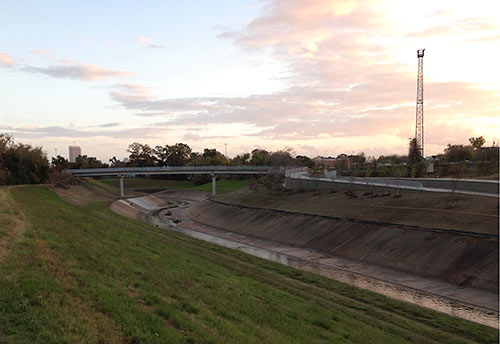
Work began last October on this new section, one that heads west from the MKT hike-and-bike trail’s former official western terminus at Lawrence Park, under the N. Shepherd Dr. and N. Durham Dr. overpasses, and over White Oak Bayou, west to Cottage Grove and north towards an eventual link with the existing White Oak Bayou trail.
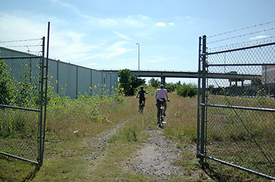
This link legitimizes a an unsanctioned though fairly popular “ninja route” long used by off-trail cyclists, who had been pedaling the gravel path from the park to a rickety, burned-out White Oak Bayou railway trestle known to as the “Bridge of Death,” seen below in a 2012 photo.
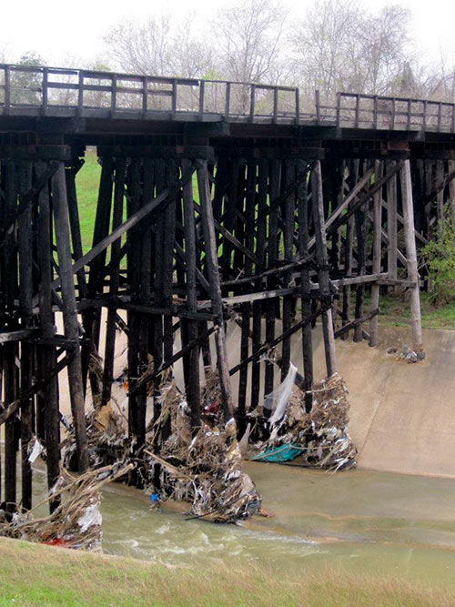
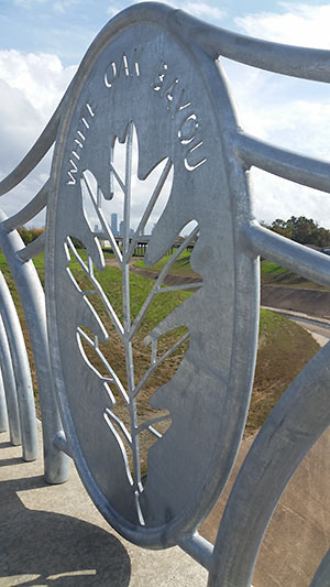
That’s been demolished and replaced with a sturdy span of of concrete and steel, complete with fancy, built-in insignia, and skyline and AIG building vistas.
***
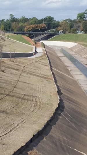
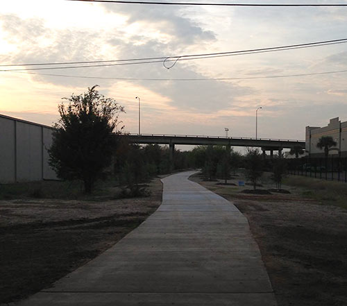
The old gravel path has been paved, and much of the sunflower-abundant underbrush along its verges hacked back and replaced with manicured landscaping and a few dozen saplings — mostly pines.
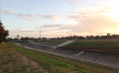
Below are views from 2012 and last week, looking west from N. Shepherd:
This section of trail connects the Heights and Timbergrove Manor to Cottage Grove: after you cross the bridge at the end of the section of trail above, you skirt the Eureka Rail Yard, a junkyard, and Texas Outhouse’s Porta-Potty storage lot.
As seen in the photo second from top, the new segment also snakes north along the bayou’s west bank to TC Jester Blvd., which you see in the distance. However, as of Friday evening, that section was incomplete, stopping just short of the bridge.
Still a ways off: the planned link-up with the existing White Oak Bayou hike-and-bike trail at W. 11th St. and TC Jester. Once complete, cyclists will be able to ride off-road all the way from UH-Downtown up to the intersection of Antoine Dr. and W. Little York Rd. in Acres Homes.
- Previously on Swamplot: Here Comes More Greenway Mileage for White Oak Bayou; Off-Trailing with Houston’s Northwest Bike Path Pioneers.
Photos: Stephen Donato, (bridge decor, view of TC Jester bridge); Elly Blue (cyclists on gravel path); Swamplot inbox (all others).

Very nice! Let’s hope some Hood Rat doesn’t tag the bridge. Perhaps the city should install a Troll.
I vote for Commonsense.
Are you sure the burned out bridge isn’t a shot of the one closest to Studemont? I seem to remember it being used as that one before. But I could be misremembering. That one definitely burned at least twice.
You know what would be a great graphic to go along with this story? A map.
Less talky, more drawy.
It was never called ‘Bridge of Death’, that’s a terrible name. It was BBQ Bridge, obviously
Going east, the path actually goes past UH Downtown and ends at McKee street. Hopefully they can connect from there to Buffalo Bayou and Columbia Tap trails at some point.
For those that can’t use a map to find it, here’s what they are talking about:
https://www.google.com/maps/@29.7832263,-95.4136348,206m/data=!3m1!1e3
Bill, there is no burnt out bride at studemont, they put in a similar bridge to this one there for the heights bike trail.
There still is no way to get to the path at stude park from the heights bike trail, the path stops abruptly as it goes under studemont. If they built a connector then bikes wouldn’t have to go on the street to get downtown and it would solve at lot of the bike traffic woes around Target.
There’s an orphaned trail section under 59 south of Runnels which will eventually form part of an MKT-Columbia Tap intertie. Likewise there is an intertie between MKT and the Buffalo Bayou trails which is currently in the final design phase… I would expect you’ll start to see construction around UHD by next summer.
So there’s no trail under Franklin/Main intersection to connect UHD to the Buffalo Bayou trails? I can’t tell on Google Earth but it looks like they are very close if not connected. It would be awesome if someone could find a way to connect Memorial to the White Oak trail near Cottage Grove or the Eureka Yard – it would be one giant loop.
@daga – I’ve been looking forward to the westward extension of the trail stub at Stude Park. It would make that path so much more functional (and let folks get on the Heights Bike Path without having to mess with the the Studewood/White Oak traffic intersection). A while ago I saw a map that said this was supposed to be built using federal TIGER funds, but I have no idea if/when that is actually supposed to happen. Does anybody have an update on the Stude Park trail stub?
The hike and bike trail system today, though much better than 10 years ago, is still a patchwork mess of unconnected segments. These pieces range in quality from bicycle superhighways (wide, off-street cement pavement with lane markings, stop signs, rest areas, etc.) to bum trails (grass and mud ruts). I still can’t ride along Brays Bayou from U of H to Hermann Park without having to navigate the 100 foot long mud pit under Almeda Drive that for whatever reason was never paved, despite the two multi-hundred million dollar construction projects that occurred there within the past 5 years.
Enough core segments now exist that the main focus should now be on connecting existing trail segments, not creating new long stretches that will also not be connected to the network at their terminals.
Aside: I’ve tried contacting numerous interested parties (COH Parks & Rec, Houston Bikeways, Hermann Park Conservancy) about the Almeda segment, but never got a response from anyone involved. I have a feeling it was one of those areas where the USACE’s Project Brays and Hermann Park Conservancy’s park revitalization project boundaries should have touched, but were inadvertently left 100 feet shy.
Be careful. The thugs will be out assaulting /robbing / attacking/shooting riders/pedestrians. @Shannon-the hood rats have tagged the concrete embankments. They’ll tag other surfaces. Karmatic punishment: can of spray all over their person.
@Superdave try the Houston Parks Board to see if it’s on their list. To all: the goal of the Bayou Greenways parks bonds ($100 million) that was passed in 2012 is to connect disjointed trail segments.