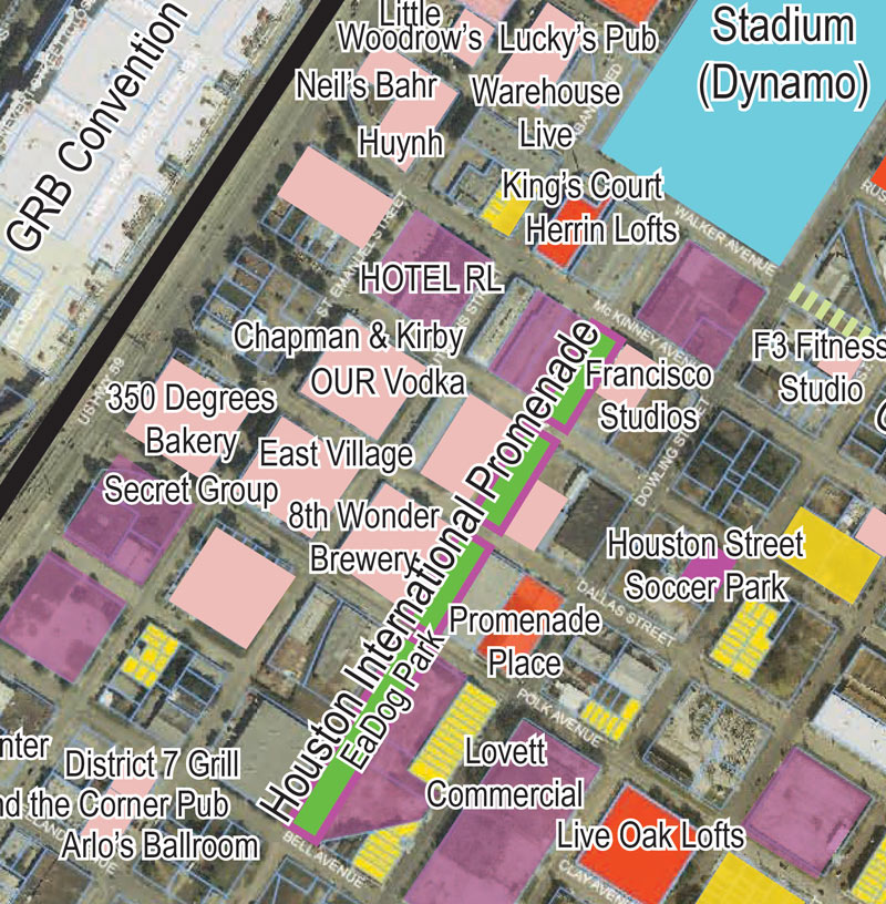
Some bidding has been going on this fall for more work in the southernmost section of the abandoned stretch of Bastrop St.’s right-of-way south of the Dynamo stadium (highlighted in green above and these days going by the name Houston International Promenade, after the plans for a more elaborate Sisters Cities Promenade fell through).  The linear greenspace has had some landscaping installed over the course of the past few years, along with a walking path; the next addition to the southern end of the strip looks to be exactly-what-it-sounds-like EaDog Park.
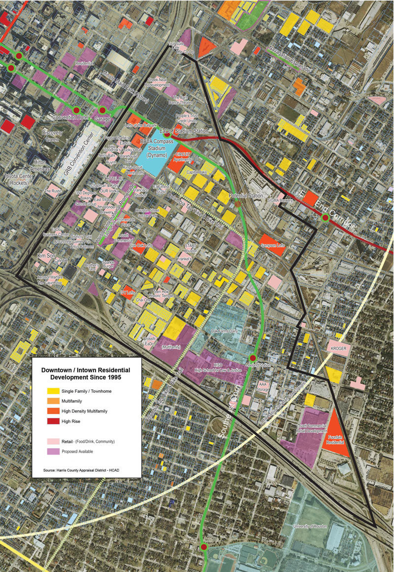
Calls for contractors for the dog park’s construction were floated around in September; as the placement of the words on the map above suggests, EaDog would stretch along the would-be Bastrop St. right-of-way between the trace of would-be Clay St. and already-is Polk St., on the next block south from 8th Wonder Brewery. The map above is part of what looks to be a recent-ish what’s-where showpiece from the EaDo Management District (tucked in with the current LoopNet listing for Start Houston’s on-the-market building). The larger version of the map purports to show development since 1995 in and around the neighborhood, which is outlined in black below:
***

Though there’s no date on the document, it’s recent enough to include some other plans confirmed this year, including the Hotel RL planned for St. Emmanuel St. at the northern end of the East Village complex, and that restaurant from The Rustic’s owners, just south of the George R. Brown.
- Downtown / Intown Residential Development since 1995Â [LoopNet]
- Previously on Swamplot: Any Takers for E-Dow?
Images: LoopNet


For the love of all that is good and true in this world please don’t name it “EaDog Park”.
what a great map to see how things are changing. thank you for posting this. very interesting
Has the re-routing of 45 through this area been killed? It seems odd that they’d make any plans for that stretch if a couple of blocks are going to be lost to freeway.
@gruffbear
So far as I know it has not been killed (yet). I still question it, though. If one of the stated goals is to “free up” the area covered by the Pierce Elevated, how does it make sense to “free up” 12 HALF blocks by obliterating 20+ FULL blocks? And a public housing project? No way that flies.
I’m quite in favor of most of the freeway projects, but I think this part of this one is just silly. You could easily widen the Pierce by decking over Pierce Street itself, without cutting off more streets, without huge amounts of displacement, and with much less traffic disruption. Plus, they’re also talking about extending Spur 5 north of IH45, along the railroad, to join US59 near IH10, which would serve the same movements.
EaDog park! Hilarious
Sorry, I saw “EaDog Park” and I thought of food trucks. Is it supposed to be a place where the inhabitants of the overpriced townhouses can avoid picking up after their canines, in addition to the tiny grass strips in front of their sidewalks?
E-Dawg & meh
Area was old china town should Asian’s be offended?
They should name it UpDog Park
MrEction
What’s UpDog?
Im wondering about the proposed GRB expansion. The map has The Rustic restaurant right in its footprint. So how smart is that? The GRB has no other place to go but south, that will be a very expensive place holder.
Can we at least put the name to a vote? EaDog isn’t clever, it’s tacky.
EaDo itself was bad enough. EaDo Dog Park would even offend my dog.
The name stinks…but I’m sure the owners will be quick to pick up all of the Ea-Doo, which by the way is the way that the Metro computer pronounces the station when riding the green or purple lines…
“Next stop, .Ea-doo/Stadium…Doors open right.”