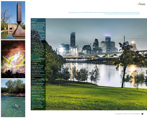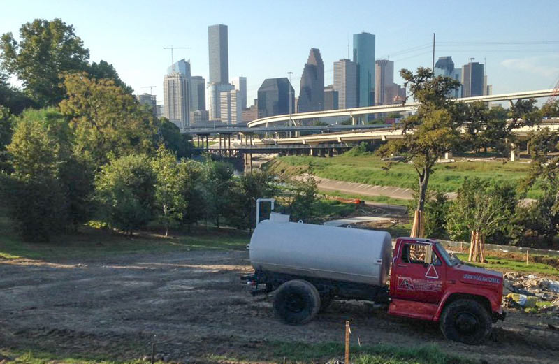
The glossed-up scene above, which shows a pushing-its-limits White Oak Bayou flirting with the lower edge of the Height Hike and Bike Trail bridge, made an appearance in this month’s edition of Kia Ora, Air New Zealand’s in-flight magazine. A sky-high peruser on Reddit noticed the article, which is currently employing the flood photo to promote Houston and several other Texas cities as tourist destinations. The original source looks to be a Getty Images contributor who captioned the shot (along with another expansively aquatic view from 2015) as stock images of Downtown Houston in the rain. For comparison with the normal scenic view of Downtown’s northernmost freeway tangle, below is a recent shot of that trail construction near the Leonel Castillo Community Center, which caught the same angle and foliage (minus the high water, but plus some heavy equipment):
***

But hey! Air New Zealand only announced its new-ish direct flights between Auckland and Houston last year, right before the Memorial Day flooding and the start of Houston’s wettest 18 months on record; the photo’s inclusion could just be an attempt to showcase what appeared to be a normal bit of local flavor around the time the the magazine geared up to research the area. And speaking of flavor: the article also highlights some restaurants for would-be Houston tourists to put on their lists, including Upper Kirby’s upscale Haven (which shut down in 2014), the Eatsie Boys’s brick-and-mortar spot (which also shut down, in 2015), and Larry’s French Market & Cajun Cuisine, located in Groves, TX, on the east side of Port Arthur.
- Previously on Swamplot: Repeated 100-Year Flooding Adds Up to Houston’s Wettest Year and a Half on Record
Image: Kia Ora (magazine excerpt), RoB (trail construction)


Actually that’s a seriously great idea! But I do it East of Downtown. I’m serious some major eminent domain, lot’s of dredging and Houston has a bay. Well, a little one. Okay a lagoon.
Wow that is some sublimely smart allecky writing right there. Well done. :)
To be fair, Haven and Eatsie Boys, despite any of their faults, would’ve been very good recommendations to someone visiting Houston as a tourist.
One of their Downtown Houston pictures is actually an obvious Downtown Manhattan. It’s a stock photo listed as “Houston” Skyline. Our company even used it on our magazine cover highlighting the region. I understand not all people around the world may recognize our Downtown… but if you can’t recognize New York City (especially if you’re selecting it out of a group of other stock photos with our actual smaller Skyline), or be able to tell one is not like the others you see side to side… You should have the cognitive ability to not chose it. Perhaps it is mislabeled for Houston Street. Either way it’s sad.