
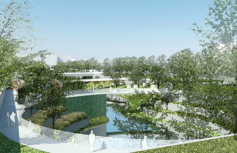
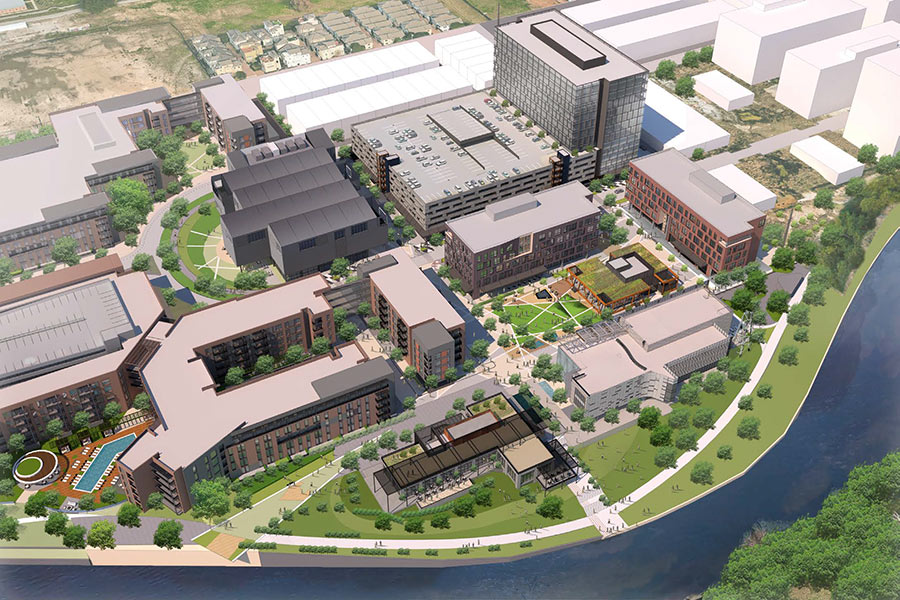
Here’s a purty watercolor-filtered drawing that shows how a portion of the concrete-lined Conrad Sauer Detention Basin extending north from the I-10 feeder road between Gessner and Conrad Sauer Dr. is supposed to look after MetroNational and TIRZ 17 upgrade it into a grassy, bike-lane-crossed area with park space that improves on its current ditch functions. It sits directly across the little ol’ Katy Fwy. from MetroNational’s ‘Death Star‘ HQ; the normally secretive company reveals a tiny bit about its plans for the area around the detention basin, lining the northwest corner of Gessner and the outbound I-10 feeder, in a variance application that’s scheduled to be discussed and possibly voted on in a planning commission meeting this Thursday.
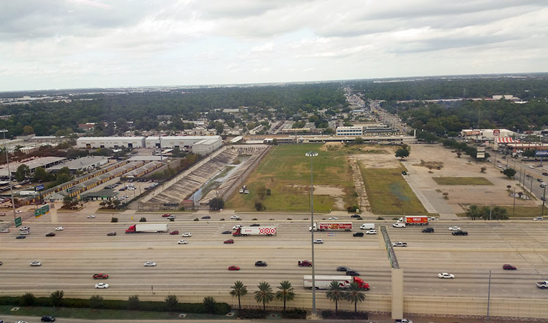
MetroNational is calling the cleared 24-acre site (shown below) the Energy Gateway District.
***
This plan from the Office of James Burnett outlines the widening of and park-like improvements to the basin, which is owned by the city:
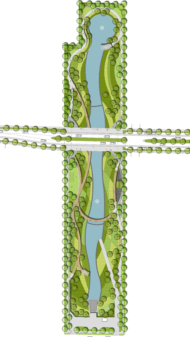
The east-west boulevard is Mathewson Ln., which will be extended through MetroNational’s property.
The variance MetroNational is requesting — in advance of revealing any of its plans for the site — is for a reduced building setback along that new (and wider) stretch of Mathewson Ln. The new setback would be 5 ft. — instead of the typical 10 ft. — for whatever the development company plans to put next to it.
- Energy Gateway District: Northwest corner of I-10 & Gessner [HAIF]
- Agreement would let MetroNational extend street, detention basin [Memorial Examiner]
- Previously on Swamplot:Â Meanwhile, Across the Freeway from the MetroNational Death Star
Renderings: Office of James Burnett. Photo: Marc Longoria. Survey: BGE/Kerry R. Gilbert & Associates

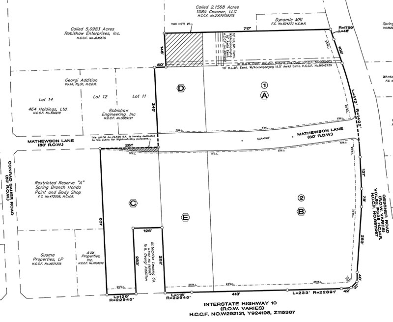
The plan is to build a twin tower of the Memorial Hermann Tower at the northwest corner of Gessner and I-10. It has been on the drawing boards for a year and a half now. It is lot B.
good thing someone drew a colored plan because I have no idea what I’m looking at in the Seurat inspired….. whatever that thing is….
If TIRZ 17 can spend 23 million dollars of the taxpayer’s money to beautify a municipal pump station, then the TIRZ can build detention for their storm water run-off.
Right now TIRZ 17 is proposing a plan to channel their storm water into two 10′ x 10′ box culverts under Memorial Drive to Buffalo Bayou via the W-153 watershed. TIRZ 17 plans to send all their storm water from CityCentre and Town & Country Village into Buffalo Bayou. The W-153 watershed is full. Water from Buffalo Bayou back flows into W-153 after every heavy rain. The Corps releases water from Barker and Addicks dams after every rain. The dams can no longer function as dams. The Fort Bend County developers are compounding the problem by channeling all storm water run off into Buffalo Bayou via the Clodine Ditch. Buffalo Bayou is over capacity and flooding into ravines and yards regularly.
Go to tirz17.org. Click on projects. Scroll down to Memorial Drive Mobility and Drainage Project. Then read the LAN Final Regional Drainage Report.
A twin to the Memorial Hermann tower?? Will two wrongs make a right?
So where is all this money coming from???? US TAXPAYERS! STOP IT! ASK FIRST! IT’S NOT YOUR MONEY! – DO WE REALLY NEED IT?
Conrad Sauer and Mathewson Ln, why is information about this project so secretive? Would like to see any “updated” information, drawings etc. about this project.