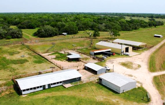
Local grassland steward the Katy Prairie Conservancy is for the first time branching out beyond its natural habitat with a 5,332-acre ranch about 90 miles outside the area the organization is named for. The Spread Oaks Ranch — part of which is shown above — sits near Hwy. 35 in Markham, just outside Bay City and about 70 miles southwest of Sugar Land. Last December, Spread Oaks’s owner closed a deal with the Conservancy giving the organization’s land trust the power to restrict development and subdivision of the coastal prairie property forever. Spread Oaks still owns the land and can pass it on if it chooses, but the Conservancy gets the power to limit its use, regardless of who has the deed.
Spread Oaks is the name given to the Morrow, Cuenca, and LeTulle ranches — pieced together by a single landowner between 2012 and 2015. The property is a working cattle ranch that “prides itself on raising some of the finest quality Brangus cattle in Texas.” Farming and hunting also take place on the land, which includes lodging for overnight guests. The Colorado River runs along an eastern section of the property.
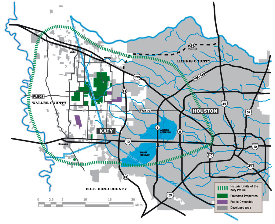
Before the agreement, all of the roughly 20,000 acres the Conservancy protected were located inside the green ring on the map of west Houston below:
***

That area circumscribed by the green hash marks indicates what was once the Katy Prairie region, back before sprawlers disturbed it. The solid green blocks indicate land the Conservancy protects by monitoring its use and, if necessary, taking legal action to stop its development. Spread Oaks is way off the map, southwest of where 59 trails off in Fort Bend County.
- Previously on Swamplot: Ring Around the Katy Prairie, and Other Orbital Highway Fun; This Week, Houston Begins Slicing What’s Left of the Katy Prairie in Two
Map: Katy Prairie Conservancy. Photo: Spread Oaks Ranch


The headline made my head explode. Ha!
Probably had to go that far just to find enough contiguous land to try saving, these days.