Swamplot’s Daily Demolition Report lists buildings that received City of Houston demolition permits the previous weekday.
No permits on the city holiday, but we’ll see what we can dig up tomorrow.
Swamplot’s Daily Demolition Report lists buildings that received City of Houston demolition permits the previous weekday.
No permits on the city holiday, but we’ll see what we can dig up tomorrow.
Here’s an inside view of the aftermath and cleanup inside the Pool family’s 1964 Meyerland Mod on the south bank of Brays Bayou near S. Rice Ave. — from the point of view of the owners’ son-in-law, October Popular Mechanics coverboy Casey Neistat. Includes a few signature Neistat drone shots of recovering areas (he only arrived on Thursday), a view of damage in Friendswood, and a focus on the cleanup work of Team Rubicon.
Video: Casey Neistat
OUR PLACE NEVER FLOODED 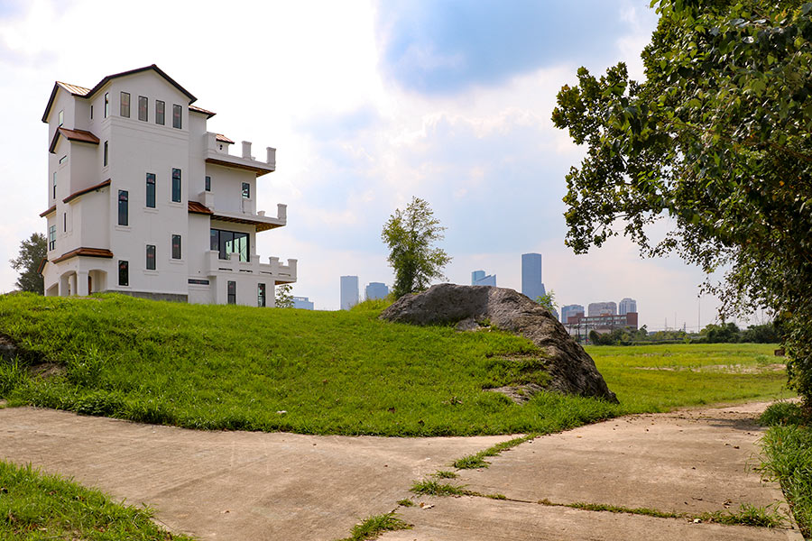 Cort MacMurray gazes into the city’s future: “. . . Houston is a cheerful amnesiac: We will rebuild in exactly the same places we built before, with exactly the same disrespect for historic floodplains. We are united, but in making this place stronger we’ll ignore fundamental inequities like school finance. We have a stronger work ethic than any other city in the Union, but when this crisis is past, we’ll slide back into affable indolence, trusting that everything is fine in our sprawling Xanadu on the Bayou.” [Houston Chronicle] Photo: Christof Spieler, via Swamplot Flickr pool
If you or someone you’re helping has been accepted into FEMA’s Transitional Shelter Assistance program — meant to clear out shelters by providing people who can’t return to their homes a hotel or motel room for a limited period of time — you may want to use the map shown here. It marks the locations of every eligible hotel or motel in the Houston area approved by the program. Using the map should make it easier to find an acceptable one nearby. To view the map in its own browser window, click here.
This map is yet another whipped-up-by-volunteers-in-a-jiffy product of Sketch City — this one created by the civic hacking group’s founder, Jeff Reichman. Sketch City volunteer and college sophomore Nile Dixon (who earlier created a similar tool to help people find nearby shelters) has created a simplified text-it-to-me version of it as well: Just text your ZIP Code to 832-981-4926 and a bot will send back contact info for the nearest verified accommodations in the program.
You can find out more about U.S. government Harvey assistance, including the TSA program, from the FEMA Harvey website.
Map: Sketch City
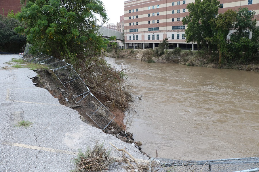
Photo of Buffalo Bayou Downtown (yesterday): Christof Spieler via Swamplot Flickr Pool
Swamplot’s Daily Demolition Report lists buildings that received City of Houston demolition permits the previous weekday.
No new demolition permits have been issued by the city yet – stay tuned and we’ll post ’em when we get ’em.
7 DAYS OF HARVEY BEFORE THE BRAZOS RIVER REACHES ITS SUGAR LAND PEAK 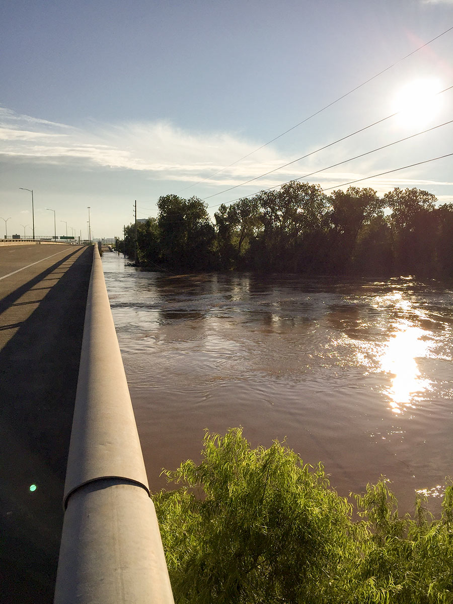 It wasn’t until early this morning that the Brazos River in Sugar Land and Richmond reached its highest level since area flooding triggered by Hurricane Harvey began. And it was a new record, reached at 5:15 am: 55.19 ft., according to the National Weather Service. The previous record, 54.7 ft. — surpassed Thursday at 1:30 am — was set by a flood last year on
 Tax Day June 2nd. The photo here shows the river during a rare moment of sunshine a day earlier than that — from Hwy. 59 where Greatwood, Riverpark, Telfair, and Sugar Land Memorial Park meet. [Houston Chronicle] Photo: Grace Carlson
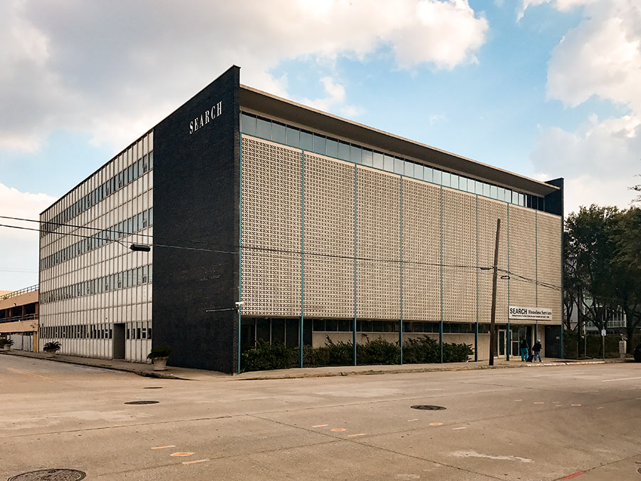
The ground floor of the former SEARCH Homeless Services building at 2505 Fannin St. in Midtown (above), spared from flooding damage, has been pressed into active emergency food service over the past week: New occupants tell Swamplot that in the kitchen that served SEARCH’s homeless clientele until the organization moved Downtown last year, former Feast and Hunky Dory chef Richard Knight and Carrie Knight have been leading a team preparing meals for first responders and other emergency workers; in the connected adjacent space, former Mark’s and El Meson sommelier Cat Nguyen now runs a food storehouse; she’s working with a team that moved in yesterday to share the space as well — one set up to match groups that can donate large quantities of food with groups that need them.
Offers of food and requests for food come to this team through a website it launched on Thursday as well, appropriately called I Have Food I Need Food. Led by a group including Amy Kavalewitz, Jonathan Beitler, Matthew Wettergreen, and Claudia Solis, the operation takes in donations of prepared or unprepared food from commercial kitchens, food supply companies, and licensed caterers, and sends it out to shelters or other service groups that need to serve hundreds of portions.
Photo: Matthew Wettergreen
Here’s the latest publicly available high-resolution aerial imagery of Houston-area flooding, in an interactive map you can use to zoom in and examine in detail and by address. The imagery in the map above comes from the National Oceanic and Atmospheric Administration, and was taken this past Wednesday and Thursday, August 29th and 30th — as floodwaters subsided in many areas of the city but continued to build in a few parts west.
Included in the portions of the city photographed by NOAA: the sections of Memorial south of I-10, west of Gessner Rd., north of Briar Forest Dr. (that’s below Buffalo Bayou), and east of the Addicks and Barker reservoirs. That’s the area where Mayor Turner earlier today said residents who already have water in their homes should probably leave their homes now if they haven’t already — because water is likely to remain in them for the next 10 to 15 days as releases from the dams continue.
To zoom in on the latest aerial imagery from that area, you can click on the search box in the map above and type “Memorial, Houston,” then click on the first option that appears below where you’re typing. Then zoom in further to see where the floodwaters are and aren’t. You can identify the date of the imagery and turn on and off various layers if you click on the lower of the 2 icons on the top right of the map. To view the map larger in your browser window, navigate directly to NOAA’s Harvey site.


Swamplot’s sponsor today is Westchase coworking space TechSpace Houston — offering help to people affected by Harvey flooding.
If Harvey left you without a good place to work, TechSpace Houston is ready to help. TechSpace Houston can provide companies and individuals an effective workplace solution for as short or long a time as needed. Just contact them and let them know how they can help.
To help with recovery efforts, TechSpace Houston is offering free coworking space next Tuesday through Friday (Monday is Labor Day) for individuals and companies in need. All you need to do is sign up.
Please sign up here to let them know you are coming — and what your space needs are.
TechSpace Houston is a unique shared office space totaling 46,000 sq. ft. — with 450 workstations and lots of campus amenities. Each floor houses a variety of office space solutions, including co-working spaces, 1-to-3-person private offices, large private office suites that can accommodate 4-to-50 people, conference rooms, event spaces, and a variety of thought-provoking collaboration lounges — including a unique social platform-style seating area and an outdoor Wi-Fi enabled patio.
TechSpace Houston provides an alternative to long-term leases. It’s a great solution for all types of businesses, no matter what stage: startups, entrepreneurs, SMEs, growth companies, and Fortune 100 teams. If you are in need of flexible office space — whether you work alone and need a co-working desk to tap into the local business community or have 2-to-50 employees who need a private office — TechSpace Houston can be a smart choice for your business.
Want to help Swamplot readers? Become a Sponsor of the Day.
This just-launched map tool from civic-minded hacking co-op Sketch City is meant to help homeowners who could use help clearing out soggy carpet and other materials from their flooded homes connect with people willing to volunteer their time and effort to help with that work. It’s called the Texas Muck Map — muck being a useful term in Houston these days. Mucking, in this context (and context truly is everything), means removing carpet or flooring, stripping drywall that was exposed to moisture and is at risk of growing mold, clearing out dirt, furniture, and other junk, and generally getting a flooded home ready to dry out.
Harvey has made sure a lot of homes around these parts will need mucking — over the next several weeks at least. Is that work you or someone you’re helping needs doing? Or work you or people you know are able to help with? The map above identifies the locations of homes people have added to it that need mucking — and the approximate locations of would-be volunteer mucker teams or individuals. (The map might appear sparsely populated now, but if you spread word about it it’s likely to fill up quickly.) Click on any of the icons to see details and contact info, which you can use to make your own connections.
To add your ready-to-be-mucked home to the map, click here and fill out the form. If you’d like to volunteer to muck homes, click here and fill out the form. To see the map in its own browser window, click here, or just go to muckmap.harveyneeds.org. Also on that site: some guidelines for using the map, a disclaimer, and links to several helpful resources about mucking and related issues.
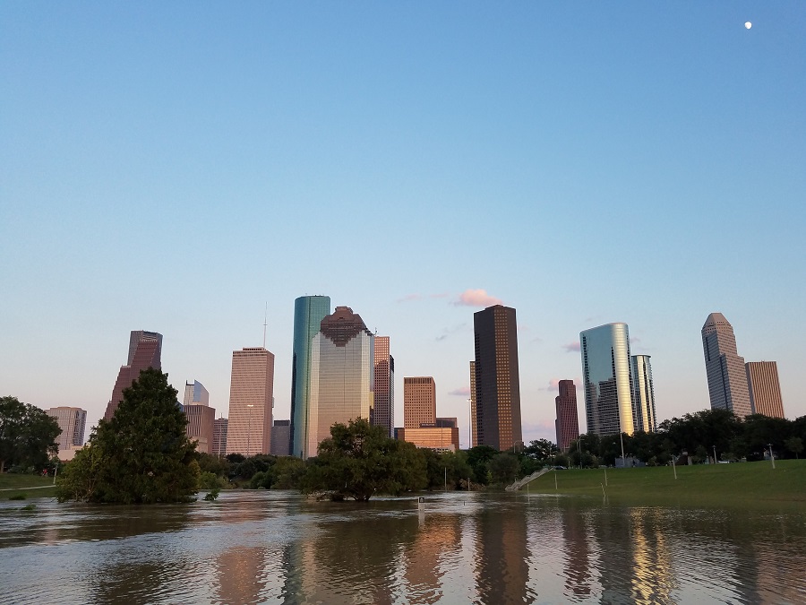
Photo: Marc Longoria via Swamplot Flickr Pool
Swamplot’s Daily Demolition Report lists buildings that received City of Houston demolition permits the previous weekday.
No new demolition permits have been issued by the city yet – stay tuned and we’ll post ’em when we get ’em.
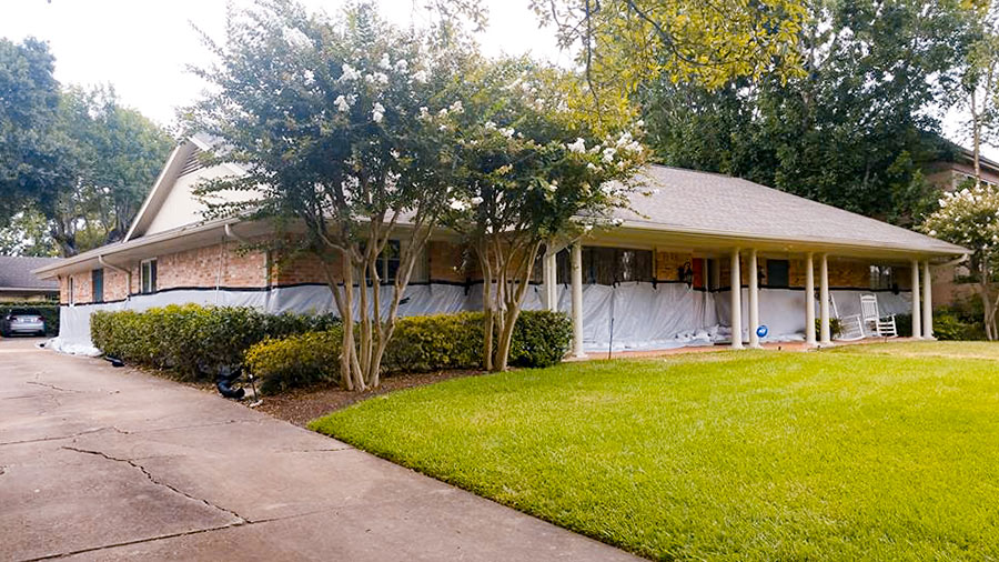
 If you had been wondering whether the sandbag and tarp barrier (pictured at top) mustered around Kristin Massey’s Meyerland home was able to hold back the floodwaters once nearby Brays Bayou overflowed its banks a block to the north Monday night, here’s your answer: “We did all that we could, but it would never have been enough,” Massey wrote on Facebook the following morning.
To prepare for the storm, Massey had spent close to $5,000 to arrange a perimeter defense using 18,000 pounds of sandbags. But the water reached the 9 ft. level on Braesheather Dr. a block south of Brays Bayou and just west of the 610 Loop (above) — and up to 4-and-a-half-ft. high inside her 1961 home:
Captured on Sunday between bands of Harvey downpour by an enterprising drone photographer hunkering in Friendswood, the video above includes a quick pan over the Brio Superfund site south of Beamer Rd. near the intersection with Dixie Farm Rd. The former chemical facility, once at the heart of both the long-gone Southbend neighborhood and of the series of lawsuits filed by Southbend residents over contamination-related birth defects and illnesses, makes its cameo around minute 3, as the drone passes over a waterlogged Exxon Mobil station and rotates from south to east down Beamer toward the San Jacinto College South Campus.
Might floodwaters flowing across the Brio site and all those other Superfund spots dotting the local map have stirred up toxin-laced sediments and spread them around? (Texas A&M Galveston scientist Wes Highfield was worried enough about the possibility to attempt a mid-flood outing from his home to try to get some water samples.) In the video, the Brio site appears to be a little less waterlogged than some of its surroundings — including the adjacent section of Beamer Rd., shown picking up a bit of kayak traffic — but likely got washed over by around 42 in. of rain altogether in the past week.
In a follow-up drone run flown on Wednesday, the site (making an appearance about 2-and-a-half minutes in) looks like it might have dried off a bit: